Monday, September 21, 2020

PCT - Santiam Pass to (almost) Three Fingered Jack

Before I launch into this latest hiking adventure, I'd like to take a moment and thank all the firefighters who worked tirelessly for the past two weeks battling the wildfires that ravaged Oregon.  Not only did these brave men and women help many people evacuate, they also fought these fires under terrible conditions (gusty winds and thick smoke).  Most of the blazes are now either under control or at least no longer posing imminent danger to populated areas.


Sooo.....jumping in where I left off in the prior post!  Continuing with my hubby and I's hiking/camping weekend in July.  (If you've forgotten, refresh your memory here.)


Gotta get the "official" sign pic!


After tackling two trails the previous day, hubby and I awoke for today's ambitious goal - hiking the Pacific Crest Trail (aka PCT) from nearby Santiam Pass northward.  According to my hiking "bible" - aka William L. Sullivan's "100 Hikes in the Central Oregon Cascades" there was a terrific view of Three Fingered Jack Mountain about 5 miles up the PCT.  One my 2020 hiking aspirations was to log 25 new miles on the PCT and this latest trek would help towards fulfilling that goal.


The beargrass was in great supply

After staying up late watching the sunset on Coffin Mountain, hubby and I slept in and lollygagged around camp, taking our time eating breakfast.  So even though our campsite was only 15 miles from the trailhead, we didn't arrive there until almost 9 am.  And despite having a huge lot, parking at this trailhead was already nearly full.  We managed to snag the last available spot - luckily it was big enough for hubby's truck!


Beargrass forest


Stepping out of the truck I was surprised by how warm it was for 9 am.  Hubby immediately switched to shorts but I decided to keep the zip-off legs on my hiking pants.  It would later prove to be a smart decision.


Hayrick and Hoodoo Buttes through the trees


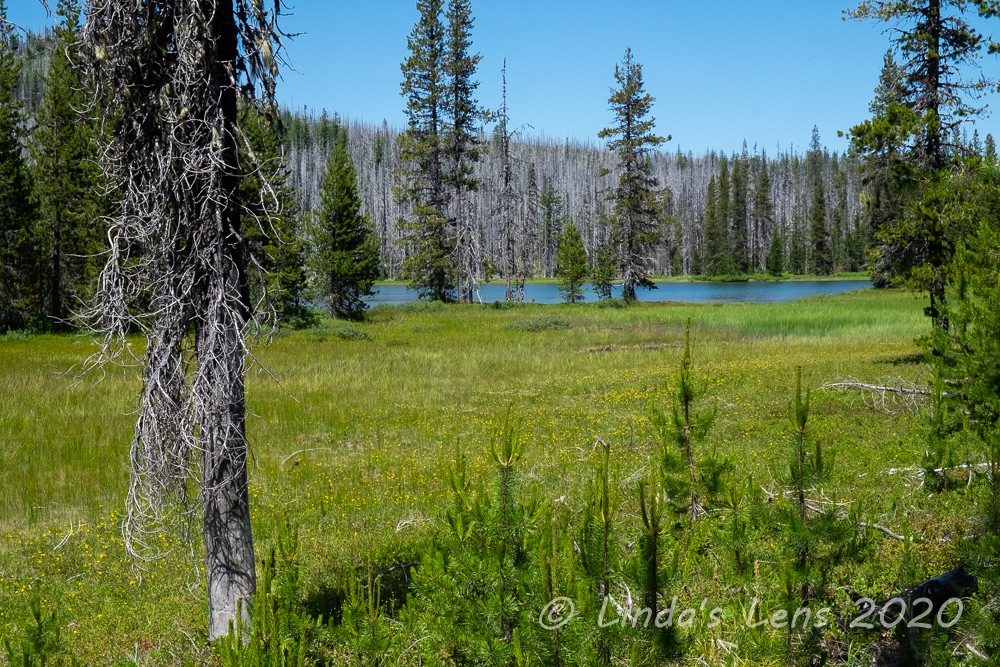
The PCT northbound from Santiam Pass traveled through forest burned in a 2003 wildfire.  The ghostly gray dead trees were a somber reminder of the devastation.  However, beargrass had established itself nicely post-fire.  Cream-colored poofy blooms lined the forest floor.  Progress was slow as I tried to capture yet more stunning beargrass images. (And, no I didn't get enough photos of it from the previous day!)


Mountain parade - Mt Washington and the Three Sisters

Although I'm not a fan of wildfires, the lack of vegetation on trees did open up views of the nearby mountains.  As we climbed higher, a line of Cascade peaks paraded across the southern horizon.  Mt Washington was the closest, followed by the Three Sisters and Broken Top.


Looking towards Three Fingered Jack


And moving northward I got occasional glimpses of Three Fingered Jack's pointy summit.


Little trailside pond


About a mile in, we passed by a cute little pond rimmed with wildflowers.
 

A few lily pads


 I zoomed in to capture the lily pads floating on it's surface.


Happy to see new tree growth


Beyond the pond, our trail started to climb more steeply.  I puffed and sweated in the increasing heat.  Thankfully a strong breeze was blowing, and that made the temperatures bearable.  If not for the wind, I would've surely overheated.


Lots of little trees sprouting up in the burn area


Hubby and I passed through an area where the forest was covered with small fir trees.  It was heartening to see the forest beginning to re-establish itself after such a devastating fire.


A nice patch of lupine


Fire zones also produce great wildflowers.  We passed through many meadows flush with purple lupine and orange scarlet gilia.


Hoodoo Butte through the burned trees


About 3.5 miles up the PCT hubby and I came upon the top of a ridge.  Views to the east were fantastic with conical-shaped Black Butte prominently anchoring the skyline above a mixture of green forest and gray burn area.  A couple teal mountain lakes glittered like jewels below.
 

Ghost trees


It was here a southbound backpacker passed by and warned us that the mosquitoes were thick in the trees and in areas where the snow had recently melted.  I had a small bottle of repellent in my backpack, so figured we could always spray ourselves if things got too bad.  So we continued on.


Hiking through snow - in July!


Unfortunately, it turned out that helpful hiker was right - hubby and I no sooner entered the forested area when the mosquitoes came after us in droves!  They seemed to like hubby better than I, and he was soon regretting his switch to shorts.  Every time we stopped, even for a minute, they would swarm us landing in great numbers on our exposed skin.  I couldn't even get out my repellent fast enough - I was spraying mosquitoes as they were biting me.


Three Fingered Jack view at our turn around point


Although Deet works the best for repelling mosquitoes, it's so toxic I try to avoid using it at all costs.  So I'd purchased a small bottle of Deet-free bug spray for hikes.  But sadly that day it failed miserably.  Realizing that keeping ourselves moving was the best way to avoid these flying vampires, we marched steadily onward.  But it was past noon, and I was in dire need of some fuel.  Hubby promised we'd stop for lunch when we arrived at the Three Fingered Jack mountain viewpoint.  But we kept hiking and hiking with no viewpoint in sight.  My gps read 5.3 miles, then 5.4, 5.5.....surely we didn't miss it?  I was getting tired and hangry.  Where was that stupid mountain?


Black Butte and a couple of lakes


About a quarter mile from the viewpoint we ran into a section of trail totally covered in snow.  Gingerly hubby and I postholed through the wet, slushy stuff, trying to follow previous hiker's footsteps.  It was slow going, and to make matters worse, the mosquitoes were thickest in these melting snow areas.


Looking westward to another lake


Finally, rounding a corner there was Three Fingered Jack rising above the trail.  A fabulous view - totally worth the hot uphill climb, slogging through snow, and facing bloodthirsty mosquitoes.  But I was beyond hungry now, and insisted on taking a lunch break right there on the trail - mosquitoes be damned!


Lupine brightens the forest floor


So hubby and hastily tried to cram down some leftover meat and cheese from the previous night while fending off mosquitoes intent on making us their lunch.  It was the fastest meal break ever - after five minutes of battling those flying demons I was ready to get moving again.


Dramatic clouds


Bidding the mountain a fond farewell, we hurried back through the snowfield, through the mosquito-infested forest until finally taking a breather on the ridge, which thankfully seemed to be free of bugs for the moment.  Hubby pulled out the rest of our lunch and we finished refueling.


Nice afternoon light on the beargrass


From the ridge, our path back to the truck was all sweet downhill.  Good thing for me, as by now temperatures were blazing hot.  I was happy for the stiff breeze and the fact that I still had lots of water left in my hydration bladder.  Those two factors saved me from totally melting down.  Heading back downhill, we passed several folks with huge backpacks slowly climbing in the opposite direction.  I don't know how these people managed - they were obviously better suited for handling hot weather than I.


Beargrass everywhere!

And then we were back in the beargrass zone.  Hooray!  The afternoon light was now so fantastic on the plumes, I couldn't help adding yet more images to my memory card.


More pics of the beargrass and forest


 Not only the beargrass, but there were also some interesting clouds in the sky.


Mt Washington view down a beargrass-lined trail


It was a relief to finally reach the trailhead.  I pulled off my hot, dusty boots and grabbed some cold water from our cooler in the back.  And, one of the advantages of camping nearby - a very quick 15-minute drive to our campsite which meant a cold beer much sooner!


Our lovely campsite at Marion Forks


That day happened to be my hubby's birthday.  Not only did he get some tasty apres-hike birthday beers, I also brought a small pie and adorned it with a candle.  What a guy - he gave up fishing on his birthday weekend to go camping and hiking with me (through a vicious mosquito-infested trail even!)


Happy birthday to my hubby!


Although one of the recent wildfires burned very close to the campground where we stayed that weekend, I was happy to see it's been spared for now.  Nearby Coffin Mountain has also escaped the flames.  So there's hope I can return next summer to camp at Marion Forks and take in another sunset on Coffin Mountain.  But I think I'll wait until the snow is entirely melted before I hike this portion of the PCT again.


Sunday, September 13, 2020

Heartbreak

For the past week I've watched my beautiful state burn.

It all started last Monday with a huge windstorm, blowing hot air eastward across Oregon.  Unusual for this time of year, it was branded as a "historic" wind event, with gusts exceeding 50 mph in Portland.   Fire danger was off the charts.  In an area that hasn't seen measurable rain most of the summer, forests were bone-dry and ripe for wildfires.  It was a disaster waiting to happen.

 In the wee hours of Tuesday morning, all hell broke loose.


Tuesday night's sunset


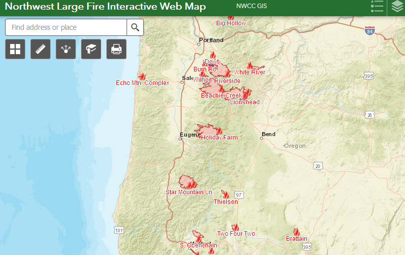
Downed power lines ignited several fires around the small towns of Detroit, Gates and Mill City, east of Salem off of Highway 22.  People had minutes to evacuate.  Detroit and Gates burned to the ground, and Mill City lost several structures.  The fires merged with another forest fire already burning to the north creating a huge inferno that threatened Silver Falls State Park and several nearby towns.

Southeast of Portland, another fire erupted along the Clackamas River.  Campers along several riverside campgrounds hastily evacuated as the wind-driven flames grew exponentially.  

East of Eugene, along the scenic McKenzie River, another fire decimated several small towns, as the occupants ran for their lives.

On the coast, a fire threatened the town of Lincoln City, prompting evacuation of nearly half the town.

And in southern Oregon another wind-driven fire destroyed the towns of Phoenix and Talent, reducing entire neighborhoods to rubble.

By Tuesday evening, a total of 35 wildfires were burning across the state of Oregon.


Apocalyptic wildfire smoke


All week I nervously scanned fire and evacuation maps, watching shaded areas indicating the fire perimeter cover more and more favorite hiking trails and inch closer to nearby towns.  Smoke from the fires began pouring into my city, creating ugly orange-tinged clouds.  The sky looked simply apocalyptic.  Thursday, one fire crept perilously close the Portland Metro area, threatening a SE suburb.  Occupants of an entire county were placed on some level of evacuation notice.  One of my coworkers who lives in Oregon City, notified of a level 2 "get set" notice, had to pack up his home and be ready to evacuate.


Winds raged for three long days until finally dissipating on Friday.  Although fires continue to burn, and likely will until the winter rains come, at least their growth has now slowed.

But the damage has been done.  One million acres of forest burned.  At least ten people dead.  Over 40,000 people evacuated, many not sure they will have a house to return to.


Hazy orange skies
 

Three years ago, watching the Columbia River Gorge burn, I thought the Eagle Creek Fire was tragic.  This has been much worse.  So many favorite hiking areas are now gone.  Among them:

Jefferson Park.  See This post from 2018.

Opal Creek.  See this post from 2015.

Olallie Lake.  See this post from 2012. 

Riverside Trail. See this post from 2019.

Table Rock.  Which I'd just hiked this past June.

So much destruction - it's heartbreaking.  So many wonderful forested areas are changed forever.  I can't even begin to comprehend what these once places will look like now. 

As the fires continue to burn, my entire state is blanketed with a thick layer of acrid smoke, pushing air quality into the "hazardous" category and forcing me indoors.  Although I'm sorely missing hiking this weekend, I am thankful I still have a home to be stuck inside.

 2020 can't get over fast enough........


Monday, September 7, 2020

Patjens Lakes and Coffin Mtn Sunset

Summer means camping and hiking.  In mid-July my hubby and I decided a trip to the Central Oregon Cascades was in order.  We have a favorite Forest Service Campground along Highway 22 where we love to stay.  But since some of its sites are first-come first-serve, there's always a risk of being skunked.  In past years, an early Friday morning arrival has always secured a spot.


Beargrass-covered forest floor

This year our luck didn't hold.  In this post-COVID world, everyone has discovered the great outdoors, and I've noticed hiking trails and campgrounds are busy all the time, not just over weekends.  So....sadly we discovered our favorite campgound was full, as was our second choice down the road. 


Beargrass close-up

Would we end up back home for the weekend instead of camping?  Luckily our third choice, Marion Forks Campground, wasn't far away.  Driving in, we were astounded to see most of the sites still empty.  After choosing a nice spot and setting up camp we discovered why.  No water.  Not being prepared for such an inconvenience, this necessitated a trip to the closest town to buy a couple gallons of water and then on the way back, another stop a nearby campground to fill up our large water jug.


Tiny pond all dried up
Finally, campsite secured, water procured, it was time for a hike!  Over the years I've visited most of the trails along Highway 22.  However, there were still a couple left on the list.  Today's trail of choice was a short loop to visit the Patjens Lakes.  A lovely trek through lodgpole pine forests at Santiam Pass, I'd heard the wildflower bloom was good here this year, so I was itching to check things out.


Wilderness boundary

So hubby and I made the short drive from our campsite to Santiam Pass, and then to the shores of Big Lake.  The Patjens trailhead had it's parking area near one of the lake's campgrounds.


Beargrass and Scarlet Gilia brightened the forest

Due to the morning's campground chores, it was nearly noon when we started our hike.  And it was already hot.  But we had plenty of water so off hubby and I went down the trail.


One of the few butterflies I was able to capture

I'd heard there was a good wildflower bloom and right away I discovered that the rumors were true!  Beargrass covered the forest floor, along with purple penstemon and orange-red scarlet gilia.  Many photo breaks may have been taken.


Beargrass everywhere!

The forest here burned in a 2011 wildfire, so there wasn't much shade.  Tall gray and black skeletons of trees provided the only semblance of a forest.  And there were lots of downed logs across the trail. Hubby and I clambered over several in the first half mile.


Gotta stop and smell the beargrass....

Deciding to save the trek past Big Lake for the end, we started heading westward on the loop, passing through burned-out forest, a dried up pond (that was really deep green) and then climbing up a ridge with some great views of the nearby hills and mountains.  Mt Jefferson, Three Fingered Jack, the Three Sisters and Mt Washington were all in view, plus nearby Hoodoo Butte.


First Patjen Lake

On the downhill side of the ridge hubby and I were passed by two young girls with huge backpacks.  One of them did not look very happy.  The older girl said they were looking to camp at one of the Patjen Lakes.  We kept leapfrogging the girls until passing by the first lake (more like a pond, really) when they left the trail to go check it out.


Scarlet Gilia

The four lakes that make up the Patjens Lakes are all very tiny.  Actually we only saw three lakes.  I suspect the fourth lake might've dried up to just a grassy swamp.  The third lake was the only one that looked suitable for any camping or swimming.  We hiked down to it's shore and admired the view.


Third Patjen Lake was the best

Past the third lake, the trail started gradually climbing uphill, back to a junction with Big Lake.  Although I'm never a fan of forest fires, I have to say the fire cleared away dense forest, opening up spectacular views of nearby Mt Washington.


Scraggly dead tree

The burned out trees also created a great habitat for woodpeckers.  My eagle-eyed hubby spotted three of them pecking away on a nearby snag.  I switched to my zoom lens, but the light was terrible and I only got a few extremely backlit images before the birds flew away.


Mt Washington

Climbing further from the lakes, we came upon the best concentration of beargrass yet.  These fluffy plumes lined the forest floor.  Forward progress may have been slowed a wee bit.....


Lovely beargrass poofs

Wildflowers also attract butterflies, and there were several flitting around the blooms.  Continuously on the move, they were difficult to capture.  We came upon one place in the trail where several beautiful blue butterflies were congregated on the trail itself.  It was a damp, muddy area, and I assumed they were attracted to the water.  I tried my hardest to get a good image of all those butterflies but nothing really turned out.  So you'll just have to take my word for it.


Beargrass was especially thick beyond the ponds

After a mile of hot climbing, I glimpsed some blue water through the trees.  Finally Big Lake!  A lovely royal blue, this lake was home to two campgrounds and a church camp.  It also attracted the motorboat/waterskiing and off-road vehicle crowd, so it really wasn't our kind of place to camp.


More Mt Washington views

But the lake made a lovely place to hike around.  As we contoured around the shore, Mt Washington became more and more visible until we reached a high point that had a money shot view of the mountain.


Hoodoo and Hayrick Buttes from Big Lake

Across the lake Hayrick and Hoodoo Buttes were visible.  Hoodoo Butte has a small, family ski area atop it's summit.


Wonderful Mt Washington view from Big Lake

As we completed the loop and headed back to our truck, both hubby and I decided this short trail packed a lot of wonderful scenery into 6 miles.  The only drawback was tons of blown-down trees that we had to navigate over, around, and in a few cases, under.


View from Coffin Mtn trail

But our day wasn't over yet.  Because we were camping a short distance from Coffin Mountain, I really wanted to capture sunset from the summit.  My hubby is such a good sport, he agreed to such a crazy request!  So we took a short break at our campsite before packing back up and driving to the Coffin Mountain trailhead.


Wine, cheese and Mt Jefferson views from Coffin Mtn

It was still hot, and we both carried a heavy load.  I had my camera gear (although my sweet hubby carried my tripod! Thanks dear!) and we packed a wine and cheese dinner to enjoy on top.  Although only a short 1.5 mile climb, it's also 1000 feet of elevation gain.  We puffed, sweated and groaned as we slogged uphill, but once reaching the top, it was so worth it.


Coffin Mtn lookout at sunset

There's a staffed fire lookout on Coffin Mountain's summit.  The guy manning the lookout waved but didn't come out.  No matter, hubby and I perched ourselves on the helipad, dug out our goodies and enjoyed a front-row view of Mt Jefferson.


Sunset over Detroit Lake

I was lucky - the sunset was spectacular.  We were joined by another couple and one young man with a big camera like mine.  As the sun sank and the sky turned colors, I tried my best to capture the show in all directions.


Mt Hood

The sky to the north and east turned a lovely shade of pink.  I caught Mt Hood on the horizon.  To the west the sky above Detroit Lake turned orange with the setting sun.


Last view as we hiked back down

Once the sun sank below the horizon, hubby and I packed up to try and beat total darkness.  We trucked downhill quickly, but about halfway I ended up digging out my headlamp.  It was nearly 10 pm when we reached the truck.  By the time we arrived back at our campground, all the sites were full and our neighbors across the road appeared to be gearing up to party for awhile.  But tired from two hikes, hubby and I fell asleep as soon as our heads hit the pillows and didn't hear much all night.

A great day of hiking!  And I'd planned a jaunt up the PCT for the following day.  Coming next post.....