Wednesday, January 28, 2015

Seagulls and Shipwrecks

Lately I've had a fascination with the Oregon coast.


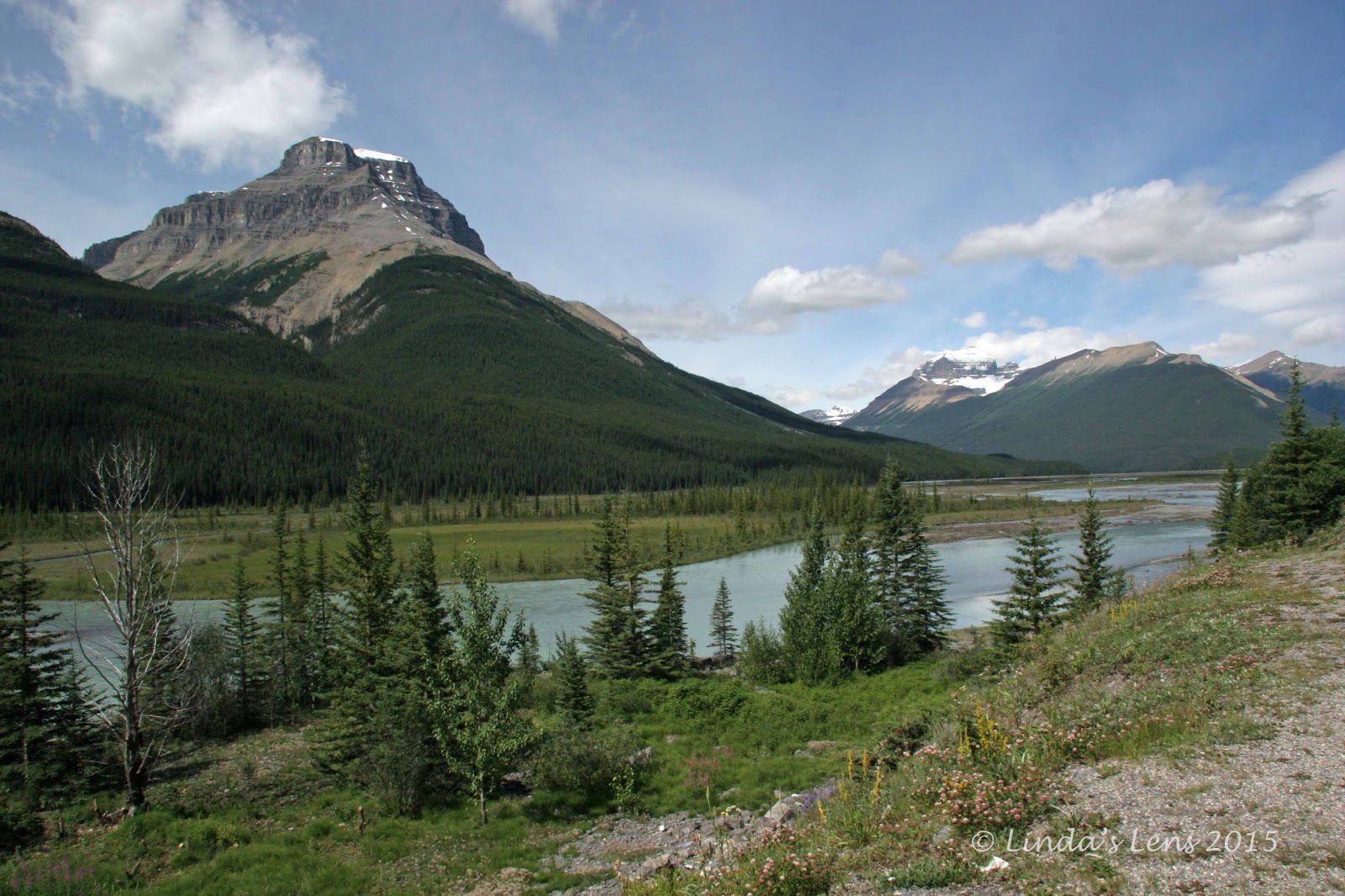
Looking across the Columbia River to Washington

Normally on the mountain this time of year, I never visit the ocean beaches.  But still barred from skiing, in early January, I set my sights westward.  It all started with an excellent New Year's Day afternoon at Cannon Beach.  That trip whetted my appetite for further exploration.


Seagulls in flight

The following weekend, I convinced my hubby to join me for another coastal excursion.  Having spent most of the fall salmon season fishing at the mouth of the Columbia River, Roger wanted to show me his favorite lucky spots.  We headed to Fort Stevens State Park, on Oregon's north-westernmost tip.


One is more friendly than the others

It was a dismal, rainy day.  The minute we left home, dark clouds opened up, and continued to follow us most of the drive.  Arriving at Fort Stevens, Roger picked the furthest road west, where vehicles were allowed to drive onto the beach.  It was nice to explore the shoreline from the comfort of our truck.  With raindrops still pelting the windows, I didn't venture far from it's warm, dry interior.


Squabbling over stale popcorn

Drab, low-lying clouds obscured most views.  Across the Columbia River's wide channel, I could glimpse Washington's Cape Disappointment.  The Astoria Bridge was barely visible through the fog (if you look real hard you can kinda see it on the far right of my first photo).  A lone fisherman's boat bobbed in the waves.


I caught one guy in flight

A huge flock of seagulls provided some afternoon entertainment.  They were gathered near the water's edge, all lined up in rows.  Venturing closer to get some photos, I disturbed a huge flock, and had fun trying to capture them in flight.  Roger found a bag of stale caramel corn in his truck, and trying to attract the gulls, scattered it across the sand.  The birds came in droves!  Being a lazy photographer, I stuck my lens out an open window, and got some great shots of seagulls fighting over the loot.


Jetty overlook

After several minutes of seagull-watching, it was time for a change of scenery.  Back on Fort Steven's main road, Roger turned down another side road to see where it led.  We came upon a parking lot next to a huge jetty.  A short trail led to an elevated viewing platform.


Where the Pacific and Columbia meet

What could we see from on top?  Of course Roger and I had to find out.  Grabbing both my DSLR and GoPro cameras, I scrambled after my hubby.  The platform gave a wonderful panoramic view of the very place where the Pacific Ocean meets the mighty Columbia River. 


Wild waves

A tall jetty stretched far into the horizon, providing protection for ships as they entered or exited the Columbia Bar.  This is an especially treacherous part of the ocean, earning it's nickname as the "Graveyard of the Pacific" for the large number of shipwrecks that have happened over the centuries.


We had a grand time watching waves crash into the jetty's rock-lined shore.  I tried out my new GoPro camera, and captured a bit of wave action.  Check out the short video above.  I was pleasantly surprised by the sharpness of this footage, despite being shot in such dark, gloomy skies.


Peter Iredale shipwreck

Speaking of shipwrecks......there was one final attraction I wanted to see.  One of Fort Steven's beaches bears the rusting remains of an old sailing ship - the Peter Iredale.


The ship's hull is nearly rotted away

It took some searching down the state park's many side roads to locate the correct beach.  We'd almost given up, when I spotted a small sign that said simply "shipwreck" with an arrow pointing down a road.  Following it to the end led us to a waterlogged parking area.


Water rushing through the hull

Climbing to the top of a sandy dune, I spotted what was left of the ship.  Only it's rotting hull still visible, the rest of the ship had long weathered away, blasted by harsh winds and ocean waves.


Rusted remains

The Peter Iredale ran aground on October 25, 1906.  It had sailed from Mexico, bound for Portland, with a crew of 27, including two stowaways.  As the ship waited for a pilot to guide them across the Columbia Bar, a strong wind blew it into the breakers.  The Iredale ran aground, hitting so hard that three of her masts snapped from the impact.  Luckily, no one was seriously injured, and the crew were quickly rescued.


Tiny shorebirds

Since that day, the Iredale has remained stuck in the sand.  An immediate tourist attraction, crowds of people flocked to the beach to view it's wreckage.  Over a century later, these rusted remains continue to draw many visitors.  A picturesque bit of history, it's an often-photographed landmark.  I walked around the beach, snapping photos of the rusting shell from all angles, until heavy rain, and an aching foot, forced me back to Roger's truck.


Shipwreck reflections

Although the weather was less than cooperative, it was still great to get away and see some new sights.  Oceans, beaches, rivers, waves, seagulls, and shipwrecks.  My coastal itch was satisfied - at least for another week!


(Note to my readers:.  I like to make leaving a comment as easy as possible, but two spam attacks in as many days has forced me to activate comment moderation.  Sorry for the inconvenience.)


Sharing with:  52 Photos Project and Saturday's Critters

Sunday, January 25, 2015

Everything is Awesome


Guess what I did on MLK day????


Back in the saddle - finally!

I twisted my doctor's arm a tiny bit, but in the end she grudgingly gave me the okay to try skiing.  Well, with conditions of course.  I promised to stay on easy groomed runs, to wrap the surgical area of my foot, and swore I'd only ski a couple hours.


Sunny skies and new snow

So last Monday, my buddy Kim and I had the MLK holiday off, and we headed up to Mt. Hood.  Our timing was so utterly perfect.  Not only did we escape the weekend rainstorm, the mountain received a couple inches of fresh snow overnight.  Then the sun came out.  Perfect!


Kim is happy her ski buddy is back

I was a wee bit apprehensive about how my ski boot would fit on my still-swollen right foot.  So two days before our planned trip, I tried it on at home.  Although snug, I was able to get it on (and more importantly, remove it) and didn't feel uncomfortable.  I texted a photo of my foot in the boot to Kim with the message "Let's go skiing!"


I missed these scenes

My poor friend Kim.  I'm the one she usually skis with, and since I was out of commission, she hadn't been up at all.  You can imagine how happy she was to have her ski buddy back!


Victory lap

My first run was a bit wobbly.  The foot was still a little sore, and it protested when hitting the inside of my boot.  But once I got going, my foot did just fine.  It felt absolutely wonderful to be sliding down a snowy slope again.  I'd waited over two long months for this day.  I was so happy, I even shed a few tears of joy.


My old friend the sunburst

I brought my new GoPro camera along, and had fun trying to take photos.  I left my selfie pole in the car, so in order to get some footage, I coaxed Kim to hold the camera while I skied by.  The result is this short video below.  Proof I can still ski!


We skied all morning, and my foot held up wonderfully.  Although it was a little swollen and sore, I was able to make turns and fly down the slopes (having some new fluffy snow sure helped!)

Near the end of a fabulous morning, Kim turned to me and exclaimed: "This is like the song in the Lego movie - everything is awesome!"


Glad to be back with my best ski buddy

Indeed it was.  I couldn't have asked for a better first day back.


Thursday, January 22, 2015

Athabasca Glacier

This is an ongoing series recapping my 2008 trip to Banff National Park in Alberta, Canada.

If you want to see a remnant of the last ice age, head to the Columbia Icefield in Jasper National Park.  This mountain valley boasts six interconnected glaciers, one of which visitors can easily access.  The Athabasca Glacier sits closest to the Icefields Parkway, and due to its location, has the distinction of being most visited glacier in North America.


The Athabasca Glacier spills between two mountains

Driving the Icefields Parkway from Lake Louise, Roger and I wanted to leave enough time to reach this glacier.  I'd read it was a must-see for Banff visitors.  Heading towards the parking area, we were greeted with this amazing overview.  Sandwiched between two massive mountains, the Athabasca Glacier spilled into the valley below.


Walking a barren plain to the glacier

Visitors can walk to the foot of this massive icefield.  Roger parked our car in the nearby lot, and we followed the other tourists down a wide, rubble-strewn path.  The surrounding area was barren, made up of dull gray sediments left behind by the retreating glacier.


Signs showed how much the glacier has retreated

The once-mighty Athabasca Glacier has been shrinking at an alarming rate of 5 meters (16 feet) per year.  It's retreated nearly a mile in the past century.  Markers placed along the main path, each with a different year, showed the extent of the icefield in the past.  A very sober visual as to how quickly we're losing this valuable resource.  The photo above shows Roger posing by the 1992 marker.  As you can see, it retreated quite a ways in 16 years.


Lots of dangers on the glacier


Another common sight along our trail - lots and lots of warning signs.  Many dangers lurk on these icefields.  The Athabasca Glacier ranges between 300 and nearly 1000 feet in thickness.  Melting ice creates many deep crevasses.  Hiking on the glacier is not allowed, unless you're with an organized tour.


This was as close as you could get

This row of cones and rope was as close as we could get.


Unless you booked a special tour

From our vantage point behind, the rope, we watched a couple of guided tour groups ascend the icefield.  I was wishing we'd signed up for one of those.


It was cold at the glacier's edge

Instead, I had to be content with just viewing from afar.  But that was okay too.  The massive size of this icefield was mind-blowing!  And it was very, very cold near the glacier's base.  I was bundled up with warm coat and hat, and still got chilly.


Glacier close-up

Roger and I zoomed our cameras in as far as they would go, and got some really cool shots of the rumpled, wrinkled ice.


Meltwater pools at the glacier's edge

A steady stream of silty meltwater flowed from the Athabasca Glacier's base.  The ice at it's toe didn't look too stable.


These snow coaches took visitors on the ice

After spending time getting up close and personal with the Athabasca, Roger and I headed to the visitor center across the road.  Walking through the parking lot, we spied a very unusual vehicle.  It was a snow coach - a specially designed bus with thick lugged tires to enable driving onto the glacier.  Another option for folks who didn't want to go hiking up the icefield.


Another glacier in an adjacent valley

Sadly, we had neither the time nor the money for such a tour.  So Roger and I had to be content with touring the visitor center.  It was quite well done, though.  And the place offered many great vantage points to view the nearby mountains, and of course, their glaciers.


Ice-topped mountains

The neighboring mountains had really cool glaciers.  And their very tops were rimmed with a thick coating of ice.  Looked like a snowy white hat.


Close up of the glacier's fractured edge

It was amazing to me how the ice perched on the side of steep mountainsides.  Although it looked ready to slide off at any moment, it stuck fast.  Zooming in on the ice, one could see a maze of cracks and crevices.  A mound of white ice particles at it's base gave evidence of frequent icefalls.  Yet another reason not to venture too close to a glacier's edge.


Another look at these majestic high peaks

Roger and I took in more of the stunning mountain scenery for a little bit longer, before realizing time was getting late, and we still needed to drive all the way back down the Icefields Parkway to reach our campsite.  So we reluctantly tore ourselves away from this very interesting visitor center, and headed back down the road.


Bidding the Icefields Parkway goodbye

It was fascinating to get so close to a huge, active glacier.  The entire length of the Icefields Parkway was full of gorgeous sights.  Another highlight of our Banff, trip I was glad we'd explored this area.  But next time I hope to make it all the way to the town of Jasper!


Sharing with:  Scenic Weekends

Sunday, January 18, 2015

The Icefields Parkway

This is an ongoing series recapping my 2008 trip to Banff National Park in Alberta, Canada.


On the list of Banff's greatest hits, the Icefields Parkway definitely makes top five.  A scenic highway paralleling the continental divide, it passes rugged, glacier-topped peaks and clear blue lakes.  Linking Lake Louise with the town of Jasper, this route winds through both Banff and Jasper National Parks.  I was told a trip to Banff wouldn't be complete without a drive on this road.  Not one to ignore good advice, I wasn't about to miss it!
  

Herbert Lake reflections

Day five of our vacation, my hubby and I rose extra-early and set out to travel as much of the route as we could in a day.  The Icefields Parkway is 230 km (140 miles) in length, one way.  Due to the abundance of attractions along this road (translation - many stops), we figured traveling the entire distance to Jasper was a stretch.

It was another lovely blue-sky day.  Our first stop was at Herbert Lake to capture the perfect mountain reflections on it's glassy surface.


Crowfoot Glacier

Next, we paused to check out Crowfoot Glacier.  This glacier was named because it's three outstretched ice fields resembled toes on a crow's foot.  Unfortunately, in the early 1930's, one of the "toes" broke off, and has since melted away.  Now it's merely a two-toed crow.


Bow Lake

Traveling further, the lovely aqua-blue waters of Bow Lake got our attention, and provided yet another reason to pull over.


Roadside fireweed

Such a scenic area!  Not only beautiful blue waters, the adjacent mountains towered their craggy peaks steeply above the lake's surface.  Glaciers suspended in crevices looked ready to slide off at any moment.  To cap things off, bright pink fireweed bloomed thick along the roadside.


Peyto Lake

So much beauty to see!  Roger and I felt like we weren't traveling very far before getting sidelined by another wonderful sight.  The next jaw-dropping attraction was Peyto Lake.  Located deep in a glacial valley, a paved pathway took visitors to a breathtaking view high above it's surface.  Absolutely stunning!  Framed by steep mountain peaks, ringed by thick forests, and a remarkable aqua-blue color, it was probably my favorite vista of the entire parkway.


Glacier that feeds Peyto Lake

The unique blue color of many lakes here was due to glacial "flour," fine particles of silt ground as the glacial ice moves over rock.  The overlook for Peyto Lake also included a great birds-eye view of the glacier that feeds this lake.


View from the car window

After a thoroughly enjoyable stop at Peyto Lake, it was "on the road again."  The scenery along the highway was fantastic.  A wall of snow-capped peaks as far as the eye could see.


Looking for wildlife at Waterfowl Lake

Seeing a sign for Waterfowl Lake, Roger, who loves trying to spot animals, decided to check it out.  While my hubby scanned the water's surface for wildlife, I took advantage of some great light illuminating the adjacent mountains.


Lovely Waterfowl Lake

Although Roger's quest didn't net him any bird sightings, I scored big on amazing scenery shots.


Mistaya Canyon

Further down the road from Peyto and Waterfowl Lakes, a sign for Mistaya Canyon provided yet another reason to detour.  Roger and I followed a trail to a powerful river (the Mistaya River) whose waters had carved deep grooves through adjacent limestone.


Mistaya River

The river's light gray-blue water was stunning.  And we discovered yet another water body nicely framed by a wall of ice-capped peaks.


Glaciers stick to mountains like whipped cream

Yet the mountains didn't end.  Around every turn of the road were more peaks reaching to the sky.  Some of the glaciers perched on their tops looked ready to slip off at any moment.  I thought the white glacial ice resembled a coating of whipped cream.  I later read that many of these peaks towered over 3,300 meters (11,000 feet) in height.


Mountains and flowers

At one point on the drive, fireweed bloomed so thickly on the roadside, I made Roger pull over so I could check it out.


Fireweed

One of my favorite wildflowers, I never pass up a chance to capture it's bright pink petals.


Mountains and water

Back on the road, following the scenic Mistaya River across broad glacial plains.


View from Sunwapta Pass

And then climbing, up, up, up, steeply to the summit of Sunwapta Pass.  Oh, were the views glorious on top!


Tangle Falls

Icing on the cake.....not only wonderful vistas awaited visitors to Sunwapta Pass, a lovely cascade, Tangle Falls, stairstepped down the mountainside.


Tangle Falls, upper portion

Tall, glacial mountains, unique blue lakes, scenic rivers, thick forests, and - waterfalls!  This road had it all!


One side you're in Banff....

We passed the boundary between Banff and Jasper National Parks, and being the dork that I am, I made Roger stop to commemorate the occasion.  (Photographically, of course!)


And the other in Jasper!

There's one sign marking both park entrances.  One side you're in Jasper.....and the other you're in Banff!


Lovely green meadows

From Sunwapta Pass, the road wound down a long incline into a lush green valley.  And - yes - ringed by more fabulous mountain peaks.  (Ho hum....more mountains.....)


Approaching the Columbia Icefields

Up ahead we spied the Columbia Icefields, and the Athabasca Glacier.  Another must-see on our Icefields Parkway tour, it deserves a blog post all it's own.  And that's why I'm saving it for part two.  Join me for my next post, and prepare to be amazed!


Sharing with:  Scenic Weekends and Weekend Reflections and Our World Tuesday