Thursday, November 30, 2017

Raindrop Dodging at Cape Horn

The first Sunday in November dawned gray and drizzly, although the forecast promised midday clearing.  Hungry for another fall color hike, I decided to try for a late morning departure, after my Sunday morning weight class at the gym.


Wet, mossy forest

My hiking buddy Catherine visits the same gym (that's how we met!).  Hoping she'd be attending today's class, I toyed with the idea of inviting her along - It's always more fun to have a companion on the trail.  However, I was afraid it might be too short notice.

As luck would have it, Catherine did show up.  After casually mentioning that I was thinking of fitting in an afternoon hike, she replied "I don't mean to invite myself, but I'd love to come along!"  Well....sometimes things just work themselves out, don't they?


Brief sunbreak

So after class I raced home, changed clothes, and stuffed my backpack with water, hot tea, and ample snacks.  The skies appeared to be clearing as I drove to our designated meet-up spot.  Maybe we'd escape the rain after all.

Due to the late morning start, I chose a location as close to Portland/Vancouver as you can get - Washington's scenic Cape Horn Trail.


Columbia River from on high

Due to September's devastating Eagle Creek Fire, most of the Oregon Gorge trails were still off-limits.  Lucky for us hike-deprived Oregonians, the Washington side offered quite a few good choices, Cape Horn being one of my favorites.  A fairly short trail, it packed a lot of scenery in it's 7-mile loop.


Looking towards the Eastern Gorge

After a dry drive to the trailhead, Catherine and I were just about ready to shoulder our packs when the clouds opened up and began dumping rain.  Huddled under my Subaru's rear hatchback door, we dubiously eyed the skies.  Was this just a quick shower or would it continue all afternoon?  Was this hike really a good idea?  After waiting five minutes with no sign of letting up, we finally decided to bite the bullet and get on with our plans.  After all, that's what raingear is for.


Forest on top of the cliff

The Cape Horn Trail starts in a lovely bigleaf maple forest.  Although by now most of the leaves had dropped from the trees, bare mossy branches and plentiful ferns made up for any lack of green foliage.  As we traversed the first switchback, the rain miraculously stopped.  We even witnessed a few fleeting minutes of sunshine when the sun quickly peeked through the clouds.


Nancy Russell viewpoint

The trail's first mile climbs steeply up the side of a ridge before leveling out on top of a high cliff.  Three dizzying viewpoints provide breathtaking birds-eye views of the Columbia River Gorge in all directions.


Fantastic views from here!

It was here Catherine and I got our first good look at the fire-damaged Oregon side.  I was relieved to see many large green patches of forest had survived.  Although it appeared the blaze hop-scotched across the Gorge's steep cliffs, we were able to recognize a few areas that looked pretty toasted.  The Angel's Rest Trail looked particularly hard hit.  Probably no hiking there for awhile.


Fire damage on the Oregon side

After soaking in the views - which, considering the cloudy, wet weather were not too shabby, Catherine and I followed a woodsy path off the summit and down an abandoned road.  We passed a couple of private homes, crossed a country lane, and plunged back into another mossy forest on the other side.


A mosaic of color

A half mile past the road crossing we came upon the best viewpoint of the day.  A large stone amphitheater, created in memory of superstar Gorge preservationist Nancy Russell, provided hikers visual access to amazing Gorge panoramas.  Not only was it a great place for photo ops, Catherine and I also took the opportunity to sit down and enjoy some of the snacks we'd packed, including a thermos of my favorite coconut truffle tea.  During our break, a few groups of hikers stopped by and Catherine enjoyed getting to know their dogs (one handsome pooch was even was sporting a raincoat!).


Peaceful woods

Energy restored, it was time to follow the trail as it plunged downhill towards the crossing of highway 14.  The woods here were especially colorful.  A carpet of fallen leaves in orange and yellow covered the trail, while quite a bit of yellow foliage still clung to nearby branches. 


Huge maple leaf!

Catherine won the "big leaf" contest, finding the largest maple leaf of them all!


Explosion of yellow

Although most of the forest was decked out in yellow, I did find a rare tiny bit of red in one area.


I spied some rare red leaves

Although the distance between the overlook and highway was only a half mile, it seemed to take a long time to traverse.  The path twisted and turned, crossing a couple of small creeks before finally reaching the fancy new road undercrossing. 


Highway 14's fancy undercrossing

The first time I'd visited this trail there was no bypass - hikers had to dart across the highway.  It was much nicer now to be able to saunter safely through this beautiful rock-faced tunnel.


Cigar Rock

I love everything about this trail, but the portion on the north side of highway 14 is by far my favorite part. The path roller-coasters through more woods, popping out at a couple of wonderful viewpoints.  Instead of being high above the Columbia, the trail is now down near river level, offering an intimate look at the Gorge.


Ominous view of the river

Not only are the eastward views fantastic, one narrow ledge offers a grand glimpse of cylindrical Cigar Rock.


Crossing the talus slope

Of course, Catherine was enjoying all of this spectacular scenery.  A new trail to her, she was already making plans to take her daughter back for a repeat visit.


Mighty Columbia through the trees

Below the highway, our path snaked along the Columbia's banks, sometimes turning and running in the opposite direction for a short distance, then switchbacking and heading where we'd been.  We crossed a mossy talus field, with some final views of the river and Oregon side of the Gorge.
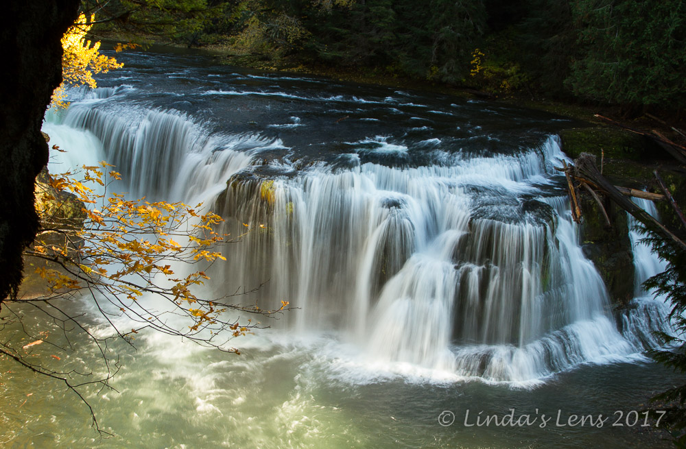

Wispy waterfall

The grand finale - crossing below this tall, wispy waterfall spilling from high atop a basalt cliff.


Admiring the beauty

Our day's journey ended with a 1.3 mile road walk.  Not exactly a great way to finish such a wonderful trail.  However, this was where having a companion really helped eased the monotony.  Catherine and I chattered away, and before we knew it, the road crossing and parking lot came into view.

Great day to be outside, taking in the views and fall colors.  And aside from the soaking rain shower at the very beginning, our entire hike was dry.

(P.S.  For you photo buffs out there, all these images were taken on my new Fujifilm XT-1 mirrorless camera)

Sunday, November 26, 2017

Surprises on the Wilson River

The day after my long drive to Cedar Creek Grist Mill and Lewis River Falls, I was itching for a good fall color hike.  The prior day's trip had been a lot of driving with very little hiking.  And, although the grist mill and waterfalls were pretty, their autumn colors were past peak.

Tired of spending time in the car, I really wanted something close to home.  And I wasn't keen on driving all the way across Portland again.  Where to go?


The mighty Wilson River

It came to me in a flash - the Coast Range!  There was a huge network of trails along the Wilson River.  Only 40 miles west of home with no city driving whatsoever.  And....on this last weekend in October, I'd heard the autumn colors might be close to peak.


Lovely place for a picnic!

The Wilson River Trails weren't new to me.  I'd hiked a segment back in 2013 with my dog Bear.  Although the forests were nice, I didn't recall them being off-the-charts gorgeous.  Besides hiking, I remembered the area had lots of "other" uses (off road vehicle trails, fishing, even target shooting-but thankfully not near the hiking trails).  These multi-use recreation areas are not usually my first choice for hiking destinations, which is probably why I'd never returned. 


Fallen leaves along the shore

Today I decided to give the area a second chance.  So westward ho I went!  Based on my prior experience, I had very low expectations for the Wilson River Trails.  I was merely hoping to get in a good walk, take a few photos, and if I happened to spot some fall color, so much the better!
 

Colorful reflections

The morning started out cloudy.  Passing through scattered fog banks on my drive, I hoped the skies wouldn't drop any moisture.  But minutes before I arrived at my destination, the fog lifted, and bright sunshine greeted me as I pulled into the Jones Creek Trailhead.


The best view was on the bridge

A short access road crossed the Wilson River on the way to the trailhead.  From the bridge, I got my first glimpse of trees lining this river, and boy were they colorful!  I made a mental note to walk back over with my camera.


Backlit leaf

With most of the Oregon side of the Gorge closed for hiking, I expected to see lots of people on the rest of the trails.  Imagine my surprise when I pulled into the Jones Creek Trailhead at 11:00 on a Saturday morning and was only the third car!


Another gorgeous view

Immediately, I headed down to the river's bank.  Several user trails threaded through the thick forest, passing scattered picnic sites (which were surprisingly empty on this beautiful fall day).  My first view of the mighty Wilson River was a great one.  Sunshine illuminated the yellow and orange trees lining its banks, and gave the river's water a brilliant blue hue.  The light was perfect, and the autumn colors appeared to be at peak.


Lots of golden trees overhanging in the river

Needless to say, my hike was delayed a bit as I wandered along the river's bank, capturing all of this incredible beauty.  The fall colors were so bright, vivid, and plentiful, I felt as if I'd hit the photography jackpot.


Colorful forest

After at least an hour of capturing the forest around Jones Creek Trailhead, I decided if I was going to get in a hike, I'd better get moving.  So I headed west, following the well-graded path paralleling the Wilson River.  The scenery was so spectacular, it was hard not to stop and take photo every other step.


Bright leaves

About a half mile from where I'd parked, a huge suspension bridge spanned the Wilson River.  This bridge led visitors to the Tillamook Forest Center.  Oregon's coast range has a long history of logging and destructive wildfires.  This visitor center strives to educate the public about reforestation, forest management, and wildfire prevention. 


Footbridge to Tillamook Forest Center

Although I did walk up on the bridge to take in some river views from on high, I wasn't planning to explore the visitor center.  Today's goal was to hike and photograph nature.


Impressive bridge!

Beyond the bridge, my path twisted through dense second-growth woods.  Logged extensively, Oregon's coast range is far from pristine.  On far side of the river I caught occasional glimpses of State Hwy 6 and heard traffic noises.  At one point the trail paralleled a gravel road and two dirt bikes flew by. 


Bridge span view between the trees

For the most part, the Wilson River Trail  had been fairly level.  But about two miles in, it began to climb.  Traversing the side of a steep cliff, the trail led away from the river. 


Colorful hills

I kept seeing signs for Wilson Falls.  I vaguely remembered a small waterfall last time I'd hiked the trail, but couldn't remember exactly where it was.  After what seemed to be an eternity, I finally came upon a small rushing stream crossing the trail.  Was this all there was?  Then I thought to look up.


The forest was a delight to walk though

High above me, a delicate sheet of water fanned out over a rock cliff, tumbling into a channel that then ran across the trail below.  I didn't remember this waterfall being so lovely, but it was!


Here's a short video I shot while walking through the forest, just to give you an idea of the Oregon Coast Range's dense foliage.


Nice river view

My day's destination was the Footbridge Trailhead, 3.5 miles from where I'd parked.  Nearing this area, the trail dropped down off the ridge, crossing several small streams on sturdy bridges.  Last time I'd hiked here these crossings had been only single logs spanning the water.  I remembered this because my dog had fallen off one of those logs.  Thankfully he wasn't hurt, but it made me realize his hiking days were coming to an end.


Wilson Falls

Although now quite hungry and thirsty, I held out until I finally came upon the large riverbend that signaled the Footbridge Trailhead.  Although I hadn't seen many people on the trail, quite a few folks were hanging around the riverbank here.


Bottom of Wilson Falls

It was a gorgeous place to sit, have a snack, and enjoy this perfect autumn day.


River Bend at Footbridge Trailhead

I even shot a short video to show all you how nice it was here!


My return trip was much quicker.  By mid afternoon, the sun's angle was no longer highlighting the colorful foliage, so photo stops were few and far between.  I was thankful I'd taken the time at the very beginning of my hike to capture these stunning fall colors.


Fantastic day!

The day was a rousing success!  I covered seven miles, and my broken toe (now nearly healed) did wonderfully.  Not only did I hit the Wilson River at full autumn peak, the weather cooperated with sunshine and amazing light. 

It's always nice when a hiking destination exceeds your expectations.   On this day, the Wilson River was full of surprises.  Lucky for me, they were the good kind.


Tuesday, November 21, 2017

Cedar Creek Grist Mill and Lewis River Falls

Every year I like to check out someplace new.  Luckily, there's no shortage of interesting and photogenic subjects in my immediate area.  One that comes up every autumn on the local photography social media sites is the Cedar Creek Grist Mill.


Cedar Creek Historic Grist Mill

Located just outside of Woodland, Washington, the mill is a short jaunt up I-5 from Portland.  One late October Friday afternoon, I decided to pay this historic structure a visit.


Hard to get a clear photo with all the trees

Fall is a wonderful time to photograph the grist mill.  Situated at the bottom of a narrow canyon, the adjacent slopes are ablaze with trees in full autumn finery.  Large, mossy branches surround the creek, draping over it's banks.


The mill, framed by mossy branches

The Cedar Creek Mill was originally built in 1876.  Throughout the years it was used for grinding grain, and as a blacksmith and machine shop.  After falling into disrepair, in the 1980s a group of local residents banded together to save the historic structure.  Through numerous bazaars and raffles, the group raised money to pay for badly-needed repairs.  Fully restored in 1989, the mill again ground wheat - just in time for Washington state's centennial celebration.


Still lots of fall leaves

Nowadays, the mill is on the National Register of Historic Places.  It functions as a working museum, demonstrating operation of a grist mill from a long-ago era.  Open most weekends, it grinds grains for visitors, and depending upon time of year, also presses apples into cider.


Covered bridge adjacent to the mill

I got lucky with a perfect fall day for my first visit to the mill.  Although the afternoon sun made photography a bit tricky, I was able to get a few shots I liked. 


Mill viewed from the covered bridge

The best place to capture the entire structure without trees blocking the view was on an adjacent covered bridge.


The bridge hidden by leaves

Of course, the covered bridge was a photo subject all by itself!


Covered bridge entrance

Although the mill wasn't open to the public that Friday, there were quite a bit of people inside, no doubt gearing up for the weekend ahead.


The Mill sign

Photographers comprised most of the visitors that day.  We all politely jockeyed for positions on the bridge and through tree openings along the opposite creek bank.  I struck up a conversation with one friendly man, and he pointed out a camera crew from the local PBS show "Oregon Field Guide" being led through the mill building.


Upriver fall color

Funny coincidence, the Oregon Field Guide story about this grist mill showed up on the OPB website just as was getting ready to write my blog post.  Check it out here.  The footage is from the very same day I happened to be there.


Lone leaf

Although the fall colors were a tad past prime, the Cedar Creek Mill was a worthy autumn destination.  It most certainly will see some return visits from me!


Lewis River Falls

With still a few hours left in the afternoon, I decided since I was in the area to drive the extra 60-some miles and see Lewis River Falls.  However, I sorely underestimated my driving time.  Winding narrow Forest Service roads take much longer to travel!  A full hour and 45 minutes later, I pulled into the day use parking lot at the very late hour of 4 pm.  Not wishing to drive the rough entrance road back out in the dusk, I had at most a mere hour to spend here.


Full view of Lewis River Falls

After driving for so long to reach these beautiful cascades, I was sorely disappointed to discover my subject in terrible light.  Mostly in deep shade, with the surrounding landscape in bright sunlight, capturing any halfway decent images was going to be tricky.

A few other photographers had set up tripods at an overlook and appeared to be pondering the same dilemma.  One guy in a group of three men recognized me from the Cedar Creek Mill.  Apparently they'd also stopped there first.


Golden leaves and falling water

Despite the challenging lighting conditions, Lower Lewis River Falls was gorgeous.  A wide, multi-tiered cascade, it fanned beautifully over a drop in the river.  The last of the fall leaves accented the surrounding area.  And the bright sunlight wasn't all bad - it did produce a brilliant rainbow!


Rainbow sighting!

One hour passes by much too quickly when you're shooting waterfalls.  Before I knew it, it was time to pack up and get out before darkness cloaked the area.  I was kind of disappointed not to be able to visit the other waterfalls in the area.  Guess that just means I'll have to come back!

Wanting to make a giant loop, I chose to return through Carson, WA with a stop at my favorite pizza and brewpub.  Although that meant a late arrival back home, despite spending most of the day driving, I felt I'd had a very productive afternoon.

To learn more about the Cedar Creek Grist Mill, you can visit their website.