Wednesday, May 29, 2013

Illumination Saddle

You thought skiing was over?  Well......not quite yet.  Still playing blog catch-up, this post is about a ski excursion from early May.    


Clear skies from Timberline parking lot

Here in the Oregon Cascades, where snow hangs around late on the mountaintops, skiing is still going strong into spring.  The first weekend in May things heated up down in the valley.  Temperatures on Friday were predicted to hit 80 degrees.  Katie and I agreed there was but one thing to do - head to the mountain and go skiing!


Illumination Saddle - our destination

Our day's destination - Illumination Saddle, high on the slopes of Mt. Hood.  Illumination Saddle is a small depression in the side of the mountain, bounded by the summit crater and Illumination Rock.  See the arrow in the photo above?  That's where Katie and I were headed.


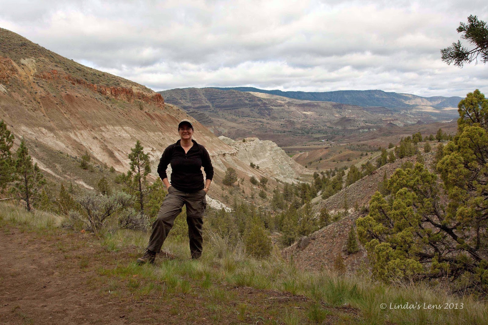
Katie enjoying the day

Our adventure began behind Timberline Lodge.  Following the rough trail from the lodge, Katie and I strapped climbing skins to skis and headed out.  The skies were clear and beautiful, the temps unseasonably warm.  We hadn't climbed far before both Katie and I were stripping down to long underwear.


Big mountain views

The Palmer Lift was now open, so uphill travel wasn't allowed on the groomed ski runs.  Anyone wishing to climb Hood was now directed a bumpy snowcat trail.  Okay if you were on foot, but not a lot of fun for us skiers.


Silcox Hut and the bottom of Palmer lift

Reaching the top of the Magic Mile Lift, and tired of making our way over the road's uneven surface, Katie and I struck out on our own.  We decided to follow the edge of Palmer's groomed trail. 


Our climb turns into a steep slog

From here, the going was much smoother.  And it was fun to watch the snowriders cruise down the slopes.  They all looked at Katie and I, slowly sliding uphill, as if we were crazy.


Illumination Rock rises over the Palmer Lift

Dripping sweat and fighting aching hip flexor muscles, I was beginning to wonder if they were right.  As many times as I've climbed Palmer's slopes this year, the trek hasn't gotten any easier.  It's still a long, tough slog. 


Pausing for a breather

One older man stopped by the side of run and called out to us.  After exchanging hellos, the man said he was in awe of our uphill skiing abilities.  He made Katie and I laugh by doing a mock bow and bestowing a humorous blessing.  That made me feel better!


Climbers appear as dots against the mountain

Again, we were passed by a few much faster uphill skiers.  One young man was moving so quickly, Katie jokingly asked the guy if we could tie a rope to him and get a tow.  Most of these skiers didn't stop at the top of the Palmer Lift, but continued on towards the mountain's crater.


Spiders in the snow?

As we ascended, I began to see tiny specks in the snow.  Upon closer inspection, I realized these dark specks were small spiders, about the size of a pencil eraser.  I'm not sure what these little guys were doing on the side of a cold, snowy mountain.  I was surprised they were alive!


Lunch break at the top of Palmer

Finally for Katie and I, the top lift station of the Palmer came into view.  Tired and hungry, it was a sight for sore eyes.  We plopped down on top of the snow and pulled out our lunches.  Some food and a short rest were just what my poor body needed.


Heading towards the crater wall

By the time Katie and I finished lunch, it was nearing one o'clock.  With the day's high temps, I knew we didn't want to wait too long to ski back down.  Enough heat and solar energy would turn the snow into a sticky mess that's difficult to ski through.  But Katie, intent on reaching Illumination Saddle, suggested we continue uphill for another hour and then, wherever we were at, turn around and head down. 


Illumination Saddle - such a wonderful sight

We finally agreed upon a 2:00 turn-around time.  Then, strapping on my skis, I followed Katie across the wide, barren snowfield above the Palmer.  Here, the slopes were not as steep, and we made good time.  The views were incredible.  Mt. Hood's summit crater was so close, I felt as if I could reach out and touch it.


I made it!

Illumination Rock, a large triangular block of basalt, loomed larger on the horizon  It acted as a beacon, drawing me ever closer.  Finally, Katie reached the saddle between Illumination Rock and the summit crater.  A short, steep climb put us on top of the saddle, near Illumination Rock's base.


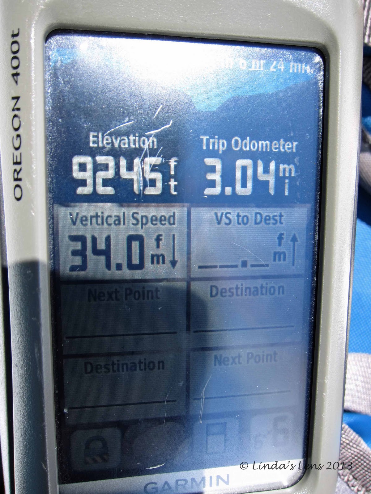
Highest I've ever been on Mt. Hood

I made it!  My gps unit displayed an elevation of 9,245 feet - the highest I've ever been on Mt. Hood.  The views were incredible.  The entire foothills and valleys spread out before us.  Mt. Jefferson, anchoring the southern horizon, seemed much larger at this high altitude.  Looking at my watch, I realized our timing was good.  It was exactly 2 o'clock - the designated turnaround time.


Time to ski down!

Our location on the saddle was a windy one.  The gap between Hood's crater and Illumination Rock acted as an air funnel.  Not wishing to linger in this chilly climate, Katie and I quickly removed our climbing skins and made preparations for the trip back down.


This was worth all that climbing

After donning coat, helmet, and giving my skis some wax, I was ready.  We'd spent all morning and half the afternoon climbing - now it was time for our reward.  With a whoop, Katie launched herself down the slope.  I quickly followed. woo-hooing as my skis sliced through the sun-softened snow.


Katie yells with glee

Oh - and the conditions were incredible!  Perfect corn snow!  My turns came effortlessly as I dropped into my tele stance.  All my worries about the snow being too soft were for naught.


Stopping to soak in the scenery

As we descended, the temperature got warmer.   Katie and I kept our eye on conditions, knowing at some point our lovely corn snow would turn into thick mashed potatoes.  But we reached the top of the Magic Mile Lift, and the skiing was still good.  Continuing downhill, the snow continued to part easily beneath our edges.  We didn't encounter bad snow until we were almost back to Timberline Lodge. 


A fabulous ski down

What a fabulous ski down!  And what an incredible trip up the side of Mt. Hood.  I figured we climbed 3300 vertical feet in a little more than 3 miles.   Katie remarked we were only 2000 feet lower than Mt. Hood's summit.

What a great way to spend a hot, sunny spring day.  Although this trip was my first time on Illumination Saddle, I assure you it won't be my last.


Sharing with:  Weekly Top Shot.

Monday, May 27, 2013

Rainy Memorial Day

Arrgggghhhh!!!  Memorial Day in Portland dawned windy and rainy.  I'd planned to go hiking, but one look out the window put a kibosh on that.  I sat at my kitchen table, drinking tea, and sulking over foiled outdoor plans.


Then I remembered this week's challenge from the 52 Photos Project.  The current theme was "waterdrops."  Boy, if today wasn't the perfect day for finding raindrops!


Grabbing raincoat and camera, I headed out to the front yard.  My husband's rose bushes were just past full bloom, but their waterlogged leaves made lovely subjects. 


The lilies in our backyard pond were also sporting droplets.  Glad I captured this one today - the flowers are looking as though the bloom is about over.


But my favorite photo of all was this view of a backlit rose leaf.  I didn't realize until I processed this image, but you can see faint outlines of small insects on the leaf's topside.

Even though I drenched both my camera and myself, it was fun to be outside capturing photographs.  At least the day wasn't a total waste!

To see more water droplet magic, check out Gallery 5 of the 52 Photos Project.

Also linking to:  Sweet Shot Tuesday.

Friday, May 24, 2013

More From Eastern Oregon

Three posts just isn't enough....

So here's an extra "bonus" story with some photos and information that I couldn't quite fit into the other Eastern Oregon trip reports.

Downtown Mitchell, Oregon

After a fine afternoon and early evening at the Painted Hills, I spent the night in nearby Mitchell, Oregon.  This tiny town had exactly two places to stay (three if you count free camping in the city park) and one restaurant.  I really liked the "Old West" theme of their main street.


Historic Oregon Hotel

The place I stayed, and the cafe I visited for dinner were both great.  I rented a room in the historic Oregon Hotel, a large house that has been converted into a lodging facility.  The lady at the front desk was very nice and super accommodating.  Although a little rustic, my room was large, clean and comfortable.  And I loved all the John Wayne decor.

At the next door Little Pine Cafe, I enjoyed a delicious burger and a huge plateful of tasty french fries - more than I could possibly eat.  The friendly lady that ran the place served my beer in a frosty mug.  A nice touch!


Creative sign

The Oregon Hotel had a couple of these very creative signs in their front lawn.  I also saw "no dog pooping" signs outside the restaurant next door, and on the windows of the general store.  Doggie poo must be a big problem here.


Sheep Rock towers over the John Day River

The next morning I traveled to the Sheep Rock Unit of the John Day Fossil Beds National Monument.  Reaching the south end of the Unit, this was my first glimpse after turning off the highway.  That tall, pointed hill in the distance is none other than Sheep Rock.  The beautiful body of water is the John Day River.  This river travels the entire length of the valley floor.


Cathedral Rock

The Monument's highway passes by a formation known as Cathedral Rock.  This colorful, stratified hill actually blocked the John Day River, causing it to change direction nearly 180 degrees.


Cathedral Rock and the John Day River

Looking at the rock from the other direction, you can see the oxbow bend in the John Day River.  Cathedral rock must be made of harder, more erosion-resistant material than the surrounding hills to force such a larger river to completely change its course.


Elegant farmhouse at the James Cant Ranch

The dry hills in this area provided ideal grazing land for livestock.  The first white settlers were cattle and sheep ranchers.  The James Cant Ranch, one of these early homesteads, has been preserved, and is now operated by the National Park Service.


This farmhouse has nice views!

The ranch is in a beautiful setting.  The John Day River flows through the valley below.  And the house and grounds have a front-row view of Sheep Rock.  The grounds are nicely landscaped, with many varieties of ornamental and fruit trees.


Lovely field of purple

There's a huge barn, complete with the original sheep and livestock stalls.  And a wide variety of old farming equipment is on display.  A very interesting place!

Sadly, not much was open when I stopped by.  There was only one other visitor the entire time I was there.  Although the barn building was open, the ranch house appeared to be closed.  No mind, photo opportunities abounded.  Weathered outbuildings against the stark landscape made for some great shots.


Some red hills here too

The Sheep Rock Unit also had a fairly new, very impressive, paleontology center.  Short on time by then, I only did a quick walk-through.  But the place had some very impressive displays and lots of fossils.  I'll allow more time to explore it fully on my next visit.


A wild, scenic place

The variety of landscapes and climates in this state never ceases to amaze me.  What a wonderful weekend getaway - exploring a part of Oregon I've never seen.


In case you missed any of my Eastern Oregon trip reports, here are the links:

White River Falls
The Painted Hills
Blue Basin


Also linking to:  Sunny Simple Monday.

Wednesday, May 22, 2013

Blue Basin

After visiting the Painted Hills, anyplace else in the John Day Fossil Beds National Monument would be a hard act to follow.  Or so I thought.  Even so, the morning after my wonderful visit/photo session, I woke up early and drove 35 miles east to check out the Sheep Rock Unit.


Turtle Cove

The Sheep Rock Unit of the John Day Fossil Beds National Monument is known for it's fossil-rich rock formations.  Hundreds of fossilized specimens, from plants to large animals, have been discovered here. 


Prairie thistles

I had a lovely early morning drive through winding canyons interspersed with radiant green pastures.  This was cattle country, as the numerous ranches attested.  Interesting rock formations lined the highway.  I even saw a herd of elk grazing in some rancher's field.


Looking back towards Turtle Cove

My primary destination - Blue Basin.  A large eroded canyon full of unusually colored blue-green rock and soil, it's one of the highlights of the Sheep Rock Unit.  Two hiking trails explore this area - the Overlook Trail, a 3.2-mile loop that circles the ridge above the canyon, and the Island in Time Trail, a half-mile path that takes visitors directly into the heart of the basin.


Interesting iron-stained rocks

I chose to tackle the longer trail first.  Beginning my trek, early morning clouds still hung thick in the sky.  Although it kept temperatures down, the lack of light wasn't much help for photo-taking.


Climbing higher

I meandered through scrubby juniper and bushy grassland plants.  About a half mile from the trailhead, I got my first sighting of the blue-green soils.  Turtle Cove, a huge eroded cliff, rose up from the prairie floor.  Water erosion had sculpted the rock and soil into interesting castle-like shapes.  Bands of harder rock more resistant to the weathering, stood out from the slope face like wavy stripes.


Self portrait attempt near the top

I later learned that turtle fossils had been found in this area, so I'm assuming that's how Turtle Cove got its name.


Looking into the Canyon from Rim viewpoint

From Turtle Cove, the trail began to climb.  It paralleled the fascinating blueish banded rock for a short distance before switchbacking steeply uphill.  Nearing the canyon's rim, a strategically placed bench provided hikers a place to rest and take in the amazing views.  Desolate hillsides dotted with colorful hues of red and blue soils mixed in with the golden brown tones of the valley below.


Blue Basin overview

Climbing up a couple more switchbacks got me to the canyon's rim.  A side trail snaked across the crest, which led to another bench.  Hikers reaching this point are rewarded with a stunning overlook of Blue Basin and the John Day River Valley.


The trail passes between these two boulders

My perch on the rim provided great views of the layered rock and sculpted soils in the canyon below.  This colorful blue crack in the earth stood out prominently from the surrounding landscape.  Breathtaking!


Nice view of Blue Basin and the surrounding area

After soaking in the scenery, I continued my hike, following a circular path around the basin's rim.  Finished with climbing, the trail now began to zig-zag back down to the valley floor.


Wildflower bloom

Coming down the other side, I was treated to some incredible scenery.  Blue Basin appeared over my right shoulder, and was my constant companion for the rest of the hike.  Beyond the canyon, the John Day River Valley spread out, rimmed by steep hills on either side.  Green fields of an adjacent farm brightened the landscape.


Island of Time Trail into the basin

As I descended (traversing 21 switchbacks), the eerie, fluted formations of Blue Basin became larger and closer.  Finally, my path intersected with the Island in Time Trail. 


The minerals stained the water blue

Time to check out the interior of this canyon I'd just circumnavigated!  This second trail leads visitors directly into the heart of Blue Basin.  I began by following a trickling creek of murky blue-green water.  Thick with minerals leached from the soil, I'd never seen water such an unusual shade of blue. 


Rocky trail

The rock in this basin was originally volcanic ash, deposited 29 million years ago, which hardened into claystone.  Erosion over the eons has transformed these rock layers into intricate castle-like shapes. Minerals leaching into the soil give the rock its distinct blue color.


Close up of blue-green soils

Many varieties of fossils have been found in this very canyon.  A few interpretive signs spaced along the trail housed replicas of some of the more common finds.  But the weatherbeaten signs were difficult to read, and looked liked they'd seen better days. 


Weird rock formations in the basin

No matter, the scenery was the show-stealer.  The further I hiked into the canyon, the more impressive the sights.  Deeply ridged hills rose from both sides of the canyon, becoming more numerous.  The eroded columns of rock looked as beautiful as any architect or artist could create.  It felt as if I was inside an elaborate cathedral.  Not expecting to see anything that would top my previous day's visit to the Painted Hills, Blue Basin came darn close.


This rock is REALLY blue!

The trail ended in a colorful amphitheater of sculpted stone.  The fluted blue formations rose around me on three sides.  And, if one cue, the sun, which had struggled all morning to break free of the clouds, began to beam down upon the canyon walls.


Erosion created sculptures

Such unusual sights!  The Badlands of South Dakota is the only area I've seen that even comes close to resembling the formations found here.


Finally some blue sky!

I'd heard all about the Painted Hills, and was prepared to be amazed.  But Blue Basin was a total surprise.  I didn't expect to see such striking, colorful rock formations twice in the same trip.  I'm glad I made the effort to drive further east and check out this unique geologic treasure.


Linking to:  Weekly Top Shot.