Showing posts with label fireweed. Show all posts

Friday, September 8, 2017

Pinnacle Ridge

In 2011, a massive wildfire torched Mt Hood's northern flank.  Named the Dollar Lake fire, after a tiny nearby pond (that coincidentally the fire never touched) it burned over 6,000 acres before finally being snuffed out by fall rains. 

This fire burned through the heart of Pinnacle Ridge, one of my favorite northside Hood trails.  I hadn't returned to this area since the fire.  But, hearing that the forest was in full recovery, I recruited two of my hiking buddies to go check things out.


Mt Hood through the burned forest

So one glorious, but hot, late July Saturday found myself, Young, and Steve bouncing down a gravel road bound for the new Pinnacle Ridge Trailhead.  Since the fire, the Forest Service had rerouted portions of this trail, and relocated the trailhead nearly a mile further away from the old one.  My friends and I laced up our boots, slathered on sunscreen, and located the new trailhead sign. 


Fireweed!

We started off winding through an unburned forest, but that quickly changed.  Soon, stark gray tree trunks lined our path.  Although somber, there was also lots of green undergrowth sprouting from the forest floor.  Further down the trail, I noticed brilliant pink fireweed brightening up the landscape.  And I now noticed a perfect view of Mt Hood through the bare tree trunks - a new clearing created courtesy of the wildfire.


The old trailhead

After about a mile, Young, Steve and I came upon the old trailhead message board.  It looked as though the fire had touched some of the forest here.  After a quick photo op, we continued our climb through the burn zone.


Climbing through the burn zone

Although sad to see all the trees that burned, there was also a stark beauty to this silver forest. 


Creek crossing

And the higher we climbed, the better the fireweed bloom became (provided lots of photo distractions!)


Lots of fireweed photo ops

I especially liked this backlit stalk.


Backlit fireweed

These bright pink blossoms provided a nice splash of color to the forest floor.


New life from the ashes

But as the morning sun rose higher, the lack of shade in the burn zone became more apparent.  Temps were getting quite toasty!


The pinnacle is visible through the trees

Despite the fire's damage, I recognized much of the trail from the last time I'd hiked it, over 6 years ago. 


Silver forest

I even remembered the trail as it passed through a boggy area, which was still very much intact, and just as muddy.  Here Steve, Young and I lost the trail for a few minutes before we waded back through the muck and retracted our steps.


Surprise avalanche lily bloom

Near the junction with the Timberline Trail (Mt Hood's famous 'round the mountain path) we came upon a huge field full of frilly white avalanche lilies.  A huge surprise, as these flowers typically bloom right after the snow melts and are long gone by late July.


Lunch at Dollar Lake

Although supposedly only 3.5 miles from the trailhead, the Timberline Trail junction seemed to take forever to reach.  Climbing through shadeless woods in the hot sun didn't help.  But finally the sign and trail came into view.  My friends and I celebrated with an impromptu snack break, sitting right on the trail itself.


Magenta paintbrush

Now that we'd reached the Timberline Trail, it was decision time.  Did we hike over to Elk Cove or up to Dollar Lake first?  My friends, wanting a nice lunch spot voted for Dollar Lake.


Fabulous mountain views

So we trekked a short distance up a rocky meadow sporting magenta paintbrush blooms until we came upon the famous water body.  A tiny glacial tarn, round as a silver dollar, it was situated in a beautiful basin with great views of Mt Hood.  My friends and I sat on the shore, admired the scenery, ate lunch, and slapped at the pesky flies that wouldn't leave us alone.


Mt Hood from the Timberline Trail

The flies began to bother all three of us, so lunch was cut short in favor of continuing our hike.  Young, Steve and I climbed back down the ridge and rejoined the Timberline Trail, heading east towards Elk Cove.  The mountain views on the way down were nothing short of spectacular!  A parade of Cascade peaks - Mt Adams, Rainier, and St Helens lined themselves across the horizon.


Dollar Lake fire burn zone

And the scenery just kept getting better....we rounded one bend to a slope chock-full of colorful wildflowers.  Orange paintbrush and fluffy Western Pasque flowers covered the forest floor.


Young can't decide what to photograph first

Poor Young just couldn't decide what to photograph first!  I must admit I had the same problem too....definitely slowed down my hiking pace.


Western Pasque flowers and orange paintbrush

Elk Cove is a gorgeous mountain valley with a clear glacial stream, and reputation for amazing summer wildflower displays.  However, this appeared to be an off-year as the flowers weren't as thick as I'd seen in past visits.  And down by the creek, the flies were so bad, my friends and I didn't linger long.


Back down the Pinnacle Ridge trail

So it was back the way we came, retracing our steps back to the Pinnacle Ridge Trail's junction with the Timberline Trail.

Admiring Mt Adams view

Afternoon sun lit up the adjacent Cascade peaks beautifully.  When we reached the boggy area once again, it's wide clearing provided a great place to take in the mountain panorama.  Can you spot all three mountains in the photo below?  (Hint...Mt St Helens is a gray shadow on the far left next to the tall trees).


Can you spot all three Cascade peaks?

Then it was back down the endless trail through hot, dusty, shadeless forest.  Young and I kept our spirits up by discussing what brewpub we'd visit for our traditional after-hike beer.
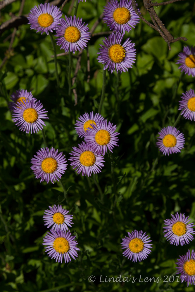

Aster bloom

As I mentioned in the prior post, this past weekend my beloved Columbia River Gorge was the victim of a huge wildfire.  All week I watched the news in despair, thinking of it's lovely mossy forests now forever destroyed by flames.  But going through photos from this Pinnacle Ridge hike made me realize forests do recover, plants and flowers return, and sometimes new vistas are opened up.  So I hold out hope that when the fires are out, although altered, the Gorge trails just might have some new and interesting sights to see.


Great day with good friends

Good to see an old favorite trail rising from the ashes!  Eleven miles traveled, 2100 feet of elevation gain, and a fun day in the woods with my friends.


Wednesday, September 30, 2015

Hikin' Around Elk Meadows

Are there really elk in Elk Meadows?  I'm not sure (haven't seen one yet) but I do know this popular area is considered the crown jewel of Mt. Hood's scenic southeast flank.


Fall colors already!

Sunny August Sundays are perfect for exploring this little bit of heaven.  Starting from the trailhead off the local ski area's access road, paths branch out to many destinations.  In the past, I've skirted the edge of Elk Meadows, and continued on to Gnarl Ridge.  But today I decided to pay this lovely mountain clearing a proper visit.


Clark Creek footbridge

Getting an early start, I had the trail to myself.  I was surprised to see crimson huckleberry leaves already sporting fall colors (a wee bit early, but it's been an unusual summer).   A quick half mile later, I was crossing Clark Creek on a sturdy log footbridge.


Smoke filtering in

One creek crossing down, one more to go!  Approaching crossing no. 2, turbulent Newton Creek, I noticed the air was becoming hazy and smelling awfully smoky.  Two large forest fires had been burning, one in Central Oregon, and another in Washington, and it appeared shifting winds had begun blowing smoke towards Mt. Hood.


Still clear to the west of Newton Creek

It was funny - while visibility was fast becoming obscured by smoke towards the east, westward skies were still clear as a bell.


Scary Newton Creek crossing

Traversing Newton Creek is the scary part of this trail.  A fast-running glacial stream, it's wide, turbulent waters always get my heart racing.  With no bridge in place, hikers are left to fend for themselves.  I scanned up and down the banks, and finally decided to scurry across on a group of narrow logs. Although appearing flimsy, the makeshift log bridge held my weight just fine.  In no time I was safely standing on the other side.


Purple wildflowers were everywhere!

Now came the climbing.  For a mile, the trail ascended Newton Creek's steep bank, through 8 long switchbacks.  The saving grace to this grueling slog was a huge swath of purple wildflowers lining the trail.  A welcome distraction!


Sun illuminates beargrass stalks

Gorgeous morning light on dried beargrass stalks also temporarily made me forget my burning legs and lungs.


Mt Hood emerges from the forest

And a few peek-a-boo views of Mt. Hood through the trees weren't too shabby, either.


Pearly everlasting blooming in burn area

Approaching the famous Elk Meadows, I came upon a junction with the Bluegrass Ridge Trail.  My map showed this side path would take hikers to a viewpoint on top of Elk Mountain.  It then followed a ridgeline for a half mile or so before looping back in to Elk Meadows.  A trail I'd never before taken - would I check it out? 

But of course!


Smoky skies on Elk Mountain

My detour climbed through mossy woods before breaking out into an old burn area from the 2008  Gnarl Ridge Fire.  Ghostly silver tree trunks lined the path, occasionally broken by a patch of pretty white pearly everlasting flowers blooming between downed stumps.


More beargrass stalks

It wasn't long before I approached the summit viewpoint atop Elk Mountain.  A former lookout site, all evidence of any tower had long been removed.  I was hoping for some nice panoramas across the Hood River Valley and Eastern Oregon, but the darned smoke had moved in just enough to foil any photographic plans.


Crimson huckleberry leaves

I tried to eat a quick snack, but some aggressive wasps drove me back on the trail.  So I continued my trek up Bluegrass Ridge, taking in the wide-open views (thanks to the Gnarl Ridge Fire) which would have been even better without the smoky skies.  I did pass by a few spots of fall color (everything is early this year!)


Fireweed in the burn area

And fireweed was still blooming at the base of several charred trees.


 Bleak forest

I enjoyed traversing this ridge trail, despite it's wanderings through an old burn area.  The views, occasional fall colors, and late-blooming flowers made for a pleasant journey.


Fireweed is taking over

Finally I came across the short tie trail that would take me off this ridge, and into Elk Meadows.  This path wasted no time descending straight downhill, winding through more deadfall.  But the silver lining was passing through a zone of thick fireweed.  These brilliant pink blooms brightened up an otherwise dull, gray forest.


Fab Hood view on the way to Elk Meadows

A highlight of the day's hike, the large amount of fireweed was absolutely stunning.  And as I continued edging closer to the meadows, Mt. Hood made a few more appearances.


Amazing wildflower display

After losing my trail twice due to downed trees blocking the way, I finally connected with the loop trail that circled Elk Meadows' perimeter. 


Mt Hood from Elk Meadows

I followed a side path that led me into the very heart of Elk Meadows.  Oh, what fabulous views!  Mt. Hood rose above the forested hills, towering over this clearing.  Dry grasses were beginning to put on their golden fall colors.


Elk Meadows shelter

I'd heard there was a wooden shelter somewhere in this area, and after a bit of searching I was able to find it.  A dilapidated, rustic structure, it looked as though it had seen better days.  Unless desperate, not someplace I'd spend the night.  But, the shelter did have some spectacular mountain panoramas framed in it's doorway.


Cairn marks the creek crossing

By this time, it was early afternoon, the sun was hot and high, and the masses were beginning to arrive.  Time to head back. 

Although I didn't see any elk, I did discover a new loop trail to a scenic viewpoint, found a huge patch of brilliant fireweed, and got to traipse through Elk Meadows proper.  This scenic little meadow is a worthy late summer destination.  Two hiking poles up!

Stats:  9 miles round-trip, 1400 feet elevation gain.


Wednesday, September 9, 2015

Vista Ridge

Are you ready to see some fireweed photos?  LOTS of fireweed photos??

Due to foot issues, I missed peak avalanche lily and beargrass bloom on the Vista Ridge Trail.  I'd heard it was spectacular, and was super bummed.  But then around mid-July I got wind that the fireweed was blooming thick and furious on this same trail.  Foot nearly healed, it was time for a visit!


Mt. Hood in morning light

The Vista Ridge Trail, on Mt Hood's northwest flank, takes lots of time and patience to reach.  Navigating a maze of forest service roads, it took nearly three hours before I arrived at it's trailhead.  I did get lost once, taking the wrong road at a fork.  But the silver lining to this misadventure was catching an amazing view of Hood illuminated by morning light.


Trailhead signage

Knowing it would be a long drive, I left my home super-early and arrived just as the sun was cresting over the hilltops.  Weather the day before had been a surprise bout of precipitation, drenching everything in raindrops.  The rising sun made these droplets glisten like diamonds.


Sunburst through the trees

In 2011, the Dollar Lake fire charred a huge area of Mt. Hood's north side.  Vista Ridge Trail was one of the casualties.  Although beginning my trek in a lush fir forest, barely a quarter mile later I came upon a bleak wasteland of ghostly gray trees.


First fireweed sighting

BUT.....the upside to this devastating fire was the abundance of wildflowers repopulating the burn area.  One of the first flowers to reestablish after a blaze is the lovely pink fireweed.  After entering the fire zone, it wasn't long before I got my first glimpse of these beauties rising up from the charred forest floor.


Lovely pink fireweed

A tall, slender wildflower, the pink blossoms of fireweed can reach up to five feet in height.


Fireweed carpeted the forest floor

The camera came out, and I immediately began shooting copious images of these pink beauties.  I hiked further up the trail, and came upon an even higher concentration of blooms.


Dew-dropped petals

Oh was it lovely!  The vivid pink petals really brightened up an otherwise gray, lifeless landscape.


A few views

Although the morning skies were still overcast from the previous night's weather, a few times the clouds parted just enough allow glimpses of the surrounding terrain.  The lack of vegetation on the trees opened up nice views of adjacent foothills and forests below.


Path through the flowers

As I ascended the trail, the concentration of fireweed became thicker and thicker.  In some places it nearly overtook the path.  A total "tiptoe through the wildflowers!"


The burned area coming back to life

I was so enthralled with the wildflower show, progress became glacially slow. I crept from one flower patch to the next, filling my memory card.  I'd never seen so much fireweed in bloom all at once!


"Hippy on a stick"

After a very slow 2 miles and 1200 feet of climbing, I arrived at a junction with the trail to Cairn Basin.  Although I'd left the burn zone and fireweed by then, some very nice specimens of Western Pasque Flower (aka "hippy on a stick") were blooming nearby.


Ghostly trees

Decision time.  I really, really wanted to hike down to Cairn Basin and return in a loop via the Timberline Trail.  However, this route necessitated double crossings of Ladd Creek, a fast-moving glacial stream.  After the previous day's rain, I was sure it would be running high.


Bright pink fireweed blooms!

After debating at the junction for a couple minutes, I decided to go for the loop.  I reasoned if I reached the first creek crossing and it was truly dangerous, I could always turn around and retrace my steps.


Monkeyflowers

The first part of this trail was a true delight.  I passed more large patches of fireweed, even more vividly colored than the previous batch.  I wandered through a gorgeous mountain meadow, already turning golden, and crossed a tiny creeklet lined by yellow monkeyflowers.


Mighty Ladd Creek

And then, I began to hear the sound of rushing water.  The trail seemed to disappear into the rocky banks of Ladd Creek, and it took a few tries before locating the crossing.


Foggy skies

A flimsy tree trunk had been placed across the Ladd's raging torrent.  This appeared to be what hikers were using to cross the creek.  I stared and stared at the log, trying to gather my courage to shimmy across.  The water was moving so fast, I knew one false move and I'd plummet into the strong current and be washed away.  From experience, I know most creek crossings look much worse than they really are.  However, something in my gut was telling me to turn around.


Huckleberries!

The fact that I was by myself finally swung the pendulum.  I reasoned that if I did attempt a crossing and fell into the creek, no one would be there to help.  It wasn't worth the risk.  Cairn Basin would have to wait for another day.


Timberline Trail

So I turned around and returned up the path I'd just galloped down, one mile uphill to the junction with Vista Ridge Trail.  And really, this trail was so beautiful the first time, I didn't mind passing through again.


Remains of the fire

As I started back down the Vista Ridge Trail, another surprise awaited.  Ripe huckleberries!  Bushes lined the trail, laden with tiny, sweet, purple fruit.  How had I missed this the first time?


Flowers brighten the burn area

After gorging on berries (slowing progress down once again) I continued downhill until reaching the fireweed zone once again.  Did I have enough photographs of the massive bloom yet?  I think you know the answer to that......


A splash of color

The overcast late morning light was nearly perfect for photography.  So of course I had to take advantage of it.  Forward progress ground to a halt.


Close up

Oh, I had so much fun trying to capture these unique wildflowers.  I came away with a bunch of amazing images (so hard to choose just a few for the blog).


Final view

Although I didn't complete the planned loop to Cairn Basin, I wasn't disappointed in the least.  Discovering such a large amount of fireweed at peak bloom was the highlight of this day. 

Stats:  8 miles, 1700 feet elevation gain.


Sharing with:  Through My Lens and Wednesday Around the World.