Sunday, October 30, 2016

Pokemon on Hamilton Mtn

After living in Oregon for the past 6 years, my son Cody moved back to Montana in June.  I've really missed having him close by, so when he returned to Oregon for a mid-September vacation I suggested catching up on a hiking trail.


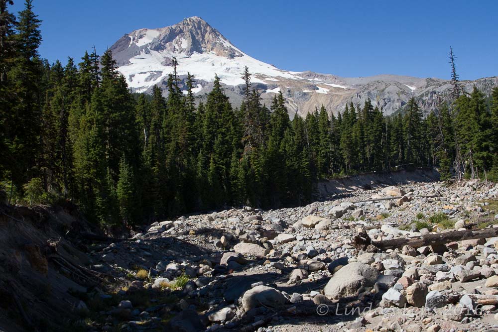
Hamilton Mtn - our destination

Cody's always had a keen interest in nature.  From the early age of 10, he'd join me in the forest and always took note of the various trees, plants, and flowers.  Not surprisingly, he earned his first bachelor's degree in Botany.  Over the years Cody taught me a quite few things about plant identification.  Our hikes have always been special times, and I was looking forward to having him on the trail with me once again.


Early fall color

For our hike, I chose a sunny mid-September Friday and decided to visit Hamilton Mountain.  A popular hike on the Washington side of the Columbia River Gorge, it's known for a lovely waterfall and tough climb to spectacular Gorge views.


Rainbow in the Pool of Winds

Cody, along with many young adults under age 30, had developed another interest - playing Pokemon Go.  While heading out to our destination, I noticed him spending lots of time staring into his phone.  After inquiring what was so interesting, Cody replied he was looking for Pokemon.  I didn't know it at the time, but I was about to get a lesson in this summer's most popular mobile game phenomenon.


More lovely color

Heading out from the trailhead, I admired some early fall colors just beginning to show, while Cody proceeded to find and catch a "seal" Pokemon.  Amazed we actually still had cell service, I was also surprised one could capture a Pokemon on a hiking trail in the boonies.  Wasn't this supposed to be a city game?


I made Cody pose at this overlook

As we climbed the path to Rodney Falls, Cody gave me a quick primer on Pokemon Go.  Apparently Pokemon can be found anywhere there is cell service.  The seal Pokemon he'd just captured was rare, and unusual to find in the woods.  Normally (according to Cody, because I'm far from an expert!) woodland-type Pokemon are found in the forest and more aquatic-type Pokemon (such as the seal) are found near oceans or other large bodies of water.  Hmmm...who knew?  I was still adjusting to finding Pokemon in the woods.


Bonneville Dam

Arriving at Rodney Falls, Cody and I first climbed a short distance to see the Pool of Winds, a cave-like chamber in the cliff face.  Rodney Falls gets trapped inside, and swirls around in a pool, creating odd wind currents, before dropping further to the creek below.  Visitors are only able to view this scene through a 10 foot wide slit in the rock.  We got really lucky that day and arrived when the light was in the right place to produce a lovely rainbow from the spray.


Impressive cliffs

Beyond Rodney Falls, our climbing began!  The trail ascends 1500 feet in a little over two miles.  Trudging up the numerous switchbacks, I struggled to keep up with Cody (ah youth!)  Of course while waiting for me to catch up, my son would pull out his phone to check for nearby Pokemon.  Although cell service was spotty, he managed to catch a couple - even demonstrating how to capture the little creatures to his Pokemon-challenged mom.


These trees are starting to turn

About halfway to the top, the forest parts giving a fantastic view of Hamilton Mountain's steep cliffs and the Columbia River far below.  Bonneville Dam's massive structure and power plant spread out across the river.  A great place for photo ops, I was busy with my camera, while Cody, taking advantage of having cell service, caught yet another Pokemon.


Columbia River shines below

Then it was a long trudge to Hamilton's brushy summit proper.  I'd forgotten how endless the switchbacks were!  Even Cody commented the climb seemed to take forever (however, for him it may have been due to lack of phone service).


Cody catches a pokemon

On Hamilton's summit, we were joined by a couple groups of hikers.  One particularly chatty guy kept me occupied, so while I conversed with him, Cody took advantage of renewed cell service to look for more Pokemon.


On the sadlle

One would think a mountaintop would provide splendid views, but Hamilton's summit is partially obscured by tall vegetation.  On this hike the best panoramas are found on an open saddle further down Hamilton Mountain's northern ridge.  Here one is treated to a front-row view of nearby Table Mountain, as well as Mt Hood and Adams.


Looking back towards Hamilton Mtn summit

After soaking in these wonderful views, Cody and I continued across the bare ridge, admiring a few nearby trees just beginning to turn gold.


View of the Sadlle

Then we ducked back into the woods, following first the Don's Cutoff Trail, and then an old road before reaching a meadowed creek crossing.  From, there another lovely forested trail led us back to our original path near Rodney Falls.


Beacon Rock and the river

Taking advantage of the nonexistent phone service along this stretch gave Cody and I ample time to catch up on each others lives.  Hiking time along a wooded path always produces great conversations.  It was great to hear about his new job and life in Montana.


Lower Rodney Falls

Before we knew it, Cody and I were back at Rodney Falls.  We crossed the sturdy bridge spanning it's creek and stopped for another look at the lovely lower falls.  Not carrying my tripod, I attempted a slow exposure shot by bracing myself against the bridge railing.


Looking up towards the pool of winds

Then it was a short uphill trudge back to the trailhead, civilization, and cell service.  I think Cody may have hunted for a few more Pokemon, but by that time I was too tired to notice.  I was more than ready for some food and beer!


Happy to be hiking with my son

Cody and I ended our day with dinner at a nearby brewpub in Stevenson.  We declared the day a success, both in climbing Hamilton Mountain and catching Pokemons!  And although Cody was able to teach his old mother a thing or two about Pokemon Go, I won't be playing anytime soon.  Think I'll stick to hiking!  :)


Stats:  8 miles, 2000 feet elevation gain

Tuesday, October 25, 2016

Hike Through the Meadows

Ever visited a ski area in the summer?  Wonder what your favorite hill looks like without snow?  Do you image it's a bleak, barren expanse of rocks and brown grass?

Well...maybe that's true for other resorts, but my home hill, Mt Hood Meadows, is actually a nice place to hike in the off season.  (There's a reason it's called Mt. Hood Meadows!)

Young finds some huckleberries

In early September, back home from my South Dakota trip, I needed a Mt Hood fix.  My friend Young was more than happy to join me. 


Mmm....great morning snack!

So off we went on Sunday morning, Mt Hood bound!  My destination was the Elk Meadows Trailhead, on Hood's east side.  The previous night had been clear and cold, but I was still surprised when pulling into the trailhead, my car thermometer read a chilly 37 degrees.


This tree burl looks like a face!

Pulling on hats, gloves, and extra layers, Young and I set out on the Sahalie Falls Trail.  My goal was a roughly 10-mile loop that passed Umbrella Falls, before climbing to the Timberline Trail, then taking this trail through the Mt Hood Meadows ski area, before descending the Newton Creek Trail back to my car.


Lovely meadow with a mountain view

Young has a nose for huckleberries, and we hadn't traveled very far when she spotted a bush full of plump, ripe berries.  This delayed our hike for several minutes while we picked our second breakfast.  Mmmm, good!


A few wilted asters

Then it was a two mile climb through Doug fir woods to Umbrella Falls.  The morning's bright sunlight made photography of this lovely cascade extremely difficult, so instead of waterfall photos I took a few pics of an interesting tree burl (it looked like an old man's face!)


Walking under the chairlift

Past the waterfall, Young and I continued our uphill slog, crossing Mt Hood Meadow's entrance road, and getting a glimpse of a brand new equipment garage under construction.  We passed through a few lovely meadows, still sporting a few wilted wildflowers, with nice Mt Hood views.


Ski trails without snow

Upon reaching the Timberline Trail intersection, some nearby terrain began to look familiar. 


Daisy Lift cuts across the mountain

Oh yeah, there was the Daisy chairlift - sitting motionless, its chairs silhouetted against the mountain.  And I recognized South Canyon, one of my fave cruiser runs.


A few straggler fireweed blooms

The Timberline Trail contoured directly across some of Mt Hood Meadow's most popular ski runs.  And instead of being rocky and brown, the treeless ski trails were lush meadows full of green grasses and a few remaining wildflowers.


Hood rises over the meadow

Oh it was lovely!  And the wildflowers were nearly done for the season.  I can't imagine what it's like here during peak bloom.  I keep meaning to hike this trail in midsummer when the wildflowers are at their best.  Maybe next year...


Young rests her legs

The day was sunny, and temps had warmed to comfortable shirt-sleeve hiking weather.  Mt Hood loomed large over every clearing, giving spectacular views - even if she was looking a little barren.... (time for some snowfall!)


Lunch under the lift

Nearing noon, our tummies grumbling, I found a couple of stumps to sit upon directly under the Shooting Star lift.  We enjoyed a leisurely nosh in our comfy perches admiring the views.  It was interesting to sit, eat my lunch, and look down upon another series of favorite winter ski trails, looking very different without their familiar snowy coverings.


Lovely waterfall in Heather Canyon

Refreshed and rejuvenated, Young and I continued along the Timberline Trail, following it into Heather Canyon.  The expert area of the ski resort, our trail began to descend steeply, winding down into the canyon's very bottom.


A few autumn colors

We passed a lovely waterfall, churning mightily over a steep dropoff.  Who knew there was a waterfall in Heather Canyon?  Certainly not me - hidden by the winter snows, I probably skied over it half a dozen times.


Late bloomers

Throughout our trek across the Timberline Trail, we met several other hikers.  Nearly all of them were backpackers on a quest to cover the entire Timberline Trail.  This 40 mile trail circles the entire mountain, and is a popular multi-day backpacking trip.  I've hiked most sections of this trail, but never all in a single trip.  Maybe next year I'll dig out the big backpack and give it a try.


Heather Canyon sure looks different without snow!

After an extremely long descent, through more stunning meadows of late-season wildflowers, and early season fall colors, Young and arrived at Heather Canyon's lowermost reach.  Looking up the canyon was a spectacular sight.  Mt Hood anchored the skyline, and we spotted another tall waterfall off in the distance.


Crossing Clark Creek in Heather Canyon

But one more challenge awaited my friend and I - Clark Creek.  This swift glacial stream had no bridge, and was churning mightily from afternoon snowmelt.  Young and I wandered up and down it's banks, looking for the least scary place to cross.  Finally Young spotted some rocks that looked close enough to jump across.  Although it looked a little iffy, we both were able to hop over the creek no problem.


Looking back up Heather Canyon

Unfortunately, what goes down must come back up again, and now we had to ascend Heather Canyon's other side.  It rose just as steeply as the opposite wall descended.  But before beginning our climb, Young and fortified ourselves with a snack (I chose my go-to sugar source - gummi bears!) and that seemed to make the uphill trudge bearable.  (Ha, ha, unintentional pun...)


First fall colors

We were nearing the homestretch!  Once on top of the canyon, Young and I followed the Timberline Trail through an area of amazingly vibrant huckleberry bushes, all sporting brilliant fall colors.  The ensuing photo session may have delayed us just a little....


Newton Cr Trail Junction

Our second to last junction was with the Newton Creek Trail.  This wonderful path followed the very top of a high ridgeline above Newton Creek.  The view down into it's 800-foot-deep chasm was breathtaking.


Newton Creek is way, way. way down there!

It was all downhill from here!  Descending Newton Ridge, Young and I were treated to some incredible panoramas.  Green foothills spread out before us.  Newton Creek's gray rocky canyon opened up like a huge gash in the land.  Mt Hood, our day's constant companion, once again anchored the head of this deep canyon.


Looking up the Newton Creek drainage

We continued downhill until our trail was nearly at the creek's elevation.  Then, the Elk Meadows Trail, our final path of the day, took Young and I the last mile back to my car.  But not before we crossed Clark Creek once again, this time in style on a sturdy log bridge.


Bridge over Clark Creek

Another great day to be outside in the wonderful Pacific NW!  And fun to see my favorite ski area without it's winter white.

Although Mt Hood Meadows is a beautiful place winter or summer, I'm already looking forward to the time when snow again covers the slopes.  Ski season is coming!  :)


Thursday, October 20, 2016

Devils Bathtub

(One more hike recap from my early September South Dakota trip)

Ahhh....Devils Bathtub.  The trail that made me break two of my cardinal rules:  1. Don't go to a popular place on a Saturday, and 2. Get an early start.


First of many creek crossings

But it was my last day in South Dakota.  I really wanted to spend time with my sister and my high school friend Nancy, both who only had weekends free.  And it'd been years since I'd visited Devils Bathtub.  So, against my better judgement, that Saturday I arranged for us to meet in the nearby town of Spearfish at the late-for-me hour of 12 noon (practically hiker midnight!)


Tall limestone cliffs

Devils Bathtub is an eroded rock formation located in Spearfish Canyon.  A small stream meanders through an area of tall limestone cliffs.  Over time, this creeklet has worn a channel through the rock, creating several small pools and waterfalls.  It's an incredibly beautiful spot, and a great place to escape the summer's heat.


My sis finds a huge tree burl

Devils Bathtub's location used to be secret, known only to a few locals.  It didn't show up on any maps.  The only way to find it's trail was through word of mouth.  The last time I'd visited, way back in the mid 80s, Devils Bathtub was still relatively unknown.


Walking over a rocky ledge

Well, boy was I in for a surprise!  After meeting up with Nancy, my sister drove us down the scenic road that winds through beautiful Spearfish Canyon.  Nearing the unofficial trailhead, I was shocked to find the highway lined with parked cars.  As there was no hope of scoring a spot at the tiny trailhead parking area, my sis maneuvered her SUV onto the shoulder, joining the fast-growing line of vehicles.


The canyon narrows

We girls crossed the highway and hopped over rocks to the other side of gorgeous Spearfish Creek.  A smaller stream converged with this creek, leading up a small side canyon.  We noticed other people following a well-worn footpath through the trees.  This must be the way!


Water-carved rock

Nancy, my sister, and I ducked through the thick brush.  There were several user trails, and at first it was difficult to determine which one to follow.  But another hiker coming the opposite direction assured us they all ended up at the same place.


Little bat trying to hide

So picking a path, off we went!  The canyon walls began to get taller, and the creek banks narrower.  Several times the three of us had to jump over the creek, only to recross several steps upstream.  Hopping over downed trees, balancing on rocks over the creek, scrambling up a rocky ledge - choosing our route became a fun challenge.


The place was swarming with people!

To say we weren't alone would be an understatement - I've never seen so many people on a trail in South Dakota!  The crowds rivaled those of the Columbia River Gorge on a sunny summer's day.   The warm weekend had brought people out in droves.


Nancy and I - high school friends reunited!

About a mile upstream, the banks narrowed until they were merely rocky shelves above the creek.  Instead of hiking, my friend, sister, and I climbed and hopped our way over these ledges.


My sister is having fun

We came upon the first pools, a series of small waterfalls separating them.  It was incredibly lovely, but the place was swarming with people.  Lots of little kids in swimsuits were having a ball sliding down smooth rocky chutes carved by the creek.


Nancy squeezes between rocks

My friend Nancy studied wildlife biology in college, so she was the first to spot a small bat flying around the pools.  It zipped right in front of one lady, and gave her quite a fright.  The tiny bat ended up attaching himself to a nearby canyon wall and sliding into a crevice.  I was able to get  a couple of good photos before the little creature disappeared entirely.


Lovely pool

Finally reaching the large pool, known as Devils Bathtub, Nancy and I stood on the edge and watched a parade of people splashing around in it's waters.


Another tall cliff

But there was way too many folks for our taste, and the three of us agreed we'd had enough.  Time to turn around, my sis led us back down the canyon, away from that mass of humanity.


Walking on the eroded rock

Still, it was a splendid trek back.  I enjoyed the views, especially all the terraced rock formations created by flowing water.  Although the sun/shade combination made photography difficult, I tried to capture the scenery anyway.


More rock channels

Back at the trailhead, I admired the fall colors starting to show on some poison ivy plants (but was smart enough not to touch!) 


Poison ivy leaves wearing fall colors


Back at the trailhead, we met several more groups of people heading towards the canyon.  No longer a secret, the internet and social media have revealed the location of this special place.  I felt a pang of regret that hidden spots such as these have vanished in this age of information.  (Although I suppose bloggers like me don't help the situation either.....)

Later, going through an old photo album, I found some photos from a mid 80s hike into Devils Bathtub.  As you can see, my husband and I had the place to ourselves back then.  Sadly, it seems those days are now long gone.


Devils Bathtub in a quieter time
 

Despite the crowds, it was fun to revisit an old favorite trail from my past and reconnect with both my sister and old high school friend.  Hopefully we can hike again when I'm back next year (although I'm choosing a less popular trail!)