Sunday, November 24, 2019

Saguaro National Park

(Sorry for my absence from blogland.  I've just returned from an amazing bucket list trip to Arizona and between work and home responsibilities, it's taken some time to sort through the hundreds of photos from my travels.  I can't wait to share images and tell the tales from this latest jaunt - it's gonna be great!  So, not to keep you in suspense (too much), I'm skipping ahead to the present.  Here's the first installment.)


The saguaro cactus with it's upright arms is the stereotypical symbol of the desert southwest.  Did you know there's a national park solely dedicated to protecting these stately icons? 

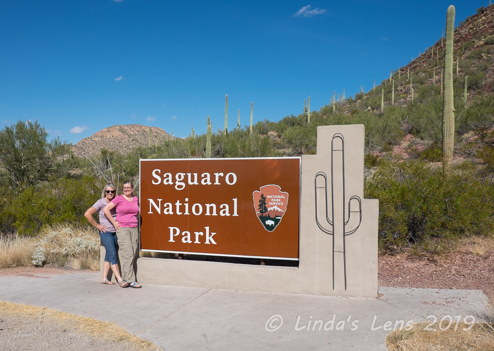
Mandatory park sign photo - a family from Oregon took this for us!

Located on either side of Tuscon, Arizona, Saguaro National Park's two districts are dedicated to preserving the Sonoran Desert landscapes, fauna, and flora, including the giant saguaro cactus.  (And by the way, it's pronounced "suh-WAR-oh")


The mighty saguaro

When planning my Arizona trip, I added a couple of days in Phoenix to visit my sister-in-law.  Being a National Parks geek, I always check for parks close to my destination.  Guess what?  Saguaro National Park, in nearby Tuscon, was only two hours away.  Luckily my SIL was totally game for a visit.


Cactus covered the landscape

The day after my arrival found my sis-in-law and I driving down I-10 bound for Tuscon.  Although Saguaro National Park has two units - one east and one west of town, in the interest of time, we decided to concentrate our visit on the west unit, called the Tuscon Mountain District. 


We read the saguaro can grow as high as a 4-story building

Approaching Tuscon, we drove down a series of local roads to reach the park.  I began to get excited every time I saw saguaro catci dotting the landscape.  My SIL, who sees them all the time, thought it was cute. 


Some cacti appeared to be rotting away

First stop of course was the visitor center (mostly to use the restroom, it was a long drive!).  We got our maps, bought a few souvenirs, and inquired about hiking trails.  Then my SIL and I walked a short loop from the visitor center through one of the saguaro "forests."  Oh, were those tall cacti amazing!  Lots of photos may have been taken.


Desert panorama

One of the trails recommended to us was the Hugh Norris Trail.  (I kept calling it the Chuck Norris Trail, ha-ha!)  After eating lunch at the visitor center, my SIL drove to the trailhead, a short distance away.  Being an out and back hike, we figured we'd walk as far as our legs would let us and then retrace our steps.


Some of your more typical saguaro

Being a wimpy Pacific NW'er I was totally un-acclimated to the desert heat.  Temps were in the upper 80s that day, and there wasn't much shade on the trail.  But wanting to see as many of these cool cacti as possible, I was willing to put up with a little hot weather.  To cope with the high temps, my SIL made sure there were plenty of water bottles in my backpack before setting out.  I donned a wide-brimmed hat and slathered myself in sunscreen.  Now, let's go see some saguaro!


Peek-a-boo!

Although one may think all saguaro are the same - aka the sterotypical two arms curving upright from the trunk, I found out right away many are not like that at all.  We found catci with low droopy arms, tiny buttons of arms just beginning, and numerous cacti with more than the standard two arms.


I found these barrel cactus almost ready to bloom

Some of the cactus arm positions were downright funny!  My sis-in-law and I began making up names for some of them - elephant cactus, carnival arms, pro wrestler, and a couple names that, um, aren't fit to mention here (this is a g-rated blog).


We climbed to a ridgetop with terrific views

I couldn't believe the number of saguaro dotting the hillsides.  There were acres and acres of hills covered with the tall, green cacti.  So impressive!  I was happy to see so many of these grand desert plants preserved for future generations to enjoy.


We called this one "carnival arms cactus"

The Hugh Norris trail ended up being quite a steep climb up a shadeless ridge.  My SIL doesn't hike much, but hot weather slows me down, so I think we were even.  Around every bend was another interesting cactus to photograph, so thankfully our progress was slow.


Close up of the outer skin

From the visitor center displays, we learned that the saguaro doesn't begin to sprout arms until reaching 75 years of age.  Average lifespan of these huge cacti is about 200 years.  Although the saguaro look very soft and spongy, in fact they are quite sturdy, with interiors consisting of wooden ribs.  We saw a few dead cactus along the trail that had deteriorated into long, wood-like strips.


I though this one looked like a pro wrestler

There were other varieties of cactus besides the saguaro here.  Lots of flat, low prickly pear cactus grew under the saguaro's long arms.  And we even saw a few barrel cactus with yellow flowers just beginning to bloom.  But that was the only colorful plant we saw - everything else was either green or brown. 


Elephant cactus

However, I learned the months of May and June are the time to see the cacti in bloom.  Something to put on the bucket list - I'm willing to endure the heat to see that!


We read that the saguaro don't begin to sprout arms until they reach 75 years of age.  We figured this one was really old.

Lots of the saguaro had holes in their trunks.  I assumed that this was where birds and other animals took shelter from the hot sun.


Mountains and saguaro forest

Speaking of critters, I was really, really hoping to see a roadrunner.  The landscape was a carbon copy of the one depicted in that long-ago Warner's Brother cartoon featuring the roadrunner and coyote.  I kept thinking I'd see Wiley Coyote come crashing through the sagebrush in pursuit of his beeping prey.  But we didn't see anything but a few birds.  I think the midday heat kept all the animals (smartly) hidden.  Sadly, no roadrunner sightings this time.  But, on the flip side, we didn't see any snakes!  (and I was fine with that)


We'll call this one "Dolly"  :)

My SIL and I trudged uphill for about and mile and a half.  We sought out shady rest areas wherever we could, behind boulders and straggly bushes.  The views from the ridge were impressive.  I could see hazy blue outlines of far-away mountains.


Loved trying to get close up photos

Finally, we'd both had it with the heat and climbing, and decided to head back downhill.  At least our trip down was much easier, although still as hot.  We met a few people climbing uphill, even in the heat of the afternoon.  They all looked like locals who were probably used to this climate.


This cactus looked like it had a mouth

Back at my SIL's car, we blasted the AC and each downed another bottle of water (which she had wisely stashed in a cooler). 


There were other varieties of cactus here too

Despite the midday heat, it had been a great hike with fantastic scenery.  This visit totally left me wanting for more.  I haven't seen the last of this National Park - next time I'm visiting the Rincon Mountain District on Tuscon's east side.


One last shot

This wasn't the last National Park visit of my trip.  My sister was flying in the following day, and we had plans for a bucket list adventure in Arizona's large, well-known National Park to the north.  Join me for my next post and you'll hear all about it!


Friday, November 8, 2019

Indian Henry's Hunting Ground

Readers may wonder where I get my ideas for places to hike.  I follow a few hiking Facebook pages, and also regularly check local hiking websites.  That's where I first learned of Indian Henry's Hunting Ground, a gorgeous wildflower meadow on Mt Rainier's southwest side.  Not only huge fields of colorful flowers, the trail also boasts grand views of the famous mountain.  After seeing countless beautiful photographs from the area, I knew I had to go there.

Originally I'd planned a visit to Indian Henry's Hunting Grounds during last year's Mt Rainier trip.  But the long distance (14 miles round trip) and the fact that I was by myself made me waver.  However, this year I had my friend Young as a companion and she was all in!


A long way to our destination!

So on the final day of my Mt Rainier summer trip (click to see Part one and Part Two) Young and I rose a bit earlier to beat the day's heat and headed a short distance from our campground to the Wonderland trailhead.  Indian Henry's Hunting Ground can be accessed by two main trails, Kautz Creek and the round-the-mountain Wonderland Trail.  After chatting with a ranger on the first day, I was told the Wonderland, although gaining more elevation (3000 feet to be exact), had a shorter overall distance.  Plus the trail was forested and shady most of the way.


Mt Rainier sighting while crossing Kautz Creek

Young and I donned backpacks and ran across a busy park road to our trailhead on the other side.  Reading the distance to Indian Henry's on the sign made us both gulp - 6.7 miles is a long way!  Then I put it out of my mind and concentrated on the first of many steep climbs we'd tackle today. 


Crossing Pyramid Creek

First Young and I had to climb up and over Rampart Ridge.  Then the trail switchbacked down to a wide, rocky crossing of Kautz Creek.  A few pink fireweed blooms decorated the river bank and Mt Rainier made an appearance far upstream.  Then we ducked back into the forest to scale yet another ridge.


The flower fields begin...

Passing by the first backpacker camp, Pyramid Camp, we snaked downhill to fast-moving Pyramid Creek.  Luckily a series of log bridges made for a dry crossing.  Then it was time for yet another climb!


Lupine and paintbrush everywhere

By mid-morning temperatures started to feel toasty.  Sweat poured off Young and I as we slogged slowly uphill.  Although I appreciated the shady forest, there really wasn't much of interest to photograph.  Hiker traffic on the Wonderland was light.  We met a handful of backpackers all heading in the opposite direction.  Although Young and I both began wondering if Indian Henry's would be worth the tough climb, a couple of the backpackers assured us that it was.


A "Sound of Music" moment

At 5000 feet elevation, Young and I came to Devils Dream Camp, another backpacker camp along the Wonderland Trail.  A passing hiker had warned of vicious mosquitoes here.  While pausing for a quick break, we got attacked.  Out came the bug spray - Young and I hastily applied it to any exposed skin and then got the heck out of there!  We pitied any backpackers camping here for the night.


Peak wildflower bloom

By mile 6 I was beginning to think we'd never get to the fabulous wildflower fields, when suddenly we came upon a huge meadow full of lupine.  My neglected camera finally saw some action.


The flowers slowed our progress

The next mile was a wildflower wonderland.  Around every bend were more flowers - lupine, paintbrush, asters, yellow Oregon sunshine and many more.  Flower bloomed in green meadows, at the banks of tiny creeks, and on bare slopes.  Although it was now past noon, and we were both ready for lunch, photo-taking slowed our progress to a crawl.


First glimpse of the ranger cabin

At Indian Henry's Hunting Ground was a picturesque cabin, used as a base by backcountry rangers.  Nestled amongst wildflower meadows in the shadow of Mt Rainier I'd seen many beautiful photos online of the place.  Now, I was eagerly anticipating taking some of my own.  But first we had to get there - and it seemed to be taking forever!  Around every bend, and on top of each rise, Young and I would look ahead for any sign of the famous cabin.  But...nothing.  Then passing by the junction of the Kautz Creek Trail, Young spied something between the fir trees.  There is was - finally!  And the scenery was just as amazing as I'd hoped.


Ranger patrol cabin at Indian Henry's Hunting Ground

After seeing hardly any hikers all morning, we encountered a steady stream of people traipsing up the Kautz Creek Trail.  And everyone was heading towards the ranger cabin.  Approaching the cabin, we could see at least a dozen hikers had already taken refuge from the hot sun on it's covered porch.  Young and I were lucky enough to squeeze into the last two spaces on one of the benches.


The shaded porch was a popular lunch spot!

Oh what a marvelous setting for lunch!  Gazing out on the colorful wildflowers, we had a picture perfect scene.  Young and wolfed our food, while striking up conversations with the other hikers on the porch.  One man produced a huge bar of Indian chocolate and proceeded to share with everyone.  Another man told Young and I of his goal to day hike the entire Wonderland Trail (the 93-mile trail that circles Mt Rainier.) 


I reached my destination!

We spent a very pleasant hour eating and chatting with our fellow hikers.  But time was ticking, and we had 7 long miles yet to cover.  So Young and I reluctantly packed up our lunches and shouldered our packs for the return trip.


Mt Rainier towers over the meadow

Oh it was hard to leave this beautiful meadow!  Young and I slowly worked our way back down the Wonderland Trail, snapping copious photos of the ranger cabin tucked underneath Mt Rainier's rocky face.  I'm sure I took lots of duplicate photos from the exact same angles, but it was such a lovely scene I couldn't help myself.


The day's money shot

We lingered in the largest wildflower meadow for one last round of photographs.  Then, knowing there wouldn't be any more flowers for a long while, I packed my camera away and concentrated on covering distance.


Magenta paintbrush

Although the downhill was a welcome change from a morning of climbing, by now the air was stifling hot.  And the lower we climbed, the hotter it became.  After having the trail nearly to ourselves on the ascent, on our way down Young and I ran into group after group of backpackers all going the other way.  Most were hiking the entire Wonderland Trail.  Many had just resupplied at nearby Longmire, so they were trudging uphill under heavy loads.  I couldn't imagine trekking up this steep trail carrying a hefty backpack.  I pitied the backpackers - they all looked extremely hot and tired.


Rainier hiding under clouds as we cross Kautz Creek

Finally we came to Kautz Creek.  After being in shady forest, it was a shock to cross it's rocky plain in full sun.  Then it was a long, hot climb up Rampart Ridge once again.  Nearing mile 12 by then, it was the hardest part of our return trip.  But once we'd reached the ridgetop, it was smooth (albeit steep) downhill sailing the rest of the way.


Young winding through the rocks

Feet aching, Young and I covered the final two miles through thick forest back to the parking area.  Oh was it a sight for sore eyes (and feet)!  Luckily our campground was a mere 5 minutes down the road, so we were back at our campsite drinking beer in no time.  After covering 14 miles and 3000 feet of climbing we'd earned it!


Gigantic trees

Although long and at times uninteresting, Young and I both agreed the trek to Indian Henry's amazing wildflower meadows had been totally worth it.  Next time I go, I'd like to try the Kautz Creek trail just to see the difference.  Or maybe I'll get a permit and backpack some of the Wonderland trail.  Either way, I'm scheming a return trip for next summer when the wildflowers are in bloom again.

Hike No. 39 of my #52hikechallenge was one of my longest distance-wise and also one of my most memorable hikes so far. 


Saturday, November 2, 2019

Mt Rainier NP - Raindrops, Waterfalls, and Steps

When planning a trip, I always pay attention to the local weather forecast.  That's how I knew the second day of my Mt Rainer summer adventure (see day one here) was going to be rainy.  Never fear - wet and overcast are the perfect conditions to photograph waterfalls!  Lucky for me, Mt Rainier National Park has plenty of beautiful cascades to chose from.  So day two became designated as waterfall day.


Iconic shot of Christine Falls

My friend Young and I woke the next morning to the sound of raindrops pattering on our tents.  Since my tent is rather old, and the waterproofing questionable, I quickly threw a blue plastic tarp over the top.  Then Young and I took turns making breakfast, alternating between huddling beneath our one umbrella, and standing under a nearby thick grove of trees.


Bottom of Narada Falls

The forecast called for precip to taper off by mid-morning, so we waited it out under the trees at our campsite.  Although neither of us mind hiking in the rain, it's more difficult to dry wet gear when you're tent camping.  Finally, seeing a letup in the moisture from the sky, we threw our backpacks into the car and headed out.


Narada Falls

First stop - lovely Christine Falls.  This cascade has the easiest access of them all, dropping below a highway bridge on the main park road.  The rock-faced span makes a perfect frame for this gorgeous waterfall.  A little further down the park road was Narada Falls.  A short downhill walk led us to its wide, wispy fan.  We lucked out with the place to ourselves for nearly 10 minutes before other people began to arrive.


Rain-dotted penstemon blooms

The hike to Comet Falls is wildly popular, with the small trailhead parking area filling up well before midday.  Although I wanted to show Young this beautiful trail, I wasn't sure we'd be able to find a parking spot so late in the morning.  But of course I had to try, so after pulling into the lot we scanned vehicles for people getting ready to leave.  I spotted a couple loading gear into their car and hovered nearby.  It seemed to take an eternity, but once their car finally backed away, I pounced. 


Glittering raindrops on huckleberry leaves

The Comet Falls Trail began by crossing a slot canyon over the creek feeding Christine Falls.  These steep rock walls were created from years of erosion, wearing a channel into the rock.  The creek absolutely roared through this narrow opening, creating quite a show of frothy whitewater.  Water droplets clung to the trailside bushes, creating glittering little jewels.  Wildflowers bloomed amongst the vegetation - penstemon, paintbrush, and many others I couldn't identify.


Green, foggy valley below Comet Falls

Although the path to Comet Falls isn't particularly long  (1.6 miles one way) it gains over 1200 feet in elevation.  Having hiked it last year, memories of a tough, hot slog were fresh in my mind.  Although temps were much milder today, the clouds didn't cooperate.  Not long after Young and I began our hike, falling raindrops had us digging for our jackets. 


Um....Comet Falls is somewhere over there in the fog

My friend and slowly slogged uphill, leapfroging a family several times.  As promised, the climb was long and tiring.  One of the ways the park dealt with steep inclines was to construct steps into the trail's tread.  Oh those steps were killers!  I think they were built for long-legged men, not short older women.  (I may or may not have complained about them once or twice.....)


Log bridge crossing the creek

About a quarter mile from Comet Falls, we crossed a single log bridge under another nice waterfall.  I had to tell Young to keep going - the better show was just over the next ridge.  But as we climbed to the first Comet Falls viewpoint we were met by a thick fog bank.  Although Comet Fall's lower tier was still visible, it completely obscured the taller, upper tier.  Last year bright, contrasty light shining in the wrong direction had thwarted my chances of a good photograph.  This year, I thought the cloudy skies would provide nice even light.  I didn't even think about the possibility of fog.  Foiled again!


Climbing down another steep staircase

Since we couldn't see much of the waterfall, there was no use climbing any further.  So Young and I took a break at the lower tier viewpoint, ate a snack, and then headed back the way we came.  (This time down all those steps!)


Lush meadow on Snow Lake Trail

Returning to our campsite for lunch, the rain had finally let up and skies were clearing.  However, after removing the tarp from my tent I made a sad discovery.  Although the tarp had kept the top of my tent dry, I'd inadvertently pitched it on a slight depression. From the morning's rain, a small amount of water had collected here, soaked through the tent's floor, and was beginning to get everything inside wet.  Fortunately only my air mattress and the bottom of my clothing bag got the worst of it.  I laid my tarp, rain fly, and air mattress on a nearby rock in hopes they'd be dry by nighttime.


Fuzzy pink unknown wildflower

Only mid-afternoon and the weather improving, Young and I decided there was time to get in one more hike.  Chatting with a fellow camper near the restroom that morning had netted a recommendation of the short jaunt to Bench and Snow Lakes.  Although only 2.5 miles round-trip, I was warned that the trail had a lot of up and down - and many more of those dreaded stairsteps.


View of Bench Lake

Watching sunshine play peek-a-boo with retreating clouds, Young and I began our second hike of the day.  We climbed more of those darn stairs over a ridge to a lovely high alpine meadow with views of pointy Unicorn Peak.  Young (who besides being an amazing hiking friend also climbs mountains) mentioned that she and her husband had climbed that peak a few years ago. 


Mt Rainier reflection (sort of) on Bench Lake

Trekking on top of a rocky cliff, Young and I were treated to some great views of Bench Lake, nestled far below in a grove of firs.  After getting our photo ops, we then descended steeply to the alder-choked lakeshore.  After crashing through the brush, we came out on the muddy beach and were treated to a view of Mt Rainier emerging from the clouds.  I even got a couple of reflection photos on the lake.


Unicorn Peak

Then it was back through the brush to the trail.  And uphill (up more steps) again.  In order to reach Snow Lake, we had to cross another ridge.  By now the addition of sunlight had warmed the afternoon temperatures.  The combination of humidity from the morning rain and sunshine made for an uncomfortable climb.  To top it off, mosquitoes began to attack.  I thought we'd never reach that darn lake.


Snow Lake and Unicorn Peak

But finally we came to an outlet creek.  A trail led around the lake to a meadow on the opposite side.  And there in the meadow was an amazing view of Unicorn Peak.  Young pointed out the route she'd taken to climb this steep mountain, and I was duly impressed.  (And she'd climbed it in early spring - over snow!)


Gray Jay

My Mt Rainier guidebook mentioned "two of the most beautiful wilderness campsites in the park" at the lake's opposite end.  So Young and I followed a rough bootpath in the other direction.  A huge logjam bridged the lake's outlet creek, and reaching the campsites meant walking across it.  But the views of Unicorn Peak from the logjam were wonderful.  Young and I balanced on the logs, snapping away until satisfied we'd captured the scene fully.


Yet another set of steps....

Then, with daylight beginning to slip behind the mountains, Young and I retraced our steps back down (and up!) all those steps until the trailhead finally came in sight.  Although our daily mileage for the two hikes wasn't large (only a bit over 6 miles) the constant climbing stairsteps had worn both of us out.  Time to head back to camp for dinner and some wine!  (And to see if my tent floor had dried out.  Spoiler alert - it hadn't.  I ended up spreading my tarp across the bottom to keep my sleeping stuff dry)

One more day in the park.  And I'd planned a big hike for our finale, the Wonderland Trail to Indian Henry's Hunting Ground.  Which I'll recap in my next post.