Showing posts with label Central Oregon. Show all posts

Monday, April 15, 2024

March Skiing at Mt. Bachelor

My final ski trip for the season was at a familiar place - Mt. Bachelor, up the road in Central Oregon.  The largest ski area in the state, I'd swooshed down its slopes many times over the span of 30 years.  As a matter of fact, Mt. Bachelor is my favorite place to ski in Oregon - and also is in the running for my favorite resort anywhere.


Beautiful view of Tumalo Mtn.

The multi-resort IKON passes my friend Kim and I purchased this season allowed for 5 days here.  We'd used one of the five in early January trying to ski on a miserable, rainy day.  After that experience, we decided to save our remaining days for March, when the snow, and the weather were more reliable.  (The Cascade Mountains usually get their highest amount of snowfall during the month of March.)


"The Cone" with all it's squiggly ski tracks

After skiing other resorts (and our home hill, Mt. Hood) in January and February, the chosen month for our Mt. Bachelor trip finally arrived.  The second Tuesday of March had Kim and I turning into its parking lot, eyeing the snowy, foggy conditions.  Snow was falling heavily, which was good.  However the swirling snow, combined with fog, made seeing where you were going mighty challenging.  (We skiers refer to this reduced visibility as "skiing by Braille.")


Gotta do a ski selfie!

No matter, we'd come to ski and ski we would!  So Kim and I rode up the lift and carefully picked our way downhill.  The newly-fallen snow was wonderful to swish through, and nearly made up for the lack of visibility.  We had a great morning, and after a coffee and granola bar break for lunch, went out for more.


Super-long line to Summit Lift

Although the second day began with more of the same weather as the first, it didn't take long for the snow to stop falling and skies to clear.  Hooray!  Sunshine and powder - my favorite!  And temperatures remained cold, which helped the snow stay soft and fluffy.


Lots of sunshine!

Conditions were good enough that Mt. Bachelor staff decided to run the Summit lift that afternoon.  The highest chairlift at the resort, it takes skiers to the very top of 9,068-foot Mt. Bachelor.  Due to its exposed location, the resort only opens it when there's low wind and high visibility.  Kim and I happened to go by the bottom of Summit right as it opened.  We considered taking a run from the top, but the humungous lift line changed our minds.  It snaked all the way up the adjacent slope!  There was plenty of other places to ski that weren't crowded, especially now that half of the people were in line for the summit.


Snow-flocked trees

Instead Kim and I enjoyed a delightful afternoon, enjoying the lack of crowds, sunshine, and fluffy, powder snow.  When skies are clear, skiers are treated to amazing views of the adjacent Cascade peaks surrounding Mt. Bachelor.  I soaked in the wonderful mountain panoramas and tried to snap images with my phone.  (For obvious reasons, I don't ski with any of my "big girl" cameras.)  When Kim grew tired, she decided to quit early and rest at the bar.  Having a bit more energy still, I opted to take a few more runs before also hanging it up for the day.  


Lovely scene under the Outback Lift


I headed over to the slopes underneath the Outback Lift, one of my favorite places to ski at Mt. Bachelor.  Located on the shadier, colder side of the mountain, snow was still firmly stuck to the trees here.  It looked like I was skiing through a bunch of flocked Christmas trees.  So pretty!  A great way to end another fun day.
  

Could almost see the adjacent mountains

The third day at Mt. Bachelor, Kim was feeling sore and needed to rest.  No problem - my brother Dale, who lives in the nearby town of Bend, decided to join me.


One day I skied with my brother

The forecast called for clear skies and temperatures still cold enough to preserve the snow.  Yeah!  I was excited for another day of good conditions.  But what I hadn't bargained on was the wind.  It was absolutely howling.


Interesting clouds

Although I had a great time skiing with my brother and catching up on his life, the strong wind definitely put a damper on things.  Riding the chairlift was a mighty cold experience.  (And during strong winds the resort runs the lifts slower than normal, so the uphill ride takes even longer!)


The Viking lifty was back!

Our fourth and final day at Mt. Bachelor dawned sunny and warm.  But that pesky wind was still blowing strongly.  Oh well, at least it wasn't as cold as the previous day.


Keeping those skiers in line


The warm sunshine, and the fact it was Friday, brought the skiers out in droves.  After enjoying short, and sometimes nonexistent lift lines for the past three days, it was kind of a shock to have to wait in fairly long lines.


"Front row!  C'mon out!"

But luckily our favorite lifty was back!  (For those who don't ski, "lifty" is what we skiers call the people who operate the chairlifts and manage the crowds trying to access them.)  There is one man who works at Mt. Bachelor that dresses up as a Viking on warmer days.  To our delight, Kim and I spotted the Viking that morning while in the lift line.


Someone drew the Mt. Bachelor logo in the snow under the lift

Not only was this guy dressed to the nines in full Viking attire, he also was so enthusiastic about his job, you couldn't help but smile along with him.  As skiers passed by, the man dished out high fives, and happily posed for photos.  I happened to notice his name tag even said "Viking."


Another fun thing to see - as Kim and I sat down on the chairlift and it began its uphill journey, we noticed someone had stomped out the Mt. Bachelor logo into the snow below us.  I tried to snap a photo of the good work, but in case you can't quite make it out, I posted a copy of the real Mt. Bachelor logo above for comparison.


Enjoying our ride

By afternoon, the temperatures had risen well above freezing.  In areas out of the wind, it was quite warm.  The snow began to soften up, destroying the nice fluffy powder I'd enjoyed the previous days.  Kim and I both agreed if not for the wind keeping things relatively cool, the snow would be too sticky to ski on.


Kim soaks up the sun


Tired from multiple days of skiing, Kim and I threw in the towel early the afternoon of our last day.  Enjoying a burger and beer in the lodge, we were entertained by a group of people doing a "shot ski."  This zany tradition is rumored to be practiced at most ski areas.  It's where multiple shot glasses are adhered to a ski and several people get together to tip the ski in unison and drink from these shot glasses.  I'd always heard of shot skis, but until today had never seen a group actually drink from one.


Shot ski later in the lodge

Having had a midweek season pass to Mt. Bachelor last year, which I used a record 17 times, five days this season was not nearly enough.  Kim and I both agreed that while it was fun to try out the IKON pass and visit some favorite resorts, we're going to skip the IKON pass next season and go back to buying a midweek season pass here at Bachelor.  It's one of our favorite resorts and we really missed coming here.

But at least we had a good time this week and made the most of the IKON pass days we had.  Until next season, Mt. Bachelor!  


Tuesday, December 13, 2022

A Double Dose of Smith Rock

My late October doggy-sitting gig provided many opportunities for exploration and photography of Central Oregon.  One of my of my favorite places to visit when in this part of the state is Smith Rock State Park.  Lucky for me, my daughter's home wasn't far from this stunning area.


Morning light on the Smith Rocks

Smith Rock State Park is a geologic wonderland.  Tall rocky pillars rise up from the surrounding plains.  Built from volcanic ash and basalt, these massive formations are popular with rock climbers. However, this park is not just for rock jocks.  Hiking trails abound here also.  The Crooked River, true to it's name, winds between the palisades and a lovely riverside trail follows it's path.  There's another trail, (aptly named "Misery Ridge") that takes folks up and over the very top of these soaring pinnacles.  You can't go wrong with a visit to Smith Rock - the scenery here is absolutely spectacular.


Rocky reflections

I love visiting Smith Rock so much I actually made two trips during my 10-day stint.  The first, on the second day of my dog-sitting commitment, was a lovely bluebird morning.  After taking the steep trail down into the canyon, I followed another trail along the Crooked River.  Smith Rock's iconic basalt pillars made perfect reflections on the waters.


Fantastic morning light!

Still recovering from the previous day's failed Black Butte summit attempt, I limped along the path paralleling the Crooked River.  Although my legs were sore, today's hiking actually helped loosen up the overused muscles.


Great blue heron reflection

Walking under the shadows of the tall rock walls, I came to a bend in the river.  Perched on a rock was a Great Blue Heron!  In hopes of some wildlife encounters, I'd placed my large zoom lens in my backpack.  Quickly I switched lenses and fired away at the big blue bird.  After a couple dozen frames, the heron, probably tired of this lady paparazzi, flapped it's wings and took off across the water.  Lucky for me, I was already focused on the bird and got a couple of nice shots of it in flight.


Moon over the rock wall

Well, that was fun!  Now, onward - trudging along the river's edge, occasionally looking up at the cliffs far above me.  I got a glimpse of the moon's half-circle in the sky above one of the pinnacles and couldn't resist a capture or two.


A robin eyeing the juniper berries

Although most of the area along the river is covered in low bushes, I passed through one area of tall juniper trees.  A flock of robins were all over the place, snacking on the plentiful berries.  Although I usually don't bother photographing robins (they're a "dime-a-dozen" bird species as far as I'm concerned) these red-breasted guys were very close and posing nicely.  So I fired off a bunch of shots, and was really pleased with the results.


Another posing robin

And then I saw a magpie flitting between the branches.  Now a magpie was a species I definitely wanted to capture!  But....these guys are super fast and always on the move.  I tried my best, but this magpie definitely didn't want his picture taken.  Just as I would lock my focus, he'd fly off.  Or he'd land in a shady area.  After several minutes of waiting and watching I finally threw in the towel.


I finally got a magpie to sit still!

I walked a bit further along the river, admiring the lovely fall hues of the bushes.  But the day was getting hot and my legs were getting tired, so I decided to head back.  Because the sun was now higher, I made many photo stops on my return trip to capture the same scenery in different light.  After crossing the Crooked River pedestrian bridge, I was taking a break when I noticed a man nearby, camera focused on a magpie.  The bird was being harassed by a robin and it was standing still!  

Now was my chance!  Switching lenses yet again, I crept over to where the man stood and focused on the magpie.  Although the bird flew around a bit, it stayed in the area and kept landing on top of the nearby bushes.  Because the bird held still I was able to get my magpie shots.


Morning sun lighting up the yellows

After that successful visit, I knew I wanted to return to Smith Rocks one more time before my doggy-sitting gig was up.  But it wasn't until the very last day that I finally made it back.  This time, I decided instead of walking down the most popular riverside trail, I'd head the opposite direction down a less-visited path.


The Crooked River's colorful bank

The morning was chilly, forcing me to don my down jacket, knit hat, and gloves.  The grasses and bushes surrounding the Crooked River had transformed into hues of yellow and gold.  Sunlight streamed through the river canyon, lighting everything up.  It was another magnificent day.


Steep canyon walls

I walked about a mile before this trail headed uphill.  After huffing up a very steep path I landed on top of a plateau.  Here the Crooked River entered a very deep canyon with steep, rocky walls.  I had an excellent birds-eye view of both the towering pillars above and the river far below.


View from the top of the canyon

After drinking in the views I returned back down to river level.  By now the sun had risen above the surrounding hills bathing the entire Crooked River in light.  Although I'd taken photos along the river on my initial trip, the light was so good now I couldn't help taking duplicate photos of the same views.


Fall colors along the river

As I focused on one particularly colorful river scene, a man with his young son walked by, hand in hand.  It was such a cute moment, I couldn't help but include the duo in one of my shots. 


A man and his son walking by

With the sun now high in the sky, the surrounding rock pinnacles reflected nicely in the Crooked River's still waters.  I took so many photos of this scene, it was hard to pick just one for the blog!


Blue skies and reflections

Returning back to the Crooked River pedestrian bridge, I still had a bit of time.  So I decided to take the trail on the river's opposite shore, back in the same direction.


Looking east from the bridge


It's always interesting to see the same scenery from a different vantage point.


Views along the Crooked River

Like this view of the iconic Smith Rock pillar from the east along the river, instead of the image everyone gets looking to the north from the top of the canyon.


Golden weeds

The sagebrush had also changed to it's fall colors, a lovely shade of gold.


Zoomed-in look

It was about this time that my phone buzzed.  A text message from my daughter confirmed she and her husband were now back in the US (they'd traveled to Europe on vacation) and their flight home later that evening was still on time.


The classic view

It had been a wonderful 10 days, getting my doggy fix, and exploring some new and favorite places in fabulous Central Oregon.  Smith Rock State Park is stunning in the fall, and I was fortunate to be able to visit it twice during my stay.


Wednesday, November 30, 2022

Summitting Black Butte - A Tale of Two Hikes

In late October I did a doggy-sitting stint for my daughter, who lives in Central Oregon.  Because my grandpuppies aren't hiking dogs and love nothing more than to laze around home, it freed me up to explore the nearby trails.  The Central Oregon area has some amazing places to hike - I was giddy just thinking about the possibilities!


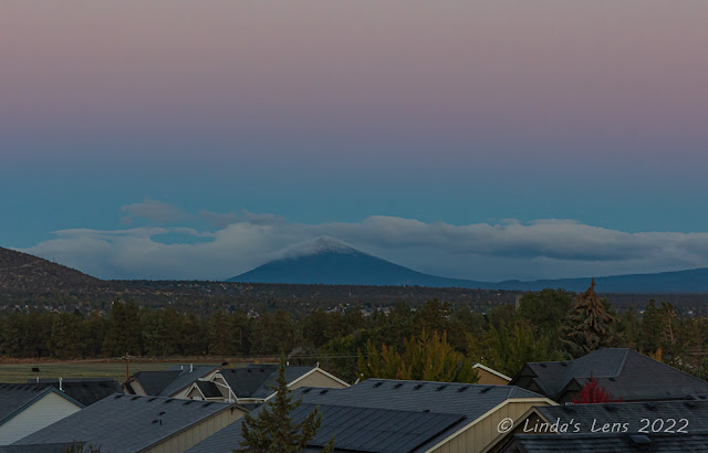
Black Butte rises prominently above the Central Oregon skyline

One trail that ranked high on my list was the trek up nearby Black Butte.  An extinct stratovolcano, it's prominent symmetrical cone is easily distinguishable among the mountain parade of the Central Oregon skyline.  It was also the inspiration for Deschutes Brewery's famous Black Butte Porter (one of my favorite beers) with the peak's silhouette featured on the label.  I'd passed by Black Butte countless times in my travels to and from Central Oregon.
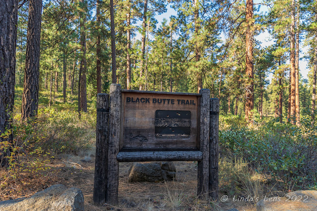

Nice trailhead sign


Now was my chance to finally stand atop Black Butte's summit.  In preparation for my Central Oregon stay, I'd checked out the book "100 Hikes in Central Oregon Cascades" by William L. Sullivan from my nearby library.  The day after my daughter left on her trip, I consulted the book for Black Butte's directions and trail information.  I discovered there were two trailheads for this particular hike, a lower and an upper.  The upper trailhead required navigating a washboard gravel road that turned rocky and rough in the final mile.  The lower trailhead, however, was right off a paved road.   


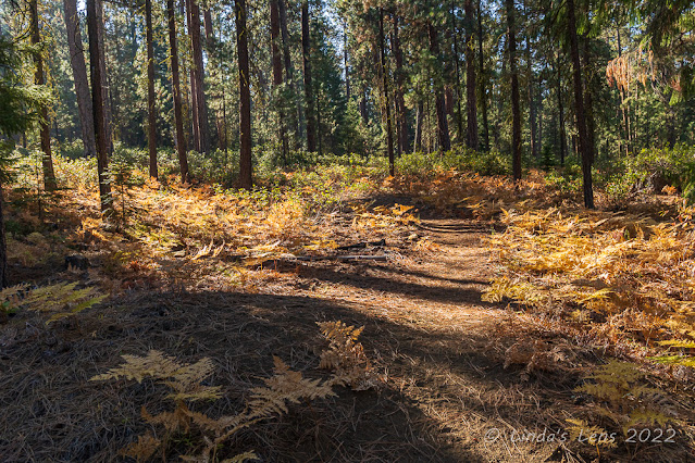
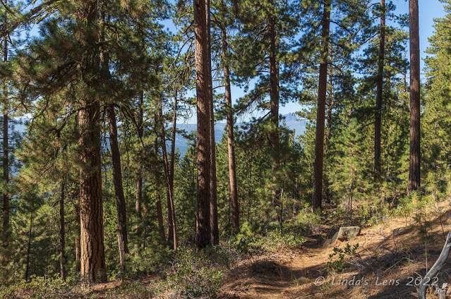
The lower portion of the trail was in dense woods


What I thought I read in the book was that Black Butte's summit was a 6-mile round trip from the lower trailhead, and a 4-mile round trip from the upper parking lot.  So it wasn't a hard decision to start at the lower trailhead.
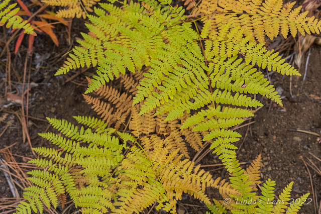

Fall color ferns

It was a sunny morning when I pulled into the parking area of the lower trailhead.  I didn't get a particularly early start, so it was a stroke of luck that I was able to claim the remaining parking spot.  After donning boots and grabbing backpack and camera, I admired the sturdy wooden trailhead sign before setting off through a thick ponderosa pine forest.


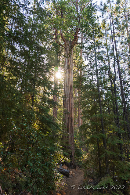
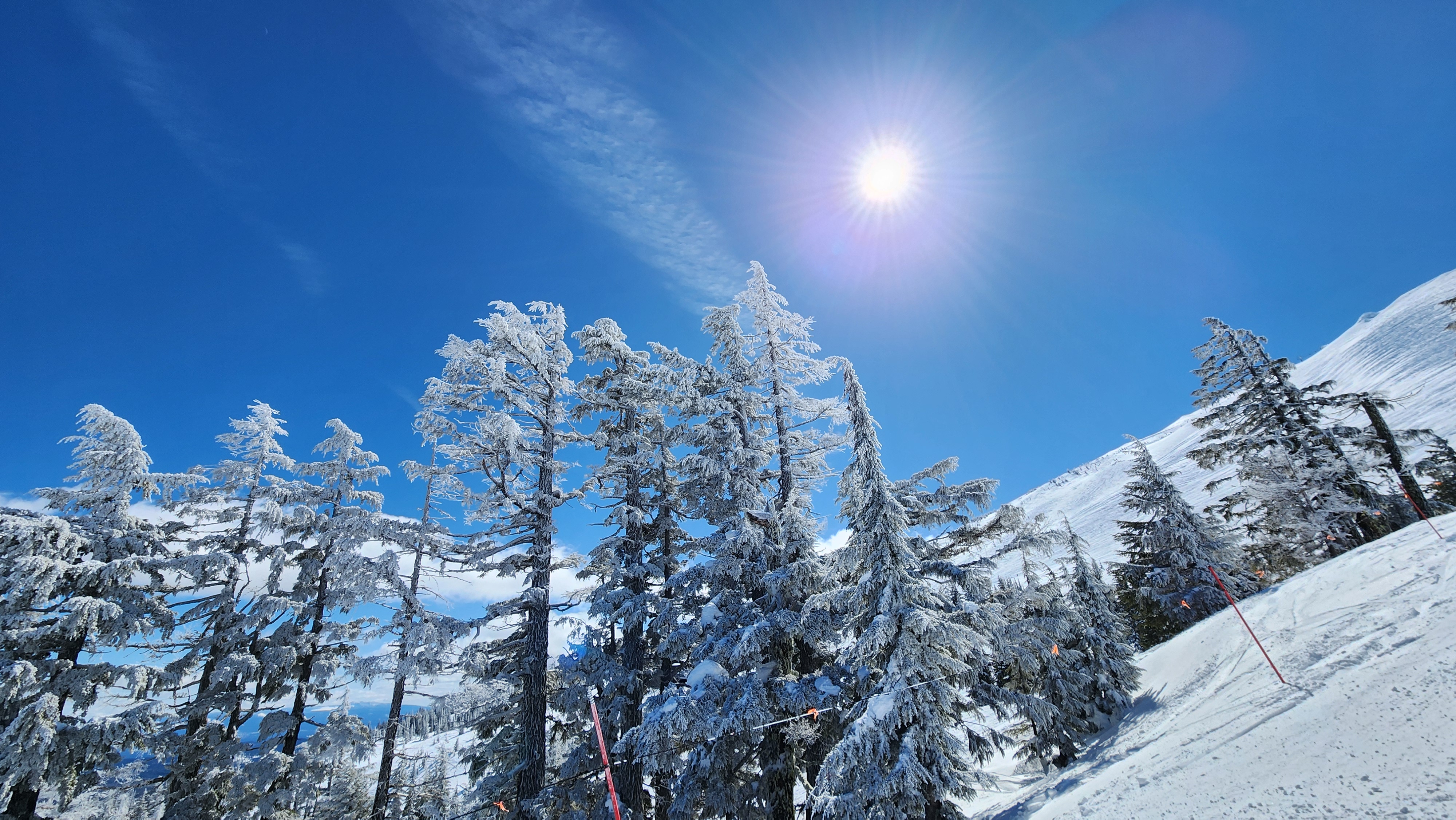
Sunburst behind an unusual tree

After wandering through the woods for a half mile or so, the trail began to climb steeply.  I began to sweat, puff and pant.  Thank goodness for the shady forest, or I'd have been one hot mess!

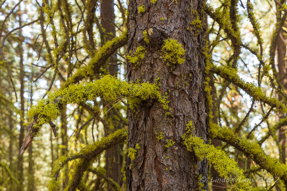
My gps read one mile, then two.  By my reckoning, I should've arrived at the upper trailhead by now.  But when I consulted the electronic map on my gps display, it still showed I had a ways to go.  Oh well, it was a nice (if slightly warm) day and my foot was doing well, so I decided to keep going.  Although the surrounding woods were nice, for the most part the trail was unremarkable.  There was an area with huge unusual trees and another spot where the trees were covered in bright green lichen.  Otherwise, the trail was just a hot uphill trudge.


In one area the trees were covered with lichen


After three miles and nearly 1700 feet of climbing I finally arrived at the upper trailhead's parking area.  Still questioning why it had taken so long to get to this point, I finally got the bright idea to consult my hiking book.  I'd taken a photo of the page with my phone, and upon retrieving the image made an awful discovery.  It wasn't 6 miles round-trip from the lower trailhead to the summit - it was 6 miles round-trip from the lower to the upper trailhead!  I'd read the book totally wrong.  In order to reach Black Butte's summit, I still had another 2 miles and 1500 feet of climbing (and that was just one-way!)


Forest views on the way down

What to do?  If I continued to the summit, it would mean a 10-mile round-trip hike, with over 3000 feet of elevation gain.  My plantar-fasciitis riddled foot, which had finally healed enough to enable short-ish hikes (5 miles or less), couldn't handle that yet.  But my foot wasn't hurting, and I really wanted to summit Black Butte.  I decided to travel a little bit further and see how things went.


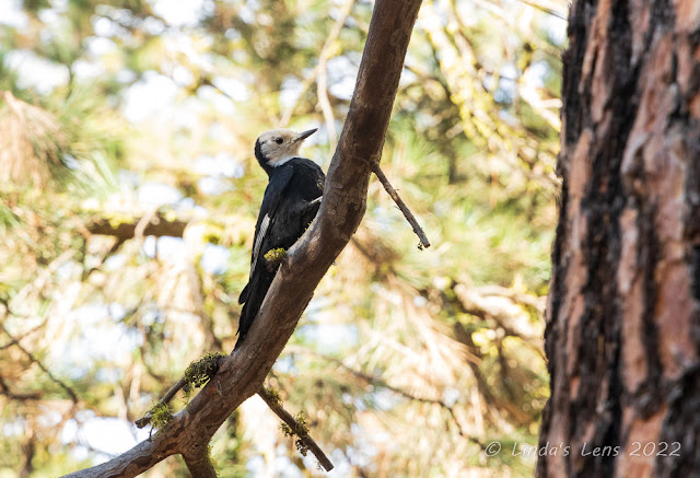
White faced woodpecker

From the upper trailhead the grade got steeper.  I trudged slowly upward, sweating in the midday heat.  It was well past 1 pm, and my body wanted lunch.  After climbing about 3/4 of a mile, I came to my senses.  What was I doing?  Even if I reached the summit, it would be a tough downhill climb all the way back to the lower trailhead.  Walking downhill seemed to aggravate my foot the most.  It wouldn't be worth it to undo the months of healing now.  I needed to turn around.  Black Butte's summit would have to wait for another day.


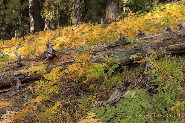
Beautiful colored ferns

But first I sat on a nearby log and enjoyed a proper lunch.  The least I could do was fuel myself for the downhill slog.  And slog it was.  As predicted, soon after starting the descent, my foot began to throb.  The forest that had initially been in shade now was partially in sun, and that made a huge difference in temperature.  As I plodded along, sweating and limping, time seemed to stand still.  It took forever to reach the lower trailhead.   When I finally did, my foot was definitely not happy!


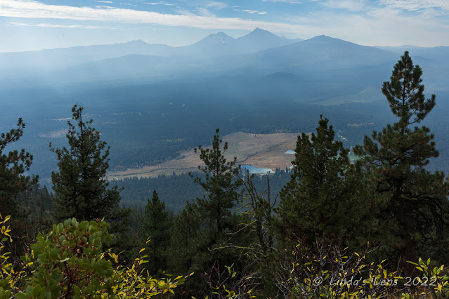
Smoky mountains to the south

But an evening of ice, rest, and ibuprofen seemed to calm things down and I was able to hike again the next day.  As the week went on, I kept thinking of my failed summit attempt.  I wanted a second chance.  So three days later, I decided to try again - only this time I'd start at the upper trailhead.


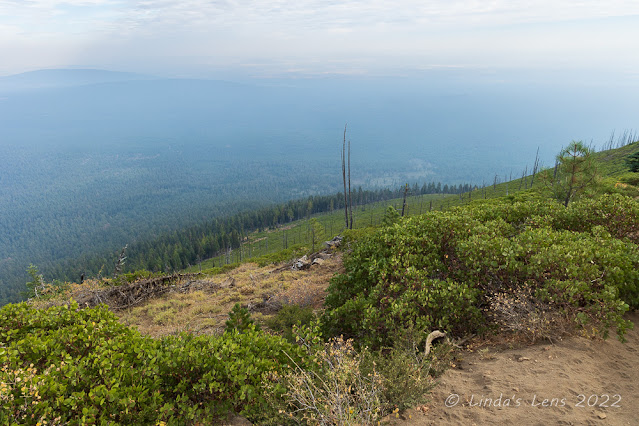
Walking through an open area

It wasn't a lot of fun bouncing along in my car over the washboard gravel road, and when I reached the rocky final mile, the road looked so rough I almost turned around.  But driving slowly I persevered, and finally the upper trailhead came into view.  I had to laugh - all the cars parked there were Subarus, including mine!


Aftermath of 2009 wildfire

Starting up the trail again, the first bit was familiar territory.  A quarter mile later, I encountered a white-headed woodpecker.  Not only did the bird stay put, it posed nicely on a low branch, so close I was able to capture some great images with my 24-105mm lens.  Such an amazing wildlife sighting, I took it as a good omen.  


A fairly clear view of Mt. Jefferson

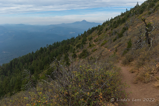
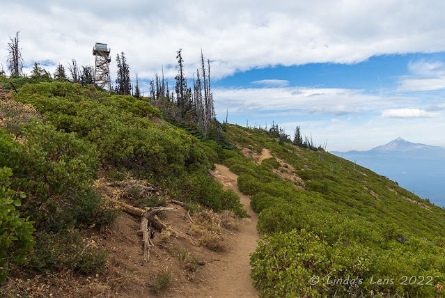
After passing my lunch log from the previous hike, the forest thinned out and I emerged into an open area.  The views were quite nice - I could see the surrounding Cascade peaks - Three Fingered Jack, the Three Sisters, Broken Top.  I could see the golf course from nearby Black Butte Ranch.  And far up on the summit I could just barely make out the fire lookout tower.  


Mt Jefferson and fire lookout

But my views to the south and east were partially obscured by hazy skies.  The entire month of October had been unusually warm and dry, and wildfires were still raging south of here.  And unfortunately today the wind was blowing all the smoke towards Black Butte.


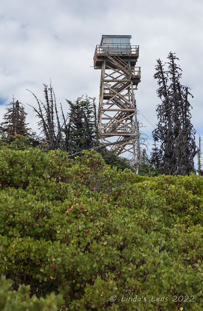
Shuttered lookout tower

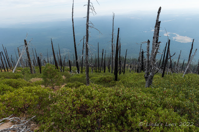
Smoke or no smoke, I was still intent on reaching the summit this time.  I continued my climb, past an area of blackened tree trunks.  A nearby sign informed visitors that a 2009 wildfire was to blame.


Finally almost there!

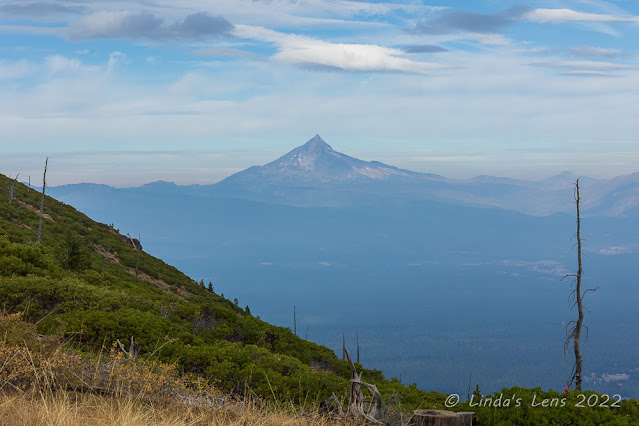
The only good thing about wildfires, they open up the terrain for views.  The upper portion of Black Butte was totally devoid of tall trees, it's slopes instead covered with thick bushes.  I could see for quite a ways, but the smoke blocked what I assumed was an even better view.  Coming around the mountain, I had a great front-row sighting of nearby Mt. Jefferson.  And it was the only mountain still in clear sky - the others were partially obscured by smoke.


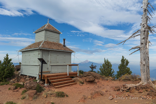
Cupola lookout at the summit

The tall fire lookout tower rose prominently from the butte's very top.  It looked shuttered up for the season, which surprised me since there were still wildfires burning. 


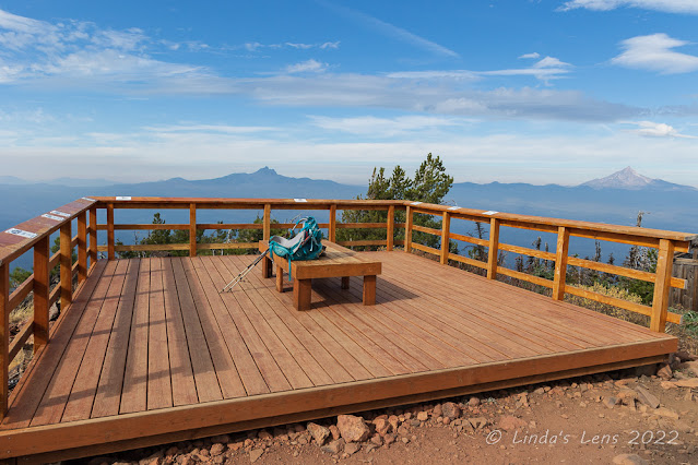
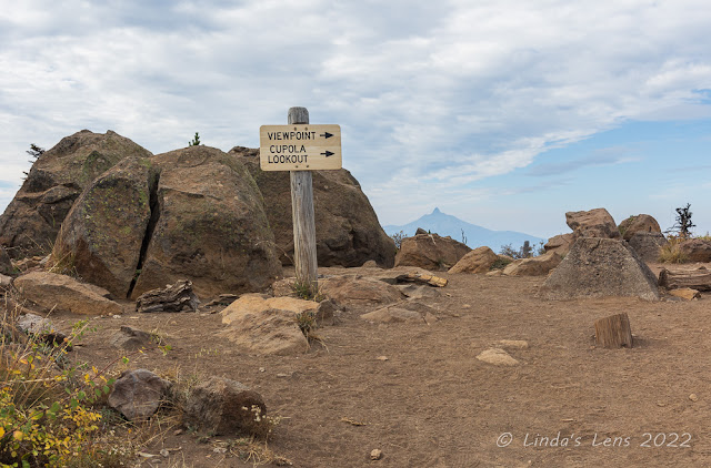
Very nice viewing platform

Finally I made it to the very top!  Yeah!  A sign pointed visitors away from the main fire tower and towards a viewpoint and "cupola lookout."  I'd read in the hiking book that people are not supposed to venture to the main fire tower, so I dutifully followed this sign.


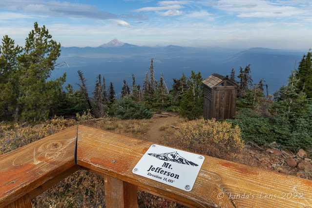
This platform had placards for all the nearby mountains

The trail led to a cute wooden building.  It looked like the top of a fire tower, but instead of being on a tall structure, it was sitting on the ground.  This was the "cupola lookout."  After my hike, I tried to find information online as to it's history but all I learned is that this building appeared to be an earlier lookout facility.  A nearby building used for sleeping and cooking fell into disrepair and was burned down by the Forest Service in 2016.  I thought this little cupola was charming, and made sure to photograph it thoroughly.


View of both lookouts

On to the viewpoint - and boy was it a nice one!  The Forest Service had built a large wooden deck in a prominent location, enabling visitors to view all the nearby Cascade peaks.  Railings enclosed the deck on three sides.  Along the railing were small plaques lined up with the view of each mountain peak.  On a clear day, Mt. Hood, Jefferson, Three Fingered Jack, Washington, Belknap Crater, North Sister, South Sister and Broken Top were visible.  I was able to see all the mountains, but some of them, shrouded in smoke, were not so clear.


Still very smoky to the north

Taking a break on the wooden benches on the deck, I enjoyed a quick snack and soaked in the vistas.  I'd finally made it up here, and the journey had been worth it!  


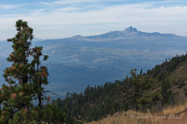
Three Fingered Jack Mountain

After chatting with a nice lady and her two dogs, I packed up and retraced my steps back down Black Butte.  My return trip was uneventful.  I did notice the smoke clearing to the west, enabling some clearer views of Three Fingered Jack mountain.


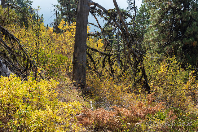
A bright patch of color

Although most of the fall colors here were past peak, I did pass by one area still showing off a nice bit of yellow leaf color.  And there were still a few aspen leaves clinging to the trees in a nearby grove.


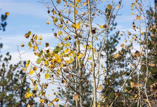
Last of the aspen leaves

After not seeing many people all morning, on my descent I met quite a few people climbing up.  Back at the trailhead the parking area was now full (and this time most of the cars weren't Subarus.)  I survived the drive down the nasty gravel road and in no time was back at my daughter's house.


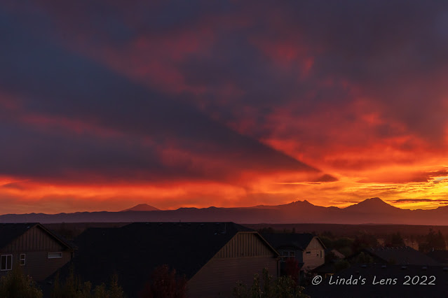
Phenomenal sunset that evening

My daughter has an incredible view of all the Cascade peaks from her back deck.  She often sees some great sunrises and sunsets from here.  That evening I witnessed a phenomenal sunset over the mountains.  Watching the light drain from the sky, I looked over at the silhouette of Black Butte on the horizon and thought to myself "I've been on top of there!"

Despite my initial trail confusion mistake, I didn't give up - and now I've earned bragging rights for summiting another Cascade peak!