Wednesday, July 31, 2013

My Wonderful Garden

Gardening has never been my thing.  I've got the world's biggest brown thumb.  But - lucky for me - my hubby loves growing stuff.  He's really good at it too.

Not only is my hubby a great gardener, Roger's skills rubbed off on our son.  So much so that Cody now has a bachelor's degree in Botany.


There's a space in our backyard that over the years, has become a large flower patch.  Although some flowers would always bloom, every year there were less flowers coming up, and more weeds. 


Early last April when Cody was home for Easter break, he and his Dad teamed up to replant our old, overgrown flower bed.  Cody said it was my early Mother's Day gift.


The guys replaced the worn out soil with new, rich mulch.  They bought tons of new bedding plants (snapdragons and pansies) and placed them in rows.  Roger planted some bulbs, and Cody scattered a wild seed mix throughout.  Finally Roger created a small brick-lined path that cut through the middle of the garden.


After a good soaking, and lots of spring rains, beautiful things started to rise from the ground.


The first to bloom were the lilies.  White, yellow, and this gorgeous orange tiger lily.


Then came the dahlias, in many hues.  These big, poofy flowers really brightened up the backyard.


From the bulbs came sunny, orange gladiolas.


The wild seed mix spawned a huge patch of brilliant pink flowers.  Some had darker pink centers, and some were white with pink centers.  So lovely!


One of my very favorite dahlias ready to bloom.


It wouldn't be a garden without some sunflowers - and I had nearly a dozen of these yellow blossoms gracing my yard.


As June wound down, and July began, the sunny days and hot temps created a huge, colorful floral frenzy.


I loved looking out my dining room window every morning, checking out the recent blooms.


On the weekends, I'd grab my camera and catch the morning light illuminating these pretty blossoms.


I had more fun photographing my flower bed.  Capturing morning dewdrops on the dahlia petals.  Catching bees in their quest for pollen.  And discovering a cute little spotted bug hanging out on one of the sunflowers.


It was the greatest Mother's Day gift.  Something I've been able to enjoy throughout the summer.

And now I'm sharing photos of my wonderful garden with all you faithful readers.  May these images brighten your day.


Linking to:  Share Your Cup Thursday  and Weekly Top Shot.

Monday, July 29, 2013

Sheepshead Rock

The last two posts have been recaps of my 4th of July hike-o-rama weekend.  I'm now up to day three.  Ready to join me for another one?


Rhodies!

After taking Saturday off to spend with my daughter, who was home for the weekend, Sunday I again hit the trail.  This time I teamed up with John and Jon for a trip to Sheepshead Rock.


Jon and John, my trail buddies for the day

I'd been wanting to hike this trail, as it's one of the few left to visit in my quest to finish the "100 Hikes in Northwest Oregon" book.  Sheepshead Rock is located deep in the woods east of Estacada.  If you follow the directions in the book, one must travel a dusty gravel road for 18 long miles to reach the trailhead.  But John had other plans.  He knew of another, closer access with paved roads all the way.  Although it meant a longer hike with more elevation gain, I'll take the better access every time.


Another wrong trail sign!

Arriving at John's trailhead of choice, I was surprised to discover it the same staring point of my failed quest to hike Old Baldy two years ago (which you can read about here and also here.)  Then, an incorrectly signed trail had led me astray.  Emerging from John's car, the first thing I did was head down the Eagle Creek Cutoff trail to see if the Forest Service had finally changed the sign.  Yes, the right sign was now in place (which temporarily restored my faith in the USFS.)  However, upon starting off, we discovered the trail sign to Squaw (now Tumala) Mountain instead announced itself as the trail to Old Baldy.  Oh Forest Service.......!


Mt. Hood shows her glorious self

The first part of our hike followed the trail to Tumala (aka Squaw) Mountain.  Having traversed this two years ago, I was in familiar territory.  The last half mile to the summit was truly glorious.  Huge pink rhododendrons bloomed profusely, accompanied by a few patches of delicate white avalanche lilies, with a couple of beargrass tufts thrown in.  Camera in hand, I lagged a considerable distance behind my companions.


John admires the view from Squaw (Tumala) Mountain

Finally I broke out of the forest to the top of Tumala Mtn.  A former lookout tower site, it boasts a killer view of Mt. Hood.  The clear, sunny weather meant no troubles picking her out from the surrounding green ridges.


The guys find a benchmark on Tumala Mtn

John, being a retired surveyor, was checking out the USGS benchmark on the summit proper.


Hiking down the trail with Mt. Hood over our shoulder

The mosquitoes were in full attack mode, so we didn't linger.  Jon and I doused ourselves with bug spray before heading off Tumala's summit.  It was such a great view of Hood, I couldn't help grab just a few more shots before my companions disappeared into the forest.


The photographer in action

On the way down, the rhodies called to John.  This time he couldn't resist, and out came his camera.  Not one to pass up a chance for more pictures, you know I joined right in.


Dewy avalanche lilies

Down from Tumala Mtn, we intersected with the Fanton Trail and followed it a little over two miles to the Plaza Trail.  The Fanton Trail led us down a steep, switchbacky hill (that I didn't look forward to climbing on the return trip) and then leveled out along a thickly forested ridge.  A few beargrass tufts were still blooming, and they added a nice touch to the dense green undergrowth.


A sign-eating tree!

 Not far from Plaza Trail junction is the site of an old guard station, built in the early 1900s by the US government.  Although the buildings are long gone, supposedly foundations and other remnants still exist in the forest.  John had hiked this trail once before, but didn't find anything.  This time he was determined to locate the old guard station site.

But right away we were distracted by an old trail sign that was slowly being swallowed up by a growing tree.  Photo op!


Awesome vistas on Sheepshead Rock

In the mile and a half trek to Sheepshead Rock, John kept leaving the trail, heading into the forest searching for the guard station.  We reached the turnoff without seeing so much as an old brick.  Oh well - it was time for lunch, and there was no better place to relax and refuel than a tall perch with a view.


You could see for miles

And what a view it was!  Tumala Mountain was nice, but Sheepshead Rock had it beat.  Climbing up to the top of this bumpy, rocky monolith was kind of tricky, but my friends and I were handsomely rewarded.  Miles and miles of thickly forested ridges spread out before us.  Mt. Hood, still wearing some of its winter snow, anchored the skyline.  A few brightly colored wildflowers completed the beauty.


But it was a scramble back down the rock

A gentle breeze kept the bugs at bay, and the Johns and I enjoyed a comfortable, sight-filled meal.  It was hard to tear ourselves away for the trek back, but we couldn't stay all day.  So finally down the rocks we scrambled, returning to the Plaza Trail.


Remnants of an old guard station

All way back along the Plaza Trail, John kept checking his gps, and peering into the woods, still searching for that guard station.  We were passing by the sign-eating tree once again, and John had just about given up, when Jon noticed an old stone fireplace in a clearing.


Rusty parts scattered in the woods

It was the old guard station site!  Once we'd all spotted the ancient stone fireplace, it was as plain as day.  John guessed we'd been so distracted by the sign-eating tree this morning that no one had looked beyond it into the adjacent woods.


The stone chimney is all that remains

Combing through the underbrush, I found an old rusted bucket, and a bunch of metal parts scattered about.  Jon found a brick foundation to a long-abandoned stable.  It was cool to find these artifacts from another time.  Slowly the forest was taking over, hiding what once must have been a bustling ranger station.


Still some beargrass hangin' around

Satisfied he'd found the mystery guard station, John then set off on the Fanton Trail.  The day was getting warm, and I welcomed the shade of thick forest.  Even though John was intent on getting back to the car, he did make a couple of stops to photograph the beargrass.  And before tackling the big switchbacky hill, I broke out the gummy bears (which along with cookies, are now my hiking staples) to give us all extra energy for the climb ahead.


Beargrass close-up

At the end of a hike, it's a great feeling to finally glimpse your car through the trees.  Always such a relief to release sweaty feet from hot hiking boots.  And upon your return to civilization, that ice-cold beer tastes mighty fine!

Total stats:  10.5 miles and 2700 feet elevation gain.  Another trail checked off in my book.  More awesome photos for a blog post.  Thanks John and Jon for a great day in the woods.


Sharing with:  Tuesday Muse.

Tuesday, July 23, 2013

Glorious Day at MSH

Are you ready to hear about hike-o-rama day two?  Well, hang onto your hats, and join me as I journey to an amazing place.....


A bumper crop of penstemon!

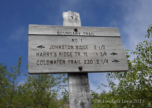
Mt. St. Helens!  One of my all-time favorite hikes is the Boundary Trail from the Johnston Ridge Observatory to Coldwater Peak.  And the perfect time to go there is mid to late July when wildflowers cover the barren ground.


Super-foggy morning at MSH

I recruited my friend Katie to join me for this latest grand adventure.  After staying up way too late on July 4th, I made her get up at the crack of dawn.  The forecast predicted sunny skies, but driving the road up to MSH, we hit thick fog.  It stayed with us all the way up to Johnston Ridge.  Forget about viewing the mountain - we could barely see across the parking lot!


Follow the posts

But we'd driven all this way to hike, and I wasn't giving up easy.  Katie and I shouldered our packs and started out in the misty chill.


Flowers brighten the devestation

Although the weather was a disappointment, the Boundary Tail was anything but.  We'd hit the peak bloom for penstemon and paintbrush.  Right from the beginning, the sandy path was lined with bright purple and orange wildflowers. 


Cheerful paintbrush blooms

With thick fog blocking our views, it was nice to have something beautiful to gaze upon as we trekked along the trail.


Seeing our way through the fog

It's a 5.5 mile journey to the base of Coldwater Peak.  My plan was to reach the base of this mountain, and if time allowed, climb to the top.  Our trail would take us across a desolate rocky plain, strewn with debris from the 1980 blast.  This area, on the north side of MSH, bore the brunt of the eruption.  When the mountain blew, hot gases and debris from MSH's summit scoured the land.


Blue sky teaser

For the first three miles, Katie and I picked our way through the dense fog.  Although the weather wasn't what we expected, it did give an unexpected bonus.  The fog kept temperatures cool which made for very pleasant hiking.  With little shade (the eruption leveled the forests for miles) this trail is notorious for being hot and dusty.


Approaching Harry's Saddle

But as we climbed towards Harry's Saddle, the fog began to part, and I glimpsed some blue sky peeking through.


Looking ahead to our next climb

From Harry's Saddle, one gets the first view of log-jammed Spirit Lake.  And, joy of joys, by the time Katie and I arrived, things had cleared enough so we could actually see it!


Hiking amidst ancient decapitated trees

But more climbing lay ahead.  About 700 feet of climbing in roughly a mile.  As we ascended the ridge above Harry's Saddle, our trail was again enveloped in the cloudy mist.


Spirt Lake peeps through the fog

The ridge was littered with bleached stumps of long-dead trees, all decapitated by the eruption.  The fog gave everything a ghostly atmosphere.


A ghostly world

At the top of the ridge, Katie and I were treated to a lovely view of round, ultra-blue St. Helens Lake.  Then we followed the trail down a steep slope and through a unique rock arch.


The fog lifted for views of St. Helens Lake

By now, we'd been hiking way past noon and my tummy was protesting.  Although our initial goal had been summiting Coldwater Peak for lunch, both Katie and I were ready for a break.  We found a nice spot not far from the arch and happily dug out some nourishment.


Approaching the rock arch

Oh, it was a perfect lunch spot.  We had a front-row view of aquamarine St. Helens Lake.  The skies cleared, and the adjacent mountains showed themselves.  And - best of all - a small band of hummingbirds darted between trees, providing great entertainment. 


Our trail went through the arch

Our break finished, I realized it was getting late, and we needed to be heading back.  No Coldwater Peak this time - climbing it would have to wait for another day.  Seeing that the summit was still socked in, we decided it wouldn't have been worth the slog anyway.


Glorious views of Spirit Lake and Harry's Ridge

So back down the Boundary Trail Katie and I went.  And with the fog lifting, we were treated to jaw-dropping views of Spirit Lake and the surrounding terrain.  Seeing the miles of denuded hillsides really puts into perspective the magnitude of MSH's 1980 eruption.


Heading back to Harry's Saddle

Coming down the ridge to Harry's Saddle is my most favorite part of the trail.  The views are incredible.  I took dozens of photos, stopping every few feet to capture the scenery from yet another vantage. 


MSH hid behind the clouds all day

But although the fog lifted enough to see the surrounding scenery, MSH remained hidden under the clouds.  I guess she was feeling shy that day.  This photo was the best view we had of her.
  

Here the trail perched on a steep slope

As we wound down the trail a second time, it was fun to see the vantage points that were covered by the morning's fog.  Katie remarked it was like hiking a totally different trail.


The flowers were even better second time around

Every time I hike in the MSH area, I'm encouraged by the amount of recovery I see.  Lots of green covers the ground now.  Along with the lovely July wildflower displays, bushes are getting bigger and trees higher.  Katie and I noticed some of the trees are taller than us now.  We wondered aloud how many years it will take for the blast zone to fully recover.


Lovely penstemon

After crossing a steep slope, we entered back into the flower zone.  And it was just as marvelous on the return trip.  There were so many penstemon blooms, it created a purple carpet across the barren plain.  Absolutely lovely!


Mother Nature's purple carpet

As Katie and I traveled nearer to the trailhead and visitor center, we began to encounter more and more people.  MSH is a popular destination and being a holiday weekend, things were hopping.  But most people don't venture very far beyond the visitor center.  Too bad - as you can see, they're missing a lot!


Beauty returns among the devestation

We reached the car, tired but satisfied.  Although the weather wasn't perfect, the day couldn't have been more so.  Loads of flowers, stunning scenery, and a good workout. 


Can our smiles be any wider?

Final stats for the day:  10 miles round-trip, approx. 1500 feet elevation gain.  A memory card full of wonderful scenic photos.  Huge smiles on our faces.  And time well spent in a truly amazing place.


Linking to:  52 Photos Project, Gallery 14 "Down Below," and Weekly Top Shot.