Where does one go to satisfy their hiking fix on a hot day in late July? Why, you head to the mountains! One of my favorite summer hikes is the trek to Mt Hood's lovely, flower-filled Paradise Park.
 |
| Timberline Lodge in the morning light |
To beat the heat, summer days dictate early starts. I arrived at Timberline Lodge soon after sunrise, and enjoyed the cool morning temps while I could. Morning light illuminated the nearby mountains with Mt Jefferson's white pointy peak prominently rising above the Cascade foothills.
 |
| Skier heading up the lift |
In good snow years, Timberline runs their ski area nearly year-round, providing groomed slopes on Mt Hood's high glaciers. As I walked underneath the Magic Mile lift, it was weird to see it running in the summer, and even more unusual to see skiers occupying the chairs. But instead of being already geared up, these skiers were carrying their skis and boots. They had to ride a second chairlift to reach the actual snow.
 |
| Patchwork snow on Mt Hood |
Because warm summer temperatures render snow a slushy mess by noon, summer skiers start early. Timberline caters to various ski camps throughout the summer season. I'm told the US ski team even trains here. Looking up towards Mt Hood, what snow was left appeared mighty patchy. Hiking seemed like the better option today.
 |
| Monkeyflowers |
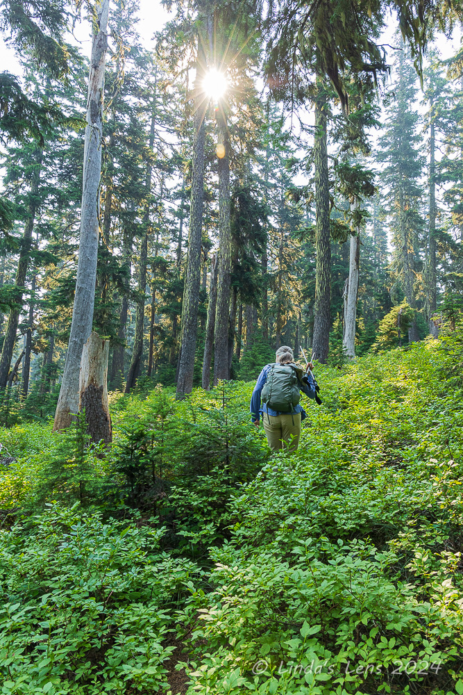
For the first mile I followed the iconic Timberline Trail across ski slopes, admiring purple lupine and yellow wildflowers. I kept leapfrogging a couple of young folks with large backpacks. Finally I came upon them standing in the trail. The couple asked if I had a map they could look at. Always prepared (I never hike anywhere without a paper map - even if it's a trail I've done many times) I whipped out my Timberline Trail map. Chatting with the couple I learned they were backpacking the entire Timberline Trail - but lacked any map. (People that head out on long hiking journeys without the proper navigation tools always amaze me!) The couple used their phones to photograph my map. (I sure hope that their batteries were fully charged.)
 |
| Gorgeous butterfly |
After parting ways with the unprepared hikers, I crossed Little Zigzag Canyon, contoured across another flower-filled gully and came upon the larger Zigzag Canyon. This deep gorge, impressive when viewed from the very top, drops several hundred vertical feet for a mile before crossing the Zigzag River.
 |
| Oregon Sunshine |
Downward I descended, sometimes steeply, through flower-filled slopes. I captured a couple of butterflies enjoying the blooms and admired a lovely display of pink and yellow monkeyflowers.
 |
| Small snow patch to cross |
Finally arriving at the canyon's very bottom, I surveyed the Zigzag River's fast-moving glacial waters for a good place to cross. Myself and another backpacking couple walked up and down the bank trying to locate the perfect crossing, until finally I picked a place that appeared to have enough large well-spaced rocks to hop across. Stream crossings always look much worse than they really are, and this one was no exception. I bounded across with no problem and was soon ascending the canyon's opposite side.
 |
| Lupine |
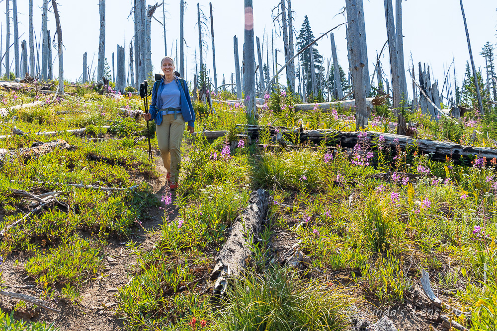
It was a steep climb out of the canyon, and the day was beginning to heat up. Soon I came upon a spur trail that branched off the Timberline trail, taking hikers to lovely Paradise Park.
 |
| Mariposa lily (aka "Cats ear") |
More sweaty climbing ensued. But I passed through many fields of lovely wildflowers, so that helped. One slope was covered with white Mariposa lilies, sometimes referred to as "Cats ears." Another slope had huge concentrations of lupine and orange Indian paintbrush. I took many photo (aka rest) breaks to capture the beauty. I passed a group of young men backpackers, and one guy had a roll of toilet paper affixed to the outside of his pack (I joked that he was well prepared!)
 |
| No flowers yet at the grand meadow |
There's one trail junction on the Paradise Park loop that is famous for having huge wildflower meadows. Mt Hood looms over the horizon, making it a special scenic spot. However, I must have been too early, because when I came upon said junction, absolutely nothing was blooming. It was kind of a disappointment. I took a photo of Mt Hood with the sign, and kept going.
 |
| Lots of lupine and hippies around the bend |
Luckily, not much farther away, I did find a few blooming wildflowers. Lupine and mop-headed Western Pasqueflowers (aka "hippy on a stick") covered an adjacent slope. The fluffy "hippy" flowers always make great photo subjects!
 |
| Two bees |
And I also managed to capture two different kinds of bees on one flower.
 |
| "Hippy on a stick" |
After a quick lunch break under a grove of scraggly trees, the trail continued above timberline for wide-open views of the surrounding foothills, with Mt Hood anchoring the sky.
 |
| Mt Hood sighting in Paradise Park |
Magenta Indian Paintbrush blooms occasionally appeared trailside, providing color to an otherwise gray, rocky scene.
 |
| Pink heather and expansive views |
I even glimpsed a few patches of pink heather standing out amongst the greenery.
 |
| Checking out Split Rock |
One of Paradise park's local landmarks is a huge isolated boulder, with a wide crack running through the middle. Nicknamed "Split Rock" by the local hiking community, it's worth a quick climb up a gravelly bootpath to see it.
 |
| Magenta paintbrush |
I love the views of Mt Hood from Split Rock, so eagerly trekked uphill hoping to spend some quality time hanging out and photographing the area. However, upon my arrival, I discovered a huge group of older hikers had already arrived, and were spread out around the rock enjoying an extended lunch break. They weren't very friendly - a couple of the men gave me the evil eye when I approached, camera in hand. Not wanting grumpy people in my photos, I retreated (but not before snapping a self-portrait for my #52hikechallenge blog page!)
 |
| Mt Hood rises over the meadow |
The Paradise Park loop meandered through more open wildflower meadows, before charging steeply downhill to reconnect with the Timberline Trail. I passed by several campsites, many already claimed by weekend backpackers.
 |
| Huge patch of avalanche lilies on the Timberline Trail |
Connecting once again to the Timberline Trail/Pacific Crest Trail (these trails combine for a few miles here) I headed back towards Zigzag Canyon. I came upon a shady area that was chock-full of avalanche lilies. An early-blooming spring flower, I assumed that the shaded spot had something to do with the longevity of this particular patch.
 |
| Timberline trail crossing a drainage channel |
After leaving the Paradise Park loop, I'd kind of assumed the good scenery was done for the day, but no, this portion of the Timberline Trail was just as lovely. I crossed flower-filled drainages, and passed by rocky gullies with peek-a-boo glimpses of the surrounding mountains. There were even a couple of waterfalls. I chatted with several groups of backpackers, most attempting to hike the entire 40-mile Timberline Trail loop. I even met a couple of PCT through-hikers.
 |
| Colorful monkeyflowers in Zigzag Canyon |
Before I knew it, the trail began descending to the bottom of Zigzag Canyon. Time to cross that river again! Although the river was flowing much stronger, due to afternoon snowmelt swelling it's waters, I hopped across the same spot a second time with no problems.
 |
| Another beautiful butterfly |
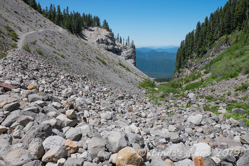
Now came the tough part of this hike - climbing out of ZigZag canyon in the afternoon heat. Not only that, beyond the top of Zigzag Canyon, the final two miles to Timberline Lodge were also uphill.
 |
| Zigzag Canyon |
It was a hot, slow, extremely sweaty trudge out of the canyon. The only good thing was the trail being mostly in shade. But once I arrived at the top of the mighty Zigzag, it was all sun for the next two miles.
 |
| Ski lifts and Mt Jefferson |
By now my feet were beginning to complain. Although thirsty, I rationed my water supply to make sure I had enough to get me to the trailhead. Good thing there were some lovely views to distract me from my misery.
 |
| Not much snow left to ski on |
Late afternoon light illuminated Mt Hood beautifully. Although skiing was done for the day, I had a good view of the tiny rectangle of groomed snow above the Palmer lift. Sure didn't look big enough to do much skiing.
 |
| PCT trail sign near Timberline Lodge |
I was never so glad to reach the PCT sign located directly above the road to Timberline Lodge. That meant I was almost done! It was a long, hot 14 mile day, but I came away with a camera full of beautiful images and although the body was weary, my mind was refreshed. Now it was time to refuel with a well-deserved burger and beer!
Hike no. 35 done! #52hikechallenge