Thursday, June 28, 2012

Back to the Coast

I've caught the bug.  My last trip to the Oregon coast was so wonderful, I just had to return.  Even though the weekend forecast was less than stellar (50% chance of rain) I decided to go anyway.  That's what raingear is for.


Size matters!  Click on any photo to enjoy a larger version.


The beach at Hug Point

My original plan was to hike from Short Sand Beach to Neahkahnie Mountain and back.  But I got a late start, so the itinerary was downsized to merely trekking up the top of the bluff overlooking the beach.  Then I passed by a sign for Hug Point Wayside.  With a name like that, it was just too tempting to pass up.


The high tide line is very apparent

What a cute little beach!  The shoreline was framed by rocky headlands on both sides, with Hug Point to the north.  Hug Point got its name from the early days when people used the beach as a road to travel from town to town.  At high tide, the waves came right up to the edge of the rocks, thus one had to "hug" the cliffs to get around this point.


Bear running from the waves

Bear was so happy to be outside!  He ran and ran, up and down the beach, ears flapping and tongue hanging out in a big doggy grin.


Bear is lovin' the beach

The beach was another wonderful scenic spot.  I, of course, got busy with my camera.  Bear usually steers clear when I'm shooting photos, but for some reason today he managed to get himself into almost every frame.  And this was one of the times I really didn't want a dog in the middle of my images.


Creek outlet to the sea

I got super lucky with the weather.  Although the skies were cloudy, the rain stayed away.


Small colorful beach flowers

Cloudy skies aren't all bad.  They make for some really nice flower shots - saturated colors and no shadows.


Raindrops bead on the leaves

And the raindrops beading up on the bright green leaves sparkled like diamonds.


Hug Point sea cave

What a picturesque little spot!  I'm coming back here again on a nice sunny day.  Or maybe at sunset.  Or maybe both.


Unusual plant

After killing an hour or so at Hug Point, I loaded Bear back in my car and drove to the huge parking area for Oswald West State Park.  The beach here, Short Sand Beach, is very popular with surfers.  They pretty much dominated most of the vehicles in the parking lot.  I joined the parade of surfers, boards and wetsuits in tow, on the path to the water.


Short Sand Beach

The cool, cloudy weather didn't look very inviting for surfing.  But in Oregon I guess if you wait for a sunny day, you'd never get in the water.  Besides, that's what wetsuits are for.

 
Wave action art

This was another lovely, rocky shoreline.  The wave action running back and forth over small rocks made very cool patterns in the sand.  Kinda artsy isn't it?


Foxglove blooms near the beach

To reach this beach, I walked through an amazing old growth coastal forest, full of gigantic trees.  Where the forest met the sand, low bushes and flowers grew.  There was a huge patch of lovely pink foxglove blossoms that brightend up this woodsy boundary.

 
Where the forest and beach meet - a flower garden

Again, I had a blast capturing all the nice scenery on my memory card.  Bear managed to stay out of the way this time.


Lichen covered rocks

It's so easy to waste a lot of time walking the beach, snapping occasional images.  After an hour of this, I realized if I was going to have time for a hike, I needed to hit the trail.  Wandering the confusing maze of paths through the thick vegetation, I found a sign for the Oregon Coast Trail.


Walk-though tree

I don't know what it is about the trails on the coast, but so far every one of them I've hiked has been super muddy!  This path was no exception.  It didn't take long before the trail turned to muck and I was again wallowing though a soupy mess.


Humungeous trees

I walked for a mile or so, hoping to find the two side paths that were supposed to lead to viewpoints on top of the bluff.  But I found nothing - only dense forest, and lots of it. 
But all was not lost. I saw a bunch of neat old, huge trees. One was so large, they cut a hole through the middle, and the trail went right through it.


Cool suspension bridge

And Bear and I got to walk across this really cool suspension bridge that led us back to the parking lot. 

Although we didn't travel very far, it was fun to hang out on the beach.  There was wide open spaces for Bear to run, and lots of amazing scenes for me to photograph.  And, best of all, the rain held off until I was safely back in the car heading home.


Wednesday, June 27, 2012

Just Chillin'

It's week 10 of the 52 Photos Project.  This week's current gallery prompt is "release."  Our assignment is to post a photo depicting life's more relaxing moments.

Columbia River Gorge view from Dog Mtn

Anybody who's followed this blog for awhile knows exactly the photo I'm going to share.  I unwind by getting out into the wilderness.  One of the best ways is hiking to the top of a steep mountain.  And once on top, relaxing in a flower-filled meadow and taking in the views.  I return home happy, refreshed, and invigorated. 

How do you chill after a hard day's work?

This week's 52 Photos Project gallery can be found here.  Check it out!


Friday, June 22, 2012

Salmon River Trail

Last Friday was my scheduled day off from work.  With gorgeous sunny weather forecast, there was no question what I was going to do.  Time for another new hike from Sullivan's book!  (I'm going to start dubbing my flex days "New Hike Fridays")


Size matters!  Click on any photo to enjoy a larger version.

Mandatory trail sign photo

After perusing my book, the Lower Salmon River Trail called to me.  A short, flat, easy riverside path, I'd kept passing it up for longer, more challenging hikes.  But combining the lower trail with a portion of the upper Salmon River Trail, I created a trek of nearly 9 miles.  A respectable distance for a sunny Friday.  Salmon River Trail, here I come!


Huge trees and tons of ferns

This trailhead is easy to find.  It's located a mere 5 miles south of the town of Zigzag, with access entirely via paved roads.  The lower trail parallels the Salmon River for 2.6 miles.  If one wishes to hike further, the upper trail continues along the river for another 14 miles.  My goal for today was to hike from the lower Salmon River Trail to "Rolling Riffle Camp," an area of designated backpacking campsites about two miles down the upper Salmon River Trail.


River rapids

The lower trail starts in an incredible old-growth forest.  It promptly descends to the Salmon River's banks.  The ancient Douglas Fir trees lining the river are enormous.  The forest floor is thick with all things green - large ferns, vine maple, and carpets of moss.


Columbine topside

As the trail winds through the forest, one is never far from the Salmon River's sparkling waters.  It's a lovely clear mountain stream, intermittently broken by small rapids.  Numerous side trails lead one to its rocky shoreline.  I made frequent detours from the main trail to check out the water's edge.


Ginormous tree!

With occasional stops to hug a humongous fir tree!  (Didn't know I was a tree-hugger did you?)


Pretty pink flowers

The forest greenery was occasionally interrupted by a bright splash of color.  The wildflowers were in bloom!  There were bright orange columbine blossoms, and these cute pink tubular numbers (that I don't know the name of!)


Trees growing on a nurse log

The above photo was a cool sight.  In these ancient forests, when old trees fall over and die, the rotting trunks become nourishment for new plant growth.  These old trunks are referred to as "nurse logs."  I've seen all kinds of moss and small plants sprouting out of these trees, even small saplings.  But never have I seen full-grown trees with roots wrapped around a nurse log!  This was a first!


Colorful river bottom

I ate my lunch at a very scenic riverbank beach.  It was a great spot to sit back, enjoy my PB & J, and watch the water flow over the rocky river bottom.  So relaxing!  The sun was out in full force, taking away the morning chill.  It's warmth felt great.  


Scenic Upper Salmon River

Although the lower trail was very beautiful, when I crossed the road that separated the upper from the lower portions, I found I enjoyed the upper trail even more.  It immediately climbed until I was perched atop a high cliff, peering down to the river far below.


Vibrant flower patch

I came upon a hillside bursting with wildflowers.  There were dark purple larkspur blooms, bright orange Indian paintbrush, and vibrant pink blossoms that looked kind of like thistles.  An amazingly colorful scene, I tried hard to capture with my camera.


Hillside full of flowers

But this was the best I could do.  Most of the flowers were located on the steep slopes high above me.  I wasn't about to try and scramble up it.


Larkspur blooms

Bear and I hiked until we saw the deserted campsites of "Rolling Riffle Camp."  By then the trail had wound back down to river level.  Although this section was mostly in dense forest, things occasionally opened up to provide grand river views like the one below.


Beautiful river view

By the time I reached our turn-around point, the sun was high and bright in the sky, and temps had heated up quite a bit.  Not used to hot weather yet (we've had an extremely cold and wet spring) the heat began to tire me out.  The return trip wasn't quite as pleasant, but seeing all those great river views a second time helped ease my discomfort.


Bear cools off

Near the trailhead, I stumbled upon an especially pretty stretch of river.  The bottom was covered with flat rocks, stained an orangish-rust color.  The water was a lovely blue-green.  Such an inviting place, I had no choice but to stop.  Bear cooled his paws off in the refreshing water.  I snapped photos and enjoyed a cool breeze coming off the water's surface.  I forgot all about being hot and tired.  It was a great way to end my hike.

Another wonderful trail discovered.  I can't think of any better way to spend a sunny day off!


Wednesday, June 20, 2012

Summertime Colors

Week 9's theme of the 52 Photos Project is Summertime Colors.

What comes to mind when I hear these words?  Why flowers of course!  I choose my spring and summer hikes based on where the wildflowers are currently blooming.  Starting in the lowlands of the Gorge, by late summer I've worked my way up to the alpine highlands in the mountains.  Summer is a glorious time to be out in the forest, taking in the lovely greens and colorful floral displays.


And from last weekend's hikes (yes, I did two!) I managed to find lots of color to photograph.  But this photo won the weekly posting honor.  These beauties were blooming just steps from the beach on the Oregon coast.

Do you like it?  Please leave a comment!  Thanks to all who commented last week.

This week's photo gallery can be found here.


Sunday, June 17, 2012

Hell (vetia) Half Marathon

The title says it all.  This was the most miserable race I've had in a long time (maybe ever!) 

I signed up to run the 2012 Helvetia Half Marathon with high hopes. Last year I'd conquered its hilly course with a sub-2 hour finish time. I foolishly expected a repeat performance.


Size matters!  Click on any photo to enjoy a larger version.

Race swag

The weekend before race day, my running partner Cami and I did one last long run.  Cami was planning to do Helvetia with me, and set her sights on a sub-2 finish.  But our training session was fraught with aches and pains - Cami complained of a sore foot, and my right hamstring started talking.  And it didn't help matters that I went for a 8-mile hike the next day.  By Monday, my hammy was not happy!


Cami and I ready to run!


I took it easy all week, icing and taking lots of ibuprofen (vitamin "I").  Cami was doing the same for her foot.  But Saturday came way too soon, and I felt less than 100% - way less.  Cami wasn't feeling up to par either.  And to top things off, race day morning her tummy was a tiny bit upset.


The sun came out for the occasion


Aches and pains be damned - Cami and I had paid our money, and we were going to run this race.  The weather forecast was iffy all week, predicting rain up until the night before.  Race day dawned cloudy and chilly, but the sun came out right before the 8 am start time!


Starting line crowds

Before we knew it, Cami and I were in a moving mass of sweating runners.  The field was extremely thick for the first mile.  Lots of dodging the walkers and slower runners, but we managed to stay together.  It's always so much fun to run a race with a friend.  Cami and I chattered away, and celebrated our first mile with "the wave."


Balloon arch after mile one

But shortly after the first mile marker Cami suddenly gasped and slowed, limping slightly.  When I asked her what happened, she said her knee had buckled under her.  Cami turned down my offer to walk saying she'd "run it off."  We continued on (slightly slower) until we reached the bridge over Hwy 26.  This point was marked by a colorful balloon arch, a water station and a bank of port-a-potties.  It was good timing, as Cami needed to make a pit stop.


Despite everything, Cami was all smiles


After a quick bathroom break, we left the "comfort stations," and crossed the Hwy 26 overpass amid cheering ODOT workers (who had closed the ramps for the race).  Then our course entered the beautiful farm country of Helvetia.  The green fields looked downright peaceful and the blue sky made our spirits rise.  The air temperature, in the low 60s, was perfect for running.


Beautiful farm country

Right after mile three, the hills began.  Helvetia's course is known for its tough hills.  We climbed up a couple of steep inclines, and up at the top was the Helvetia Tavern.  A local landmark, this ramshackle building is known for it's delicious hamburgers.


The historic Helvetia Tavern

At the tavern was another water station and port-a-potty bank.  Cami needed to take another pit stop, so while she was waiting in line for the loo, I took photos of the passing runners.  I wasn't paying attention to what was going on in the bathroom line, and thought I heard someone call my name.  Thinking I'd just missed Cami, I took off running to catch up with her.


Helpful volunteers at a water stop

I ran a fast pace for a good half mile or so, but didn't see any sign of Cami.  Then I got to wondering, was the shout I heard meant for someone else?  Maybe Cami was still back at the tavern waiting for me.  Uh-oh!  I'd just ditched my best running friend!  Feeling really awful, I stopped at the top of a big hill to wait for Cami. 

I sat at the crest of the hill for a good 3-4 minutes, scanning the runners, hoping to see my friend.  I was hoping I didn't totally miss her.  It would be a bummer if we ended up not running together.  To pass the time, I shot some pictures of people gasping up the hill.  Finally, I saw Cami's shirt in the crowd and hollered.  Yahoo!  Back together again.  Turns out, Cami was waiting on one side of the line of potties, and I was on the other, and we didn't see each other.  She thought I'd gone in to use the bathroom too, and was waiting for me to come out.  What a comedy of errors!


The course went by the entrance to Roloff Farm

Teamed up once again, Cami and I began tackling the rolling hills that characterized miles 4-6.  About this time, my hamstring started letting it be known it didn't like uphills.  Cami's knee and foot weren't happy either, so we stopped at the next water station (next to a cute little white country chapel) so Cami could take some more "vitamin I."


I waited for Cami at the top of a big hill

Around mile 6, the course took a corner and did a quick out and back, following a winding country lane downhill.  Cami and I looked at this hill and both thought the same thing - we have to come back up it!  The road was lined with the most fabulous homes - huge McMansions and country estates.  We kept ourselves occupied oohing and aahing over the gorgeous real estate.  At the turnaround, Cami and I powered back up the hill, realizing it wasn't as bad as we thought it was gonna be. 

But just after mile 7, Cami needed another potty stop.  Not wanting to miss her this time, I waited right outside the honey bucket's door.  As we started out again, my hammy protested loudly.  In the short time I'd spent waiting for Cami to finish, it had tightened up.  It took a half mile of running before it grudgingly loosened some.


The horrible gravel road

From miles 8 to 10 was the longest stretch of the race.  We ran down one road that seemed to go forever!  And I started to feel crummy.  My leg was hurting, my energy dropping.  Someone passed us wearing a t-shirt that proclaimed "running sucks!"  I told Cami that's how I felt at the moment.

From last year's race, I knew there was a short portion of the course that's run on a gravel road.  When Cami and I finally hit the gravel, around mile 10, it instantly slowed us down.  Our footing unstable, the rocks underfoot hard and sharp, it was no fun!  And poor Cami needed yet another bathroom break badly.  Luckily, an aid station was not far, so Cami sprinted ahead.  The potties were next to a lovely green field.  The break in the action gave me an excuse to snap some more scenery photos.


Friendly ODOT guy

Back on the road again, for our final push.  But there wasn't much push left in me.  Normally a chatty person, I ran in silence.  My smarting hamstring put me in a grumpy mood.  I just wanted to be done with this miserable race.  Cami, who I know was hurting way more than me, was still upbeat and tried to raise my spirits.  She is one tough lady.

We trudged along, finally leaving the gravel road, on our way back to the highway overpass.  Once the overpass came into sight, I gained a small bit of hope.  Just a little more than a mile left!  Cami and I stormed up the bridge, to the encouragement of some orange-vested ODOT workers.  Those guys were super!


Back to the balloon arch

But shortly after mile 12, I got a horrible side stitch right below my ribs.  I told Cami I needed to slow down.  I trudged along, trying to take deep breaths, hoping it would go away.  As the stadium came into view, Cami tried to encourage me to run faster, but I just grumpily replied "This is the best I can do!"  We turned into the parking lot, amid some cheering spectators.  Then I followed Cami onto the field of Hillsboro stadium, and to the finish arch.  What a wonderful sight! 


I was never so happy to be done with a race!

I was never so happy to finish a race!  Our time, 2:15:40-something was a lot better than I expected, considering all the bathroom breaks, and losing each other at mile 4.  After walking around to relieve my side stitch Cami and I went to claim our reward - a burger from Helvetia Tavern.  And yes, believe it or not, it tasted really good!

After all she went through in this race, Cami kept such a great attitude.  She never complained once, and was always cheerful and encouraging.  A good person to have by your side when race day doesn't go your way.  I'm glad she's my running partner.

Now it's time for Cami and I to set our sights on the next goal.  We've both signed up to run the Portland Marathon, the third marathon for both of us.  Race date is October 7th, so we'll be starting our training cycle next week.  Wish us luck!


Wednesday, June 13, 2012

Shadows

It's week 8 of the 52 Photos Project and this week's theme is shadows.  Living in rainy Portland, Oregon there's not many shadows to be seen (especially the spring we've been having!)  But last Sunday the sun decided to make an appearance, and I noticed this cool pattern of shadows some tree branches made across our backyard lawn.  Last week's prompt got me all excited about black and white, so I had to try again.  Converting this photo to B &W made the shadows much more prominent.


What do you think?  I'd love to hear your comments!

This week's gallery can be found here.

Monday, June 11, 2012

In Search of Lewis and Clark

It all started with this article in May's issue of Backpacker magazine.  The Oregon Coast Trail, from Ecola State Park to Arch Cape, was featured in the "destinations" section.  The trail description and beautiful magazine photo got me thinking "why don't I ever hike at the coast?"


Size matters!  Click on any photo to enjoy a larger version.

The first explorers

Growing up in South Dakota, I never had access to an ocean.  When I moved to Oregon, 24 years ago, I gravitated to familiar surroundings - rivers and mountains.  Having never lived near the sea, I didn't know what I was missing.  My home is an hour's drive from the coast, but I hardly ever visit.


Ocean view from Ecola Point

So I decided, if there's a local trail good enough to be featured in a national magazine, I'd better go hike it.  The original plan was to visit Ecola State Park on my Friday off.  But the weather for the coast that day didn't look promising (lots of rain) so instead I went to Three Corner Rock (see previous post).  Sunday's weather, although not sunny, was at least predicted to be dry.  It was as good as it gets for a trip to the beach.


White foamy waves

A big fan of William L. Sullivan's hiking books, I also own his "100 Hikes on the Oregon Coast."  This particular edition details a section of the Oregon Coast Trail, from Seaside to Ecola State Park.  Not only does Sullivan give a dead-on accurate description of this trail, he also includes some historical tidbits.  I learned this portion of the Oregon Coast trail was first traversed by explorers Lewis and Clark during the winter of 1806.


Ancient coastal forest

Wintered at Fort Clatsop, Lewis and Clark heard from the local Indians of a huge whale that had washed up on a beach south of their encampment.  The party set off in search of the "monstrous fish," hoping to acquire some of the blubber for food.  Led by a native guide, the explorers scaled a large headland now known as Tillamook Head.  Clark described this headland as "the steepest worst and highest mountain I ever ascended." 


A Lewis & Clark viewpoint?

But once on top, the men marveled at the amazing ocean views.  Clark liked one viewpoint in particular, where he exclaimed "I behold the grandest and most pleasing prospect which my eyes ever surveyed."
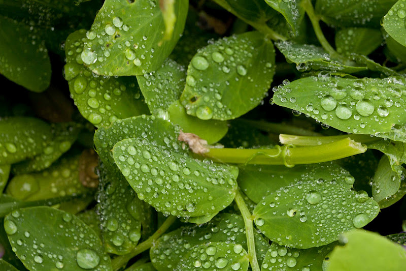
 

Frilly petals

Their party found the whale after descending to a "beautiful sand shore" and crossing a stream, which Clark later named Ecola Creek, from the Chinook Indian word for whale ("ekoli").


Wood steps through a muddy area

It was exciting to learn this hike would follow in the footsteps of these great explorers.  My plan was to park at the southern parking area at Ecola State Park.  From this lot, I'd hike 1.5 miles north along the bluffs of Ecola Point until winding down to Indian Beach.  From Indian Beach I'd climb north, hugging the high cliffs for another 1.8 miles, to reach the rocky promontory of Tillamook Head.  From this viewpoint, the trail continues further north 4.3 miles to the town of Seaside. 


A steep, windy trail leads to Indian beach

Sullivan's book promised some excellent ocean views on this final stretch of the trail, including the one that Clark liked. Since I had to hike back the way I came, it was too far to go all the way to Seaside. But I really wanted to find Clark's favorite viewpoint. From the sketch in Sullivan's book, it appeared it was about a mile or so north of the Tillamook Head viewpoint. That seemed doable.  I decided Clark's viewpoint would be my goal.


Bear checking out Indian beach

Bear and I set out under cloudy skies and mild temperatures.  The first leg of our hike, across Ecola Point, wound through a mossy forest of gigantic trees.  Large ferns grew everywhere, and the forest floor was a lush carpet of greenery. 


The tide comin' in


The trail was very muddy in places.  A wooden boardwalk was placed across a few extremely swampy portions, but there were also plenty of boggy areas where Bear and I had no choice but to slide and squish through.


Waves splashing on the rocks


The first section of the trail, from Ecola parking area to Indian Beach, offered two very nice viewpoints, one at Ecola Point.  This headland jutted out into the sea, offering vistas all around.  From the promontory, one could see a trail of sea stacks stretching out into the ocean.  One was in the shape of a small arch - super cool!  Watching white foamy waves crash onto these rocks was mesmerizing.  I sat and enjoyed the show for several minutes before moving on.


Surfers

As I approached Indian Beach, I saw a trail descending through the forest underbrush.  Thinking this was the way to the beach, I started down.  Not only was this trail extremely steep, it was also super muddy. I gingerly crept downhill, hanging onto trees and vegetation to arrest my slides.  Luckily, I managed to stay upright the entire trip down, but it was pretty nip and tuck. 


Nice place for a picnic


But at the bottom of the path was my reward.  Indian Beach spread out before me.  I walked through a band of perfectly round rocks until I hit the sandy shoreline.  The southern end of the beach was wilder, hemmed in by Ecola Point and the rows of sea stacks.  The northern end was more developed, a parking lot close by.  There were quite a few people on this portion of the beach, sitting in the sand or walking around.  There was also a small band of surfers in wetsuits tackling the waves.


Lovely wild irises

Bear enjoyed running around the beach, but didn't like the waves coming at him.  I, however, had fun talking photos of the crashing waves, and liked the challenge of trying to click a shot before my feet got wet.  In the sand, there were many interesting things to photograph - rocks, seaweed, and one little sand dollar (which you saw in an earlier post).


Hangin' off the cliff edge

I could've stayed at Indian Beach the rest of the day, enjoying the magnificent sights.  But remembering my goal - Clark's viewpoint - I knew I had to get moving.  So Bear and I walked through the surfers and beach goers, past the crowded parking lot, to the trail's continuation on the south side of Tillamook Head.


Windswept tree


The path climbed steeply from the parking lot.  But not very far up the trail, I was stopped by the most gorgeous viewpoint.  The forest opening offered a wide-angle panorama, looking back over the entire stretch of Indian Beach.  And there in the foreground was a patch of lovely purple wild irises.  The scene was absolutely jaw-dropping!  Certainly one of the highlights for the day. 


One last gorgeous bloom

After memorializing this fantastic place with dozens of photos, Bear and I continued on.  The trail climbed and climbed and climbed some more.  It was steep, muddy, and slippery.  After the wonderful viewpoint, and one other clearing close by, our path turned into the forest and there were no more ocean views.  This middle portion of the hike seemed to take forever, even though it was only a mere 1.8 miles.


Hiker's camp near Tillamook Head

I finally emerged from the forest, coming upon the spur trail leading to Tillamook Head viewpoint.  There at that junction, I was surprised to see three wooden bunkhouses and a covered picnic area.  I'd stumbled upon the hiker's camp.  My guidebook alluded to a hiker's camp in this area, but I wasn't expecting anything quite as established as this!  (The camp even had its own pit toilet.)  I chatted with a young couple who were packing up from a night's stay and they told me it was free to stay here, first come, first served.  The State park hosts even provided firewood.


Tillamook Head's amazing view

After checking out the hiker's camp, I followed the short spur trail to the end of Tillamook Head's rocky point.  And my timing couldn't have been better.  As I approached the clearing, the clouds that I thought would be hanging around the entire day, magically parted to reveal a sunny, blue sky.


Seafoam leads to the lighthouse


And, oh were the views glorious!  They were even better than the Indian Beach panorama, I'd seen previously.  Perched on the side of a steep cliff, I could see for miles in all directions.  The Pacific Ocean stretched before me to the horizon.  Sunshine made the sea sparkle in a lovely shade of blue-green.  Waves churned against the rocks below, foaming white.  Dark green forests framed the rocky cliffs.  Blue skies complimented everything.


Tillamook Rock Lighthouse

Far out in the distance, perched on a rocky island, I had a great view of the old Tillamook Head Lighthouse.  This lighthouse operated from 1881 to 1957.  It's nickname, "Terrible Tilly," was due to its perilous location.  Sitting a mile out to sea, this island was repeatedly battered by winter storms.  Waves brought water, rocks, and fish crashing into the building, at levels as high as the lantern room, which was located 150 feet above normal sea level.  Abandoned since 1957, today the structure stands empty.


Vibrant blue-green sea

A young couple I met on the trail told me they'd seen a bald eagle nest in the forest below Tillamook Head.  But they mentioned in order to see the nest, you had to climb over the protective fencing across the top of the bluff.  As I now scanned the cliffs below, trying to locate the nest, I briefly considered ducking over the fence to get a better look.  But not wanting to be on the evening news, common sense prevailed, and I stayed put on my side of the fence.  Not worth risking my life over, the eagles would have to wait for another day.


Boardwalk through the boggy trail


After taking a long lunch break and soaking in the incredible views at Tillamook Head, I again reminded myself there was one more goal for the day.  I still wanted to reach Clark's viewpoint.  Time to pack up and hit the trail for leg three of my journey!


Late afternoon light on Indian Beach

So off Bear and I went, climbing through more dense forest.  The trail became incredibly muddy, much worse than anything I'd encountered thus far.  A couple of stretches had wooden planks placed over the soupy muck, but for the most part, we were on our own.  Bear's white legs and underbelly turned black with mud and my boots became caked with the sticky stuff.  Climbing up the steep trail, I often held onto adjacent trees to stop myself from sliding.  Progress was glacially slow.


Nice evening for a beach walk

I kept scanning the trees ahead, trying to locate Clark's viewpoint.  Small openings between the trees provided occasional glimpses of the ocean, but nothing seemed to open up to a broad panorama.  These little peep shows were such a tease, I began to get annoyed.  The climbing continued, the mud wasn't letting up, and I was surrounded by dense forest, with nary a viewpoint in sight. 

My gps battery died, so I'm not really sure how far I traveled.  But I'd chosen 3:00 as my turn-around time (promising Roger I'd be home at six for dinner).  The appointed hour arrived, and I still was no closer to the final goal.  I conceded defeat, turned around and slid back down that muddy trail, returning to my car.


Beautiful rugged Oregon coast


As I retraced my steps back to the parking area, I thought about Lewis and Clark and their team of men, who made their way through these very woods over two centuries ago.  There wasn't a nicely-graded, cleared trail back then.  Certainly nothing as established as the trail I hiked today (mud and all).  The men didn't have Vibram hiking boots or technical clothing.  They didn't have a gps, ergonomically designed backpacks, or fancy Camelback hydration bladders.  The explorers didn't have Cliff bars, trail mix, or peanut butter.  All they had was their buckskin clothing, and dried elk to eat.  And yet Lewis and Clark's party successfully traveled through these rugged, muddy woods, discovering amazing viewpoints in their quest to obtain food.

Even though I didn't reach my final goal, this was hands-down the most incredible hike I've completed so far this year.  I've forgotten what a beautiful place the Oregon Coast really is.  I totally understand now why Backpacker magazine included this hike in one of their current issues.  No, this won't be my only trip to the coast.  Next time, I plan to finish the rest of the hike described in Backpacker, starting at Ecola State Park and heading south. 

And of course, I'll also come back another day and find Clark's elusive viewpoint.