Thursday, October 31, 2013

Punkins

Every year my hubby grows pumpkins in our garden.  Some years, they prosper, other years, we're lucky to get one nice orange one for Halloween.  Many years ago, we grew giant pumpkins.  One of the vines traveled under our fence, into the neighbor's yard, and grew a humungous giant in his flower bed (which we let him keep and carve for his granddaughter).


2013 brought a crop of four nice sized jack-o-lantern sized punkins.  Roger picked them in mid-October, and they resided on our back patio.  Since our kid's haven't been home for Halloween in many years, we don't carve pumpkins anymore.  They just get set outside, as is, for the big night.


Tonight got me thinking of some of the great memories I have of Halloween's past.  When my kids were little, I used to love making their costumes.  Roger and I had a great time walking them around the neighborhood, and taking them to the local mall.

Here they are - my little punkins!  I'm not sure exactly what year this photo was taken, but I think Cody was in kindergarten or first grade, and Denise was probably 3 or 4 years old.  They used to get so excited for trick-or-treating.


Of course, Halloween is not just for kids.  My hubby, who has been told for years he bears a canny resemblance to the character Mario, of the Super Mario Brothers video game fame, finally decided to embrace his alter ego.


Roger assembled an awesome Mario costume.  This is what my hubby looked like when he left for work today.  Isn't he a dead ringer?  (Yes - my husband has been replaced by Super Mario!)

So there you have it - my Halloween punkins - past and present.

Happy Halloween to all my readers!


Tuesday, October 29, 2013

Big Views....Big Mushrooms

I love fall hiking.  The weather is cooler, the bugs are all gone, and the forest is ablaze with color.


Big view No. 1

The day after my short ramble to Dry Creek Falls, my friend John invited a group of us to trek the McIntyre Ridge Trail to Wildcat Mountain.  I hiked this trail last year and although it wasn't my favorite, I did remember great views of Mt. Hood along the way.  And, besides, after Friday's wimpy hike, I needed something with a little more mileage.  At the last minute, I emailed John and accepted his invitation.


In the woods, ready to go

The following morning, a group of six happy hikers assembled at the makeshift trailhead - basically the end of a bumpy Forest Service Road deep in the woods.  This area had a history of illegal camping and target shooting, but it appeared this year the Forest Service was trying to clean things up.  They'd installed large rocks in front of all the old target practice areas, and stamped "no shooting" on their surfaces.  But most of us wore an article of orange clothing, just in case.


Hiker paparazzi

Our day's journey began up a rough dirt road that quickly intersected with the McIntyre Ridge trail.  After winding through thick, mossy woods of fir and hemlock, we emerged at a clearing.  It was big view number one.  The cloudless sky provided a drop-dead gorgeous view of Mt. Hood, shining white from a recent snowfall.  Cameras came out in force - talk about paparazzi!  (I'll bet you never knew they existed deep in the woods of Oregon)


Single file

After a fine photo session, we dived back into the woods, climbing up a steep hill, and then emerging into a lovely meadow.  As you can see, our crew was an orderly bunch, trekking through the tall grass single-file.


John shows off his muscles

But not without a little clowning for the camera!


Steve working for the shot

Steve was the group's mushroom expert.  Our rainy late September weather gave rise to a bumper crop of 'shrooms in the woods.  There were small ones and big ones, in every color imaginable.  And eagle-eye Steve found them all.  He loved photographing the colorful fungi.  As you can see, Steve went to great lengths to get the perfect shot!


"I'm ready for my close-up"

The enthusiasm was contagious.  So much so, that even I got in on the 'shroom photography action.  I liked these pancake-colored guys, hiding under some blades of grass.  (Kinda reminds me of a Donald Trump comb-over.)


Big view No. 2

Just past the mushroom fields, the woods gave way to our second big viewpoint.  Another nice Hood sighting meant more clicking cameras.  And a little splash of orange vine maple didn't hurt.


Hey everyone, it's Young and Steve!

Following the ridgeline, not far from big view number two, was the best vista of all - aka big view number three.  Forested ridges spread out forever, with Mt. Hood a prominent front and center.  You could see for miles.  As an added bonus, the rocky slope below was full of fiery-orange vine maple leaves.  It was such a scenic spot, someone had constructed a wooden bench here, for tired hikers to relax and take it all in.


Fiery orange vine maple

After yet more photos, some snacking, and conversation, John rounded up his group and pointed us toward our next destination - Wildcat Mountain's summit.


John finds the trail marker to Wildcat Mtn

Ambling down the trail, John and I got caught in conversation, and nearly missed the turnoff.  Wildcat Mountain's spur trail wasn't well marked.  No nice wooden trail sign, a single blue ribbon of survey tape was our lone clue.


Ginormous fairy-tale mushroom!

Ascending this steep trail, Steve, our top mushroom guy, noticed something hiding under the rhododendron bushes.  Parting back the branches, we discovered a patch of the largest mushrooms we'd ever seen.  They ranged from softball to soccer ball size!  And these huge brown toadstools looked like something from a fairy tale.  Although I didn't think to put an object in the above photo for scale, this particular 'shroom was about the size of a small cantaloupe.  Wowza!


Lunch spot on Wildcat Mtn

After another mushroom photography frenzy, we all arrived on Wildcat Mountain's rocky, overgrown summit ready for a lunch break.  Although once the site of a fire lookout, trees had grown tall enough to obscure any views.  Bushwacking through the thick undergrowth, one could get peek-a-boo glimpses of Hood.  But everyone was focused on eating, and besides, we'd already passed by three much nicer viewpoints.


Big view no. 3

Although the morning had been chilly, by noon temps had warmed up enough that everyone had stashed their jackets.  We sat in the warm sun on Wildcat Mountain's summit, enjoying a fine fall day and good food and conversation.


Hikers line the ridge

After a pleasant break, John led his hikers back down the mountain, retracing our steps back across McIntyre Ridge.  It was nice to stop by all the big viewpoints a second time.  The afternoon sun had shifted angles, which made for better photographic light on the mountain.


Huckleberry fall finery

Although there wasn't a lot of fall color yet, a few scattered vine maples, and some bright red huckleberry bushes added accents to the green forest.


Hanging out on the bench

Some of us enjoyed a brief rest break on the bench at viewpoint number three.


A spot of yellow in the woods

Heading back through the thick forest, our group was crossing a draw when I happened to look up.  I don't know how it got missed before, but the entire canyon was full of bright yellow leaves.  The sun illuminated the leaves making them glow.  Everyone gaped in awe.  A wonderful patch of fall color, it made the perfect ending to a nice fall hike.


Big view No. 4 (Are you sick of Mt. Hood yet?)

Well.....actually the perfect ending was heading to a local Mexican restaurant for some local brews and unlimited chips and salsa.  Ahhhh!  Food tastes so much better after you've been trekking around the woods all day.

Total stats:  8 miles, 1700' elevation gain.  And a camera full of Mt. Hood and mushroom photos.


Sharing with:  Tuesday Muse.

Saturday, October 26, 2013

Dry Creek Falls

Stupid government shutdown!  I had a Friday off, the weather was perfect, and I'd made big plans to hike around Coldwater Lake at Mt. St. Helens National Volcanic Monument.  BUT - you guessed it - due to our elected official's ineptitude, I was pretty sure the road to get in there was closed.  Not wanting to drive the 2+ hours to find out, I needed a backup plan.


Boooo!!

Second choice?  The Columbia River Gorge.  Although a designated National Scenic Area, main access was from an interstate highway.  With no easy way to close roads, I assumed the trails would still be open.  Besides, it was a lot shorter drive than MSH.


Barge approaching the Bridge of the Gods

So plan "B" became a hike up Nick Eaton Ridge.  I pointed my car towards the trailhead, located just east of the town of Cascade Locks.

Nature was calling as I drove into Cascade Locks.  So I stopped at the Char-Burger Restaurant, located at the foot of the Bridge of the Gods.  After using their facilities, I felt obliged to buy something.  A giant oatmeal raisin sandwich cookie called my name (filled with cream cheese icing!).  A little bit of heaven, I now had my day's dessert.


Barge crossing under the bridge

Exiting Char-Burger, I stopped to check out the famous Bridge of the Gods.  Spanning the Columbia River, it forms a vital link between Oregon and Washington.  It's also the official Pacific Crest Trail crossing.  My timing was good, as I got to watch a huge barge cross under the bridge's steel span.


North end of the Oregon PCT

Onward to the day's hike!  But I'd forgotten one minor thing - the trailhead for Nick Eaton Ridge was adjacent to a Forest Service Campground.  Arriving at the access road, I was dismayed to find it barricaded.  Since the campground had been closed, the road was also closed, preventing hikers from reaching the trailhead.  Arrghhh!!  Foiled again by the feds!


Lush, green forest

Okay, plan C??  I racked my brains for nearby trails.  Then I remembered driving by the PCT trailhead next to the Bridge of the Gods.  I'd read of a short hike on the Oregon PCT to a place called Dry Creek Falls.  This was the only gorge waterfall I'd yet to visit.  Well, today would be the day!


Gorgeous yellow leaf

So I backtracked through Cascade Locks until I came to the PCT trailhead, adjacent to the Bridge of the Gods tollbooth.  Pulling into the parking lot, I immediately noticed yet another sign announcing this facility's closure.  Although the bathrooms were locked tight, I didn't see anything preventing people from parking or accessing the trail.  Pooh on the feds!  I was hiking the PCT today whether they liked it or not!


A scattering of yellows and oranges

I'd never hiked the PCT from its northern terminus in Oregon.  Heading south from the Bridge of the Gods, I ducked under I-84, and followed a road until I picked up the trail's continuation into the forest.


Golden ferns

Oh, it was a lovely, mossy green forest!  Ferns sprouted from the ground and the undergrowth was thick and lush.  I was hoping to catch a little fall color, but it was still too early.


This old tree is heavy with moss

There were, however, some small patches of yellows and oranges.  Enough for a few photographs.


Colorful forested dell

And I ran across a patch of ferns that had already turned into golden browns and yellows.


PCT sign

Since it was only a mere two and a half miles to the falls, I took my time moseying through the forest, snapping photos of everything that caught my eye.


Old road to the falls

After a little over two miles, the trail intersected with an old road.  The road paralleled a cute rushing creek.  At road's end was my destination, Dry Creek Falls.


Dry Creek Falls

Approaching the waterfall, I was amazed to discover such a tall, full cascade.  It plunged 50 feet from a slot in the adjacent basalt cliffs.  Green moss lined the walls, giving everything a springtime look.


Rocky stream below the falls

When I left my home that morning, I wasn't planning on photographing waterfalls, so didn't think to bring my tripod.  I was sorely wishing I had it now.  But I made do with propping my camera on my backpack and setting the self-timer.  I also dug out my Gorillapod, which worked well for horizontal shots.


Interesting basalt rock amphitheater

A gorgeous waterfall - definitely a hidden gem.  I spent at least an hour sitting at its base, enjoying a scenic lunch (and a most excellent cookie) and taking tons of photos.


Leaf-littered bridge

Finally, I packed up and headed back down the trail, retracing my steps back to the Bridge of the Gods.  I passed by a cool, sturdy wooden bridge spanning Dry Creek.


Official PCT trail sign

Beyond that bridge, the PCT continued southbound, heading towards California.  Someday I'd like to travel this trail all the way through Oregon.  But today, I needed to head the opposite direction. 


Still lots of green in this forest!

The hike back was uneventful.  I arrived back at the trailhead, happy to see that my car was still there.  And - it had been joined by a few other vehicles.  More folks decided to defy the government and go hiking anyway.  Yeah!

Although Dry Creek Falls was impressive, the rest of the trail wasn't anything spectacular.  If it wasn't for the shutdown, I'm sure this trail would've stayed on my "unhiked" list.  But sometimes a setback provides an opportunity, and even though I didn't get to hike my "A" nor my "B" options, it was great to get outside and explore more of Oregon's beautiful scenery.


Sharing with:  Weekly Top Shot. and I Heart Macro.

Tuesday, October 22, 2013

Magnificent Mt. Adams

In many states, Mt. Adams would be a star attraction. Rising up to an elevation of 12,276 feet it's taller than Mt. Hood and what's left of Mt. St. Helens.  But because this mountain is surrounded by other more popular Cascade peaks, it's often overlooked.  I've admired its massive white bulk from viewpoints on many a hike.  But have I ever bothered to pay a visit?   Nooo.....


Mt. Adams emerges from the burn zone

Because Mt. Adams is far enough away from Portland and Seattle, it doesn't get the crowds like its sister peaks of Hood, Rainier, and St. Helens.  Quite of few of my friends have climbed the mountain, and some have even skied up and down its slopes.  But I've never had the desire to drive the extra distance to check it out.  Finally my friends John and Young went on a midsummer hike and brought back glowing reports of breathtaking wildflower meadows.  OK, Mt. Adams this time you've got my attention.  Time for me to pay you a visit.


Wildflowers rise from ashes

One week in mid-September I got my chance.  After dreary cloudy skies all week, the weatherman predicted Thursday would be the only sunny day for awhile.  Not wanting to waste it sitting around at work, I asked for the day off, deciding to make Mt. Adams my destination.  This might be my last chance to visit before winter set in.


A glimpse of Mt. Hood

I left my home early, and drove the nearly three hours to the South Climb Trailhead.  Although the day had a foggy start, by the time I arrived, promised sunshine was illuminating the mountain.  The trail started off climbing through a forest of scorched trees, victims of a recent 2012 fire.  Although sober to view, the blackened woods had an eerie beauty.  I fired off numerous pictures while trudging along.


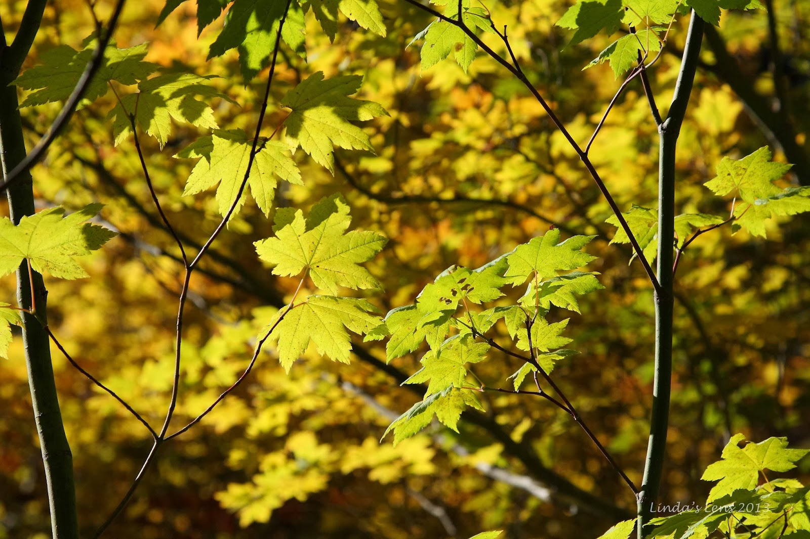
Fall colors are starting

After ascending for nearly a mile and a half, I reached the intersection with the Round the Mountain Trail.  This mostly level trail encircles three quarters of Mt. Adams and would be my path to the lovely Bird Creek Meadows.
 

Grand mountain view

I left the burn zone behind and entered an area of scraggly trees at timberline, and then crossed through a cool ancient lava flow.


Crossing the lava flow

Although the morning had been chilly, moving along had warmed me up enough to peel off my layers.  The temps were perfect for hiking.  The clear, blue sky meant I could see for miles.  And the Round the Mountain Trail provided lots of viewing opportunities.


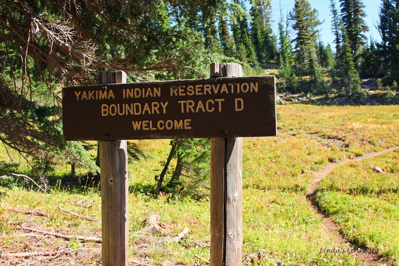
Entering the Yakima Indian Reservation

After following this trail for nearly two miles, I entered the boundary of the Yakima Indian Reservation.  This tribe won jurisdiction of the southeast flank of Mt. Adams, with the condition to allow public access.


Beautiful creek

Although my hike had been great so far, it's here that the really wonderful scenery began.  The place was full of verdant green meadows, crossed with cute mountain streams.  The trail was well-signed and in great shape, with most of the creek crossings spanned by new, sturdy log bridges.  The Yakima Nation appeared to be doing a great job maintaining this trail network.


Lovely green meadow

Although the summer flower show was long gone, huckleberry bushes were donning their red fall clothing, making lovely crimson splashes amongst the greenery.


The trails were well signed

I came upon a junction with a trail sign that directed hikers to Crooked Creek Falls.  It was only a quarter mile away.  Never passing up a chance to see a waterfall, I decided to take the side trip.


Last of the summer flowers

The path followed an absolutely lovely creek, rimmed with electric green moss.  A few straggler asters bloomed in the adjacent meadow and I captured some bees vying for the last of the pollen.


Lush green creeklet

It wasn't long before I heard the sound of rushing water.  Turning a bend in the trail, I got a glimpse of a large rock cliff.  Smack dab in the middle was the pretty white cascade of Crooked Creek Falls.  At 50 feet in height, it was impressive indeed.


Crooked Creek Falls

I spent some time taking photos of this beautiful waterfall, from every conceivable angle.  I didn't have my tripod, so all the shots had to be very quick exposures, with none of the silky smooth water that a long exposure would give.  But the fast shutter speeds did a great job of capturing the motion and raw power of this good-sized cascade.


This way to Hellroaring View Point!

I returned to the Round the Mountain Trail for another mile and a half, before finally entering the famous wildflower paradise of Bird Creek Meadows.  In late summer, I've heard this place erupts in the best floral display anywhere.  Sadly, by mid-September the blooms were all gone, and I was left trudging through nothing but ultra-green meadows (gee...darn!).


More vibrant reds

Leaving the main trail, a side path led hikers up to a place called "Hellroaring Viewpoint."  A few hundred feet of climbing was required.  As I gained elevation, the trees became shorter, and the terrain more open.  Mt. Adams began to show itself on a regular basis, and I made frequent photo stops to capture just one more image.


Breathtaking view from Hellroaring view point

And then I came upon a cliff-edge viewpoint.  And there was Mt. Adams, front and center, right in my face.  The terrain opened up to a fabulous view of the Mazama Glacier (shrunken by summer sun), and the entire drainage basin of Hellroaring Creek. 


Perfect spot for a selfie!

Oh, it was amazing!  I tried to capture its immensity, but photos did not do it justice.  This area alone was totally worth the long hike in.


Rutted trail above Hellroaring view point

The description in my hiking book mentioned a faint trail above Hellroaring Viewpoint that followed a ridge, ending at an iceberg-filled glacial lake.  It sounded like an interesting destination, and was only 1.7 miles away, so I decided to extend my trip.


Looking back down the valley

Let the climbing begin!  My trail  rose steeply from the viewpoint.  Slogging along, gasping for breath, I attempted to follow a faint footpath through the rocky terrain.  Many times it was hard to determine the actual trail.  Intermittent cairns helped with wayfinding, but there were times I stumbled along through the rock gardens, not sure if I was on the right path.


Iceberg Lake was just beyond this cinder dune

After crossing a snow-filled depression, I found myself at the foot of a massive cinder slope.  My gps showed the lake just beyond this tall mound of rock and ash.  So close!  All I had to do was ascend this slippery hill.

But easier said than done.   The slope was entirely loose rock and soil.  For every step I took, I slid back at least half as far.  Large rocks tumbled around me, and I often found myself dodging boulders.  Progress was super-slow.  Fighting this slope, I was burning tons of energy.  After reaching the halfway point, I checked my watch.  It was 1:30, and I'd yet to have lunch.  At this rate, it would take another 45 minutes just to reach the lake.  And the trailhead was at least six miles away.


Rocky terrain made trail finding a challenge

I decided to sit down right then and there and have some lunch.  And I also decided I'd gone far enough.  After refueling, I turned around, a half mile short of my goal.  But it was getting late, and I had a long trek ahead of me.  Iceberg lake would have to wait for another day.


Mt. Adams extreme close-up

Still I'd made it to the 7200 foot level of Mt. Adams.  And I'd soaked in some incredible views from this high.  It was so nice to have a bright, sunny day to enjoy my lofty perch to the full extent.  Although a tough climb, this was my reward.  And a grand one it was.


I discovered a huge clump of gentians

Sliding back down the dusty slope, I picked my way through the rocky alpine gardens below.  Again, route finding was an issue, and I totally lost the trail.  Stumbling through the low bushes I came upon a huge clump of bright violet-blue gentian flowers.  Such a lovely bouquet, I had a quick photo session before resuming my search.  Getting lost does have its advantages!


Red huckleberry leaves brighten the meadow

Using my gps track as a guide, I headed in the general direction of my uphill route.  I discovered I'd wandered quite a ways from the path.  There were a few anxious moments, but I eventually stumbled across the trail well below Hellroaring Viewpoint.  Disappointed I'd missed a chance to see this cool vantage again, I chided myself for not paying closer attention on the descent. 

Now back on good trail, I put the pedal to the metal.  It was nearly 3:00, and I needed to get myself back to my car at a decent hour.  It was still a long drive home and I didn't really want to be doing it in the dark. 


Late afternoon light on the burned forest

Back down the trail I marched.  I didn't stop for much, and made good time back to the last junction.  Ascending the path through the burn zone again, the late afternoon light on the ghost trees made for some beautiful scenery.  A perfect end to an amazing day! 

Returning to the car, I was surprised to see my gps registered a total of 14 miles traveled, and over 1600 feet of elevation gain.  All those side trips added up!  But it was well worth the time and mileage spent.  How often does one get to visit such a magnificent mountain on a sunny fall day?

And in the end, I was really, really glad I'd visited Mt. Adams when I did.  The very next weekend, a large wet storm descended upon the Pacific Northwest, coating the Cascade mountains under many feet of snow.  The weather window now closed, I'd have to wait until next year for a return to Mt Adams.

But I will be back....


Sharing with:  Tuesday Muse.