Tuesday, September 12, 2017

Cape Falcon

The first week of August was a scorcher.  Temps in Portland rose above 100 degrees every day, extremely unusual for this part of Oregon.  The kicker came when Thursday's high hit 105, close to Portland's all-time record.  Enough!  On Friday I decided to escape this inferno with a hike on the cool Oregon coast.


Lush coastal forest

When things heat up in the Willamette River Valley, Portlanders head to the ocean beaches to get relief.  When I pulled into the Oswald West State Park's huge lot that Friday morning, it was a pleasant, foggy 58 degrees.  Heaven!


Fireweed blooming on the beach

There's a few trail choices here, but I decided my hike today would explore Cape Falcon's rugged headlands.


 Short Sand BeachS

After getting my stuff together, I shouldered my pack, crossed under Hwy 101, and followed the path through a lovely uber-green coastal forest of huge spruce trees.  Quite a few surfers joined me on the trail, lugging surfboards and wetsuits.  A half mile later I came upon Short Sand Beach's picturesque cove.


Fireweed along the beach

Although foggy here at the beach, it was lovely nonetheless.  I lingered for several minutes, watching the waves crash on shore and photographing a huge patch of surprise fireweed blooms.


This way to the trail

Then I located a marker for the Oregon Coast Trail (OCT).  My plan was to follow this trail northward to Cape Falcon, and possibly beyond.


Foggy Cape Falcon from Short Sand Beach

From the beach, the OCT's windy path charged upward through lush woods.  Anything but smooth, this first climb forced hikers to navigate over large, bumpy tree roots.


Look out for the tree roots!

I was enjoying the cool, foggy conditions.  I was even comfortable in a long-sleeve shirt!  It seemed like ages since it had been chilly enough to don layers.  Perfect hiking weather.


More trail signs

Oh, how I love coastal forests!  The tall spruce trees, with giant trunks.  The moss draped over their branches, like an old man's beard.  The lush trailside ferns covering the forest floor.


Uber-green forest

There must've been moisture in that heavy fog, as I noticed all the vegetation was covered in misty water droplets.  After so many dry weeks without even a hint of rain, it was a welcome sight!  I didn't even mind that my arms and pant legs got wet shimmying through some of the brushier portions of the trail.


Dewdrops on the leaves

And the dewdrops on nearby leaves and flowers made for fantastic photo ops.


Fireweed bloom sparkling with dew

After two miles of winding along the steep cliffside trail with occasional ocean glimpses through the trees, I came to the trail junction for Cape Falcon itself.  A short trail through a huge field of salal bushes led me to the tip of the headland.


Cape Falcon headland

Lucky for me, the fog retreated upon my arrival.  I was able to enjoy clear views of the craggy rocks and crashing waves below.  Seabirds flitted in and out of the rocky point.  A golden colored slope showed remnants of what appeared to have been an impressive white daisy bloom.  I was about a week too late.


Small cove barely visible through the fog

After a snack and many photos, I decided to continue northward on the OCT.  For the next mile, the trail rounded another scenic cove, visible from occasional viewpoints through the thick forest.  About then the fog decided to roll back in, slowly obscuring cliffs and beaches.


Salal berries

From the final foggy viewpoint, the trail then turned inland, climbing steadily through the woods.  The undergrowth became thicker and began to intrude onto the path.  I also started to encounter lots of blown down trees, requiring scrambling skills to scale over or under.  And of course, everything was covered with dew.


Foggy forest

Although the foggy forest was beautiful, my arms and legs were starting to get soaking wet.  When I stopped, my body became chilled.  Tired of crashing through damp underbrush, I decided it was time to turn around.


Lots of moss!

As I retraced my steps back through the woods, the fog became thicker.


Huge spruce trees in a row

Made for some great photos in the forest, but not so great for capturing shots of the ocean viewpoints.


Another hidden cove

Passing back by the Cape Falcon headland, I decided to check out the views again.  But now the entire headland was shrouded in fog and you couldn't even see the ocean below.  Glad I took so many photos the first time around!


Short Sand Beach through the trees

I'd started my hike fairly early in the morning, and had the trail nearly to myself on the trip in.  But on the return, as I came closer to the trailhead, I encountered more and more people.  It seemed everyone in Portland had woke up and decided to head to Cape Falcon.  I judged my distance from the trailhead by the people's footwear, and when I began to see flip-flops, I knew it was close.


Lots more people here now!

Now Short Sand Beach was packed with people.  Glad I'd spent some time photographing in early morning when it was nearly empty.  I looked back towards fog-covered Cape Lookout one final time before trekking up the trail to my car.

I'm glad Oregon has these refreshingly cool ocean beaches to escape to when things heat up in town.  The best way to spend a hot summer's day!

Stats:  7.5 miles, 800 feet elevation gain.

Friday, September 8, 2017

Pinnacle Ridge

In 2011, a massive wildfire torched Mt Hood's northern flank.  Named the Dollar Lake fire, after a tiny nearby pond (that coincidentally the fire never touched) it burned over 6,000 acres before finally being snuffed out by fall rains. 

This fire burned through the heart of Pinnacle Ridge, one of my favorite northside Hood trails.  I hadn't returned to this area since the fire.  But, hearing that the forest was in full recovery, I recruited two of my hiking buddies to go check things out.


Mt Hood through the burned forest

So one glorious, but hot, late July Saturday found myself, Young, and Steve bouncing down a gravel road bound for the new Pinnacle Ridge Trailhead.  Since the fire, the Forest Service had rerouted portions of this trail, and relocated the trailhead nearly a mile further away from the old one.  My friends and I laced up our boots, slathered on sunscreen, and located the new trailhead sign. 


Fireweed!

We started off winding through an unburned forest, but that quickly changed.  Soon, stark gray tree trunks lined our path.  Although somber, there was also lots of green undergrowth sprouting from the forest floor.  Further down the trail, I noticed brilliant pink fireweed brightening up the landscape.  And I now noticed a perfect view of Mt Hood through the bare tree trunks - a new clearing created courtesy of the wildfire.


The old trailhead

After about a mile, Young, Steve and I came upon the old trailhead message board.  It looked as though the fire had touched some of the forest here.  After a quick photo op, we continued our climb through the burn zone.


Climbing through the burn zone

Although sad to see all the trees that burned, there was also a stark beauty to this silver forest. 


Creek crossing

And the higher we climbed, the better the fireweed bloom became (provided lots of photo distractions!)


Lots of fireweed photo ops

I especially liked this backlit stalk.


Backlit fireweed

These bright pink blossoms provided a nice splash of color to the forest floor.


New life from the ashes

But as the morning sun rose higher, the lack of shade in the burn zone became more apparent.  Temps were getting quite toasty!


The pinnacle is visible through the trees

Despite the fire's damage, I recognized much of the trail from the last time I'd hiked it, over 6 years ago. 


Silver forest

I even remembered the trail as it passed through a boggy area, which was still very much intact, and just as muddy.  Here Steve, Young and I lost the trail for a few minutes before we waded back through the muck and retracted our steps.


Surprise avalanche lily bloom

Near the junction with the Timberline Trail (Mt Hood's famous 'round the mountain path) we came upon a huge field full of frilly white avalanche lilies.  A huge surprise, as these flowers typically bloom right after the snow melts and are long gone by late July.


Lunch at Dollar Lake

Although supposedly only 3.5 miles from the trailhead, the Timberline Trail junction seemed to take forever to reach.  Climbing through shadeless woods in the hot sun didn't help.  But finally the sign and trail came into view.  My friends and I celebrated with an impromptu snack break, sitting right on the trail itself.


Magenta paintbrush

Now that we'd reached the Timberline Trail, it was decision time.  Did we hike over to Elk Cove or up to Dollar Lake first?  My friends, wanting a nice lunch spot voted for Dollar Lake.


Fabulous mountain views

So we trekked a short distance up a rocky meadow sporting magenta paintbrush blooms until we came upon the famous water body.  A tiny glacial tarn, round as a silver dollar, it was situated in a beautiful basin with great views of Mt Hood.  My friends and I sat on the shore, admired the scenery, ate lunch, and slapped at the pesky flies that wouldn't leave us alone.


Mt Hood from the Timberline Trail

The flies began to bother all three of us, so lunch was cut short in favor of continuing our hike.  Young, Steve and I climbed back down the ridge and rejoined the Timberline Trail, heading east towards Elk Cove.  The mountain views on the way down were nothing short of spectacular!  A parade of Cascade peaks - Mt Adams, Rainier, and St Helens lined themselves across the horizon.


Dollar Lake fire burn zone

And the scenery just kept getting better....we rounded one bend to a slope chock-full of colorful wildflowers.  Orange paintbrush and fluffy Western Pasque flowers covered the forest floor.


Young can't decide what to photograph first

Poor Young just couldn't decide what to photograph first!  I must admit I had the same problem too....definitely slowed down my hiking pace.


Western Pasque flowers and orange paintbrush

Elk Cove is a gorgeous mountain valley with a clear glacial stream, and reputation for amazing summer wildflower displays.  However, this appeared to be an off-year as the flowers weren't as thick as I'd seen in past visits.  And down by the creek, the flies were so bad, my friends and I didn't linger long.


Back down the Pinnacle Ridge trail

So it was back the way we came, retracing our steps back to the Pinnacle Ridge Trail's junction with the Timberline Trail.

Admiring Mt Adams view

Afternoon sun lit up the adjacent Cascade peaks beautifully.  When we reached the boggy area once again, it's wide clearing provided a great place to take in the mountain panorama.  Can you spot all three mountains in the photo below?  (Hint...Mt St Helens is a gray shadow on the far left next to the tall trees).


Can you spot all three Cascade peaks?

Then it was back down the endless trail through hot, dusty, shadeless forest.  Young and I kept our spirits up by discussing what brewpub we'd visit for our traditional after-hike beer.


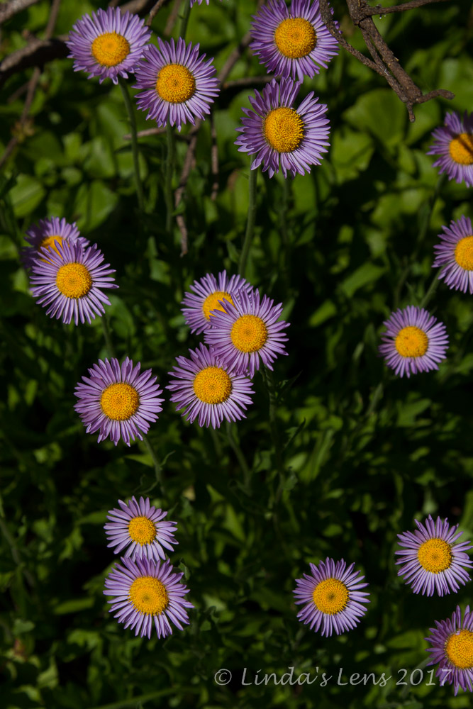
Aster bloom

As I mentioned in the prior post, this past weekend my beloved Columbia River Gorge was the victim of a huge wildfire.  All week I watched the news in despair, thinking of it's lovely mossy forests now forever destroyed by flames.  But going through photos from this Pinnacle Ridge hike made me realize forests do recover, plants and flowers return, and sometimes new vistas are opened up.  So I hold out hope that when the fires are out, although altered, the Gorge trails just might have some new and interesting sights to see.


Great day with good friends

Good to see an old favorite trail rising from the ashes!  Eleven miles traveled, 2100 feet of elevation gain, and a fun day in the woods with my friends.


Tuesday, September 5, 2017

Duffy and Santiam Lakes

After a successful hike up Crescent Mountain I returned to our campsite to find my hubby had just arrived.  Due to heavy traffic, what is normally a two hour drive took twice as long.  He was more than ready for a beer!  Which, after unloading his truck, is what we both enjoyed.


Our wonderful riverside campsite

Here's our beautiful riverside campsite.  The North Santiam River was just beyond the trees.  We spent a lovely evening sitting around the campfire, listening to the music of its rushing waters.


Someone forgot the Coleman camp stove!

Of course, it seems every camping trip there's something vital we forget, and this trip was no exception.  In his haste to leave, my poor hubby neglected to grab our Coleman camp stove.  So, we had to make do cooking on the campfire coals.  We did a pretty good job with breakfast the following morning.  (Note - this trip took place in mid-July, about a week before all the fires began breaking out in Central Oregon, so campfires were still allowed)


Hubby zipping away down the trail

The following morning, hubby said he'd join me on a hike.  Consulting my trusty hiking book, I found a nearby trail that led to Duffy and Santiam Lakes.  Places I'd yet to visit, it became the day's destination.  We loaded up the truck and drove a few miles down the highway to the trailhead.


Blue sky and lovely pine forest

After yesterday's nearly people-free trek up Crescent Mountain, it was a shock to see dozens of vehicles parked at the Duffy Lake trailhead.  As hubby and started out, we noticed a large group of backpackers had begun assembling by the message board.  Not far down the trail we began meeting more backpackers heading in the opposite direction.  I had no idea this trail was so popular!  (Of course, it was a Saturday)


Bunchberry

On the subject of things we forgot, that morning hubby realized he'd also neglected to grab his backpack.  So...I lent him mine and just toted my huge camera bag/fanny pack.  It was funny hiking with just that bag and nothing on my back.  You'd think it would make me hike faster, but that wasn't the case.  Of course, my hubby is an extremely fast walker, so he shot off like a rocket leaving me to meander along the trail, snapping photos when something struck my fancy.


Lupine was plentiful

And there was much to photograph.  At first the path led through a dense forest of tall pines.  But after a mile and a little elevation gain, I began to notice the first patches of purple lupine brightening up the trailside.  The further and higher I went, the more lupine there was.


A few straggler beargrass poofs

And then I began seeing small patches of beargrass.  Beargrass!  I thought it was past season, but apparently some stragglers didn't get the memo.


Aster

All the while I was hiking towards Duffy Lake, I saw many groups, mostly backpackers, heading out to the trailhead.  Hubby and I even encountered a large group of people on horseback, leading more pack horses, that said they'd spent an entire week camping in this lovely wilderness area.  Again, I had no idea this place was so popular.


Duffy Lake GoPro pano

It was another hot day, and by late morning, I was sweating profusely, enjoying any and all shade I could find.  Although the trail wasn't too steep, it provided just enough uphill to wear me out quickly (the combo of yesterday's hike and today's toasty temps didn't help either)  And to add even more misery, the mosquitoes woke up and decided my hubby and I would be their breakfast.  I kept my long sleeved shirt on and fumbled to find a small bottle of non-deet skeeter spray in my backpack. 


Duffy Lake east side

Finally we came upon Duffy Lake, a beautiful blue water body nestled between tall foothills.  Many groups were already camping here, some enjoying a swim.  As hot and sweaty as I was, the water looked mighty tempting.


Another Duffy Lake shot

But we'd only traveled about 3.5 miles so far.  Not quite enough for a good day's hike.  My map showed it was a little over a mile further to nearby Santiam Lake.  We were so close - why not check it out?


Beargrass macro

So off through a sometimes-rough trail scattered with blowdown hubby and I traveled, him zooming far ahead, and myself meandering behind.


Lupine on the shores of Santiam Lake

I passed by a spectacular meadow, colored with many different varieties of wildflowers.  But not wanting to squish these fragile plants by wandering into the middle to capture things, I lingered on the edge and tried to zoom as much as my lens allowed.  (Sadly none of my photos did it proper justice)


Three Fingered Jack rises over Santiam Lake

For such a short distance that mile and a bit seemed to take a long time!  Hubby and I traversed a couple of steep uphills, and wandered on a side path that went nowhere before finally locating our destination.  Surrounded by huge patches of vibrant purple lupine, Santiam Lake was worth the extra mileage.


Soaking our feet in Santiam Lake

We walked around to the opposite shore to get away from a group of incredibly loud people (why do folks think they have to turn up the volume when they're in the wilderness?  Spoils everyone else's enjoyment and solitude)  Hubby found a couple of nice rocks at the water's edge.  Perfect places to sit and soak our hot, weary feet!


Three Fingered Jack reflection

The water was cold and refreshing.  We enjoyed a nice lunch with fantastic views of Three Fingered Jack Mountain, which towered over the lake, casting perfect reflections in it's waters.


Lots 'o lupine!

Food, rest, and a soak in cold water does wonders to restore two hot, weary hikers!  After a nice lunch break, hubby and I packed up for our return trek.  By now the day was quite hot.  And we had only one small bottle of water between us.  Hubby carried the water, but I warned him to not race off too far ahead......he agreed to stop and check frequently with me in case I needed a drink


One friendly butterfly

On our trip back towards the trailhead, we met a large number of hikers (mostly backpackers) heading towards Duffy Lake.  I don't know where they were all going to camp, as all the designated sites around this lake appeared to be taken.  Another beautiful wilderness area that was being loved to death.


Moss hanging from a tree

Promises of a cold beer (or three) once we arrived back at our campsite kept hubby and I going through the endless dusty trail and afternoon heat.  We ended up with a total distance traveled of 10 miles and 1100 feet of elevation gain.  Not too shabby!  We definitely earned our beers.

Sadly, the following weekend, lightning sparked a huge forest fire in the Mt Jefferson wilderness not far from here.  It was the beginning of what has been a horrific fire season in Central and Southern Oregon.  And just this weekend the destruction hit home, as my beloved Columbia River Gorge went up in flames. 

I'm glad my hubby and I were able to slip in a midsummer camping and hiking trip before everything went south.  My advice - if you've been waiting to visit some special place, do it now.  Nothing is here forever, and you just never know when something you love might disappear.