
It was the last weekend of June, and I wanted to get in a hike. The following weekend I'd be busy and not able to hike due to an upcoming vacation. The weather looked good for Sunday - clear skies and not too hot. But where to go?

Pink trillium bloom
I whipped out my Sullivan book. As I mentioned in a previous blog post, one of my long-time goals is to hike all of the 100 hikes featured in William L. Sullivan's book "100 Hikes in Northwest Oregon and Southwest Washington." (This book is the Oregon hiker's bible!) I've completed approximately 3/4 of the hikes in this book, and am always looking for an opportunity to bag another one.

The trail winds along the side of Table Rock
So I leafed through my book looking for hikes I had not done. Hmmm.....Table Rock. This hike was located in a pocket wilderness near the town of Molalla (southeast of the Portland metro area). A place I'd never explored. I'm usually always hiking in the Gorge and Mt. Hood areas, so I was ready to expand my horizons. My choice was made - Table Rock it was!

Mt. Hood peeks out the of clouds

Three Sisters view from the top of Table Rock
Finally I reached the trailhead. Bear and I piled out of the car, ready to do some hiking. We started out following an old road. After about a mile, the road turned into a trail, and we began climbing through the woods.
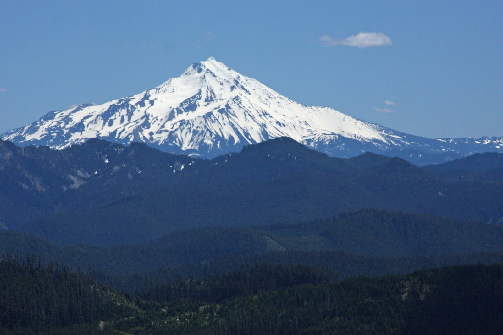
Fantastic view of Mt. Jefferson from Table Rock summit
Then I ran into a man standing on the side of the trail. He asked "Is this the way to Table Rock?" I told him it was, and that I had a map and gps guiding me. The man asked if he could tag along as he'd never hiked here before and wasn't sure of the trail. We got to talking and I found out that he also worked for the City of Portland. Small world!

Summit photo with Mt. Hood in the background
We climbed up and up, and finally reached the top of Table Rock. And oh what a glorious view! I could see a panorama of Cascade peaks. There was Mt. Hood, Jefferson, Three Fingered Jack, the Three Sisters, and Mt. Washington. It was a fairly clear day so all the mountains were visible. My camera was busy capturing the terrific scenery.

Trail to the top of Table Rock
Bear and I hung out on top of Table Rock, eating our lunch and enjoying the view. I then got to looking at my map from Sullivan's book. The map described a route from Table Rock to another formation called Rooster Rock. The trail was only an additional 2.5 miles round trip, and it was still early in the afternoon. I decided to go for it. The man that had been tagging along said he'd join me.

Table Rock as viewed from the trail
On our way down Table Rock, I ran into an older man. We stopped and chatted and I mentioned I was going to hike over to Rooster Rock. The man warned me that the trail was really, really steep. He said it dived down into a valley and then climbed up to a saddle between Rooster Rock and an unnamed rock outcrop he called "Chicken Point." The man recommended that I just follow the ridgeline instead. Since this was my first time in the area (and not wanting to get myself on the evening news), I didn't heed his advice, and decided to just follow the trail.

Bear finds some snow
The trail started off great. We followed the ridge accompanied by great mountain views. But then, as we were warned, the trail took a nosedive into a valley. As I stumbled down to the bottom I thought "Ugh! I have to climb back up this!"

Beautiful wildflower fields on the saddle
After walking through the valley floor, I discovered the trail to the saddle. It was super-steep! My hiking companion decided not to attempt it, and said he'd wait at the bottom for me. So up Bear and I trudged.

Rooster Rock and Mt. Jefferson
The trail was murder! I huffed and puffed and tried to stay upright. Seemed like gravity wanted to pull me back down the hill. I was also getting tired, which didn't help at all. About halfway up, I was tempted to abort the climb and rejoin my partner at the bottom of the hill. Bur curiosity got the best of me - I really wanted to see the view from the saddle. So I soldiered on.

Panoramic view from "Chicken Point"
And boy was the climb worth it! The saddle was a beautiful wildflower meadow. The views were spectacular. I climbed up the rock outcrop opposite Rooster Rock, which the man on the trail had dubbed "Chicken Point." What a great view of rooster rock, and the surrounding mountains!

Late afternoon light illuminates Table Rock
I hung out at Chicken point and enjoyed the the great views - my reward for such a hard climb up. But remembering my companion was waiting for me at the bottom, I didn't linger too long. We reunited at the bottom, and I told him what he'd missed. Then we headed back up the other side of the ridge.
It took a long time to hike back to the trailhead. I was getting tired, and the time was getting late. We finally made it back to our cars at 6:00. Total stats for the day: 10 miles round trip, 2600 feet elevation gain.
It was great to get out and explore a new trail. The weather was wonderful, and I had a good hiking companion. What a beautiful place! I'll definitely come back to this area again.
I can now check off hike # 89 in my Sullivan book!
This poor neglected post ought to have at least one comment!
ReplyDelete