Having grown up in the wide-open spaces of the midwest, when I first moved to Oregon it's tall trees, dense vegetation, and hilly terrain felt confining. Accustomed to watching storm clouds rolling in from miles away, my new home's closed-in sky views took some adjustment.
After 30 years of calling Oregon home, I still miss seeing the horizon. My house is located in the lowlands, so any glimpse of the heavens competes with tree crowns and rooftops.
But one night in mid-May impressive thunderheads rolled into town. Since we seldom see such storms, I grabbed my camera to try and capture their grandeur.
Sunset lit the clouds in gorgeous hues of orange and pink. Oh, they were stunning! I was wishing my home were situated on a high point, so I could view the entire sky. But - I made do anyway, capturing snatches of the show between tree canopies and neighbor's homes.
Such tall, puffy clouds are rare where I live. So when an impressive sky show happens, I appreciate it all the more.
Wednesday, August 14, 2019
Thursday, August 8, 2019
Caught by the Rain at Kings Mtn
A Saturday in mid-May and chores kept me home all morning. But, finishing things up by afternoon, I was hankering to fit in a short hike. Where could I go that was challenging, but a short distance away?
Kings Mountain, of course.
A short but brutally steep trail in the Oregon Coast range, the Kings Mountain trailhead was a quick 40 minute drive from home. Perfect for some afternoon exercise!
As this wouldn't be an all-day affair, I grabbed my tiny hydration pack and a couple of granola bars. I debated whether to carry my rain jacket with me. Dark clouds at the trailhead convinced me to tie it around my waist. And of course I couldn't go anywhere without my camera!
After a short quarter-mile romp through the woods, this trail shot straight up, and wouldn't flatten out until reaching the summit, some 2.7 miles and 2800 vertical feet later.
But I was up for the challenge. Cloudy skies and moderate temperatures made climbing much easier. That, and I wasn't carrying much weight on my back. Normally used to shouldering a heavy daypack on most of my hikes, I practically skipped up the trail (well.....almost).
The lower portion of the Kings Mountain trail passed through some spectacular, mossy coastal forest. I'm a lover of all things green and these forests are among my favorites in Oregon.
Approaching the summit, I began to see tiny bits of color in the surrounding woods. Hooray! The wildflower bloom was in full swing.
Tiny purple Phlox blooms carpeted Kings Mountain's steep slopes. There were also many serviceberry bushes erupting in white flowers, along with Indian Paintbrush, some unknown yellow flowers, and one early lone beargrass poof.
Heavy clouds obscured some of the far vistas, but I could still spot adjacent forested ridges from the summit proper.
The final steep push to the summit seemed to take forever (it always does) but finally I glimpsed the elaborate wooden sign and trail register that signified I'd reached the top.
While most folks use their phones to take selfies, I attempted the same thing with my camera. It took several tries, (much to the amusement of a nearby group of young people) but I managed to get one photo that I really liked.
Once reaching the summit, I had planned a long snack break. However, the clouds appeared to be getting much thicker and blacker. Then I noticed a dark curtain of rain rapidly moving my way. No break for me! Time to hightail it off the summit before I got soaked!
I'd just ducked below the first patch of trees when a rumble of thunder shook the sky. If I wasn't moving fast before, that certainly got my legs hustling. Throwing caution to the wind, I flew down that steep trail faster than I think I've ever descended.
I was about halfway down when I felt the first raindrop. Stopping to quick don my jacket, I stashed wallet and cell phone in its pockets, and covered my camera bag with a plastic grocery sack. My timing was perfect - right after battening down the hatches, the skies opened up in a torrential downpour.
Instantly the dirt trail turned into a muddy river. Slick with mud and water, I was forced to slow my pace to avoid slipping. A few more peals of thunder rumbled above. I put my head down and marched along as fast as I dared. Soon my pant legs were soaked. Then my jacket began dripping water. It was downright miserable. Oh, where was that parking lot? The final mile and half seemed to take forever.
I was never so happy to see the trail junction, and even happier when my car came into view. Tossing all my wet clothing into the back of my vehicle, I gratefully ducked inside and turned up the heater.
Although caught by the rain on my way down, I'd been prepared with a jacket and waterproof camera cover. And the discomfort was temporary. Once back home, warm and dry, my rainy trek down Kings Mountain became a good story.
And......hike no. 19 done! #52hikechallenge
Kings Mountain, of course.
![]() |
| Green coastal forest |
A short but brutally steep trail in the Oregon Coast range, the Kings Mountain trailhead was a quick 40 minute drive from home. Perfect for some afternoon exercise!
![]() |
| Huge mossy tree |
As this wouldn't be an all-day affair, I grabbed my tiny hydration pack and a couple of granola bars. I debated whether to carry my rain jacket with me. Dark clouds at the trailhead convinced me to tie it around my waist. And of course I couldn't go anywhere without my camera!
![]() |
| Elevation 2000 feet |
After a short quarter-mile romp through the woods, this trail shot straight up, and wouldn't flatten out until reaching the summit, some 2.7 miles and 2800 vertical feet later.
![]() |
| Cool mushroom |
But I was up for the challenge. Cloudy skies and moderate temperatures made climbing much easier. That, and I wasn't carrying much weight on my back. Normally used to shouldering a heavy daypack on most of my hikes, I practically skipped up the trail (well.....almost).
![]() |
| Bright colors |
The lower portion of the Kings Mountain trail passed through some spectacular, mossy coastal forest. I'm a lover of all things green and these forests are among my favorites in Oregon.
![]() |
| Summit views |
Approaching the summit, I began to see tiny bits of color in the surrounding woods. Hooray! The wildflower bloom was in full swing.
![]() |
| Serviceberry |
Tiny purple Phlox blooms carpeted Kings Mountain's steep slopes. There were also many serviceberry bushes erupting in white flowers, along with Indian Paintbrush, some unknown yellow flowers, and one early lone beargrass poof.
![]() |
| Phlox |
Heavy clouds obscured some of the far vistas, but I could still spot adjacent forested ridges from the summit proper.
![]() |
| Indian Paintbrush |
The final steep push to the summit seemed to take forever (it always does) but finally I glimpsed the elaborate wooden sign and trail register that signified I'd reached the top.
![]() |
| The year's first beargrass! |
While most folks use their phones to take selfies, I attempted the same thing with my camera. It took several tries, (much to the amusement of a nearby group of young people) but I managed to get one photo that I really liked.
![]() |
| Selfie attempt at summit sign |
Once reaching the summit, I had planned a long snack break. However, the clouds appeared to be getting much thicker and blacker. Then I noticed a dark curtain of rain rapidly moving my way. No break for me! Time to hightail it off the summit before I got soaked!
![]() |
| More flowers |
I'd just ducked below the first patch of trees when a rumble of thunder shook the sky. If I wasn't moving fast before, that certainly got my legs hustling. Throwing caution to the wind, I flew down that steep trail faster than I think I've ever descended.
![]() |
| The clouds are gathering... |
I was about halfway down when I felt the first raindrop. Stopping to quick don my jacket, I stashed wallet and cell phone in its pockets, and covered my camera bag with a plastic grocery sack. My timing was perfect - right after battening down the hatches, the skies opened up in a torrential downpour.
![]() |
| Colorful slopes |
Instantly the dirt trail turned into a muddy river. Slick with mud and water, I was forced to slow my pace to avoid slipping. A few more peals of thunder rumbled above. I put my head down and marched along as fast as I dared. Soon my pant legs were soaked. Then my jacket began dripping water. It was downright miserable. Oh, where was that parking lot? The final mile and half seemed to take forever.
![]() |
| Here comes the rain! |
I was never so happy to see the trail junction, and even happier when my car came into view. Tossing all my wet clothing into the back of my vehicle, I gratefully ducked inside and turned up the heater.
Although caught by the rain on my way down, I'd been prepared with a jacket and waterproof camera cover. And the discomfort was temporary. Once back home, warm and dry, my rainy trek down Kings Mountain became a good story.
And......hike no. 19 done! #52hikechallenge
Monday, July 29, 2019
Falls Creek Falls
Falls Creek Falls. That's got to be the most unoriginal name for a waterfall.
This spectacular 200-foot high cascade with the dumb name wasn't my original destination. On this mid-May Friday, I'd planned to hike nearby Dog Mountain hoping to catch the better-than-average wildflower bloom currently blanketing its slopes. However, ferocious winds greeted my arrival at the trailhead. From prior experience, I knew windy weather at lower levels meant downright miserable conditions at the summit. So I scrapped the day's Dog Mountain itinerary.
Where to go now? Any trails adjacent to the Columbia River Gorge would also be windy. Then I remembered a short, but beautiful nearby trail to an enormous waterfall. Hidden in a canyon and inland from the Gorge, it was sure to be calmer there. Falls Creek Falls, here I come!
It had been several years since I'd hiked this trail. A short 3.4-mile round trip journey, I'd been passing it over for longer and more challenging jaunts. But today I was spring photography mode, and nothing says spring like green forests and gushing waterfalls.
The Falls Creek Falls trail started in a lush forest full of blooming wild dogwood trees. I loved the large, white flowers and it was a nice surprise to see so many.
The path quickly transitioned into an old-growth forest, full of huge, mossy Douglas fir trees. I marveled at the tree's sizes.
The day was cloudy and threatened rain. Wanting to reach this cascade before the clouds let loose, I hurried down the trail, only occasionally stopping for a quick photo or two.
The sound of roaring water was my clue that I was close. Climbing a small rise, the forest parted to reveal the middle and lower portions of this three-tiered waterfall. What a sight! Full from spring runoff, it was gushing mightily.
Although Falls Creek Falls has three distinct drops, the top 50-foot tier was hidden from view. The middle 70-foot fan and lower 80-foot drop were the only parts visible from the viewing area.
The viewing area wasn't very large. Perched on the side of a steep drop-off one had to watch their step. Trees blocked a clear straight-on view, so I had to jockey my tripod a bit to capture the entire scene. There was a lower viewpoint, but it involved scrambling down a steep slope, something I wasn't willing to do.
The day's cloudy, damp weather was perfect for waterfall photography. Although it sprinkled briefly any serious rainfall held off the entire time I was at the falls. And, normally a popular spring hiking destination, I had the place to myself!
Hiking back out, I encountered several groups of people, all toting cameras and tripods, marching towards the falls. The sun began peeping out of the clouds, ruining the nice, even light from overcast skies. Now I was doubly glad I'd arrived early.
I took my time hiking back, enjoying the bright green mossy forest. Lots of great old trees to photograph, as well as the scenic Falls Creek.
And of course, I couldn't resist capturing some more dogwood blooms.
I passed by an old stump with a thick mat of moss on top - like it was growing hair. A well-placed hole on the side looked like a mouth. It almost appeared human!
So despite being a second-choice trail, I enjoyed my hike through this truly lovely forest. But the Forest Service really needs to come up with a better name for such an impressive waterfall.
![]() |
| Wild dogwoods in bloom! |
This spectacular 200-foot high cascade with the dumb name wasn't my original destination. On this mid-May Friday, I'd planned to hike nearby Dog Mountain hoping to catch the better-than-average wildflower bloom currently blanketing its slopes. However, ferocious winds greeted my arrival at the trailhead. From prior experience, I knew windy weather at lower levels meant downright miserable conditions at the summit. So I scrapped the day's Dog Mountain itinerary.
![]() |
| Mighty Falls Creek Falls |
Where to go now? Any trails adjacent to the Columbia River Gorge would also be windy. Then I remembered a short, but beautiful nearby trail to an enormous waterfall. Hidden in a canyon and inland from the Gorge, it was sure to be calmer there. Falls Creek Falls, here I come!
![]() |
| Lower falls |
It had been several years since I'd hiked this trail. A short 3.4-mile round trip journey, I'd been passing it over for longer and more challenging jaunts. But today I was spring photography mode, and nothing says spring like green forests and gushing waterfalls.
![]() |
| Upper falls |
The Falls Creek Falls trail started in a lush forest full of blooming wild dogwood trees. I loved the large, white flowers and it was a nice surprise to see so many.
![]() |
| A photo with me in it for scale |
The path quickly transitioned into an old-growth forest, full of huge, mossy Douglas fir trees. I marveled at the tree's sizes.
![]() |
| Lovely cedar woods |
The day was cloudy and threatened rain. Wanting to reach this cascade before the clouds let loose, I hurried down the trail, only occasionally stopping for a quick photo or two.
![]() |
| Oregon grape in bloom |
The sound of roaring water was my clue that I was close. Climbing a small rise, the forest parted to reveal the middle and lower portions of this three-tiered waterfall. What a sight! Full from spring runoff, it was gushing mightily.
![]() |
| Mossy rocks line the creek |
Although Falls Creek Falls has three distinct drops, the top 50-foot tier was hidden from view. The middle 70-foot fan and lower 80-foot drop were the only parts visible from the viewing area.
![]() |
| Lone dogwood bloom |
The viewing area wasn't very large. Perched on the side of a steep drop-off one had to watch their step. Trees blocked a clear straight-on view, so I had to jockey my tripod a bit to capture the entire scene. There was a lower viewpoint, but it involved scrambling down a steep slope, something I wasn't willing to do.
![]() |
| The trail followed a spectacular old growth forest |
The day's cloudy, damp weather was perfect for waterfall photography. Although it sprinkled briefly any serious rainfall held off the entire time I was at the falls. And, normally a popular spring hiking destination, I had the place to myself!
![]() |
| Moss-covered trees |
Hiking back out, I encountered several groups of people, all toting cameras and tripods, marching towards the falls. The sun began peeping out of the clouds, ruining the nice, even light from overcast skies. Now I was doubly glad I'd arrived early.
![]() |
| Scenic Falls Creek |
I took my time hiking back, enjoying the bright green mossy forest. Lots of great old trees to photograph, as well as the scenic Falls Creek.
![]() |
| Huge streamside tree |
And of course, I couldn't resist capturing some more dogwood blooms.
![]() |
| More dogwood flowers! |
I passed by an old stump with a thick mat of moss on top - like it was growing hair. A well-placed hole on the side looked like a mouth. It almost appeared human!
![]() |
| This stump looks human! |
So despite being a second-choice trail, I enjoyed my hike through this truly lovely forest. But the Forest Service really needs to come up with a better name for such an impressive waterfall.
Monday, July 22, 2019
Weekend Hiking Two-Fer
It was nearly mid-May and I was getting a little panicked. Due to weekend commitments and general life getting in the way, I was creeping behind on my #52hikechallenge. Luckily, Mother's Day weekend I had absolutely nothing planned. Time to get outside and hike!
Saturday of that weekend, hot temps were predicted. That meant choosing a cool, shady place to hike - bonus points if it followed a river. The Salmon River Trail, near Mt Hood, checked all the boxes.
William L. Sullivan's "100 Hikes" book (aka "bible") breaks the route along the Salmon River into two separate hikes. The Lower Salmon River is a 2.5 mile ramble that mostly hugs the river banks, passing some magnificent stands of old growth forest. The Central segment continues along the mighty Salmon River before veering up a bluff. One can hike anywhere from 3.5 to 6 miles or even farther up the canyon. For today's trek, I decided to start with the Lower trail and continue about two miles up the Central trail, for a respectable 9-mile round trip total.
In order to beat the heat (and get a parking spot) I got an early start. The other advantage of my wee morning hour arrival, hardly anyone was on the trail.
I wandered along the river, admiring the huge, mossy old growth trees. Several decaying downed logs on the forest floor had new life sprouting forth from their crumbling wood. Called "nurse logs" it was fascinating to see the various plant life growing out of them. Even a high number of very large trees!
I'd heard the wildflowers were in top bloom along the Salmon River and discovered the rumors were indeed true. Trilliums were just fading, but pink-purple Corydalis was going strong. I also noticed lots of yellow violets, chocolate lilies, a few straggler avalanche lilies.
After a wonderful walk through the Lower Salmon trail's magnificent old growth forest, I passed through a car campground and crossed the road to find the Central Salmon River trailhead.
If I thought the Lower Salmon's forests were impressive, the Central Salmon River trail's woods were even grander. Green moss covered everything, dangling off branches like old, gnarled hands. The fir trees were huge - some trunks pushing 8 feet in diameter.
Although this trail climbed high above the water, river views were never far away. A popular place for backpacking, I passed by several nice campsites. Surprisingly, there was only one site occupied - strange for a dry Saturday morning in May.
I traveled a little over two miles in. My turnaround was at sturdy log bridge that spanned a side creek. After capturing a few selfies by balancing my camera on a nearby log (much to the amusement of a passing group of young people) I grabbed a quick snack and headed back.
Now early afternoon, I began to encounter large numbers of people heading up the trail. It seemed the rest of Portland had decided a shady hike was a good idea too. No more solitude for me!
Although there's not a large amount of elevation gain on either trail, by the time I hit the Lower Salmon Trail again, my feet and legs were beginning to tire. But colorful wildflowers buoyed my spirits, as did the sighting of a merganser couple floating in the river's crystal-clear waters.
The following day was Mother's Day. In the past I'd commemorated the occasion by dragging my kids and husband on a hike. But with both kids now living out-of-town that wasn't going to happen. If asked, my hubby would've hiked with me, but the salmon were biting and I knew he was itching to be out fishing. So I decided this year's Mother's Day hike would be a solo endeavor.
After driving nearly to Mt Hood and back the previous day, I wanted someplace closer to home. Hardy Ridge, my old standby, rose to the top of the list. A short distance from Portland on the Washington side of the Columbia River Gorge, I knew I could be up and down it's 8-mile loop and back home in plenty of time for a Mother's Day steak dinner.
Wildflowers were putting on a show here too. Rose-colored bleeding hearts bloomed profusely in the woods leading up to the ridge. Fringecup, serviceberry, fairy bells, and Oregon grape added to the colorful underbrush.
On top of Hardy Ridge, I marveled at the stupendous Gorge panoramas from the many overlooks. I lucked out with clear skies to fully enjoy the views.
The final ridge is named "Phlox Point." On today's hike, I finally got to see how this ridge got it's name. The entire crest was covered with tiny, purple Phlox flowers. Oh, it was so lovely!
After not seeing a soul my entire climb up Hardy Ridge, I was just settling down with my lunch, when a large group came tromping across the point. So much for peace and quiet.....
However, the people were friendly, and asked if I'd take a their group photo. After snapping a few images, one lady offered to take my picture. Although I was planning to set up my small tripod and get a selfie, I took the woman up on her offer. Turned out, I didn't like any of her shots (of course I didn't say anything). Luckily after their photo session, the group moved down over the ridge and left me to my solitude. It was then I set up my tripod and used my camera's timer to snap a few frames. Much better! I was really happy how the photo below turned out.
Mother's Day dinner (and a beer) were calling, so I packed up my stuff and headed back down to the parking lot. Making it a loop hike, I took a different trail on the way down, and the flowers weren't nearly as prolific. Maybe it was a good thing - less distractions for my camera! I got down in record time. I was able to capture a nice patch of bright yellow Oregon grape flowers, which by the way, are Oregon's state flower (although I happened to be in Washington).
A productive weekend - Hikes No. 16 and 17 DONE! Yeah!
![]() |
| The lovely Salmon River |
Saturday of that weekend, hot temps were predicted. That meant choosing a cool, shady place to hike - bonus points if it followed a river. The Salmon River Trail, near Mt Hood, checked all the boxes.
![]() |
| Huge old growth trees |
William L. Sullivan's "100 Hikes" book (aka "bible") breaks the route along the Salmon River into two separate hikes. The Lower Salmon River is a 2.5 mile ramble that mostly hugs the river banks, passing some magnificent stands of old growth forest. The Central segment continues along the mighty Salmon River before veering up a bluff. One can hike anywhere from 3.5 to 6 miles or even farther up the canyon. For today's trek, I decided to start with the Lower trail and continue about two miles up the Central trail, for a respectable 9-mile round trip total.
![]() |
| Fairy Bells |
In order to beat the heat (and get a parking spot) I got an early start. The other advantage of my wee morning hour arrival, hardly anyone was on the trail.
![]() |
| Lots of trees growing from this nurse log |
I wandered along the river, admiring the huge, mossy old growth trees. Several decaying downed logs on the forest floor had new life sprouting forth from their crumbling wood. Called "nurse logs" it was fascinating to see the various plant life growing out of them. Even a high number of very large trees!
![]() |
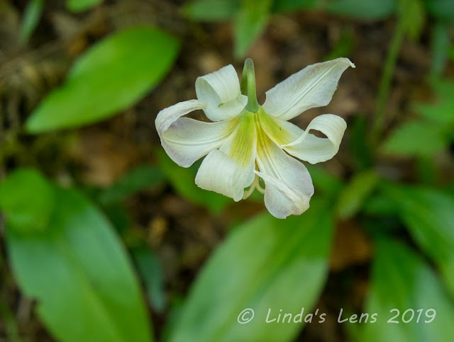
| A straggler avalanche lily |
I'd heard the wildflowers were in top bloom along the Salmon River and discovered the rumors were indeed true. Trilliums were just fading, but pink-purple Corydalis was going strong. I also noticed lots of yellow violets, chocolate lilies, a few straggler avalanche lilies.
![]() |
| Loved this mossy forest! |
After a wonderful walk through the Lower Salmon trail's magnificent old growth forest, I passed through a car campground and crossed the road to find the Central Salmon River trailhead.
![]() |
| Selfie on the bridge |
If I thought the Lower Salmon's forests were impressive, the Central Salmon River trail's woods were even grander. Green moss covered everything, dangling off branches like old, gnarled hands. The fir trees were huge - some trunks pushing 8 feet in diameter.
![]() |
| Striped unknown flower |
Although this trail climbed high above the water, river views were never far away. A popular place for backpacking, I passed by several nice campsites. Surprisingly, there was only one site occupied - strange for a dry Saturday morning in May.
![]() |
| Corydalis was everywhere! |
I traveled a little over two miles in. My turnaround was at sturdy log bridge that spanned a side creek. After capturing a few selfies by balancing my camera on a nearby log (much to the amusement of a passing group of young people) I grabbed a quick snack and headed back.
![]() |
| One more nurse log (because they're cool!) |
Now early afternoon, I began to encounter large numbers of people heading up the trail. It seemed the rest of Portland had decided a shady hike was a good idea too. No more solitude for me!
![]() |
| Mergansers |
Although there's not a large amount of elevation gain on either trail, by the time I hit the Lower Salmon Trail again, my feet and legs were beginning to tire. But colorful wildflowers buoyed my spirits, as did the sighting of a merganser couple floating in the river's crystal-clear waters.
![]() |
| Yellow violets |
The following day was Mother's Day. In the past I'd commemorated the occasion by dragging my kids and husband on a hike. But with both kids now living out-of-town that wasn't going to happen. If asked, my hubby would've hiked with me, but the salmon were biting and I knew he was itching to be out fishing. So I decided this year's Mother's Day hike would be a solo endeavor.
![]() |
| Love this sign alteration! |
After driving nearly to Mt Hood and back the previous day, I wanted someplace closer to home. Hardy Ridge, my old standby, rose to the top of the list. A short distance from Portland on the Washington side of the Columbia River Gorge, I knew I could be up and down it's 8-mile loop and back home in plenty of time for a Mother's Day steak dinner.
![]() |
| Lots of bleeding hearts on Hardy Ridge |
Wildflowers were putting on a show here too. Rose-colored bleeding hearts bloomed profusely in the woods leading up to the ridge. Fringecup, serviceberry, fairy bells, and Oregon grape added to the colorful underbrush.
![]() |
| Fantastic Gorge views from atop the ridge |
On top of Hardy Ridge, I marveled at the stupendous Gorge panoramas from the many overlooks. I lucked out with clear skies to fully enjoy the views.
![]() |
| Phlox was blooming in full force! |
The final ridge is named "Phlox Point." On today's hike, I finally got to see how this ridge got it's name. The entire crest was covered with tiny, purple Phlox flowers. Oh, it was so lovely!
![]() |
| Mt Hood and Columbia River from the ridge |
After not seeing a soul my entire climb up Hardy Ridge, I was just settling down with my lunch, when a large group came tromping across the point. So much for peace and quiet.....
![]() |
| There's a reason they call this "Phlox Point" |
However, the people were friendly, and asked if I'd take a their group photo. After snapping a few images, one lady offered to take my picture. Although I was planning to set up my small tripod and get a selfie, I took the woman up on her offer. Turned out, I didn't like any of her shots (of course I didn't say anything). Luckily after their photo session, the group moved down over the ridge and left me to my solitude. It was then I set up my tripod and used my camera's timer to snap a few frames. Much better! I was really happy how the photo below turned out.
![]() |
| Enjoying the view |
Mother's Day dinner (and a beer) were calling, so I packed up my stuff and headed back down to the parking lot. Making it a loop hike, I took a different trail on the way down, and the flowers weren't nearly as prolific. Maybe it was a good thing - less distractions for my camera! I got down in record time. I was able to capture a nice patch of bright yellow Oregon grape flowers, which by the way, are Oregon's state flower (although I happened to be in Washington).
![]() |
| Oregon grape (in Washington!) |
A productive weekend - Hikes No. 16 and 17 DONE! Yeah!
Subscribe to:
Posts (Atom)


