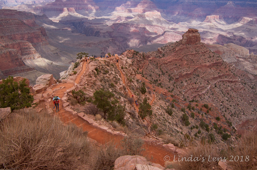
After hiking the South Kaibab Trail to Cedar Ridge, I took a return bus to the Grand Canyon Visitor Center, and from there hopped on a different one bound for the Village. This packed-to-the-gills bus wound through crowded roads, made even more so by heavy road construction in the park. We riders were finally deposited at the Bright Angel Lodge.
 |
| Expansive vistas at Trailview Overlook |
The rim trail adjacent to the lodge was swarming with tourists. Never in my wildest dreams, did I expect to see so many people visiting the Grand Canyon on a Wednesday in mid-March! (I later learned this particular week coincided with Arizona's spring break) Walking along the paved pathway was an exercise in frustration. People were everywhere! I couldn't snap a photo without getting at least half a dozen bodies in the frame. And forget about going anywhere fast - the trail was clogged with slow walkers and stopped people gazing into the canyon.
 |
| The Bright Angel Trail looks like a bunch of squiggles |
Although only mid-afternoon, I'd hoped to arrive early and scope out a good place to capture the sunset. But this crowded walkway was definitely not the place.
 |
| Colorful layers |
Scouring my park map, I noticed another bus route took visitors further west to a place called Hermits Rest. This seven-mile journey featured stops at nine viewpoints. I had a few hours to burn until sunset, so I decided to escape the Village madness and go west. My new plan was to hit all the viewpoints along the way, finally ending up at Hermits Rest in time for sunset.
 |
| One more from Trailview |
The gusty winds that had accompanied me on my earlier hike out of the canyon seemed to have intensified. While waiting in line to board the Hermits Rest bus, they whipped through the crowd of hopeful passengers, chilling us all. I was prepared with hat, gloves and extra jacket, but many of the folks I saw were shivering, clad in only shorts and t-shirts.
 |
| Maricopa Point |
When a bus finally arrived, it was a relief to board and get out of the wind. The cozy bus sped away towards Trailview Overlook, our first viewpoint.
 |
| Wrinkled features |
It was so nice to be warm, I initially planned to stay on the bus, and pass up the first viewpoint. But as we approached Trailview Overlook, the bus driver glowingly said it was "the best view on the route" and we shouldn't miss it. Plus, he promised once we got below the rim, we'd be out of the wind.
 |
| Canyon rim close-up |
Well, that driver only got one thing right. True, the vistas were absolutely stunning. I could see back towards the Rim Village, with all its hotels and shops (and people!). The Bright Angel Trail zig-zagged below, looking like a bunch of orange squiggles. And the adjacent eroded rock formations were spectacular.
 |
| Maricopa Viewpoint |
But as our busload of people climbed below the canyon we were hit with gust upon gust of wind. It nearly blew the hat off my head. So much for no wind below the canyon's rim! Instead of slacking, off, instead the wind appeared to pick up speed. I braced myself against the guardrail, steadying my camera, trying to keep things in focus the best I could.
 |
| Stunning colors |
Needless to say, nobody hung around the viewing platform very long. After five minutes, we were all back at the bus stop waiting for the next shuttle.
 |
| Powell Point |
Lucky for us, buses ran every 10 minutes, so the wait wasn't long. Back on the shuttle, it was a quick hop to Maricopa Point.
 |
| View from Powell Point |
Again, I was loathe to leave this warm, wind-free shelter. But I'd come here to photograph the scenery, not sit on a bus. So once my ride came to rest at the Maricopa Point stop, out I went.
 |
| Hopi Point |
Maricopa Point was mighty spectacular also (it's part of the Grand Canyon, how can it not?). After prowling around, snapping copious images, I returned to the bus stop for a ride to the next overlook.
 |
| Glimpse of the Colorado River |
Powell Point and Hopi Point were the next two overlooks, and of course I stopped at each. I noticed fewer people getting off, and most of the folks that I'd started with on my first bus weren't around anymore. But I did seem to meet the same husband, wife, and teenage boy at every viewpoint. Finally, I introduced myself and we had a good chat. The fun of travel - meeting nice people from all over.
 |
| Zoomed in |
The wind continued to be a nuisance, but when you've traveled a long way specifically to see the Grand Canyon, you put up with whatever the weather dishes out. I noticed clouds gathering on the horizon, and remembered that tomorrow's forecast had predicted snow flurries.
 |
| Nice light on the trees |
At Hopi Point I got my first glimpse of the Colorado River, far below the Canyon's walls.
 |
| Bus stop |
Besides capturing the wide, colorful panoramas (which were so tempting to fill a memory card with) I also zoomed my camera's lens as far as it would go, trying showcase some of the canyon's finer details.
 |
| More close-up features |
Loved the jagged, red lines on this image.
 |
| Red lines |
I spent way too much time at the next two viewpoints.
 |
| Clouds moving in |
Finally, 5:30 pm had me pulling into Mohave Point. This particular bus driver mentioned that Mohave Point was a good place to catch the sunset. With only an hour to go until sundown, I decided a quick tour was in order, otherwise I'd never make it to Hermits Rest.
 |
| Mohave Point |
But....again I was captivated. The overlook here had an amazing view of the Colorado River's blue ribbon, shining so far below.
 |
| Golden light |
People were already staking out sunset-watching spots. I noticed many groups sitting in choice locations, bundled up against the wind and rapidly-dropping temperatures.
 |
| Rain falling far away |
At 6 pm, I walked back to the bus stop, hoping to catch a final ride to the very end of the road. But after waiting a long 10 minutes, no shuttle was forthcoming. Calculating the time it would likely take to reach Hermits Rest vs. the amount of daylight remaining I came to the realization if I was gonna catch the sunset, I needed to stay put.
 |
| Pink clouds and rain |
So back to the overlook I traipsed. By now, a sizeable crowd had gathered near the iron railings. Boldly I shuffled my way to a spot along the rails, and staked out a viewing spot.
 |
| Colorado River far below |
Now for the wait.....a cold, windy wait. I passed the time snapping shots of the expansive canyon views and Colorado River below. The clouds also put on a show, turning several shades of pink, and producing wispy virgas that dangled across the sandstone formations.
 |
| Last light of day |
I'd left my tripod in the van (yeah, I know I'm a lazy photographer) so to capture the disappearing light, I turned up my camera's ISO and stabilized it by bracing my lens on the guardrails. Seemed to work okay - I was vindicated upon noticing another photographer having a hard time keeping his tripod stable in the gusty wind.
 |
| Sunset glow |
Sadly, cloudy skies kept the nighttime show at bay, and the only good light we had was a brief orange flash as the sun sank below the horizon. It did, however, illuminate the clouds with a nice orange-pink hue for a few short minutes.
 |
| Setting sun turns the clouds red |
And then, that was it. The show over, people began leaving en masse for the shelter of a warm bus. I lingered a few minutes longer, capturing one final image of some spectacular cloud wisps over the canyon. Then, walking in the dark while trying to stuff my camera into it's bag, I tripped on the uneven, rocky surface and went down. My right elbow took the brunt of the impact, mostly because I sacrificed it to keep my camera from harm. (That's what we photographers do) I ended up with a nice purple bruise for my efforts, but luckily that's as bad as it got.
 |
| Last image after sunset |
Well, I didn't make it to Hermits Rest, nor the last three viewpoints, but I did see a lot of wonderful scenery and managed to catch a tiny sunset. Boarding a return bus back to my campsite, I reflected on the amount of ground covered during this very full day on the South Rim.
Maybe tomorrow morning I'd finally capture a sunrise........
If you've missed any of my Grand Canyon posts, click on the links below:
The Introduction
Critters of the Canyon
Of Hikes and Mule Trains
P.S. Bonus points if you made it all the way through this post! :)