|
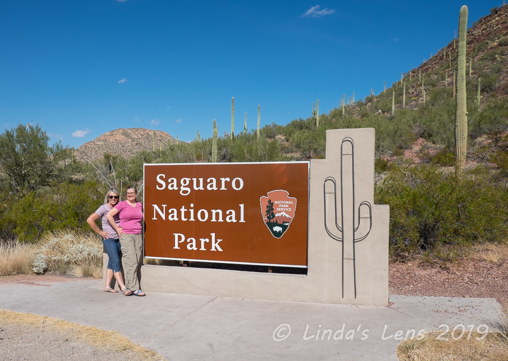
| At the trailhead ready for our adventure! |
This adventure was nearly a year and a half in the making. September 2018, during a family visit to South Dakota, my sister mentioned she wanted to do something big for an upcoming milestone birthday. Hiking to the bottom of the Grand Canyon was at the top of her list. A long-time item on my bucket list, I immediately was in. We looked up reserving a cabin at Phantom Ranch, the resort facility at the canyon bottom. Staying at Phantom Ranch is wildly popular, the demand so high that securing lodging requires applying to a lottery 15 months in advance. At the time, November 2019 was the earliest possible date, so we each put in separate applications for mid-November.
 |
| Steep switchbacks at the beginning of the South Kaibab Trail |
Luck was on our side! Not only was my Phantom Ranch lottery application drawn, so was my sister's. We both scored two bunks in the women's dorm. Since my date was midweek, and my sister's over a weekend, the decision was made to keep my reservation (less crowded during the week we reasoned).
Let the training and planning begin!
 |
| Ominous warning sign near trailhead |
Although at the time, November 2019 seemed light-years away, the months passed quickly. My spring and summer were filled with lots of conditioning hikes (participating in the 52 hike challenge helped), making airline and other accommodation reservations, and purchasing a few items for our hike. Now finally here we were, at Bright Angel Lodge on the Grand Canyon's South Rim. I had to pinch myself - it was actually going to happen!
 |
| This viewpoint was appropriately named |
The night before was spent anxiously packing and repacking everything we'd need for a 2-day hike and overnight stay into a daypack. How much water to carry? What about snacks? Would I need my long johns? Or should I bring a pair of shorts? Did I want to carry my kindle? My sis and I both slept poorly that night, tossing and turning, fretting about the mammoth adventure we were about to undertake.
 |
| Panoramas on either side of the trail |
Lucky for us, the weather forecast couldn't have been more perfect - sunny, mild temps, and no wind. We awoke to clear, but chilly skies. Checking out of our room, my sis and I locked our luggage in the trunk of our rental car, then headed to the bus stop to catch the first hiker bus of the day.
 |
| Looking at the layers |
Doing my research, I discovered most visitors to Phantom Ranch hiked down the South Kaibab Trail and used the Bright Angel Trail for their return. Although steeper, the South Kaibab trail was shorter, 7.5 miles and 4800 feet descent between the rim and the Colorado River. However, reaching the South Kaibab Trailhead required a ride from one of the park's shuttle buses. In fact, the park catered to early morning hikers offering three "hikers only" express shuttle buses between the village and South Kaibab Trailhead.
 |
| We hiked around and below this lone pillar |
Neither one of us awoke hungry, but knowing I had to eat, I sat at the bus stop gobbling down an apple and energy bar, and nursing a cup of tea. Showing up at ten minutes to 7 we were the only hikers at the stop. But it didn't take long for other people to begin arriving. The first hikers we met were an older couple from Oklahoma. The lady was very friendly, and we had a pleasant chat while waiting for the bus.
 |
| Crazy guy hauling a bike on his back! |
Right on time, the bus pulled up. A handful of Grand Canyon hikers filed inside. The bus stopped by the Backcountry lot, where our nice driver jumped out and got a handful of Grand Canyon hiking maps for his riders. Then, on to the main visitor center before heading to our final destination - the South Kaibab Trailhead. Pulling into the trailhead parking area, our bus had to dodge a herd of elk. Then the bus opened it's doors and we hikers filed out. Let the adventure begin!
 |
| Some nice guy offered to take our picture |
Of course no one immediately took off down the trail. There were last-minute restroom breaks and photo ops by the trailhead sign. My sis and I shouldered our backpacks and had the nice Oklahoma couple snap a few photos. Then we joined the conga-line of hikers from our bus starting down the South Kaibab Trail.
 |
| The trail's steep zigzags |
At first with all the hikers bunched together, there was a lot of passing back and forth as we trekked down the steep, windy switchbacks. I really wanted to take a lot of photos but frequent photo stops meant we'd be leapfrogging many of the same people. The canyon was in shadow here so the light wasn't very good, and I'd taken lots of photos from a previous visit in March 2018. So my sis and I rambled downhill towards our first stop, "Ooh-Aah" Point, a mere 0.9 miles from the trailhead.
 |
| This flat area was most appreciated |
Ooh-Aah Point (my favorite name for an overlook) was a busy place. Perched on the bend of a switchback, space was at a premium. Most of the hikers from our bus had congregated here, and there weren't many open spots to sit and take in the views. One couple was monopolizing the sign, taking copious photos of each other from every conceivable angle. When they finally finished, my sis quickly jumped in front of the sign. I fired off a couple of quick shots, and then we decided to get the heck out of there!
 |
| Skeleton Point - thankfully no skeletons! |
Another half mile of steep, rocky trail took us to Cedar Ridge, the next rest stop on the South Kaibab. This place featured a restroom and large, level area to sit and take a load off. My sis and I took a short snack break here. We'd just shouldered our packs to continue, when the Oklahoma couple came ambling up to us. Bidding them good day, we continued on. We wouldn't see them again until Phantom Ranch.
 |
| Towering cliff |
The next trail section, from Cedar Ridge to Skeleton Point was gorgeous. Craggy rock formations rose up from the canyon walls. The morning sun was now high enough to cast nice light on the colorful, layered rock cliffs. The crowd of hikers we'd followed from the trailhead seemed to spread out from this point, and my sis and I enjoyed long stretches of trail to ourselves.
 |
| Our first mule train |
Before Skeleton Point the relentlessly steep trail flattened out, giving our knees a blissful short break from the downhill pounding. Here we began to meet hikers climbing up. We met a man climbing uphill carrying a bicycle on his back. We asked what he was doing and the man replied that he'd ridden it to the North Rim, and since bikes aren't allowed on the canyon trails, he was carrying it rim-to-rim, with plans to continue his ride once he reached the South Rim. I wasn't sure if I should admire the guy for his gumption or call him a lunatic.
 |
| Waiting for me to finish yet another round of photos |
There wasn't much at Skeleton Point, but my sister and I took a snack break here anyway. The day was beginning to get warm, and we shed our final layers down to shirtsleeves. Just below Skeleton Point, we passed a sign that marked the halfway point. And we met our first mule train. Grand Canyon trail courtesy states mules have the right-of-way, so my sis and I stepped aside and allowed them to pass (while I snapped lots of photos).
 |
| My sis taking it all in |
The 1.5 miles from Skeleton Point to Tipoff, our next rest area, were extremely steep and rocky. The closer we got to the canyon bottom, the warmer it became. The trail, churned up by mules, was dusty and we began to get covered with fine grit. But - oh - the scenery! It just kept getting better.
 |
| Heading down to Tipoff |
It seemed to take forever to reach the Tipoff. It was near mid-morning, and not having eaten much breakfast my sister and I were now ready for lunch. Finally two tiny rooftops were spotted at the bottom of a huge hill. The final descent to Tipoff was gorgeous. The canyon opened up with wide, dramatic views of the adjacent red cliffs.
 |
| Another mule train, this one hauling trash from Phantom Ranch |
Not only did Tipoff have a restroom, it also offered a covered seating area for hikers to rest and have lunch. Although it wasn't beastly hot that day, I could see where a shaded rest facility would be most welcome during the summer months. My sis and I joined a group of three hikers under the roof and hungrily attacked our PB&J sandwiches.
 |
| Mule wranglers all dress the part |
Now rested and refreshed it was time to tackle the final 2 miles to the Colorado River. As we were leaving Tipoff, my sister and I met our second mule train of the day. This one, instead of hauling people, was hauling cargo up from Phantom Ranch. The resort's remote location and difficult access necessitates the use of mules to carry supplies in and trash out.
 |
| The trail followed this narrow, red ridge |
Then the trail wound down, down, down, across a narrow red plateau. It was here we got our first glimpse of the Colorado River. So exciting! It couldn't be much farther now, could it? But looks were deceiving - there was still quite bit of distance and elevation yet to cover.
 |
| Our first glimpse of the Colorado River |
It was here we encountered a couple of trail runners we'd seen earlier coming back up the canyon already. One guy was moving! (How do they do it?) We met a super-fit old lady running down, who told us "I'll see you on the way up." (And later we did) By now the temps were nearing 80 degrees and there was absolutely no shade. I was hot and dusty, my energy beginning to sap from baking in the sun - those people were way more resilient than I.
 |
| The Black bridge is in sight! |
The last mile to the Colorado River was super-steep, rocky trail. Here we began to see hikers faltering. One older man, hiking with his daughter, was slowly limping down the trail, favoring his knee. He looked like he was in pain. Another older lady, carrying a huge backpack, also appeared to be having a difficult time. Her husband, hiking far ahead, would impatiently wait for her to catch up and then immediately start out again, not giving her any time to rest. My sis and I wondered aloud if these people would make it.
 |
| The trail here was really steep and rocky |
We began to see a black thread strung across the river. As my sis and I got closer, we realized that thread was the suspension bridge across the Colorado River. Known as the "Black Bridge" it carried South Kaibab Trail hikers across the river to Phantom Ranch. An engineering marvel in it's time, it was constructed in 1928. Because motorized vehicles couldn't access the construction site, humans and mules transported all the materials down the trail. The suspension cables were carried down the canyon on the backs of 42 Havasupai tribesman walking single file.
 |
| We finally make it to the tunnel |
On the river's south side, the Black Bridge is accessed through a tunnel blasted into the rock. After a brief photo op (some nice guy offered to take our photo at the tunnel's end), we walked through the darkness, following a dim light. The tunnel's exit opened up to reveal the river and canyon walls before us. What a dramatic way to approach a bridge!
 |
| What a dramatic view on the other side! |
And, oh were the views spectacular from mid-span! The green Colorado River flowed beneath our feet. We could see yellow and gold vegetation lining the opposite river banks. Tall canyon walls rose near-vertical from the shore.
 |
| The Colorado River from the bridge |
As this bridge was the primary mule route, it's deck was lined with wooden planks.
 |
| Wooden planks on the bridge for the mules |
I lingered on the bridge, soaking in the fantastic views, and snapping copious photos. But, now by early afternoon, the heat was taking it's toll. Time to finish this hike! I followed my sister to the other side.
 |
| Fall colors along the Colorado |
Our trail crossed underneath the bridge. We could see a tiny beach below. A few people had set up chairs and were enjoying the river views, some dipping their feet into the Colorado's waters. (However, due to cold temps and fast current, swimming in the Colorado River is not advised)
 |
| Trail continuation on the other side |
I briefly thought about detouring to the beach area. But I was tired and ready to be done. A cold beer was calling. My sister, who was also developing a case of "horse in the barn" syndrome, began marching down the trail, bypassing the river bank.
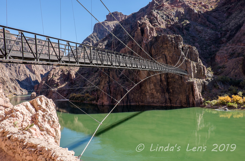 |
| One last look at this beautiful bridge |
A short distance later, our trail left the river and turned inland, following another canyon. Thankfully this canyon was full of cottonwood trees, our first shade for many miles. Much to my delight, many of the trees were displaying fall colors. Yellow leaves against the red canyon walls made for some absolutely lovely photo ops.
 |
| Beautiful golden trees in the canyon to Phantom Ranch |
The final half mile to Phantom Ranch seemed to take forever. My sis and I were both so hot and tired. We were looking forward to a shower and beer!
 |
| Looking back towards the river |
Finally, we passed the mule corral. A nearby sign welcomed us to Phantom Ranch. Following the dusty trail we began to see cute rock-lined cabins. Then the main canteen building came into view. Yahoo! We made it!
 |
| At this point we were hot, tired and so ready to be done |
First order of business - a cold beer! Because everything had to be carried in by mules, beer was expensive. But neither my sister or I cared. That cold beer tasted so good, I would've gladly paid twice the money. The place even carried a brand of local beer brewed specifically for Phantom Ranch.
 |
| Our reward (a little blurry, I was tired!) |
Then my sis and I decided to claim our bunks in the women's dorm. Arriving by 1:30, we were pleased to discover the dorm empty. My sis and I claimed prime bottom bunk locations, and then had first dibs on the shower. Aaah....that shower felt so good - almost as good as the first beer! (almost!)
 |
| Phantom Ranch hiker dorms |
Worn out from the day's journey, my sister decided to take a nap. But invigorated by the shower, I grabbed my camera for a photo tour of Phantom Ranch. All the buildings at Phantom Ranch were designed by Mary Colter, the Grand Canyon's famous architect. I loved the rock-faced cabins with the green doors and windows. There appeared to be a dozen cabins, four dormitory buildings (2 for men and 2 for women), a showerhouse, and a large cantina building, where dinner and breakfast were served. Yellow cottonwood leaves glistened in the afternoon sun. What a gorgeous place to spend the night!
 |
| Afternoon light on the fall colors |
Returning to my dorm, I discovered the Oklahoma lady we'd met at the bus stop was assigned to our dorm too. We compared notes on our respective hiking experiences and then left her to rest. My sister, now feeling better, returned to the Cantina with me to have one more beer before dinner. By now the Cantina was full of hikers, all enjoying a cold drink. We recognized several people we'd seen on the trail. The struggling lady with the huge backpack had made it, as had the older man with the bum knee. There were lots of interesting stories from our fellow hikers. One young woman who had started from the trailhead with us that morning told my sister and I she'd wanted to do this hike with her dad for many years. Realizing he was getting older and time was running out, she trained for months to be able to hike with him today.
 |
| Beautiful stone buildings |
Phantom Ranch offers two seatings for dinner, steak at 5 pm, and hiker stew at 6:30. All meal reservations had to be made in advance. When making our reservation fifteen months ago, I'd randomly chosen the steak dinner. Now, starving from the day's hike, my sister and I were glad we'd picked the earlier time. When the dinner bell chimed, we were first in line. The steak dinner was absolutely delicious. Included with our meal was fresh salad, a baked potato, and vegetable with huge pieces of chocolate cake for dessert. There was plenty of food to fill even the hungriest hiker's stomach. Assigned to tables with fellow lodgers, it was fun to compare experiences from the day. I chatted with a older man seated at our table that told me he'd gotten space in the dorm via a last-minute cancellation, and had decided to do the Grand Canyon hike for his 70th birthday.
After dinner, one of the Phantom Ranch staff members gave us a little talk about this unique lodging facility. She said the people who worked here had to hike up the canyon for their days off, and then hike back down to report to work. Tough commute!
 |
| One of the Phantom Ranch cabins |
Night falls early in November. By the time we'd finished dinner, it was completely dark outside. Returning to our dorm, we discovered it was now full. All ten bunks were occupied by women, the last top bunks claimed by three older ladies - sisters who'd hiked down to celebrate one of their birthdays (sounds familiar!). None of them looked like hikers, and one lady had hauled her CPAP machine all the way down in her backpack. Despite that, the ladies were in good spirits, chattering happily amongst themselves.
 |
| Time for dinner! |
It was now 6:30 in the evening, it was dark outside, and I had nothing to do. Trying to keep my pack weight light, I'd left my kindle with my luggage at the car. I hadn't even brought as much as a deck of cards. My sister smartly had lugged her kindle down the canyon and was now sitting in her bunk reading. With nothing to occupy my time, I laid down and tried to sleep. Although the dorm was full with 10 ladies, tired from the day's exertions everyone settled down early, and it was surprisingly quiet. I drifted off to sleep, fretting about the next day's journey - the hike back out of the canyon. I was a tiny bit worried about the difficulty of climbing nearly 5000 vertical feet up the Bright Angel Trail. Would my sister and I make it before sundown?
To be continued........