Showing posts with label lupine. Show all posts

Monday, September 4, 2023

St. Helens Superbloom

 The things we photographers do to get the shot.


First views

Back in mid-July photos began circulating on some of my online hiking groups of a massive lupine superbloom on Mt. St. Helens' east side, near Windy Ridge.  Images of entire slopes colored purple with flowers got my attention.  Such prolific wildflower blooms don't come around very often, so naturally I wanted to go there and capture some photographs for myself.


Lupine fills the plain, except in the tire tracks


But the problem was reaching this side of MSH required a long drive.  The usual route from Portland, approaching from the south, was closed due to a large landslide on one of the Forest Service roads.  That meant anyone who wanted to travel here had to take a circuitous path.  I'd need to drive further north and then east to the Washington town of Randle, and then head south towards the Windy Ridge Trailhead.  Google maps estimated this would take 3 1/2 hours.


Paintbrush was thick here

The long drive made me hesitate.  Gas was expensive, and I'd need to find someplace to camp overnight if I went.  Seven hours round-trip was too much time to spend in the car.  Over the next two days I vacillated between wanting to go see the superbloom but not wanting to be in the car for so long.


A little flower garden

However, the lupine bloom photos continued to show up on my Facebook feed until finally I caved.  I couldn't miss this rare event!  Devising a plan to travel there after a morning doctor appointment, in order to break up the long drive, I decided to sleep overnight in my car.  


Paintbrush, up close and personal


So on a hot, sunny July mid-morning I started out from home towards Mt. St. Helens and that amazing wildflower show.  Along the way I ended up being delayed by not one, but two construction zones, pushing my drive time closer to four hours.  Finally at 3 pm I rolled into the parking area at Windy Ridge.  Access to the superbloom meant hiking from here to access a loop connecting the Boundary and Truman Trails near the mountain's north side.  Did I have enough time to hike the 9-mile round trip?  Or should I wait until tomorrow morning to visit the flower fields?


Spirit Lake (that red dot in the middle is a person)


Well, sunset wasn't until nearly 9 pm.  I had a headlamp and flashlight in my backpack.  And I could cover two miles in an hour (without photo stops, that is.)  I'd driven all this way, and didn't want to wait until morning.  So I decided to go for it.  


The beginning of the superbloom

So off I went, hustling down the 2-mile gravel road to access the flower trails.  Although it was a warm mid-afternoon I covered the boring road walk relatively quickly.  My excitement began to mount as I rounded a corner and got my first glimpse of MSH's flattened summit.


Looking towards the lava dome


As I approached the trail junction between the Truman and Boundary Trails, a younger man came up behind me.  Like myself, he was armed with a camera, and after a bit of chit chat I learned the guy was also after superbloom pics.  

Now, which trail to start first?  The man turned towards the Boundary Trail so I decided to go explore the Truman.


These flowers were dwarf lupine


The Truman Trail began on what appeared to be an old road.  Right away, lupine and Indian paintbrush blooms rose from the rocky soil.  The lupine flowers were small and close to the ground, a variety known as dwarf lupine.  There were also a couple of really large patches of bright orange paintbrush.


No, the mountain wasn't erupting - winds at the summit stirred up dust


I rambled along the trail, snapping copious flower pics, and admiring views of Spirit Lake that kept getting closer the further I traveled.


Field of purple


After about a mile of walking, I reached a junction with a short trail that would take me over to the Boundary Trail.  Although so far there was lupine blooming, the amount of it wasn't anywhere near what I'd seen in the online photos.  But beyond this trail junction was where I started seeing the massive purple fields of internet fame.


Purple as far as the eye can see!

Now I was walking towards Mt. St. Helens' open crater.  One could see the huge hole blown into the mountainside from the fateful 1980 eruption.  The mountain lost nearly 1400 feet of elevation in this single blast.  MSH now resembled a flattened pancake with a small dome rising in the center.


Superbloom and Spirit Lake


As I approached the Boundary Trail, the lupine show kept getting better and better.  Just past this trail junction I again ran into the young man I'd spoken with at the beginning.  Inquiring how the flower conditions were in his direction he smiled and said "incredible."


My flower-lined trail

And so it was - hiking along the Boundary Trail I traveled through the most amazing bloom of lupine I've ever seen anywhere.


The late evening sun made for spectacular lighting


Small purple flowers covered every inch of the broad plains north of the volcano's crater.  It looked as though someone had taken lavender paint and coated the entire landscape.


Paintbrush mixed in with the lupine


Traveling along the Boundary Trail, the hour was approaching 7 o'clock and the sun was dropping fast.  The low angle sun made for some most excellent light on the lupine fields.  But it also meant nighttime was coming fast, and even though I was prepared with flashlights, I didn't really want to hike out in the dark.


Colorful slope

So I kind of hustled through the last mile of the lupine bloom.  In hindsight, I really wish I would've taken more time.  But the thought of hiking out in the dark was a great motivator.  Arriving back at the trail junction near the gravel access road I met at least two groups of people and one lone woman who were all hiking in at this late hour.  It appeared they all planned to capture the sunset.


Downed trail marker


Once on the gravel road, I covered the two miles of uphill and then a steep downhill in record time.  I arrived back at my car just past 8 pm with the sun low on the horizon, but still lighting the sky.  Although my original plan was to spend the night in my car and drive back the following day, I started reassessing things.  The thought of sleeping in my cramped car didn't seem like sch a good idea anymore.  My cozy bed at home was calling.  And I still felt very much awake.  Leaving now meant less traffic and no waiting at both construction zones.

  
Lavender fields forever.....


So that's how I ended up driving back home that same evening.  The trip back wasn't as bad as feared.  I put in a couple of podcasts and they occupied my mind as I navigated first the winding Forest Service roads, and then highways of increasing size and traffic.  I pulled into my driveway just before midnight, jazzed that I'd actually pulled off the long drive and hike to see the lupine superbloom!  It might have been a crazy trip but I now had some amazing images to show for my hard work.


Final look as I puffed up the gravel road

Those of you who admire the pictures we photographers share now have an idea of the effort that goes into getting these amazing scenery shots.  It often involves long drives, late nights, early mornings, hikes in the heat or cold, and time spent sitting waiting for the sun to rise or set.  It also requires large investments in camera equipment and photo editing software, as well as lots of time spent learning how to use both.  Finally, with every photoshoot comes hours of post-processing - sorting and choosing the photos to edit, and then spending more time editing each image until it becomes the amazing final product you enjoy viewing.

So please, please don't copy any photographers images without permission.  We work very hard to create these works of art.  All photographs are the property of the person who captured them (and are often copyrighted).  I enjoy sharing my pictures online and hope they bring joy to those who view.  However, if you are interested in obtaining one of my photos, please ask!  


Monday, July 15, 2019

Springtime at Tom McCall Point

After spending a long weekend on the Oregon Coast, I was itching to get back to the Columbia River Gorge for another spring wildflower fix.  Rumor had it the balsamroot was peaking at Tom McCall Point, so the following Friday I made an early morning visit.


Lupine at sunrise

Although arriving in plenty of time for sunrise, cloudless skies made for a less-than-impressive dawn.  I wasn't satisfied with any of my images (of course, that might have been due to the photographer.....)  The only shot that I felt really turned out well was this backlit cluster of lupine.


Lovely morning light on the Columbia River

Once the sun crested over the hills, I wandered around the Rowena Plateau, enjoying fantastic early morning light on the wildflowers and Columbia River.


Rowena Plateau

I ran into a professional photographer from the East Coast, out scouting locations for future photo workshops.  He had lots of questions about photogenic spots in Oregon.  The guy asked about some of the well-known and photographed spots on the coast and I was able to tell him "I was just there last weekend!"


Riot of color on Tom McCall Trail

After the photographer and I parted ways, I decided to hike up Tom McCall Point.  Rumor had it the wildflowers were at peak on top.  The hike started out well - not far from the trailhead I ran into this technicolor meadow.


Breathtaking Mt Hood view on top

The 1.7-mile climb to the top was a pure delight.  Wildflowers bloomed profusely on the grassy slopes.  I even spotted a few deer happily grazing in the meadows.  With so many photography subjects, let's just say I wasn't a speedy hiker.


Mt Adams peeping over the hills

Visitors making the 1100 foot climb to the very top are rewarded with stellar views.  Mt Hood rises from the southern skyline, while Mt Adams peeps over the Washington side of the Columbia River. 
And down low before you, the Columbia River and it's steep banks spread out east and west, as far as the eye can see.


Columbia River view looking west

This wonderful preserve is owned by the Nature Conservancy, who maintains the trails, studies the rare plants, and keeps this area as pristine as possible.  The name of Tom McCall honors a past Oregon governor, who was committed to conserving Oregon's natural treasures. 


Another grand view from Tom McCall Point

Once on the summit, of course I got busy with my camera trying my best to capture all this floral beauty.


Balsamroot sunshine

The morning was still early, so I shared the summit with just a couple other people.  I chatted briefly with one lady who'd trekked up solo.  After snapping a few images, I turned around and she was abruptly gone.  A few minutes later, I located her lying in the middle of the flower fields, apparently taking a nap.  Going off trail is a big no-no here, as people can trample the plants (not to mention ticks live in the grassy areas). 


Lovely lupine

That's the problem with the onslaught of social media.  Although I love to share my photos of these special places, it does bring more people to visit.  And not everyone is aware of the damage that occurs when you start walking through delicate flower fields.  My message to those reading my blog is this - if you visit, please stay on marked trails and be respectful of nature.  Don't pick flowers, leave litter, or stand in the middle of flower fields for your Instagram shot.


Amazing spring wildflower bloom

Before departing from the summit, I switched to my 60 mm macro lens, hoping to get some close-up flower images on my way down.  Imagine my surprise when a deer bounded across the trail, not 10 feet in front of me.  Only having my macro lens, I did the best that I could trying to capture it.  (Story of my life - I never have the proper lens on my camera at the right time!)


Caught this deer running by

Despite the bungled photo op, I still had a lovely hike down, capturing all the flowers I missed on the way up (or thought I missed!)


Penstemon

These purple penstemon were especially fetching.


Chocolate Lily

And I even found a few stems of chocolate lilies.  One of my favorites!


More amazing lupine

Lower down, the lupine was a lovely deep shade of purple.


Caught one butterfly

I was even able to capture a blue butterfly as it paused atop a flower.


Mother Nature's bouquet

But by far my favorite spring flower is the balsamroot.  It's bright sunny yellow petals make me smile.


Happy flower

As I descended back to the parking lot, I met group after group of people, all climbing to the flower fields.  The advantage of going early, I had the trail and summit nearly all to myself.  I arrived back to an overflowing parking area.  Time to get the heck outta Dodge!


Best way to spend a spring morning!

No better way to spend a sunny spring morning than chasing wildflowers in the Columbia River Gorge.


Sunday, September 17, 2017

Canyon Creek Meadows (with a broken toe)

The evening after my Oregon Coast hike to Cape Falcon, I accidentally slammed my foot into a doorway at  home.  The toe next to my pinky caught the brunt of the impact and immediately swelled up, while the top of my foot turned black and blue.  Just like that, my weekend hiking plans went out the window.

%$##%^%^@^*&&^#$$%!!!

I hoped the toe wasn't broken, as I'd made big plans the following weekend.  Friday, I was driving to Bend, hiking Canyon Creek Meadows on the way, and Saturday I'd signed up to run a 6-mile trail race.


Reflections on Jack Lake

Of course the only way to tell for sure was an x-ray, but there really wasn't anything you could do whether it was broken or not.  So I vetoed seeing a doctor.  Instead, I limped around for a week, hoping things would magically get better.  Thursday night I saw some fabulous photos on a local hiking website from a recent trip to Canyon Creek Meadows.  The lupine was in full bloom and it looked incredible.  That did it.  Friday I was hiking there, sore toe or not!


Dew-spangled lupine

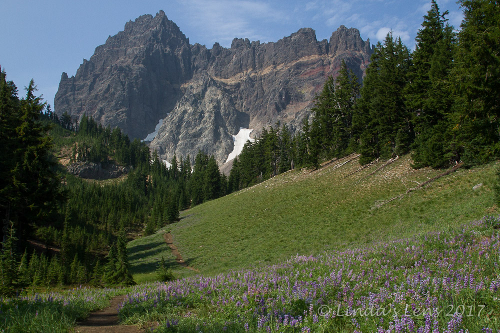
Canyon Creek Meadows is a beautiful alpine meadow at the foot of Three Fingered Jack Mountain.  Located on the eastern fringe of the Mount Jefferson Wilderness, it was barely outside the Whitewater wildfire's closure area.  This fire had been raging for two weeks, consuming vast portions of forest, with no sign of stopping.


Three Fingered Jack rises above an alpine meadow

So that mid-August Friday I woke up ungodly early and made the three-hour drive to Canyon Creek Meadow's trailhead at Jack Lake.  I drove by a very smoky Detroit Lake (which necessitated turning car headlights back on) and caught the fire crew's vehicle convoy heading out from their camp near Santiam Pass to the front lines of the Whitewater fire (I sent those brave folks good vibes and silent thank yous as they drove by).


Lotsa lupine in the upper meadows

I pulled into Jack Lake's parking lot at 8:30 sharp.  Being a weekday, there were only a few cars already.  Stuffing my feet into hiking boots, I noticed my swollen toe wasn't too happy about being confined.  Hoping it would loosen up as I walked, I shouldered my backpack and headed towards the trailhead.


The mountain, up close and personal

The trail started out following the shoreline of Jack Lake.  This tiny water body sat in an area that burned in a 2003 wildfire.  Ghostly silver dead trees rimmed it's shores, making nice reflections in the calm waters.  I stopped to take a few images before moving on.


Bands of color in the rock

I'd just passed the wilderness boundary sign when my foot started complaining.  Wedged into my boot, the sore toe was not happy.  I stopped to loosen my bootlaces, and while I was at it, downed a couple of ibuprofen.  Hopefully that would keep things under control for awhile.


Glacial cirque lake at TFJ base

The path climbed gradually, through an area of burned-out trees.  I spied a smoky outline of Mt Jefferson through their silver trunks.  I then passed through a lovely meadow of tiny lupine, their leaves spangled with sparkling dewdrops.


Magenta paintbrush

About two miles in, I came to a junction with the trail that led hikers to Canyon Creek's scenic meadows.  Crossing Canyon Creek, I could see Three Fingered Jack's outline rising above the trees.


Huge field of lupine

A little more climbing, a bit more wandering through several green meadows containing withered remnants of what looked to have been an impressive wildflower bloom.  Then I climbed a ridge, trekked through a forest, and came out into the grand meadow I remembered from my last visit five years ago.  Three Fingered Jack rose like a wall above the forest.  Lupine bloomed in the green meadow.  A calendar-worthy shot!  It looked like something you'd see in Switzerland.  (Although there's no photographic evidence, I did have a "Sound of Music" moment)


So.much.lupine!

But the best was yet to come.  Traversing the wonderful alpine scene, I passed through another grove of trees, and on the other side was a huge meadow right below Three Fingered Jack.  And it was chock-full of lupine.


Smoke begins to obscure the mountain

Wow!  Best lupine bloom this year!  But Three Fingered Jack loomed above, beckoning.  From my previous visit, I knew there was a pretty glacial cirque lake in the gravelly moraine at it's base.  I really wanted to see that first, so I decided to climb up the moraine.


Colorful meadow

It was a tough climb.  The loose gravel was treacherous.  I'd take one step up and slide a half step back.  I had to be careful my footing, as some of the rocks would slide out under my feet.  It was kind of like climbing on a slope of ball bearings.  At one point, I slipped and landed hard on my knees.  But I picked myself up and kept going.  Finally, I found myself on top of the moraine.  I rested, had a snack, and enjoyed the views of the tiny lake nestled in between the moraine and the mountain.  It was still mostly covered in snow. 


Time for your close-up!

Although the views were fabulous from this high perch, the weather was not.  Strong winds buffeted the mountain, blowing silt in my face.  Although I'd been lucky to have clear skies thus far, I began to smell smoke.  The northern skies started looking hazy.  As I was beginning to climb down, a band of smoke began to drift into the area, darkening the air and ruining my view of Three Fingered Jack.


Lots of butterflies

My sore toe had been behaving itself thus far.  I don't know if the ibuprofen finally kicked in or it became numbed by the walking, but it wasn't bothering me much.  Then, as I was descending the moraine, both feet slid out from under me.  I came down hard on my bad foot.  That inured toe took the entire impact.  I could feel it wrenching under me, moving in a way toes aren't supposed to move.

I couldn't talk, couldn't yell, couldn't swear.  All I could do was gasp in pain.


Yellow flowers beside a stream

Oh no....if it wasn't broken before, I was pretty sure I'd broken it now.  I gingerly limped down the rest of the moraine very slowly.  Making my way through the fantastic lupine field, I saw a tiny stream winding through the middle.  Maybe soaking my foot in it's cold waters would help a little.


Asters

So I took another break, and stuck my aching foot into the stream.  Although not as cold as I expected, it did feel good.  I opened my first aid kit and downed another couple of ibuprofen.  Hopefully the combination of meds and cool water would be enough to enable me to walk the 3.5 miles back to my car.


A cold stream brings relief to my aching toe

After a good 10 minutes in the cold water, I removed my foot, gingerly put my boot back on, and meandered my way back through the meadow.  The flowers were so fantastic, I made frequent photo stops to document it all.  Lupine, magenta paintbrush, asters, yellow Oregon sunshine, and other wildflowers brightened the area, making me temporarily forget my pain.  By now it was early afternoon, and hundreds of beautiful butterflies soared through the flower fields.  Truly a magical place, it was hard to leave.


Pretty blue butterfly

But I needed to get back to my car before my foot got any worse.  So I limped down through the meadows, past tiny Canyon Creek.  At the trail junction, I looked back for one final view of Three Fingered Jack, now almost entirely obscured by smoke.  Then, taking the recommended right hand turn, I followed Canyon creek for the next mile.


Smoke is getting thicker

I didn't remember much above this leg from my previous visit, but it turned out to be a delightful trek along a charming mountain stream, gradually transitioning into another burn zone from the 2003 fire.  Fireweed and white pearly everlasting flowers bloomed underneath the charred, gray trees.


Flowers blooming in old burn area

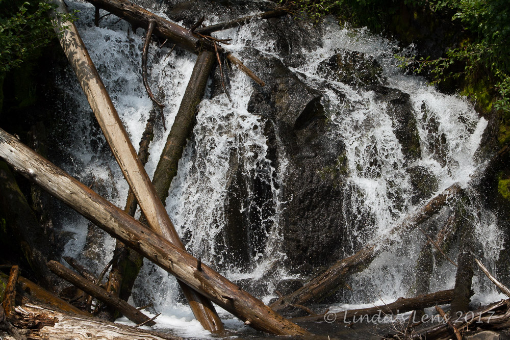
At the junction with the Wasco Lake trail, I came upon a lovely cascade, spilling over a small rocky outcrop.

Canyon Creek Falls

Then I hobbled down the last leg of my journey, another mile through the burned forest.  Although somber, I was pleased to see a solid mat of green across the forest floor.  Small pine trees, some now almost five feet high, were rising from the ashes.  The trees were almost big enough to begin overtaking the desolate gray burn area.  It cheered me to see this forest coming back to life.


Butterfly on pearly everlasting

About a half mile from Jack Lake I began seeing bushes loaded with ripe, purple huckleberries.  Mmmm!  I picked and snacked as I hiked along.  The berries sweet goodness helped me forget about my foot for a few minutes.


Huckleberries!

Although the lovely sights and yummy berries helped distract me from my throbbing toe, I was never so happy to see Jack Lake.  A short half mile trek and I was back at my car, tugging off that darned boot, and gratefully sinking into the driver's seat of my car. 


New trees beginning to overtake the burn area

Now - on to Bend, to see my brother and his family.  But sadly, I realized tomorrow's race was not gonna happen.  With my toe swelling and throbbing the way it was, there was no way I could run six miles.  But as a happy alternate, I ended up instead at the Bend Brewfest with my brother (and it was much more fun than running.)

I wouldn't have my broken toe diagnosed for another month.  Just this week I saw my podiatrist and she confirmed via xrays that it was indeed broken.  (And wasn't very happy I'd been hiking on it.)

But, I'm still glad I decided to hike the Canyon Creek Meadows loop.  The flowers and mountain views were so spectacular, it was totally worth it - broken toe and all.