It's a new year, time for some new trails! Early in January I decided to jump right into my 2022 hiking challenge and tackle a "new to me" trail in the northern Oregon Coast Range. I'd read about the Gnat Creek Trail some time ago and bookmarked it as a possible future hike. Heavy rains during the past week had flooded the coast, brought high avalanche danger to the mountains, and produced landslides in the Gorge. The Coast Range appeared to be the only safe place to hike that weekend. So I invited my friend Catherine and her daughter to join me for an exploration of the Gnat Creek Trail.
The beauty began almost immediately
It was an extremely cold and frosty morning. Driving highway 30 to the trailhead I had to slow down several times, not only for ice on the roadway, but also due to a huge fog bank enveloping everything, that severely reduced visibility. After an hour and a half of fighting fog and ice on that winding highway, we finally arrived at the trailhead.
Dense, dark forest
The parking area was just a wide spot in the road. Most of the vehicles parked here were large trucks belonging to fisherman. We only noticed one other car where the occupants were grabbing backpacks instead of fishing rods. Starting up the trail, my friends and I immediately put our best limbo moves to use navigating a bunch of blow-down trees.
Last leaf
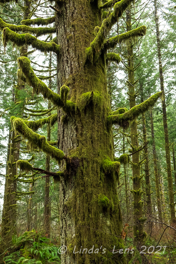
The first part of the Gnat Creek Trail wound through a wonderful mossy forest with some huge fir trees. Catherine and I oohed and aahed over the long trains of moss dripping from the branches. Although all that dense vegetation made the forest very dark, a tiny shaft of sunlight managed to make it through and lit up a small sliver of the moss beautifully.
Can you spot the fisherman?
We hadn't traveled far when we met up with our first group of fishermen. Four young guys, all carrying long poles, were scouting for the best route down to Gnat Creek, which was well below the trail at that point. Catherine couldn't help but notice one of the men was also carrying a six-pack of beer. (Gotta stay hydrated I guess!)
Ferns a-plenty
A few more fisherman passed us on the trail and educated us on what they were up to. My friends and I learned that Gnat Creek is a popular place for steelhead fishing. As we sauntered further along the trail began to descend to water level, and we spotted a few men (no women today) standing on the gravel bank, poles at the ready.
Sunlight trying to shine through the forest
The first part of the Gnat Creek trail was spectacular! This forest was stunning, with it's tall mossy trees, green ferns, and occasional sunbursts shining through.
Catherine admiring the creek
Our trail finally dropped enough elevation to put us close to creek level. The previous week's heavy rainfall had Gnat Creek running full and fast. The current was moving so rapidly Catherine and I wondered aloud how any fish could linger long enough to get caught in a fisherman's line.
Gnat Creek was especially beautiful here
Adjacent to the creek bank here the trees were absolutely coated in moss. Trunks, branches, everything! The long mossy branches kind of looked like spooky arms, waiting to grab an unsuspecting hiker.
Moss was plentiful here!
The trail rambled through the woods for a little over a mile before emerging onto the side of Highway 30. Continuing the trail required my friends and I to scramble across this busy highway. We waited several minutes for a large gap in traffic before quickly darting to the other side.
Walking through the green tunnel
Now safely on the opposite side of the road, my companions and I made our way through a short segment of trail before emerging onto the grounds of the Gnat Creek Fish Hatchery. The first thing we noticed was a huge woodpile adjacent to the caretaker's house. It was so impressive I almost took a picture of it - but then I realized maybe I shouldn't be taking photos of someone's home.
Enjoying a peaceful moment along the creek
There were many large concrete tanks full of young fish (salmon we guessed). The three of us stood at the railings and watched huge schools of fingerlings zip about. Once those fish saw our shadows though, they immediately swam en masse to the other side of the pool.
Gnat Creek Fish Hatchery
Just before arriving at the fish hatchery, my companions and I were getting hungry and discussing where we'd stop for lunch. As luck would have it, the hatchery had a covered area with several picnic tables. Perfect! Instead of sitting on the forest floor or balancing on a tree stump, we enjoyed a nice break with dry seats and a proper table.
More views of Gnat Creek
Our trail made a loop around the fish hatchery, so we had our choice of which route to take. Since both paths converged at the Upper Gnat Creek Trail, we randomly chose the left branch. It was a good pick - this route followed Gnat Creek through more huge, mossy, grand forests. There were even small signs for a nature trail (although we didn't read many of them).
Creek overlook in mossy, old-growth forest
Under a canopy of giant old-growth trees we came upon a nice overlook of Gnat Creek. A good place for photo ops!
Gnat Creek was absolutely roaring!
Bursting with rainfall from last week's storms, Gnat Creek was absolutely roaring!
Long, mossy tree limbs
The last part of the "left hand" trail branch wandered through more mossy goodness. My camera was kept busy here!
Trailhead to Upper Gnat Creek
But finally we reunited with the right hand trail branch and entered the Upper portion of Gnat Creek Trail. This point was announced by a funky trail sign that looked straight out of the 70's.
What do I spy that behind the trees?
As we passed by the beginning of the Upper Gnat Creek Trail, my friends and I spied something up on the hillside, behind a bunch of trees. What was that?
Sasquatch dropped by to say "hi"
Well, what do we have here? It was Sasquatch himself, dropping by to say hi! My friends and I had a big chuckle over the large wooden cutout. It seemed the trail makers had a sense of humor!
Follow the sunburst
Beyond the Sasquatch encounter we rambled through more mossy, ferny woods, up and down hills and through small drainages, always Gnat Creek rushing down below.
Premature trail's end thanks to a washout
The total length of this trail was supposed to be four miles, for a total of eight miles out and back. However, one group of hikers we met on their return trip warned us that the trail was washed out about a half mile short of it's terminus. Sure enough, as the trail approached Gnat Creek, we saw a bunch of downed trees and a huge crater where the tread used to be. It looked impassible, and none of us wanted to risk crossing to find out, so my friends and I decided this would be our day's turn-around point.
Negotiating a patch of blow-down
Back we went, retracing our steps through the forest, saying "hello" to Sasquatch once again. Through the fish hatchery grounds, and dashing across highway 30 for a second time. The lower part of the trail after the roadway crossing had lots of blown down trees to navigate, which now that we were tired from hiking all day, seemed like much more of a chore to traverse. But we successfully wiggled around all the downed trees and tromped back through the thick forest.
Old mossy tree stump
In the final mile, a bright afternoon sun illuminated the forest. This light was so nice I couldn't resist just a few more photos breaks to capture it's beauty.
Lovely afternoon light on the forest
Despite its premature ending, I was mighty impressed with the Gnat Creek Trail. I absolutely loved the dense, mossy coastal forests here. There were lots of interesting things to see - the fish hatchery, the nature trail, Sasquatch, and of course Gnat Creek itself. I can't wait for a return trip once the washout is fixed so I can experience the full length of this trail. I definitely will be back.
My hubby's New Years resolution is to walk a certain number of steps every day. He's been very diligent about meeting this goal, even heading out in the pouring rain to get his steps in. However, one Saturday morning in late January I suggested "Instead of walking the same neighborhood route, why don't you join me for a hike?"
Foggy hills above the Wilson River
The day's weather wasn't very promising - rain was forecast. However it appeared there was a short window of dry weather in the late morning, so we decided to get a quick saunter in before the heavens opened up. Naturally I didn't want to drive very far, so suggested someplace in the nearby Coast Range.
Huge mossy tree
There's wonderful trail in Oregon's Coast Range that follows the Wilson River. A total of 20.6 miles in length, frequent trailheads provide multiple access points to allow for shorter section hikes. I've trekked a small portion of this trail, and so far my favorite part has been the section from Jones Creek Day Use Area to the Footbridge Trailhead. I suggested to hubby that we head there.
Spooky forest
The sky was dripping precipitation when I parked at the Jones Creek Trailhead. Donning raingear hubby and I set out into the wonderful mossy forest of the Coast Range. Here the trail followed the Wilson River, flowing furiously after an overnight rainstorm. Lined by lots of grand fir trees, mossy rocks, and ferns it was a lovely sight.
However, we'd only covered a half mile when we encountered our first roadblock. A construction fence was strung across the trail - apparently a nearby bridge was out.
There's the bridge!
What to do? Lucky for us, the closure notice attached to the fence also included a map of nearby trails. It appeared the downed bridge could be bypassed by hiking through nearby Jones Creek Campground and rejoining the Wilson River Trail on the other side. It added a half mile or so to the daily total, but since our goal was to get steps, it was no biggie.
Side creek crossing
So hubby and I navigated our way through the closed Jones Creek Campground, making a couple of wrong turns before finding the correct connector trail. This path wound through a beautiful forest full of mossy old trees and huge green ferns. I kept finding so many photo subjects it took me awhile to cover the extra half mile distance. But it was so pretty I was glad for the detour.
More wonderful mossy trees
After crossing a side creek on a sturdy bridge (that was very much intact) we rejoined the Wilson River Trail. Passing by a huge suspension bridge over the mighty Wilson, we briefly considered walking across to visit the Tillamook Forest Learning Center on the opposite shore. But a sign indicated it was closed due to COVID so we continued on.
Fairy tale forest
This section of trail followed the Wilson near river level. I enjoyed glimpsing it's blue-gray waters between mossy tree trunks. Hubby noticed a few fisherman scattered along the banks, all vying for winter steelhead.
And yahoo - the intermittent sprinkles that had fallen off and on since we'd started our hike finally let up. It was nice to finally hike with my hood down.
Wilson River framed by mossy trees
I made frequent stops to photograph the amazing scenery, especially the mossy trees. With leaves absent from the branches, the brilliant green moss really stood out. Some trees were absolutely coated with the stuff.
These trees had tiny branches
Some of the trees had tiny nubs for branches, each with a tuft of moss attached.
The mighty Wilson
Another mile down the trail hubby and I ran into another closure notice. This one mentioned downed tree removal and trail repair work a short distance ahead and to detour onto the adjacent powerline road. Since it was a weekend, I didn't think any work was happening, and told hubby we should just keep going.
Detour on a powerline road
But.....only a short distance later we came upon another fence blocking the trail. It appeared we could easily slip around this obstacle, and it was tempting to ignore the sign and keep going. But my law-abiding hubby said we probably shouldn't (also the sign also mentioned a stiff fine for noncompliance). Not willing to backtrack the entire way, we ended up bushwhacking through the forest to reach the powerline road.
Back to the riverside trail
After crashing through brush and ferns, it was nice to walk on a level gravel road. Luckily, the detour wasn't too far of a distance and before we knew it another sign directed us back to the Wilson River Trail.
Moss close-up
I'd mentioned to hubby that this portion of the trail was relatively flat. However, after a couple of miles, the trail began to climb quite a bit - a fact that I'd obviously forgotten.
Trail lined by mossy rocks
The path zigged and zagged uphill until we were looking down on the Wilson River, far below.
Another river view
But all that climbing did give us great views. Not only of the Wilson River, we also passed by a nice waterfall. It was named - you guessed it - Wilson River Falls.
Wilson River Falls
The waterfall was near the trail's high point, so once we passed by this cascade, the trail began switchbacking downhill to eventually reach the Footbridge Trailhead on the banks of the Wilson.
Taking in the lush forest
My hubby's knees aren't fond of downhill grades, and the steep downhill in combination with some extremely slippery mud made him extra cautious. We traveled a short distance gingerly stepping over the muddy track. It didn't seem to be getting any better the lower we descended. Afraid of wrenching a knee, hubby asked if we could turn around early.
Wilson River's emerald waters
Since the detours had added some mileage to our day I was fine with cutting our trek short. Besides, the sky was darkening once again, and I knew it was only a matter of time before the afternoon's predicted showers would start up.
Mega-mossy forest
Retracing our steps we climbed back to the waterfall, then downhill to near the river level once again.
Fog in the woods
Thus far, we'd only encountered a half dozen people, all of them fisherman. But past the waterfall climb, hubby and I began to meet a couple of hiking parties traveling in the opposite direction. Still it was nothing like the crowds of hikers we would've encountered at some of the more popular Coast Range trailheads (or in the Columbia River Gorge).
Hubby watching the fishermen
At one place where the trail gave particularly nice views of the Wilson River, hubby and I stopped and took in the beauty of the aqua-green water. We watched a couple fishermen on the opposite banks casting for steelhead.
Steelhead fishermen
Then we meandered back down the trail, past the suspension bridge, until we reached the final trail detour. Winding through the beautiful mossy forest once again, I couldn't help but take just a few more photographs, despite droplets beginning to fall from the sky. Back at the campground, I took a quick potty break at a very stinky pit toilet (but luckily it was open - and even had tp!). After my little break I noticed this very cute building in the campground with trees carved into it's door. I think it served as a woodshed for the campground.
Cute woodshed at Jones Creek Campground
From the campground it was a quick (very quick because it was now full-on raining) back to the parking area and hubby's truck.
Driving home, we passed by overflowing trailheads at Elk and King Mountains. Cars lined the highway on both sides. I remarked how lucky we were to have had such an empty trail where we hiked. Encountering less than a dozen hikers, I decided we'd chosen well for our trek. Not only that, we'd succeeded in meeting hubby's step quota for the day.
Ever wanted to take a jet boat ride on a wild and scenic river? Driving by the coastal town of Gold Beach last year I glimpsed a sign for Jerry's Rogue Jets, a company offering guided jet boat rides up Southern Oregon's Rogue River. It looked like a lot of fun. Intrigued, I told myself "I gotta do this sometime."
Fast forward to late April - while planning this year's annual Southern Oregon Coast trip, on a whim I decided to treat myself and gave Jerry's a call. I told my hubby to think of it as an early Mother's day gift.
Jet boats in Gold Beach harbor
A repeat of last year's journey, in early May I traveled as far south as you can go on the Oregon Coast to a state park yurt in Brookings, Oregon. The town of Gold Beach, my meeting spot for the jet boat ride, was 25 miles north. The morning of my scheduled ride, I rose early and arrived with plenty of time to stroll around the dock, snapping photos of colorful jet boats waiting in the early morning sunshine.
My ride for the day
Jerry's Rogue Jets offered three different trips, a 64-mile, 80-mile, and 104-mile "wilderness whitewater." It didn't take me long to decide which one I would take. Anything with wilderness and whitewater in the name had to be fun. Sign me up!
104 mile round-trip journey up the Rogue River
On the wall of Jerry's office was a detailed map showing their tour routes. From the coastal town of Gold Beach (at the mouth of the Rogue River), the boat would travel upriver 52 miles to Blossom Bar Rapids, before turning around and riding the river back.
The Rogue is divided into different sections. The day's trip would start out in the recreational section, pass through the scenic section and finally end up in the wild portion of the river. The Rogue was one of 8 rivers originally included in the Wild and Scenic Rivers Act of 1968. Portions of forest land adjacent to the Rogue are roadless. Homes and lodges in these stretches are only reachable by boat or helicopter (or hiking). Jet boats were originally used to deliver mail to these remote outposts. The upper Rogue River is often shallow and rocky, and the jet propulsion system allowed boats to safely traverse these hazards.
Issac Lee Patterson Bridge
This sunny spring day brought out the customers. There were so many people wanting a jet boat ride that Jerry's had to add second boat to their lineup. All seats are first-come, first serve, so wanting to get a good seat on the first boat I cued behind a short line next to the dock. As I was waiting a big pickup pulled up and a very loud, obnoxious large man rolled out, jabbering incessantly about seeing seals in the bay. Ugh - I hoped he didn't end up on my boat.
Another view of the bridge
Finally our captain opened the gate and escorted the first group down to the dock. After explaining, "the front seats get splashed the most and the back seats have the smoothest ride," he let us choose our spots. I slid into the middle section, and claimed a seat on the outer edge. I wanted an unobstructed vantage point for photos.
For awhile I was all alone in my row. Secretly hoping I'd get the entire row to myself, my hopes were dashed when I heard a loud voice, and looked up to see the large obnoxious man from the parking lot lowering himself into the boat. He slid down my row - and plopped himself right next to me!
Lucky salmon fisherman
I eyed the row behind me, which was still empty, and tried to decide if it would be rude to suddenly change places. But the man held out his hand and introduced himself and his wife. He seemed friendly, so I smiled back, shook his hand and decided to give him a chance.
Towards the wilderness
Although sunny, the morning air was chilly, and I'd donned three layers to keep warm. Our boat captain introduced himself (but of course I can't remember his name - that's what I get for writing this blog post two months later!) and slowly maneuvered the boat into Gold Beach's wide harbor. We motored under the lovely Issac Lee Patterson Bridge, which carried US 101 traffic across the Rogue River. Once safely on the other side, our captain warned us to "hold onto our hats." With that, he gunned the motor and our boat shot upstream. I just barely caught my hat before it flew off.
Buzzing the fishing boats
Our boat effortlessly glided across the water. We passed wide gravel bars and rolling low hills covered in trees, bright green with new spring foliage. The lower (recreational) portion of the Rogue was full of fishing boats, their occupants all trying for spring salmon. At each boat, our captain slowed down and asked if they'd had any luck. One man proudly held up his catch for us to see - a nice, fat salmon!
Blue heron sighting!
Wildlife was abundant on the Rogue. Right away, our captain pointed out osprey and blue heron. One blue heron even posed on a rock for us. Not knowing how much splashing would occur, I'd opted to bring my smaller Fujifilm mirrorless camera and lens (easier to stash under my rain jacket if things got wet and wild). Now wishing I'd brought my big zoom lens, I had to make do with a measly 18-55 mm landscape lens. (Can you spot the blue heron in the above photo?)
Nice reflections
Then our eagle-eyed captain spotted a weasel peeping out of some shoreside rocks. He slowly edged the boat closer. The weasel was on my side, and I got a front row view of him. The little guy lingered just long enough to snap a few good images.
Our captain spotted a weasel
The scenery was incredible Steep cliffs rose from each side of the river, thickly covered in trees and other vegetation. Waterfalls tumbled from cracks in the rocks. Everything was so lush and green. After passing into the scenic portion of the Rogue, we saw no houses or other structures. It truly looked wild. Our captain said there was only one long, winding Forest Service road to serve some of the tiny towns along the river. And that road ended at the hamlet of Illahe, about 35 miles upriver from Gold Beach.
Landslide aftermath
When the boat was zipping along at full speed, it got mighty cold. I pulled my jacket's hood over my head (kept my hat from flying off too) and placed hands into pockets. But luckily there were many stops - to look at scenery, say hello to fellow boaters, or when someone spotted wildlife. Our captain pointed out a huge landslide on one side of the river, likely caused by last winter's heavy rains.
One of the many riverside waterfalls
Spring runoff was in full force, causing numerous waterfalls to gush from side creeks. Simply lovely!
Photo op
Due to the morning's chilly temperatures, our captain was careful not to splash his customers too much. (I suspect midsummer riders aren't as fortunate) But upon reaching a wider spot in the river, he gunned the motor, cranked the wheel, and whipped our boat into a 360 degree spin. People whooped as water splashed over the boat front and sides. Oh how exhilarating!
Fishing platform
Onward up the river our jet boat sped, gliding like silk across the water's surface. I was amazed how close the boat got to the many rocks sticking up in the current, only to smoothly veer away at the last minute.
We passed many river rafters
We passed by a floating fishing platform, complete with holders for fishing rods. Further upriver, our boat began to meet a few rafting parties. Several companies offer guided raft tours of the entire Rogue, from the town of Grants Pass to Gold Beach. But private raft trips are regulated. Running the Rogue has become so popular, a lottery system was enacted to keep the river from being overrun with people.
Tree growing out of a rock
Further upriver the riverside became steeper, and canyon walls on either side moved closer together. The shoreline now consisted of huge rocks, tumbled down from vertical cliffs above. One rock must've been in place for awhile as it had a tree growing on top.
My river view
Our boat passed by the confluence of the Illinois River, another wild and scenic river draining from the Klamath Mountains in Southern Oregon and Northern California.
Fantastic scenery
Beyond the Illinois was the tiny riverside village of Agness. High time for a potty break, our boat tied up at their dock and the captain directed passengers uphill to Cougar Lane Lodge. Perched on a hill above the river, it was a stunning setting for a country inn. The place featured a full service restaurant (our lunch stop later that afternoon), rooms, campground and a general store, where I purchased a much-needed bottle of water. (Jet boating makes one thirsty!)
Another tiny waterfall
Beyond Agness the river transitioned into churning whitewater rapids. Returning from our break, the captain instructed passengers to don lifejackets for this next segment. Ulp! Things were about to get real!
Time to run the rapids!
Upriver we sped, past a few remote lodges, only accessible by boat, hiking, or helicopter. The scenery continued to impress, with steep, rocky shorelines and tall, forested canyon walls. Then we hit our first rapid. The boiling water, spilling over several rocks looked mighty intimidating. But our boat bounced over with no problem, save a few huge splashes. What fun!
Here's a video so my readers can experience it too.
Getting up close and personal with this waterfall
Our boat jostled through several more rough patches, we passengers getting doused with spray. I was impressed by how easily the jet boat navigated the rapids. Now I understood why they were preferred over regular prop motors. Finally we came to Blossom Bar Rapids, the end of our day's journey. The boat hung out below the churning water, watching a group of rafts bounce through before turning around.
Rafters setting up camp
But our captain had other tricks up his sleeve. It was now past noon, the day warming up considerably since our chilly start. Spotting a nearby waterfall, he drove the boat up to it's very base, giving front row passengers an up close and personal (although wet!) view.
The other jet boat passes by
Then it was back downriver, seeing familiar sights once again. We passed by a group of rafters camped out on a gravel bar. And we met the second tour boat, heading up to Blossom Bar.
Hello!
Everyone smile and wave!
And just for fun, whenever our boat hit any wide, calm spots in the river, our captain threw in a few more 360 spins. Wheee!
Bear sighting!
We were almost back to Agness when our captain slowed the boat and directed everyone's attention to a spot high up a tall cliff. A tiny black spot was moving near the top. It was a bear! Wow! Now I really regretted not packing my big lens. Of course, I tried to take photos anyway, but the bear only showed up as a very small black dot.
Ok, now do you see the bear?
A little creative cropping later, and now you can see that it was indeed a black bear. Our captain said the bears had just come out of hibernation, and were ravenously hungry. This one appeared to be munching away on vegetation.
Lunch break at Cougar Lane Lodge
Although I really tried to make the best of my large, obnoxious seat partner, by the time we headed back to Agness he was really getting on my nerves. Not only did the guy continuously complain about the bumpy ride and getting splashed (that's what you signed up for!) he took up more than his share of the seat and started to manspread, squishing me up against the boat's inner wall. When our boat finally docked for our lunch break, I was the first one off. I literally sprinted up the hill, hoping to get a spot in the dining room as far away from him as I could.
The food was delicious
Cougar Lane Lodge had both indoor and outdoor dining areas. Off the boat and out of the wind, it was suddenly toasty hot in the sun, so I chose a shady spot in the very back of the outdoor deck area. Not only did the lodge have a delicious pulled pork meal, they also offered a great beer selection. I decided, "hey I'm on vacation" and ordered a brew with my lunch.
Lovely river views from Cougar Lane deck
With over an hour for lunch, I had plenty of time to eat and hit the restroom. Done with my meal, I was sitting outside on a picnic table enjoying the view, when a lady in the row behind me stopped by. We struck up a conversation and I learned she was a local, living in a house along the Rogue just outside of Gold Beach. She said we'd passed right by her home that morning. The lady was a wealth of information about the area. She said I'd taken the boat trip at the right time of year - the river was so green and beautiful in spring. Apparently by mid-summer everything turned brown.
Looking upriver from the boat dock
I groused to my new friend about my seat partner and she offered the same opinion of the guy. The lady said there was room in her row if I wanted to change places. Back at the dock, since my seat was on the end, I waited for everyone else in my row to board first. As I was waiting, the local lady motioned for me to get into her row. Since her row wasn't full, there was plenty of room. Not caring about appearing rude anymore, I gratefully accepted her offer. Hooray - no more being squished against the boat!
Homes across the river in Agness
By now the sun was high in the sky, beating mercilessly down upon everyone seated in the boat. I removed my layers down to a t-shirt. Our captain mischievously remarked that we looked too hot, and began spraying us with a large squirt gun.
Our captain didn't think we got wet enough
The ride back was quicker than our initial journey. By now, tired and sun-baked we riders quietly took in the passing scenery. But I enjoyed a nice chat with my new seatmate. She was an interesting woman, definitely someone I'd be friends with if I lived nearby. We spotted lots of birds both in the sky and on the shore - ospreys, blue herons, and bald eagles. One eagle even flew right over our boat and hung there for a moment. I was so enthralled, I didn't even think to grab my camera and capture it.
Row of riverfront cabins
Passing by a tall bridge over the Illinois River, our captain talked about several great floods that in the past had roared down the Rogue, taking out bridges. On this placid spring day, it was hard to believe the water could reach such heights!
Tall bridge over the Illinois River
Of course, our captain couldn't resist throwing in a few more spins every chance he got. And we passengers (save for my ex-seatmate) loved every minute! In the hot sun, the wind and river spray felt great.
When our boat docked back at Gold Beach, I was sad that the trip was over. What a unique way to experience the scenery along an otherwise remote wilderness area. Definitely a lot of fun, I'd go again in a heartbeat!
(I've received no money or other compensation from Jerry's Rogue Jets for mentioning them in this blog post.)