Monday, October 15, 2018

Mt Rainier National Park - Soggy Day One

For the past two summers I've journeyed north to visit the closest National Park to home - Mt. Rainier.  Having concentrated my most recent trips on the park's amazing NE corner, this year I decided it was time to check out the SW area around Paradise.  Home to waterfalls, a historic Inn, and stunning alpine flower fields, unfortunately it's also the most popular part of the park.

Despite the crowds, social media posts of fantastic wildflower meadows were enough persuasion to plan an early August trip.  Not having campground reservations, I worried about snagging one of the few "first-come, first-serve" sites at nearby Cougar Rock Campground.  Increasing my odds meant leaving Portland at the crack of dawn Friday morning.


Christine Falls

In this case, the early bird did catch the worm.  Not only did I find nonexistent lines at the Nisqually Entrance (where traffic backups often extend for miles) I also landed a sweet campsite in the "generator free" loop at Cougar Rock.  (That's what a 7:30 am weekday arrival will get you!)

Campsite procured, and tent set up, it was time to explore.  First stop, lovely Christine Falls.  Directly adjacent to the main park road, it's easy access meant battling crowds.  But persistence paid off, and after waiting for a couple of photographers to clear, I had the place to myself for several minutes. Situated in a gorgeous rocky canyon perfectly framed under the highway's decorative rock bridge, lens candy doesn't get much better!


Soggy aster

Still fairly early in the morning, I then pointed my car up the steep, winding road to Paradise.  Knowing that the parking lots filled up quickly, a mid-morning arrival was imperative.  Although the main lot was already full, I did manage to find a spot in the overflow.  Shouldering my backpack and camera bag, I eyed the heavy clouds but neglected to grab gaiters and umbrella.  (After such a dry spell, it couldn't possibly rain, could it?)  I'd later regret that decision.


Damp, foggy Skyline Trail

After grabbing a map at the visitor center, I followed a paved walkway to a huge trail junction.  Which way to go?  Seeing a patch of purple asters, I impulsively started in their direction.

Fog hid Mt Rainier from view, and a light mist hung in the air.  I grabbed a few shots of the raindrop-soaked flowers before stashing my camera inside my rain jacket.


Flowers were out!

It didn't take long before the light mist transitioned to heavy raindrops.  After several weeks of hiking in scorching temperatures, I reveled in the cool, wet weather.  Boy had I missed the rain!  Delighted, I splashed through a few puddles that were forming on the asphalt path. 


Love the Magenta Paintbrush

Wildflowers in Rainier's high alpine meadows were putting on a fine show.  I wanted to take zillions of photographs, but the rainy weather put a kibosh on that.  Instead, I kept my camera safely stashed away, only braving the elements for a few truly beautiful sights.  Trying to cut down on weight, I'd brought my Fujifilm XT-1 mirrorless camera for this trip, and unlike my diehard Canon 7D,  it wasn't quite as weather-resistant.


Into the fog

I wandered about two miles on the Skyline Trail, taking in the foggy wonderland and flower-filled meadows.  I passed by lovely Myrtle and Sluiskin Falls, and huge fields of Western Pasqueflower (aka "Hippy on a Stick") and Magenta Indian Paintbrush.  But the now-constant rainfall began taking it's toll.  My feet started to get wet, and water began seeping through the seams of my jacket.  (Yeah, I was kicking myself for leaving those gaiters and umbrella in the car.)  Although I'd had big plans on hiking the entire Skyline Loop Trail, a sign noting a 1-mile return to the visitor center via the Golden Gate Trail made me decide to cry "uncle."


Fantastic roadside flower garden

I drug my waterlogged self into the visitor center's cafeteria, ordered a hot tea, and located an open table.  The place was crammed with tourists, most like me taking refuge from the wet weather.  Since I'd brought one rain jacket and only one other change of clothes I lingered for a long time in the warm cafeteria, hoping these garments would dry out a bit.  The disadvantages of tent camping, I had no other heat source.


Nurse stump

I found a seat by the heater on the visitor center's upper level, and spent a good 40 minutes watching folks wander by while my clothes dried.  But eventually the itch to see more sights won out, so I took my slightly damp self back to the car.  Once inside, I cranked the seat heater and fan and spent extra time driving around enjoying the warmth.  Seat heaters do an amazing job of drying wet hiking pants!


Paradise River's rocky plain

Surprisingly, once I descended from the Paradise area, the rain stopped.  Arriving back at my campsite, although the skies were still cloudy, it looked as though it had never rained.  (Amazing the difference 2500 feet in elevation makes!)  I was thankful - having paid for two nights, I didn't want to begin my weekend in a wet tent.


Single log footbridge

By now it was mid-afternoon, and I still had time to explore a bit more.  Consulting my maps and guidebook I discovered a trail that led right from the campground and followed the Paradise River past two waterfalls.  Perfect!  It's always a bonus when you're able to hike right from your campsite.


Ulp!  (It looks worse than it really was)

So off I went to get in as many miles as I could before nightfall.  The trail wound through mossy woods before coming out onto the barren, rocky plain of Paradise River.  A glacial stream, the Paradise was lined by large, round boulders and it's water ran milky with sediment.  Being late afternoon, the river was churning with the day's snowmelt.

A single log bridge led hikers across this scary waterway.  I watched a lady ahead of me traverse the log first before scampering across.  Although intimidating, the crossing was actually much tamer than it appeared.


Old pipe paralleling the trail

Once across the river, my path climbed steadily through more dense woods.  I came upon an old wooden water pipe following the trail.  A relic from the past, this huge pipe once diverted water to a generator, supplying the park's electricity.


Carter Falls hid by vegetation

After a mile and a half, I came upon Carter Falls.  Hidden behind thick vegetation, it was kind of a disappointment.  But just a short distance beyond, Madcap Falls was smaller but much more visible.


Huge bridge spanned a tiny creek

I'd hoped to make it all the way to Narada Falls, another 2 miles down the trail, but I lollygagged enough that approaching darkness forced me to turn around a mile short of my goal.  After balancing on that narrow log crossing raging Paradise River, I did have to laugh when I came upon a wide, sturdy bridge spanning a tiny trickle of a stream. 


Deer sighting

The icing on the cake was rounding a corner and nearly walking into a deer on the trail.  After glancing up at me, the doe calmly resumed her evening dinner.  I stood firing off photos in the dwindling light until she got tired of the paparazzi and ducked into the woods.

Reaching my campsite shortly before sunset, I enjoyed dinner before turning in for the evening.  Despite the wet start, it had been a successful first day at Mt Rainier National Park.  Having a couple big hikes planned for tomorrow, I hoped the weather would be a bit drier.

Stay tuned for day two!


Friday, October 12, 2018

June Lake and Ape Caves

In late July, my son came to visit. When he's in town we always make sure and visit a local trail.  Lucky for me, he loves hiking as much as his mom. 


First glimpse of MSH
The PNW's hotter-than-normal summer continued it's streak, with highs in the 90s predicted on our chosen hiking day.  When musing over where to go, my son had a brainstorm.  He suggested "Why don't we go to Ape Cave?"  Visiting an underground cave on a toasty summer's day?  Pure genius! 

Huckleberries are ripe!

Ape Cave is an old lava tube located near Mt St Helens' south side.  It was formed 1900 years ago when MSH erupted a very runny type of lava.  As it spewed across the landscape, the lava flow's crust hardened, but the still-liquid lava underneath drained away via a buried streambed.  Then superheated gases blew through the tube, remelting the walls into smooth, solid surfaces.

The cave is broken into two sections, upper and lower.  The lower section is 0.8 miles long, and a relatively easy walk, while the upper section, at 1.4 miles long, is much more rugged.  Ape Cave's unusual name came courtesy of a group called the Mt St Helens Apes, Boy Scout cavers who adopted their nickname from a supposed nearby Sasquatch sighting. 


Fireweed

But Ape Cave was a relatively short hike for the long drive to reach it, so to get more bang for our hiking buck, I researched other nearby trails.  The June Lake trail wasn't very far away, at nearly 6 miles round-trip wasn't too long, and looked interesting enough.  So our plans were made - we'd leave early in the morning and hike June Lake first before the day heated up, and then tackle Ape Cave in the afternoon.


Reflections on June Lake

Sunny skies and cool early morning temps greeted my son and I as we stepped onto the June Lake Trail.  It was a very pleasant 1.3 mile jaunt to the lake, following a relatively wide, flat path lined with ripe huckleberries.  Mt St Helens made an early appearance, looming above the treetops.


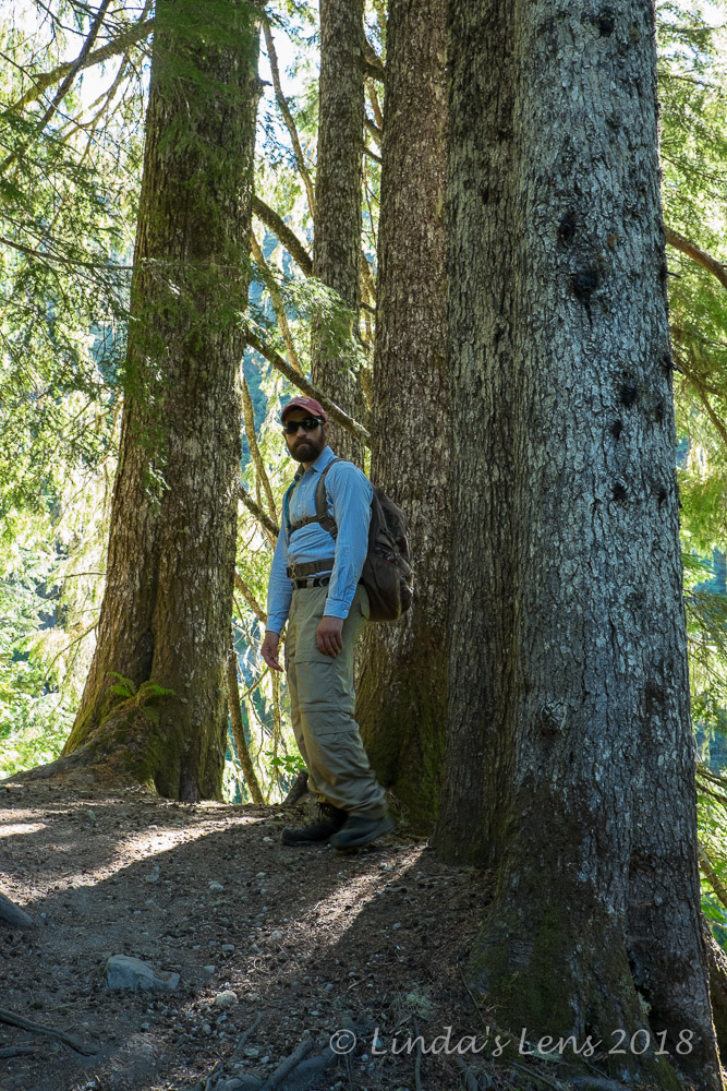
My son flanked by tall trees

June Lake itself was a tiny pond rimmed with brushy vegetation.  A small waterfall gurgled from a nearby cliff and several dead, gray tree trunks reflected in it's still waters.  The morning light wasn't great for photographs, so my son and I didn't linger. 


Killer views of the mountain

From the lake, our trail switchbacked steeply uphill past a lovely forest full of large hemlock trees.  It wasn't long before we came upon the Loowit Trail, the famous "round the mountain" path circling Mt St Helens.  From here, our plan was to follow the Loowit 1.3 miles to Chocolate Falls, and then choose one of the many ski trails for our return trip.


Small snowmelt stream

Although we began in an dense forest, it wasn't long before the trees thinned out and we came upon an old lava field known as the Worm Flows.


Vantage point

This was where the going got rough.  The Worm Flows were comprised of giant basalt boulders.  A tiny path snaked around the huge rocks, but often times it petered out, leaving my son and I to find our way around and over the rugged landscape.  Wooden poles placed at intervals occasionally helped with navigation.


Rough trail

Progress slowed abruptly.  It took much more time and effort to wind our way through the rough, rocky plain.  In some places we climbed hand over hand to clear the large boulders.  A much more strenuous trek than we'd anticipated.  By mid-morning this rocky plain was beginning to heat up, and it's lack of shade didn't help matters either.


Wandering through the lava rock

After a half hour, my son was getting tired of clambering through the lava fields.  I, too was weary of the rough trail, and looked ahead to see if I could spot Chocolate Falls.  For a mere 1.3 miles, traversing this section of the trail seemed to take forever.


Tall wooden poles marked the way

But, finally we spotted a thin stream of water dropping over a basalt cliff.  Surrounded by desolate, gray rocks, it wasn't the prettiest waterfall, but I was happy to see it nonetheless.  My son and I took a snack break on a nearby ledge and enjoyed the view we'd worked hard to reach.


Chocolate Falls

Now to decide on our return route.  I'd initially thought about taking the Pika ski trail back to June Lake, but it appeared to traverse the same lava field we'd just came through.  Neither one of us were too enthused about hiking the Worm Flows again, so I suggested following the main ski trail downhill along Swift Creek, and then take another trail that paralleled the main road back to our car.

Funny thing, the trail we ultimately decided to follow was the very one I'd used back in 2014 to climb Mt St Helens on my skis.  It was interesting to see it in the summer without snow.  We traveled downhill through pleasant, shady woods, spotting a few wildflowers and wild strawberries along the way.


Foxglove

It was near noon when we arrived back at my car.  After a quick lunch, I drove the short distance to Ape Cave, arriving at a parking lot swarming with people.  The disadvantage of waiting until afternoon, apparently lots of folks had the same idea.

My son and I followed a short, paved path to the cave's main entrance.  Rock and timber fencing encircled a huge hole in the ground and a metal staircase led to the underworld below.  A crowd of people were gathered by the stairs, and we waited several minutes for a few large groups to make their way up.  Then we joined the conga-line heading down into the cave.


Wild strawberries

Unlike many underground caverns, Ape Cave doesn't offer guided tours.  Visitors are on their own to wander around as far as the lava tube will take them.  Although the visitor center does offer lantern rentals, it's up to you to provide your own illumination.  Without it, you won't get very far - it's pitch black inside.


Ape Cave Main entrance

My son and I switched on our headlamps, and I dug out a back-up flashlight (always like to be prepared).  We followed the large crowd of people past the lower cave's mouth and into the darkness.  Although this was my very first time at Ape Caves, my son had visited many years ago with his Boy Scout troop, and luckily still remembered a lot from that trip.  He was really an invaluable guide.

The farther we traveled into the cave, the thinner the crowds became.  The floor was uneven so you really had to watch your step.  Parts of the cave had very high ceilings, so there was no danger of hitting your head.  Best of all, it was a lovely, chilly 42 degrees F underground, which after trekking around in 90-plus degree heat, felt wonderful.


The lower cave was a busy place

Distance always seems a lot farther when you're walking around in a dark place.  After leapfrogging with a nice family from England, my son and I finally reached the end of the lower cave.  Time to turn around and retrace our steps.  The return trip was much quicker, and when I started to see lots of small children and people in flip-flops, I knew the entrance was close.

 My son suggested trying the upper cave next.  He said it was "a little bit more rugged" and longer but thought I'd be fine.  So instead of climbing the stairs back out, we ducked behind them and headed in the opposite direction.


Near the lower cave's end

The upper cave started out okay, but conditions quickly deteriorated, until we found ourselves scrambling over a field of large basalt boulders - very similar to our morning hike, but with the added challenge of being in the dark.  (I later read that old earthquakes over the years had loosened these boulders from the cave's ceiling.)  It was tough going, as we had to try and determine the best path through the rocks.  Our hands became sore from scrambling over the rough basalt, and more than once I hit my knees while climbing.

Then we came to our first real obstacle - an 8 foot high wall of slick, solidified lava.  There was only one real foothold.  I looked at my son and said "I don't think I can scale this."  At this point we were about halfway through the upper cave, and he pointed out that if I couldn't climb this lava fall, we'd have to turn around and scramble back through the boulder field again.  Not keen on worming back through that rocky maze, it was the incentive I needed.  Summoning all my strength, agility, and courage, I plastered myself flat against that wall and slowly pulled myself up.  It wasn't pretty, but I got there.


Upper Cave exit

Beyond that obstacle, there was one other lava fall (thankfully not as tall), and many more large boulders to navigate.  I began to think we'd never reach the end.  But my son noticed sunlight streaming down from an opening in the ceiling, and quarter mile later, the metal ladder for the upper cave's exit came into view.  I've never been so happy to see a ladder in my life!

The trek through Ape Cave turned out to be more of an adventure than I'd expected.  It was fun to experience a different kind of hike, especially exploring this chilly cave on a hot summer's day.  But I think the upper cave will be a "one and done" for me.

Still, it was wonderful to spend time with my son (who I don't see very often these days) and create some more good memories.


Sunday, September 30, 2018

Hot Day on Tilly Jane

The Pacific NW experienced another summer of record-breaking heat.  It was a tough few months for us PNW'ers accustomed to cloudy skies, moderate temperatures, and cool, wet weather.(Agghhh....what's that glowing globe in the sky???)

Doubly difficult if you're planning to hike above timberline on Mt Hood.


Mt Hood sighting

For one of my mid-July Fridays off I planned to explore a trail that until now I'd only experienced during winter months, the Tilly Jane Ski Trail.  This route passed through an old burn area showcasing spectacular mountain views, including picture-perfect Mt Hood vistas.


Butterfly posing for me

I'd seen photos from past summers where the fireweed grew thick below skeletons of burned-out trees.  Hoping to catch the bloom, I headed to Mt Hood's Northeast side and parked near the Cooper Spur Ski Area.  Having previously only visited during winter months, the trailhead and parking area looked so different without snow!


Purple power

Then it was slather on the sunscreen, top off my water bladder, don a large, shady hat, and hit the trail!  The first mile meandered through thick forest.  Temps were already rising, so I enjoyed the shade while I could.


Mountain views through the burn

Beyond a trail junction, the terrain abruptly changed.  I entered the burn zone from the 2008 Gnarl Ridge Fire.  Gray, dead, tree trunk-covered slopes as far as the eye could see.  (No more shade for me!)  But the silver lining was this lack of vegetation cleared the way for amazing views of Mt Hood.  And, although I was too early to catch peak fireweed bloom, the ground was thickly covered with other yellow and purple wildflowers.  Totally unexpected!


Tilly Jane A-frame cabin

So, per normal "Linda with a camera" hiking speed, I sauntered slowly by these colorful flower fields, capturing the beauty from all angles.  (However, full sun and hot temperatures also were to blame for my granny-gear pace.)


Lupine

After nearly three miles and 2000 feet of uphill climbing, I came upon the famous Tilly Jane A-frame Cabin.  Maintained by the Oregon Nordic Club, this rustic building can be reserved for year-round overnight accommodations.  (The only hitch, access is human-powered.  Visitors have to hike or ski/snowshoe to get here.)  On this day, I took advantage of the cabin's sturdy outdoor picnic tables for a short rest and snack break.


Timberline Trail intersection

Then after a bit of snooping around, located trail 600A, a connector that would take me to the 'round the mountain Timberline Trail.  Another mile and thousand feet of climbing was in store.


Cooper Spur shelter

Oh boy, this part of the hike was tough!  Although the path wound through a few forested areas at first, the majority of this leg was above timberline in full sun.  Steeply uphill.  At midday.


Three peak view

Needless to say, I reached the Timberline Trail junction feeling fully cooked.  I'd been sipping water from my Camelback reservoir at regular intervals, but it didn't seem to make a difference.  Feeling a tiny bit delirious from the heat, I scanned uphill towards the Cooper Spur Trail, trying to locate the stone shelter.  My day's destination, I was hoping it wasn't much farther.


Hood looks really close!

Upward I slogged at a snail's pace.  Although the shelter itself was only a quarter mile from the Timberline Trail junction, at the time it seemed like I would never get there.


Shelter and mountains

Finally the metal roof of the tiny rock structure came into view.  Toiling up the final steep pitch, I was never so happy to see the shelter's rocky walls.  I gratefully removed my backpack and sank into a tiny patch of shade.  Time for some food, rest, and copious amounts of electrolyte drink!


Stone shelter close-u[

Built by the Civilian Conservation Corp in the 1930's, several of these sturdy little shelters were constructed in strategic places around Mt Hood.  Designed to withstand extreme mountain weather, all featured small wood-burning fireplaces, metal roofs, thick rock walls, and dirt floors.  Although primitive, these tiny huts were intended to provide refuge from the elements for hikers, skiers, and rescue parties.  Sadly, only three shelters have survived (the other two are located at McNeil Point and Cairn Basin). 


Purple trail
At 6700 feet elevation, the Cooper Spur Shelter provided impressive vistas of the surrounding Cascade peaks (Mt St Helens, Rainer, and Adams) and in-your-face views of Mt Hood.  After resting and re-hydrating, it wasn't long before my camera came out of it's bag.

Some white-ish lupine

Although clear skies meant full sun exposure on this scorching hot day, it also provided perfect views of nearby Cascade peaks.  I guess there are some advantages to sunshine!


Mountains peek through the trees

Rest and hydration did wonders for my parched body.  After a half hour break, I was ready to haul my hot, sweaty, tired self back down the mountain.  Although facing a four mile return trip, at least this time gravity would be in my favor.
 

Lupine and bug

The first mile back to Tilly Jane A-frame was steep and challenging.  My quads and feet weren't too happy about this rocky, arduous descent but once we reached the cabin, the trail flattened out a little.


Silver forest

Normally forest fires leave behind charred patches of ugliness, but the Tilly Jane Trail is really a scenic area.  These silver, ghostly trees add to the beauty.  Void of vegetation, the surrounding hills and Cascade peaks are visible.  Exposed to full sun, wildlowers bloom profusely.  Although I didn't take as many flower photos (the uphill trip had already been well documented) my return trek became focused on capturing the mountains, gleaming white between bare trunks.


Lots of Penstemon

On such a beautiful summer's day, I expected to see lots of hikers out and about.  But I only encountered a handful of folks the entire time, and most of them were near the Timberline Trail.


The flowers were amazing!

Guess this place is kind of a hidden secret.  (Well, until certain bloggers post fantastic wildflower and scenery photos. Wink, wink!) 


Golden flower patch

When I finally reached the trailhead it was over 90 degrees, and I'd sucked the last drops of water from my Camelback reservoir.  Thirsty, sweaty, and filthy dirty (dust from the trail had stuck to my sweaty legs so it looked like I'd hiked through mud) I felt totally gross.  The water bottle I'd left inside my car felt like bathwater.  Perfect for cleaning up, but not so perfect for drinking.  Time to head to the nearest town for a cold beverage!


Washington Lily

Another "new to me" hike (well, sort of), I discovered the Tilly Jane Ski Trail is just as amazing in summer as winter.  Hindsight has a way of diminishing the difficulties while amplifying the wonder.  Once back home, showered, and reviewing the day's photos with a cold beer in hand, I decided it had been totally worth the toasty trek.


Stats:  8 miles round-trip, 3000 feet elevation gain.