Tuesday, October 14, 2014

Running Along the Deschutes

Along with hiking and traveling to visit family, this summer I've also been busy preparing for the Portland Marathon.  They say the hard part about running a marathon isn't the race itself, but the enormous amount of training required.  So true!  What seemed like a good idea when I first signed up last fall, morphed into a huge obligation, taking precious time away from hiking and photography activities.


Well-signed trails

Still, I did my best to work in the required training runs around my other stuff.  The weekend I traveled to Bend, after hiking both Friday and Saturday, Sunday was dedicated to a weekly long run.


The mighty Deschutes.with Mt. Bachelor in the background

Lucky for me, Bend is an outdoor enthusiasts playground.  Trails abound throughout town, reaching out into the surrounding plains and foothills.  And I'd heard the trail that followed the Deschutes River was the most scenic of them all.  A perfect place to get my run in!


Yellow vegetation lined the river

The Deschutes River winds through the town of Bend.  Numerous parks and trails line it's banks.  Some areas are very developed, while others are wild and unimproved.


Morning reflections

Because hot temps were predicted for Sunday, I started my run as soon as it was light.  Parking at Riverbend Park, I did a warm-up loop to the north, passing by the Les Schwab Amphitheater and Old Mill District.  The morning chill felt good, and I kept my long sleeve shirt on for most of the first two miles.


Nice wide path

Stopping back at my car for a water break, I ditched the long sleeves, and grabbed my point and shoot camera.  Time to explore the trail south of Riverbend Park. 


A rougher portion of the river

Oh was I in for a treat!  The river bank, lit up by the early morning light, was stunning.  Large yellow-fringed bushes (I have no idea the name) lined the river.  The combination of the yellow vegetation and blue water made for some gorgeous photo ops.  At one point, I even glimpsed a tiny Mt. Bachelor wayyy off in the distance.


Admiring views from the bridge

As I ran south, the trail became narrower, rocky and much more rugged.  The river's placid current was replaced by fast-moving water.  The developed parks and adjacent homes disappeared.  I felt like I was back in wilderness.


A bit of fall color

After a couple of miles, my trail crossed the Deschutes on a high pedestrian bridge, and I headed back on the opposite side.  The closer I traveled towards the park, the more people I began to see on the trail.  There were walkers, runners, dogs, kids, all enjoying a beautiful September morning.  People who live in Bend are so lucky to have this amazing trail network along such a lovely river.


Heading back towards town

I made a couple of loops around the river, trying to get in the required 16 miles.  However, two prior days of hiking were taking their toll.  My body fatigued fast, and my pace became turtle-slow.  After 11 miles, the heat and my growling stomach persuaded me to finish (that and a breakfast burrito was calling my name).


Tall, rocky cliffs

About a mile from my car, I stopped to capture a final photo of the lovely, wild scenery.  A lady walking by generously offered to take my picture.  This is what I look like after running 11 miles on a hot morning.  (Yep, you can tell I need that breakfast burrito!)


A nice lady took my picture

Back at my car, I noticed this sticker on the SUV parked next to me.  Some runners post "13.1" or "26.2" stickers on their cars (indicating they've run a half or full marathon).  But this sticker made me laugh - especially since I'd just finished a run.


This car sticker made me laugh

You're probably wondering when I'm running the Portland Marathon.  Well, I already ran it about a week and a half ago, on October 5th.  I'm working on a recap, and in my next post I'll tell you all the gory details.  :)


Saturday, October 11, 2014

Broken Top

I love visiting the Bend area.  It's open Ponderosa pine forests are so different from the Cascade's western side.  There's lots of cool volcanic mountains to climb.  Sunny, dry weather is the norm.  And best of all, my brother Dale lives here.


Broken Top Mountain

Dale loves hiking just as much as I do.  But, with a job and school-age kids, he doesn't log many outdoor miles.  That all changes when his big sis comes to town!


Horrible road to the trailhead

After reading multiple online trip reports of hikes into Broken Top Mountain's crater, I was itching to get up there.  Lucky for me, Dale was an easy sell.


This sign has a "broken top"

Many trails lead into Broken Top, but the shortest most direct route is to depart from the Broken Top Trailhead.  The hike may be easier, but the drive is anything but.  Reaching this trailhead requires a slow slog on a terrible, rocky dirt road.  My brother happens to have an old 4-wheel drive pickup, and loves driving these kind of roads.  With Dale at the helm, we bounced along on the rutted access road.  Although the going was tough, the fantastic mountain views made it bearable.


Fantastic mountain views all along the trail

Reaching road's end, Dale parked his truck amongst the various other large pickups and SUVs.  Hitting the trail, it didn't take long for Broken Top's craggy crater to show it's face.  See the patch of snow in the middle?  That was our destination.


Crossing the canal

Dale and I followed a well-worn path through a bleak field of pumice.  Occasional clumps of stunted trees provided a little break in the open plains.  After a mile, we crossed an irrigation ditch that diverts water from Crater Creek for irrigation far below.  Dale remarked that it was unusual to have such man-made structures in a designated wilderness area.  We both surmised the ditch must've been established first.


Off-trail through the rocks

Because there is no official path to the crater, Dale and I decided to leave the trail here at the irrigation ditch, and follow the creek upstream.  So cross country we went, following this cute little brook flowing from Broken Top's crater.


Broken Top beckons us on

Broken Top's craggy crater walls rose up from the plain like huge castle spires.  It was an impressive sight.  Everything was brown, except for a tiny patch of green surrounding the flowing creek.  I could hardly believe there was still enough snow in the crater to keep it flowing.


Colorful rock bands on the crater wall

I zoomed my camera lens in on the colorful crater walls.  Broken Top is considered a composite volcano, formed from many layers of lava flows over time.  The multicolored stripes indicate different flows - red cinders, yellow ash, and black lava, all having a hand in building this peak.


Peek-a-boo through the trees

Geologists say that Broken Top, like many of the adjacent Cascade peaks, used to be a smooth-sided typical volcanic cone.  But violent eruptions destroyed the mountaintop, hurling 8-foot lava bombs across the area, and burying what is now Bend city limits under 20 to 50 feet of volcanic debris.  Erosion by glaciers added the finishing touch, further defining Broken Top's jagged profile.


Lunch break selfie

Dale and I continued across the rocky, barren plain, still following our little creeklet.  The crater didn't seem to get any closer.  It was nearing noon, and my tummy began to rumble.  We took a short lunch break alongside the flowing water.


More rock climbing...

Then it was up, up, up again.  The terrain got rougher.  We stuck to the creek bank, which was a little bit less rocky.  We could see up ahead a steeper slope that looked to made be entirely of fine sand and rocks.  Our little creek tumbled through the middle, cutting a jagged slash.


Following the glacial melt stream

Reaching the foot of this steeper slope, the going really got tough.  Although it looked like fine sand and ash from afar, up close we discovered the slope was really composed of large rocks.  We had to be careful where we stepped, as many of the rocks were loose and wobbly.  Slogging up this extremely steep slope, our pace ground to a crawl.


Inside the crater

Dale discovered the footing was a bit more stable adjacent to the water.  So we started climbing in the creek bed itself.  We had to watch for slippery rocks, but at least most of them stayed put.  Slowly we pulled ourselves up through the rocky dam.  And the very top kept getting closer...


Woo-hoo! We made it!

And then finally - hooray - we climbed the final steps over the top pitch, and there before us was Broken Top's snow-filled crater.  A wonderful sight indeed!  The crater walls rose above us, like lofty towers, while below the plains and mountains spread out in a glorious panorama.


Tremendous view from the crater

Dale and I enjoyed a quick water and snack break.  Then Dale climbed up through the snow, exploring a bit more of the crater.  I was amazed to see such a large snowfield still lingering into mid-September (especially after such a hot summer).  I struck up a conversation with a friendly father-son team, who'd followed our route, and arrived several minutes after us.


Heading back down

After soaking in the marvelous views we'd worked so hard for, it was time to work our way back down the rocky creekbed.  Descending was muck trickier than climbing.  It was very easy to lose footing and slide in the loose, rocky soil.  I was thankful for my trusty trekking poles.


Lovely Central Oregon scenery

After successfully downclimbing the steep portion of our route, Dale and I decided to strike out directly across the trailless plain.  We could see ahead to our destination, and knew as long we continued downhill, we'd eventually reach our original trail.  Besides, I had my gps, and if all else failed, I could point us toward the trailhead.

We ended up following an old jeep track through the scrubby pumice plain.  A nearly snowless Mt. Bachelor anchored the horizon.  It was our beacon, guiding us back to the trail, and Dale's truck.


Mt. Bachelor looms big on the horizon

Upon completion of a successful hike, there was just one thing left to do.  After bumping back down that dusty, terrible road (we actually saw someone pulling a camping trailer up it!), Dale and I rewarded ourselves with a cold beer at one of Bend's fabulous breweries.

The area around Broken Top is wonderfully scenic.  It's definitely going on my "must explore further" list for next summer.  And hopefully Dale will join me again.

Stats for the day:  5 miles round-trip, about 1000' of elevation gain.


Sharing with:  Our World Tuesday.

Tuesday, October 7, 2014

Dee Wright Observatory

After hiking The Obsidian Trail, I did not turn around and drive the 3 1/2 hours back to Portland (I'm not quite that crazy!)  The Central Oregon town of Bend, a mere hour and a half away, beckoned.  I love, love, love visiting Bend, and it was an easy decision to spend the rest of my weekend there.


This highway runs right through the lava fields

But first, I had sights to see.  During my 4th of July trip, I'd missed traveling the rest of the McKenzie Scenic Highway.  Time to remedy that!  From the Obsidian Trailhead parking area, I turned my car onto this highway, heading east towards the town of Sisters.


Belknap Crater at the end of a lava field

I didn't travel far before the forests cleared, and I found myself in the middle of an enormous lava field.  Huge black basalt rocks stretched for miles.  Anchoring the northern skyline sat Belknap Crater, the volcano responsible for producing all this basalt.  The eruptions, taking place between 1,500 and 3,000 years ago, filled this area with tons upon tons of jagged lava cinders.


Dee Wright Observatory!

The road offered numerous pullouts for vehicles to park and allow their occupants a closer look.  I jumped out a couple of times and clambered up the tall lava blocks, being careful not to scrape myself (the basalt was sharp!)  It was a desolate black moonscape as far as the eye could see.


The observatory looks like a hobbit house

One great thing about the lack of forests - wide open views of every adjacent mountain.  I stopped for a killer view of North and Middle Sister.  Across the road, Mt. Washington towered above the black, rocky sea of basalt.


Great view of North and Middle Sister

McKenzie Pass, at 5,325 feet, marks the high point of this scenic byway.  Located here is a unique structure, built to allow the public a panoramic view of adjacent mountains and landscape.  I'd heard of the Dee Wright Observatory, but until that day, had no idea exactly what it was.


Everything here was made of lava rock

Perched up on top of the lava field, at first glance this observatory blends right into the landscape.  Built of the same lava rock, it looks like a little Hobbit house - complete with a rocky staircase.


Viewing platform at the top

Built during the Great Depression by the Civilian Conservation Corps, this tiny building provides an outstanding viewpoint.  It's lofty perch helps visitors locate nearby geologic features and surrounding mountain peaks.  On a clear day, seventeen mountains are visible from here, including the larger peaks of Mt. Washington, Jefferson, North and Middle Sister, Belknap Crater, Black Crater, Black Butte, and even Hood (on a good day).


Mts. Washington and Jefferson

The observatory was finished in 1935, and named for the construction crew's foreman, who had died the previous year.  A career Forest Service employee, Dee Wright served 24 years working in the area.


Black Butte rises over the lava

I followed a winding asphalt path that took visitors through the lava field up to the building's entrance.  Inside, windows had been strategically placed so they lined up with views of the closest mountains.  I'd hoped to get a couple of peek-a-boo mountain shots through these openings, but a man touting a video camera was blocking the ones with the best light.  I waited a couple of minutes hoping he'd move, but the guy stayed put.  He appeared to be camped out for the long haul.


McKenzie Pass from on high

Giving up, I continued up a very elaborate stairway, built entirely of lava rocks, to the rooftop observation deck.  A small rock column had been constructed, and atop it's surface, a large bronze medallion inscribed with the names of the nearby mountains.  An elaborate sign, this "peak finder" helped visitors to identify the nearby features.


Black Crater fills the eastern sky

Looking down, I spied the McKenzie Scenic Highway, cutting a small path through the rough lava fields.  This road follows an old wagon route.  Created in 1860 to help wagons navigate over the mountain pass, this road had to be cut through the lava beds.  Just a short distance to the west, the Pacific Crest Trail crosses the highway, and meanders through this hostile environment.  It crosses over the flank of Belknap Crater, before reaching the forested foothills of Mt. Washington.


Another view of this unique building

I was really fortunate to visit on such a clear, blue-sky day.  The views on top were nothing short of spectacular.  I identified all the Cascade Peaks poking up through barren lava beds.  It would be fun to see this place when all the mountains are covered in snow.  But due to the narrow, windy nature of the road, the McKenzie Scenic Highway is closed during winter months.   


McKenzie Pass and Black Crater

Although it doesn't look like much from the road, a stop at the Dee Wright Observatory is now a must-see on my list.  I'm glad I took the time to stop and poke around. 

But more adventures awaited.....on to BEND!!


Sharing with:  Our World Tuesday.

Thursday, October 2, 2014

The Obsidian Trail

Last July's brief visit to McKenzie Pass left me wanting more.  Chased off my mosquitoes during a short hike to Benson Lake, I vowed to return.  Mid-September, a weekend finally opened up.


Morning light illuminates the forest

Looking through Sullivan's "100 Hikes in the Central Oregon Cascades," I zeroed in on the Obsidian Trail.  One of my friends who'd recently hiked there gave it high marks.  In fact, I discovered this trail was so popular that the Forest Service had imposed daily limits on the number of hikers.  To visit the Obsidian Trail, one had to first obtain a permit.


Raindrop-studded lupine leaves

Thanks to an online reservation system, permit acquisition was easy.  The hard part?  Getting up super-early and driving 3 1/2 hours to the trailhead.  But I arrived at my destination just as the morning fog was burning off.  It was going to be a gorgeous late summer day. 


The first lava flow

The Obsidian Trail began in a dense forest of lodgepole pine.  Reputed to be dusty in late summer, I was thankful for the heavy dew keeping things in place.  Early morning light filtered through the trees, illuminating small slivers of vegetation.  Hundreds of dead beargrass stalks lined the first mile and a half.  In peak bloom, it must've been quite a sight!  I made a mental note to plan a return visit in July.


Trees growing up through the lava

After trudging through viewless woods for 3 1/2 miles, the forest suddenly cleared, and my trail abruptly climbed up a steep, rocky lava flow.  Reaching the top, I was treated to some marvelous views.  The entire forest spread out below me, with vistas extending across adjacent forested hills.  I even spotted Mts. Washington and Jefferson poking up from these green ridges.


Lovely creek (hidden in the bushes)

Then the path wound mostly downhill through a barren plain of blocky lava.  A most hostile environment, only a small number of scraggly trees managed to rise up from this rocky soil.  I crossed White Branch Creek, a lovely mountain stream below towering red cliffs.  In a charming mountain meadow, I reached the first trail junction.


A gorgeous meadow, anchored by Middle Sister

This intersection formed the beginning of a loop through the Obsidian Trail's famous alpine meadows.  Following the pointer towards Linnton Meadows, I again began to climb.  The trail alternated between dense woods and clearings.  Each clearing was more scenic than the last, until I reached an open meadow already beginning to display some fall colors.  Anchoring one end was a stupendous view of Middle Sister.


Dewdrop-spangled fall colors

Although the day was heating up, dewdrops still clung to low-growing vegetation.  Made for great photo ops!


Nice new trail sign!

Although my guidebook stated this section of trail was only 1.7 miles, it seemed to take a long time to cover.  Feeling my energy waning, I finally took a break beside a tiny mountain stream.  Food, water, and a short rest helped revive body and spirit.


Obsidian Falls

A short distance beyond my rest stop, I finally reached the intersection with the Pacific Crest Trail (PCT).  A quick jaunt northbound on the PCT got me to Obsidian Falls.  A pretty 20-foot gushing cascade, this waterfall was framed by a bit of bright fall color.  And it helped that I'd arrived when the day's light was perfect for photography.  A surprise bit of beauty!


Lovely alpine meadow

More wonderful sights awaited.  I crossed a burbling spring into a grand alpine meadow.  Although the grasses were turning gold, and dried up flowers lay wilted, I could tell this was an amazing place.  Tall black cliffs rose from one side, and Middle Sister peeped over the horizon.


Black, glassy obsidian rocks

Underneath grasses, the ground was littered with shiny, black obsidian rock.  Glittering in the sunlight, it looked like black glass.  As a matter of fact, this rock is rich in silica, a main ingredient in glass making.  The obsidian formed from volcanic activity.  Rhyolite lava oozed to the surface without contacting water, and cooled rapidly, forming a smooth surface.


Bright blue tarn

I continued on my trek, through more fantastic alpine meadows.  I saw remnants of many small ponds, now all dried up from summer's intense heat.  However, I did pass by one lovely blue tarn, still holding water.   In a field of gold grasses and red groundcover, it was absolutely stunning.


Obsidian covered the ground

Underneath the meadow's vegetation was a layer of shimmering black obsidian.  It sparkled in the sunlight - quite a sight to behold.  I tried my best to capture this glittering black rock, but photographs just didn't do it justice.


Red, rocky cliffs anchor the meadow

This portion of the PCT north from Obsidian Falls was nothing short of amazing.  Rounding a corner, I could see North and Middle Sister rising up from the nearby ridge.


Amazing view of North and Middle Sister

Then I came upon the top of a high cliff.  Below was another lovely meadow, bisected by a glacial stream.  And rising above were jaw-dropping views of North and Middle Sister.  A panorama like this called for a break.  Taking a seat on a nearby rock, I spent several minutes enjoying this spectacular scenery.


More fantastic mountain views (Mts. Washington, Three Finger Jack, and Jefferson)

Many minutes, and lots of photographs later, I shouldered my backpack, and began the long downhill trek to a meadow known as "Sunshine," and my next trail junction.  Before descending back into the forest, I was treated to another wonderful mountain view.  This time, Mtns Washington, Three Finger Jack, and Jefferson lined the horizon.
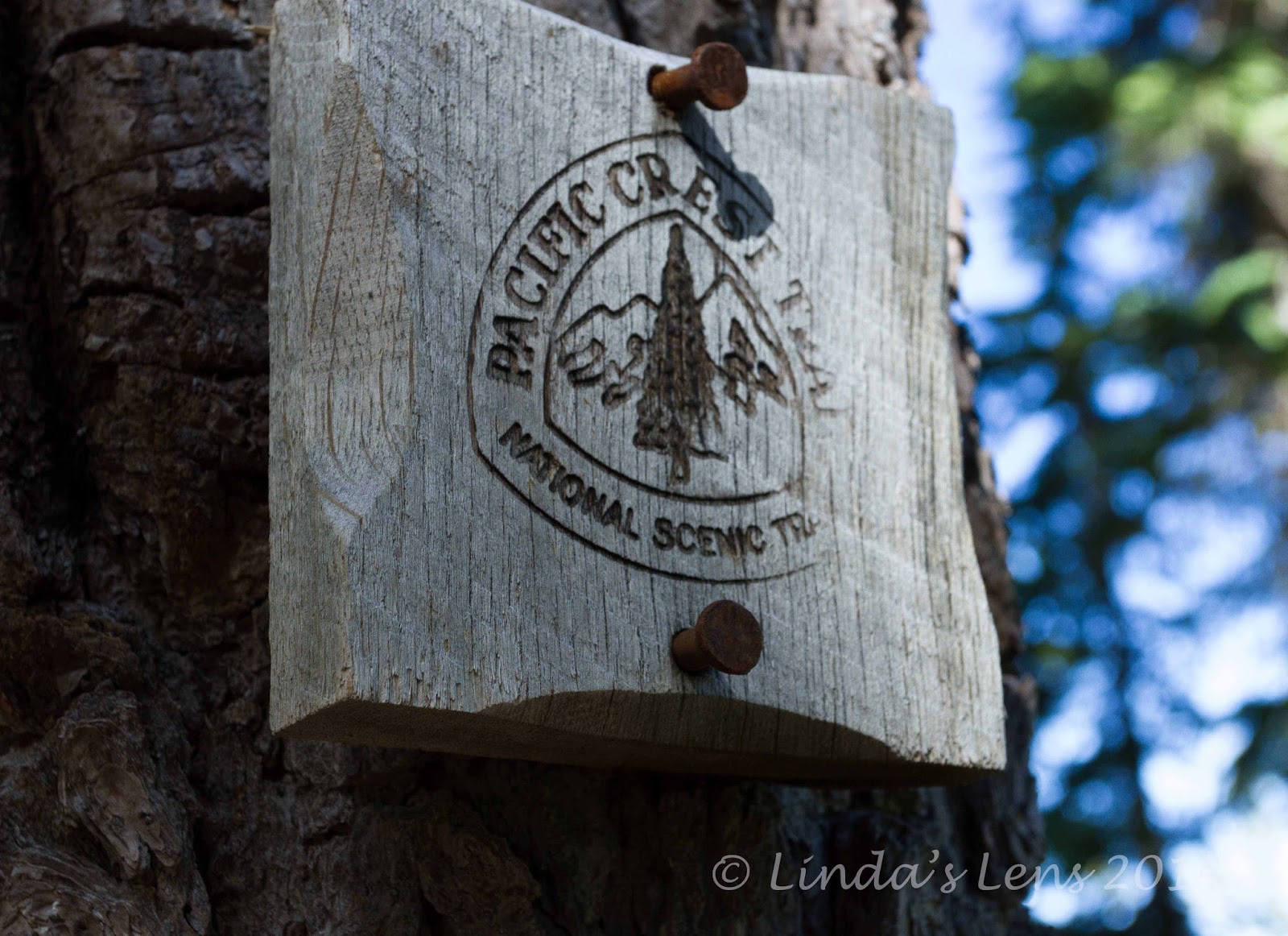

I explored another stretch of the PCT

A couple of friends told me that the meadows at Sunshine were the best of them all.  One, who'd used this route to climb Middle Sister many times, told of a lovely side trail following Glacier Creek through the meadow, that was supposed to be absolutely gorgeous.  All day I'd been looking forward to seeing this special place.


Gorgeous meadow at Sunshine

But.....when I finally reached Sunshine, the recommended side trail had been closed for restoration.  The meadow was still a brilliant shade of green, and I had some great views of Middle Sister.  However, I could tell that the time to visit was when the wildflowers were in bloom.  Again, I made a mental note to try for a mid-July permit next year.


Back through the lava

Near Sunshine, my final trail junction awaited.  Leaving the PCT, I turned down the Glacier Creek Trail for 0.7 miles.  Following a lovely, crystal-clear brook, this path took me back to the beginning of the loop.


Parting view of the Sisters

Then it was a long trek, retracing this morning's steps, back through the lava field.  Now well into afternoon, the sun's heat reflected off the dark rocks.  Hot and tired, the thought of a cool drink and salty potato chips waiting in my car kept me going.

Once past the lava field, diving into the dense woods brought cool relief.  But after seeing such wonderful sights, 3 1/2 miles through dull, endless forest seemed to take forever.  My feet began to hurt.  The parking lot couldn't come fast enough!


Trail winds through the lava field

But all good hikes eventually come to an end, and so did this one.  After taking of my boots and enjoying some hard-earned goodies I'd stashed in my car, it was time to head over McKenzie Pass bound for my brother's house in Bend.  More weekend fun awaited - which I'll tell you about in my next couple posts! 

Stats for the day:  12 miles, 1800' elevation gain
