Thursday, July 12, 2012

Circles

Another week of the 52 Photos Project.  This time our assignment (should we choose to accept it) is incorporating circles in our images.


This was a hard one for me.  And it shouldn't be considering my engineering mind (or maybe it should - engineers are not known for their creativity!)  But a house across the street had the most lovely flowers - all with nice round centers.  Ahhh!  There's my photo!

To check out more "circle" pics click on the link right here.

Thanks to all the great people who've stopped by and left comments.  You rock!


Monday, July 9, 2012

Grassy Knoll

You just can't trust the weatherman.

Planning ahead for last weekend's hike, I consulted the local forecast.  Saturday was typical Oregon cloudy and rainy, but sunny skies were predicted for Sunday.  My destination - Grassy Knoll, a flower-filled trek near Carson, WA.  I'd visited this trail twice before, and knew it offered some great views.   Naturally, I chose Sunday for my hiking day.


Size matters!  Click on any photo to enjoy a larger version.


At the foggy trailhead


I recruited my skiing friends John and Young to join me (they're now also my hiking friends!)  As we drove the long, winding, endless gravel road to the trailhead, the sky started looking cloudier.  Then we were engulfed in a thick bank of fog.  Mist dotted the windshield.  Where was that sunny day we were promised?


Nice lupine right at the trailhead sign


Foggy, wet skies greeted my party at the trailhead.  We all donned gaiters, rain jackets, and slung plastic trash bags over our packs.  Ugh - it's late June!  I thought we were done with waterproofing ourselves.  Apparently not.


Foggy woods

The hike begins climbing almost immediately from the trailhead.  It winds through a dense forest of huge Douglas firs.  Fog clung to the woods in a misty white cloud.  Although I was still feeling disappointment about missing the great views this hike showcases, I had to admit the fog made for some cool photos.


John discovered a bird's nest

About a mile in, we began seeing the wildflowers.  First there was "paintbrush alley," a spot in the trail lined with glowing orange Indian paintbrush blooms.  Then a rock outcrop, brimming with bright pink penstemon.  Finally, the side of Grassy Knoll itself anointed in a kaleidoscope of wildflowers.


Wildflower meadows on the side of Grassy Knoll

As we hiked the steep trail up the side of Grassy Knoll, John was surprised by a bird bursting from the flower fields, practically next to his foot.  Peering under the vegetation, he spotted a small nest with four tiny speckled eggs.  Young and I crouched down for a look.  Careful not to touch the nest, Young snapped a couple of quick shots for documentation.

 
Lunch with a nice view

We arrived at the top of Grassy Knoll to find it enshrouded in a thick fog.  There were a few small scattered flowers, but without the views there was no reason to linger.  Time to move on.  Nothing to see here.


The larkspur were abundant!

 
Beyond Grassy Knoll, the trail continues a mile to Grassy Pass.  From previous hikes, I remembered the flowers at Grassy Pass being even more spectacular than at Grassy Knoll.  I suggested to John and Young we continue farther and check things out.


The trail leads right through a flower patch

And boy am I glad we did!  The best was yet to come.  The trail continued through open areas where the wildflowers raged.  There were fields of purple larkspur, interwoven with yellow and white flowers (which I couldn't identify). 


Taking time to smell the flowers

When lunchtime rolled around we all sat down in a small open area amidst a sea of yellow and purple.  Lunch spots don't come much better!


Now we're in a huge balsamroot patch

Post lunch my party continued its journey, first through a huge field of balsamroot.


The largest amount of paintbrush I've seen in one place - ever!

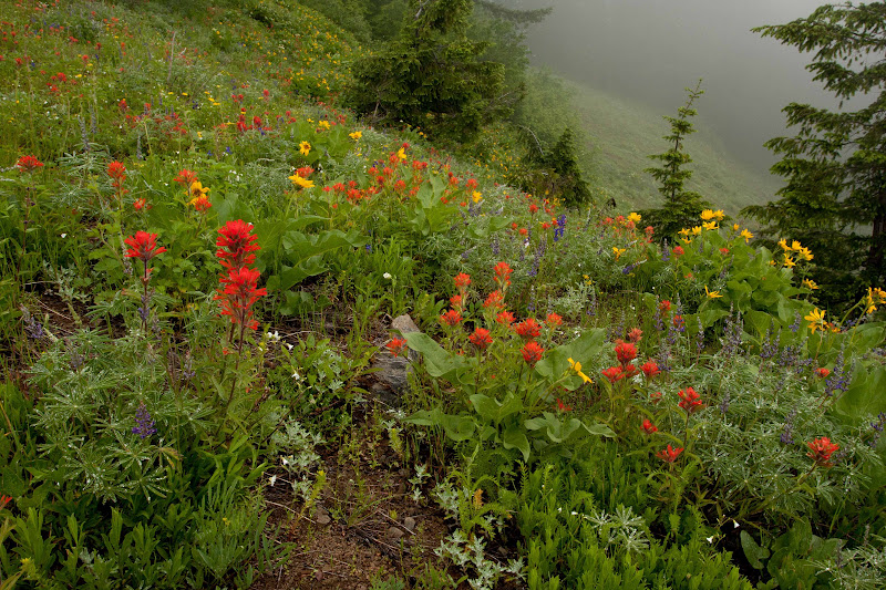
Then encountering the largest field of Indian paintbrush I've ever seen.  The hillsides were dotted with orange spots as far as the eye could see.  It was breathtaking!


Vivid orange paintbrush

And the foggy weather actually made for good photographic conditions.  No shadows and super saturated colors.  I got some wonderful shots.


We crossed the Pacific Crest Trail

After trekking through all those amazing meadows, the trail again re-entered the forest.  My maps showed Big Huckleberry Mountain an additional 2 miles away.  Still thinking we had plenty of time, the group consensus was to push on.


Reaching the summit of Big Huckleberry Mtn

After all those beautiful flower fields, the forest path seemed downright boring.  We trudged along through endless woods.  It was the longest two miles I've ever traveled.  But we finally intersected with the Pacific Crest Trail.  From the PCT it was only a steep 0.2 mile climb to the top of Big Huckleberry Mountain.  We celebrated our arrival on the summit by taking a few group victory photos.


The skies began clearing on our return trip

We didn't linger long on top.  Big Huckleberry's summit was windy, and besides it was getting late, and the brewpub was calling.  The promise of a cold beer was good motivation to get us back through the boring 2-mile stretch of forest.


Path to the top of Grassy Knoll

As we re-entered the grassy flower fields, I noticed the skies clearing.  Adjacent hillsides earlier cloaked in fog were now visible.  Maybe I'd get some views today after all.


Old fire lookout foundations

Approaching Grassy Knoll's summit a second time, visibility was much improved.  Not only the slopes of Grassy Knoll, but also adjacent hillsides could be seen.  And breaks in the clouds offered occasional glimpses of the Columbia River.  This time I actually stopped and spent a couple of minutes photographing at the top of the knoll.


Finally some views!

Returning back through the rocky outcrops, the skies cleared enough to provide a reason to stop and gaze towards the horizon.  Although the clouds wouldn't lift high enough to show Mt. Hood and Mt. Adams, I was still happy that at least we could now see something.

Arriving back at our vehicles, all declared the hike a success.  Although we missed the famous views, the prolific wildflowers more than made up for it.  The fog was fun to photograph and created vibrant colors for our images.  And the cool, wet weather made for comfortable hiking conditions.

Ironically, driving home through the Gorge later that evening, I was almost back to town when the sun finally decided to make an appearance.  (No, you really can't trust that weatherman!)



Friday, July 6, 2012

A Different Pathway

It's week 11 of the 52 Photos Project.  This week's prompt is "A Different Pathway."

There's comfort to be found in following the familiar path.  But what happens when we deviate from the norm?  New discoveries await!


In my quest to hike all 100 hikes in William Sullivan's "100 Hikes in Northwest Oregon" book I've trod on many different paths.  It's been a wonderful goal - there's a thrill to finding a yet another new special place.

Last Sunday, I took a hike in the foggy woods near Carson, Washington.  This trail led me to a grassy knoll, and a huge meadow brimming with wildflowers.  I'll post a full report once I've sorted and edited all my photos.  Stay tuned!

In the meantime.......go out and find your different path.  For inspiration, check out more photos from all the creative people who posted here.


Wednesday, July 4, 2012

Fish Creek Mountain

Welcome to another edition of "New Hike Fridays."  Today's hike takes us to a little-known trail near the Clackamas River, deep in the heart of Mt. Hood National Forest.


Size matters!  Click on any photo to enjoy a larger version.


Attention-getting first photo (did it work?)

Flex Friday off work rolled around again.  Time to pick another untrodden trail from my Sullivan "100 Hikes" book.  Fish Creek Mountain was this week's winner.  The road to the trailhead was washed out back in 1996, so this hike had never made it on my radar.   Inaccessible for many years, I discovered the trailhead had been reopened after seeing a couple trip reports on the Portland Hikers website.  Apparently the Forest Service had created a new access from a different road.  That was good enough for me.  Time to check it out!


The trailhead was marked by this tiny sign

I was nervous about finding the trailhead, as it was down a long, winding, isolated Forest Service road.  Armed with maps and detailed instructions from the Trail Advocates website, I bravely struck out that morning.  Turned out the road was a snap to find, and even better, it was paved most of the way.  Bonus!

The trailhead, however, wasn't as obvious.  If I hadn't wandered into the bushes for a "nature break," I don't think I would've seen the small, brown message board uphill from the parking area.  This was the beginning of the new connector trail built to lead hikers to the old trailhead.


The columbine was going strong

This crude trail switchbacked up a ridge.  It was overgrown in places, and not very easy to follow.  I twice lost the path and had to backtrack.  Not even my gps was helpful.  But just as I was starting to wonder if I was on the right track, the trail popped out onto an old abandoned road.  Some nice person had left a rock cairn and flagging to mark this junction.  A good confidence booster, these markings confirmed I wasn't lost.


So were the rhodies!

My directions were to follow this long-abandoned road for a third of a mile to reach the original trailhead.  The road was totally overgrown and in a few places nearly impassible.  But there was a couple of nice patches of columbine flowers and another spot full of small purple flowers that made the journey enjoyable.


Original trailhead sign - I was very glad to see this!

I walked on, looking for a fork in the road with a ridge rising between the junction.  According to my directions, this was supposedly the start of the old trail.  After traveling a distance that felt longer than a third of a mile I came upon the said intersection.  There was a well-worn gash in the ridge between the roads - was this the trail?  Only one way to find out.  I ascended the ramp and once on top saw, much to my relief, a sign for "Trail 541" affixed to a nearby tree.  I'd found the old trailhead!


Larkspur everywhere

The top of this ridge was a lovely place. Large pink rhododendron blossoms sprouted from a nearby bush.  Purple penstemon flowers covered the ground.  And bright orange Indian paintbrush added accents to the forest floor.  Happy to finally arrive at the "official" trailhead, I celebrated by capturing images of these magically beautiful woods.


Forest views

From this point on, the trail was easy to follow.  But it began a relentless climb up a ridge.  I trudged on, panting and puffing under my backpack's load.  Not remembering so much elevation gain in the hike description, I looked it up later and discovered the trail climbed 1300 feet in a little less than two miles.  No wonder I was sucking air!


My doggie is havin' a ball

Bear and I came upon a clearing that offered nice views down to the forested valley below.  The adjacent slope was chock-full of wildflowers.  There were purple larkspur, and a yellow flower I didn't know the name of.  A wonderful sight!  Time for more Kodak moments.


Almost to the summit.  Yippee!

I kept looking for the next trail junction.  This junction gave visitors the choice between a 0.4 mile trek to the top of  Fish Creek Mountain, or 0.7 mile descent down to High Lake.  I traveled along, debating whether to head for the summit first, or check out the lake.  Finally coming upon this sign, the summit called louder, so that's where I headed.


Summit shot with Bear

I'm always happy to reach the top of a mountain, no matter the size.  Fish Creek Mountain was no exception.  Bear and I checked out the remains of an old fire lookout tower, long gone.  All that was left were four concrete piers, some melted glass, and an old rusted bucket.  The cloudy skies obscured any view of Mt. Hood, but I was able to spot Olallie Butte and a few glimpses of Mt. Jefferson.


The trail to High Lake was obliterated by snow

After taking in some lunch, it was time to head back down to High Lake.  Bear and I turned at the junction, this time choosing the trail to the lake.  I love tiny alpine lakes that are tucked into remote corners of the forest, and was looking forward to discovering this one.


Gorgeous trailside rhodies

The path crossed a small patch of snow.  Not a big deal.  Then we encountered a longer patch.  Still okay, I could see the trail continuation on the other side.  But then I hit a a huge snowbank that totally obliterated the trail.  Hmmm........


Caterpillar on a flower

I pulled out my gps.  Could I navigate my way to the lake?  Looking around, the forest floor was covered with snow as far as the eye could see.  Even if I could find my way, did I really want to deal with hiking through snow?  I love skiing in the snow, but hiking in it, not so much.


Rhodie close-up

So I turned around and picked my way back through the snow, following my footprints to the trail.  High Lake would have to wait until another day.


Another columbine photo - just because!

My return trip was even better.  Not only did I get to see (and of course photograph) all those lovely flowers and forest scenes again, but my path was all downhill!  I arrived at my car with a full memory card and a tired dog.  And I got back late enough to avoid most of the rush hour traffic on the way home.

That concludes this week's episode of "New Hike Fridays."  Another hike closer to finishing the book.  Join me again next time!


Thursday, June 28, 2012

Back to the Coast

I've caught the bug.  My last trip to the Oregon coast was so wonderful, I just had to return.  Even though the weekend forecast was less than stellar (50% chance of rain) I decided to go anyway.  That's what raingear is for.


Size matters!  Click on any photo to enjoy a larger version.


The beach at Hug Point

My original plan was to hike from Short Sand Beach to Neahkahnie Mountain and back.  But I got a late start, so the itinerary was downsized to merely trekking up the top of the bluff overlooking the beach.  Then I passed by a sign for Hug Point Wayside.  With a name like that, it was just too tempting to pass up.


The high tide line is very apparent

What a cute little beach!  The shoreline was framed by rocky headlands on both sides, with Hug Point to the north.  Hug Point got its name from the early days when people used the beach as a road to travel from town to town.  At high tide, the waves came right up to the edge of the rocks, thus one had to "hug" the cliffs to get around this point.


Bear running from the waves

Bear was so happy to be outside!  He ran and ran, up and down the beach, ears flapping and tongue hanging out in a big doggy grin.


Bear is lovin' the beach

The beach was another wonderful scenic spot.  I, of course, got busy with my camera.  Bear usually steers clear when I'm shooting photos, but for some reason today he managed to get himself into almost every frame.  And this was one of the times I really didn't want a dog in the middle of my images.


Creek outlet to the sea

I got super lucky with the weather.  Although the skies were cloudy, the rain stayed away.


Small colorful beach flowers

Cloudy skies aren't all bad.  They make for some really nice flower shots - saturated colors and no shadows.


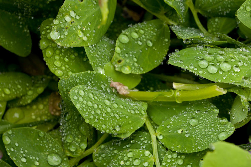
Raindrops bead on the leaves

And the raindrops beading up on the bright green leaves sparkled like diamonds.


Hug Point sea cave

What a picturesque little spot!  I'm coming back here again on a nice sunny day.  Or maybe at sunset.  Or maybe both.


Unusual plant

After killing an hour or so at Hug Point, I loaded Bear back in my car and drove to the huge parking area for Oswald West State Park.  The beach here, Short Sand Beach, is very popular with surfers.  They pretty much dominated most of the vehicles in the parking lot.  I joined the parade of surfers, boards and wetsuits in tow, on the path to the water.


Short Sand Beach

The cool, cloudy weather didn't look very inviting for surfing.  But in Oregon I guess if you wait for a sunny day, you'd never get in the water.  Besides, that's what wetsuits are for.

 
Wave action art

This was another lovely, rocky shoreline.  The wave action running back and forth over small rocks made very cool patterns in the sand.  Kinda artsy isn't it?


Foxglove blooms near the beach

To reach this beach, I walked through an amazing old growth coastal forest, full of gigantic trees.  Where the forest met the sand, low bushes and flowers grew.  There was a huge patch of lovely pink foxglove blossoms that brightend up this woodsy boundary.

 
Where the forest and beach meet - a flower garden

Again, I had a blast capturing all the nice scenery on my memory card.  Bear managed to stay out of the way this time.


Lichen covered rocks

It's so easy to waste a lot of time walking the beach, snapping occasional images.  After an hour of this, I realized if I was going to have time for a hike, I needed to hit the trail.  Wandering the confusing maze of paths through the thick vegetation, I found a sign for the Oregon Coast Trail.


Walk-though tree

I don't know what it is about the trails on the coast, but so far every one of them I've hiked has been super muddy!  This path was no exception.  It didn't take long before the trail turned to muck and I was again wallowing though a soupy mess.


Humungeous trees

I walked for a mile or so, hoping to find the two side paths that were supposed to lead to viewpoints on top of the bluff.  But I found nothing - only dense forest, and lots of it. 
But all was not lost. I saw a bunch of neat old, huge trees. One was so large, they cut a hole through the middle, and the trail went right through it.


Cool suspension bridge

And Bear and I got to walk across this really cool suspension bridge that led us back to the parking lot. 

Although we didn't travel very far, it was fun to hang out on the beach.  There was wide open spaces for Bear to run, and lots of amazing scenes for me to photograph.  And, best of all, the rain held off until I was safely back in the car heading home.