In late October I did a doggy-sitting stint for my daughter, who lives in Central Oregon. Because my grandpuppies aren't hiking dogs and love nothing more than to laze around home, it freed me up to explore the nearby trails. The Central Oregon area has some amazing places to hike - I was giddy just thinking about the possibilities!
 |
| Black Butte rises prominently above the Central Oregon skyline |
One trail that ranked high on my list was the trek up nearby Black Butte. An extinct stratovolcano, it's prominent symmetrical cone is easily distinguishable among the mountain parade of the Central Oregon skyline. It was also the inspiration for Deschutes Brewery's famous Black Butte Porter (one of my favorite beers) with the peak's silhouette featured on the label. I'd passed by Black Butte countless times in my travels to and from Central Oregon.
 |
| Nice trailhead sign |
 |
| The lower portion of the trail was in dense woods |
 |
| Fall color ferns |
It was a sunny morning when I pulled into the parking area of the lower trailhead. I didn't get a particularly early start, so it was a stroke of luck that I was able to claim the remaining parking spot. After donning boots and grabbing backpack and camera, I admired the sturdy wooden trailhead sign before setting off through a thick ponderosa pine forest.
 |
| Sunburst behind an unusual tree |
After wandering through the woods for a half mile or so, the trail began to climb steeply. I began to sweat, puff and pant. Thank goodness for the shady forest, or I'd have been one hot mess!
My gps read one mile, then two. By my reckoning, I should've arrived at the upper trailhead by now. But when I consulted the electronic map on my gps display, it still showed I had a ways to go. Oh well, it was a nice (if slightly warm) day and my foot was doing well, so I decided to keep going. Although the surrounding woods were nice, for the most part the trail was unremarkable. There was an area with huge unusual trees and another spot where the trees were covered in bright green lichen. Otherwise, the trail was just a hot uphill trudge.
 |
| In one area the trees were covered with lichen |
 |
| Forest views on the way down |
What to do? If I continued to the summit, it would mean a 10-mile round-trip hike, with over 3000 feet of elevation gain. My plantar-fasciitis riddled foot, which had finally healed enough to enable short-ish hikes (5 miles or less), couldn't handle that yet. But my foot wasn't hurting, and I really wanted to summit Black Butte. I decided to travel a little bit further and see how things went.
 |
| White faced woodpecker |
From the upper trailhead the grade got steeper. I trudged slowly upward, sweating in the midday heat. It was well past 1 pm, and my body wanted lunch. After climbing about 3/4 of a mile, I came to my senses. What was I doing? Even if I reached the summit, it would be a tough downhill climb all the way back to the lower trailhead. Walking downhill seemed to aggravate my foot the most. It wouldn't be worth it to undo the months of healing now. I needed to turn around. Black Butte's summit would have to wait for another day.
 |
| Beautiful colored ferns |
But first I sat on a nearby log and enjoyed a proper lunch. The least I could do was fuel myself for the downhill slog. And slog it was. As predicted, soon after starting the descent, my foot began to throb. The forest that had initially been in shade now was partially in sun, and that made a huge difference in temperature. As I plodded along, sweating and limping, time seemed to stand still. It took forever to reach the lower trailhead. When I finally did, my foot was definitely not happy!
 |
| Smoky mountains to the south |
But an evening of ice, rest, and ibuprofen seemed to calm things down and I was able to hike again the next day. As the week went on, I kept thinking of my failed summit attempt. I wanted a second chance. So three days later, I decided to try again - only this time I'd start at the upper trailhead.
 |
| Walking through an open area |
It wasn't a lot of fun bouncing along in my car over the washboard gravel road, and when I reached the rocky final mile, the road looked so rough I almost turned around. But driving slowly I persevered, and finally the upper trailhead came into view. I had to laugh - all the cars parked there were Subarus, including mine!
 |
| Aftermath of 2009 wildfire |
Starting up the trail again, the first bit was familiar territory. A quarter mile later, I encountered a white-headed woodpecker. Not only did the bird stay put, it posed nicely on a low branch, so close I was able to capture some great images with my 24-105mm lens. Such an amazing wildlife sighting, I took it as a good omen.
 |
| A fairly clear view of Mt. Jefferson |
After passing my lunch log from the previous hike, the forest thinned out and I emerged into an open area. The views were quite nice - I could see the surrounding Cascade peaks - Three Fingered Jack, the Three Sisters, Broken Top. I could see the golf course from nearby Black Butte Ranch. And far up on the summit I could just barely make out the fire lookout tower.
 |
| Mt Jefferson and fire lookout |
But my views to the south and east were partially obscured by hazy skies. The entire month of October had been unusually warm and dry, and wildfires were still raging south of here. And unfortunately today the wind was blowing all the smoke towards Black Butte.
 |
| Shuttered lookout tower |
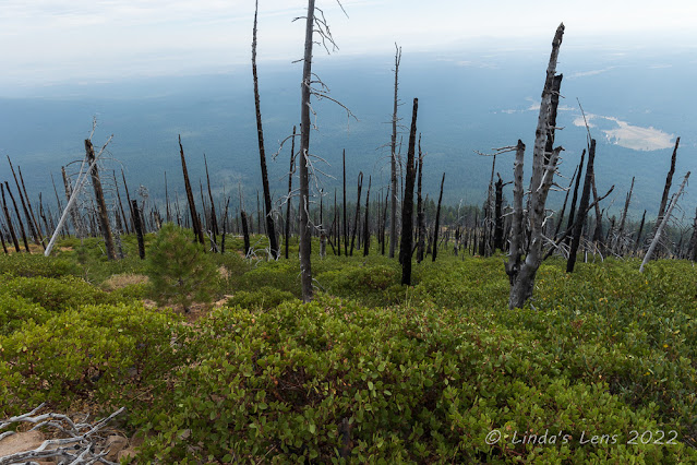
Smoke or no smoke, I was still intent on reaching the summit this time. I continued my climb, past an area of blackened tree trunks. A nearby sign informed visitors that a 2009 wildfire was to blame.
 |
| Finally almost there! |
The only good thing about wildfires, they open up the terrain for views. The upper portion of Black Butte was totally devoid of tall trees, it's slopes instead covered with thick bushes. I could see for quite a ways, but the smoke blocked what I assumed was an even better view. Coming around the mountain, I had a great front-row sighting of nearby Mt. Jefferson. And it was the only mountain still in clear sky - the others were partially obscured by smoke.
 |
| Cupola lookout at the summit |
The tall fire lookout tower rose prominently from the butte's very top. It looked shuttered up for the season, which surprised me since there were still wildfires burning.
 |
| Very nice viewing platform |
Finally I made it to the very top! Yeah! A sign pointed visitors away from the main fire tower and towards a viewpoint and "cupola lookout." I'd read in the hiking book that people are not supposed to venture to the main fire tower, so I dutifully followed this sign.
 |
| This platform had placards for all the nearby mountains |
The trail led to a cute wooden building. It looked like the top of a fire tower, but instead of being on a tall structure, it was sitting on the ground. This was the "cupola lookout." After my hike, I tried to find information online as to it's history but all I learned is that this building appeared to be an earlier lookout facility. A nearby building used for sleeping and cooking fell into disrepair and was burned down by the Forest Service in 2016. I thought this little cupola was charming, and made sure to photograph it thoroughly.
 |
| View of both lookouts |
On to the viewpoint - and boy was it a nice one! The Forest Service had built a large wooden deck in a prominent location, enabling visitors to view all the nearby Cascade peaks. Railings enclosed the deck on three sides. Along the railing were small plaques lined up with the view of each mountain peak. On a clear day, Mt. Hood, Jefferson, Three Fingered Jack, Washington, Belknap Crater, North Sister, South Sister and Broken Top were visible. I was able to see all the mountains, but some of them, shrouded in smoke, were not so clear.
 |
| Still very smoky to the north |
Taking a break on the wooden benches on the deck, I enjoyed a quick snack and soaked in the vistas. I'd finally made it up here, and the journey had been worth it!
 |
| Three Fingered Jack Mountain |
After chatting with a nice lady and her two dogs, I packed up and retraced my steps back down Black Butte. My return trip was uneventful. I did notice the smoke clearing to the west, enabling some clearer views of Three Fingered Jack mountain.
 |
| A bright patch of color |
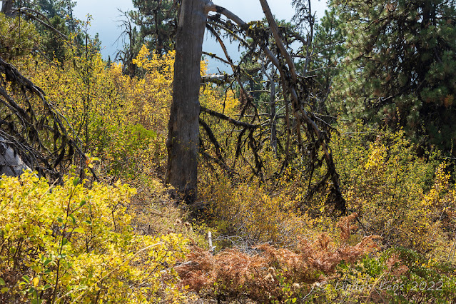
Although most of the fall colors here were past peak, I did pass by one area still showing off a nice bit of yellow leaf color. And there were still a few aspen leaves clinging to the trees in a nearby grove.
 |
| Last of the aspen leaves |
After not seeing many people all morning, on my descent I met quite a few people climbing up. Back at the trailhead the parking area was now full (and this time most of the cars weren't Subarus.) I survived the drive down the nasty gravel road and in no time was back at my daughter's house.
 |
| Phenomenal sunset that evening |
My daughter has an incredible view of all the Cascade peaks from her back deck. She often sees some great sunrises and sunsets from here. That evening I witnessed a phenomenal sunset over the mountains. Watching the light drain from the sky, I looked over at the silhouette of Black Butte on the horizon and thought to myself "I've been on top of there!"
Despite my initial trail confusion mistake, I didn't give up - and now I've earned bragging rights for summiting another Cascade peak!

...life at the top of the world.
ReplyDeleteI've snowshoed there but never hiked. Glad your foot is getting better. PF is awful!
ReplyDeleteNice going, too bad there was so much smoke, but nothing to be done about that! Another peak conquered!
ReplyDeleteWell done you and what a magnificent sunset reward!
ReplyDeleteI've never even heard of a White-headed Woodpecker!
ReplyDeleteThe first and last photo...those are my favourites!
ReplyDeleteCongratulations! Your perseverance paid off and your views prove it! What an awesome feeling of accomplishment you must have experienced when you reached the summit!
ReplyDeleteFantastic post! Great views although it is sad about the fires. Love the white faced woodpecker. Be careful with that foot!
ReplyDeleteJust spent a happy couple of hours catching up on the last 6 months of your posts! Some fantastic trips and hikes in there and enjoyed reading all of them. I feel for you with the dreaded PF - I've suffered from it a couple of times and its really painful. I wore one of those boot things in bed to keep your foot/ankle at 90 degrees and it worked for me. All the best. Andy
ReplyDelete