Saturday, May 15, 2021

Totally Tulips

Okay, the tulip bloom was actually a month ago, but you know me, always behind the times!  So you're getting an April tulip post in mid-May.  (Better late than never, am I right?)


Ominous rain clouds hang over the tulip fields


Located near the town of Woodburn, Oregon, a visit to the Wooden Shoe Tulip Farm is a favorite spring tradition for area photographers.  In March and April, the farm opens their fields to the public.  With 40 acres of tulip fields, it's quite a sight to witness thousands of colorful tulips in bloom.  Closed in 2020 due to COVID, I sorely missed my annual tulip trip.  It was especially wonderful to have the festival open again this year.


Rows of yellow sunshine


Wanting flexibility in visitation, I bought an all-access "photographer pass" for 2021.  Along with  unrestricted access to the fields, this pass also provided early and late sunrise/sunset privileges.


Sunrise at the tulip farm

I used my pass for the first time in late March, when my neighbor and photography mentor Cheri suggested we run out one afternoon to check on the tulip status.  There weren't many fields in bloom yet, but we did capture some ominous rain clouds hanging over the farm (and got drenched a short time later!)


Surprise hot air balloon launch!

A couple of weeks later, I decided to get up early and catch sunrise at the tulip farm.  I thought a Tuesday morning wouldn't be very busy, so I was surprised to find a couple dozen photographers out in the fields, their tripods lining the rows.


Drifting over the tulips

The only glitch for sunrise was one of the neighboring farmers who decided to start up a burn pile right before daybreak.  The smoke traveled upward in exactly the place that the sun was supposed to rise.  Ugh!  Good thing I have photoshop....


Another colorful balloon

I was so concentrated on capturing sunrise, I didn't see two hot air balloons inflating on the far side of the fields.  A nice man with his tripod set up next to mine pointed the balloons out, otherwise I would've totally missed them.


My favorite shot of the balloons


I enjoyed photographing the colorful balloons almost more than the tulips!  And I edited many more balloon than tulip images from that morning.


Yellow tulip bedazzled with dewdrops

After the sun rose and the balloons drifted away, most of the photographers left.  I however stuck around capturing some of the tulips in detail.  Such as the dewdrops on this lovely yellow variety.


Deep red beauties

A local news crew happened to be there that morning, and I had fun watching them do a few live broadcasts for the morning news.  I even chatted with the very friendly cameraman between takes.


Loved the soft pink and mauve combination

My third trip to the tulip festival came a couple of weeks later.  I suggested to Cheri we capture sunset one evening and she was all for it.


Cheri doing what she does best

Arriving at the tulip farm, we were amazed to discover another huge field in a totally different location.  In my two prior visits, I hadn't noticed this field.  It was enormous, and full of thousands of tulips of every color you could imagine.


Another favorite color

Cheri and I got right to work, capturing each tulip color, row by row.  We had a couple of tulips that were our favorites.  We both liked the pink and mauve color combination.  And I loved the yellow tulips with a tiny splash of red in the middle.


Endless fields of flowers

But my favorite field of all was the one with the multicolored tulips.  It was a gigantic kaleidoscope! We decided to set up at the edge of this field and capture sunset over the sea of different colors.


Mt Hood sighting

But first a quick capture of Mt Hood towering behind a wave of red tulips.


Wonderful light at sunset

As the sun began to drop we caught some wonderful light glowing across the field, backlighting the flowers nicely.


Colorful sky just after sunset

Sadly the sunset wasn't very spectacular.  However, right after the sun finally dropped, the sky glowed with a lovely pink hue.  I actually liked the images I captured after sunset better than the sunset itself.  

The tulip fields are now done for another season.  But posting these images and writing about my photographic experiences have brought the happy memories back for me.  I hope they bring some joy to your day too.


Saturday, May 8, 2021

The Labyrinth

Labyrinth......this word evokes feelings of mystery and intrigue.  It conjures up images of secret passageways winding through a maze.  Does it get your attention?  It did mine!

So when I discovered a trail in the Gorge called the Labyrinth, well I just had to go hike it!


Follow the road to the labyrinth

Located on the Washington side of the Columbia River Gorge, between Coyote Wall and Catherine Creek, the Labyrinth provides a connection between the trail networks for both areas.  Although I've hiked both places multiple times, this middle Labyrinth trail had never come up on my radar.  


Surprise waterfall (with rainbow!)


Doing a bit of online research I discovered a plethora of trails connecting Coyote Wall, Catherine Creek and the Labyrinth.  I could do a loop from the Labyrinth east to Catherine Creek.  Or I could do a loop to the west and pick up some of the Coyote Wall trails.  Which direction should I go?  So many choices!  


Enter the labyrinth.....

I ended up at the Labyrinth Trailhead one sunny Friday morning in March, still undecided on which direction to go.  As with many of my treks, I'd chosen to wing it and make my decisions along the way.  After parking in a gravel pull-out right off Highway 14, I shouldered my backpack and headed down an abandoned gravel road.  This road, formerly the old highway, headed straight west and would eventually connect near the Coyote Wall trailhead.


Mt Hood and Columbia River

But I'd only follow this road for a mere half mile before coming to the official Labyrinth trailhead.  Despite it's short distance, the road walk packed a lot of beauty.  I enjoyed early morning views of the calm Columbia River and Mt Hood poking it's snowy peak above the hills on the Oregon side.  I also passed by a lovely tall waterfall roaring down an adjacent basalt cliff, complete with a surprise rainbow!


Grass widows!

The official Labyrinth trailhead looked intriguing from the start.  The path zig-zagged uphill past a few scraggly oak trees before winding behind a large basalt outcropping.  What was beyond there?  I was about to find out.


Another lovely cascade hidden within basalt walls

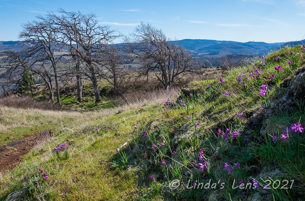
A stiff climb from the start, I puffed uphill past the first basalt palisade.  To my delight I discovered a few purple grass widows blooming beside the trail.  The higher I hiked the more of these flowers I spotted.  Some photography may or may not have happened.  (Trailside wildflowers always tend to slow me down!)


Color spot beneath gnarly tree branches

I passed by another beautiful waterfall, hidden deep in a basalt-walled canyon.  I couldn't get close enough to get a decent photo, so had to rely on the pathetic zoom of my 18-55 lens.  Still it was a wonderful surprise for this trail with the mysterious name.


Columbia River water patterns


I switchbacked through another meadow lined with a grove of gnarled oak trees.  More palisades of columnar basalt towered overhead.  I meandered through these rocky columns and came out on a plateau with river views.  Hundreds of grass widows were blooming in the shade of an old oak tree.  Such a lovely place, I lingered to take it in (and take some pictures too!)


Yellow spots of desert parsley

Then I continued climbing.  I passed a junction with the Desert Parsley Trail, but decided to keep going.  From my crude map printed off the internet, I knew the Labyrinth Trail eventually intersected with Atwood Road, an abandoned road that now served as a connector between Catherine Creek and Coyote Wall.


Grass widows were everywhere!


Wildflowers were still thick, even at higher elevations.  Grass widows were everywhere, their lovely purple petals providing color to the hillsides.  Desert Parsley, the other predominant plant in bloom, also lit up many slopes with bright patches of yellow.


More Mt Hood views


Temperatures were beginning to rise and I sweated as I climbed up the winding Labyrinth trail.  Although it was only two miles from the trailhead to the Atwood Road intersection, it seemed much longer.  Finally glimpsing the trail sign, I was a very happy hiker.


Lone oak tree above the river


Decision time - which direction should I go?  East towards Catherine Creek or west towards Coyote Wall?  Last year I'd hiked up Catherine Creek's most westerly trail to it's intersection with Atwood Road.  Wanting to see what was in between last year's stopping point and my current location, I opted to head east.


I finally reach Atwood Road!


Now on top of a ridge, my trail flattened out considerably and rolled along, dipping down through the woods into a drainage before emerging to a stunning Gorge viewpoint.  It would've made a great lunch spot, but a group of ladies had already claimed it.  So on I trekked, hoping to find an awesome vantage of my own.


Fantastic lunch spot

After seeing few hikers on the Labyrinth, I ran into several large groups along Atwood Road.  Every flat spot with views seemed to be claimed by people taking lunch breaks.  Hungry, and now past noon, I kept on towards the Catherine Creek trail junction, hoping to find someplace to take a break.  Reaching the Catherine Creek junction, I decided not to continue any farther east and instead retrace my steps back along Atwood Road.  Lucky for me, I remembered the locations for most of the fantastic lunch viewpoints, and on my return trip came across one that was now unoccupied.  Aaahh...finally!  Lunch, rest, and a fabulous view was just what I needed!


Flower power


Returning back to the Labyrinth- Atwood junction once again, I really wanted to make this more of a loop hike.  So I decided to continue westward, in hopes of using one of the Coyote Wall trails to make a wide circle of the area.


Selfie spot


My plan seemed to be working.  I came upon another junction, this one with the "Old Ranch Road."  Remembering this road from my Coyote Wall hikes, I knew it would get me downhill and back towards the Labyrinth.  But the Coyote Wall trail system is popular with mountain bikers, and I began to encounter several people on bikes.  All of the bikers I met were extremely courteous, and for my part, I made sure to step aside for them - especially when they were coming downhill (self preservation y'know!)  But it was another hazard to be aware of that kept me on edge.


Hundreds of grass widows!


Nearing the junction with the Little Maui Trail (that would eventually lead me back to the Labyrinth) I passed by an open slope absolutely covered with grass widows.  Oh my goodness, there must have been hundreds, if not thousands, of these little purple blooms!  Backlit by the afternoon sun, it was a stunning sight.  


Purple spots everywhere


My final path on this huge, wandering loop, the familiar Little Maui Trail, led me downhill towards the river.  I was hiking this trail in reverse of the direction I had hiked it in the past.  It was really fun and interesting to see the trail from a new angle.  I noticed a few new things, and enjoyed seeing some of the familiar - a couple of great viewpoints, a grove of oaks, and a pretty burbling waterfall sandwiched between green fields dotted with desert parsley.


I couldn't believe the huge grass widow bloom

And, still I found grass widows blooming in force!  I think I picked the right week to enjoy peak bloom.


Looking down on the labyrinth and river


The Little Maui Trail endlessly wound downhill.  Going on 8 miles now, my feet and legs were getting mighty tired and the midafternoon heat stifling.  I was ready to be done!  Where was my final junction with the Labyrinth connector?  

Finally coming upon the connector, I could see the first rocky promontory near the Labyrinth trailhead ahead.  Yeah, almost done!  I picked my way through this very rocky trail, stumbling a bit due to tired legs.  Thankfully the connector was short, and before I knew it I'd arrived at the final junction before a short walk downhill to the road.  


Waterfall from Little Maui Trail


And then it happened.  I'm not sure if I caught my foot on a rock, or if my tired legs dragging caused it, but suddenly I found myself falling.  Seeing rocks coming towards my face, I threw my hands out to protect myself.  Then a hard impact - and pain.  Uh oh.......

I found myself on my back.  Luckily it appeared my backpack had absorbed most of the fall.  But from attempts to protect the face, my hands were scratched and bleeding.  And my left wrist really hurt.  Shakily I picked my body up, a bit embarrassed by my klutzy tumble.  I shook arms and legs - nothing appeared to be broken.  So I grabbed my poles and headed back to the car.


The end is in sight!

By the time I arrived at the trailhead, my left wrist was throbbing.  A mini mart stop for some ice and an empty sandwich bag provided an makeshift ice pack for the ride home.  The following morning a trip to urgent care confirmed nothing was broken (luckily just a bad bruise to my left wrist).

Despite the unhappy ending, it was still a wonderful day in the Gorge exploring this new trail with the mysterious name.  And it was a winner!  I'll definitely be adding the Labyrinth to next year's spring hiking lineup.   

Nearly 9 miles and 1800 feet total elevation gain for the day's impromptu loop.


***Note to my readers who follow this blog via email:  I've been notified that the "Follow by Email" widget on my blog will no longer be supported after July 2021.  I'll do some research to see if there's a replacement, but I'm not very hopeful of success.  I do have a Facebook page, so if you're on Facebook I'd suggest you follow me there (link is on the sidebar).  


Tuesday, May 4, 2021

More From Cottonwood Canyon

On my second day at Cottonwood Canyon State Park (read about day one here), I emerged from my cozy cabin into the pre-dawn chill, hoping to catch sunrise.  I walked up the Sage Knob trail to the park overlook toting my camera and tripod.  Although I enjoyed watching the day break from my lofty perch, sadly sunrise wasn't anything spectacular.  Oh well, I had another full day to explore this wonderful state park - time to move on!


More wonderful signage

Hoping that the bighorn sheep herd would return to the cliffs overlooking the Pinnacles Trailhead, I dropped my tripod at the cabin and hoofed over that direction.  On the way I passed another example of this park's beautiful and creative signage, this time at a fishing spot along the river.  


Tall cliffs along the John Day River


I retraced a bit of yesterday's hike down the Pinnacles Trail, hoping to spot some wildlife.  The only critter I saw was a lone Canadian goose sitting on the beach.  No sheep to be seen anywhere.


Rust-colored vegetation along the river


Even the cliff swallow nests high on the cliff faces were empty.  It apparently wasn't nesting season yet.


Cliff swallow nests

Coming up empty in my wildlife quest, it was now time to check out another hiking trail.  Today's trek of choice was the Lost Corral Trail.  This path headed in the same direction as the Pinnacles trail, except it was on the south side of the John Day River.  I drove across the highway bridge to access this trail via J.S. Burres trailhead.


Near the Lost Corral Trailhead

The parking area was huge.  Not only was this a hiking trailhead, it also provided parking for river rafters accessing a nearby boat ramp.  Besides fishing, rafting was also an extremely popular activity on the John Day River, especially in warmer months.  Although it seemed too early (and too cold!) to be riding the rapids, I noticed two vehicles with trailers parked in the lot.  


Interesting clouds

Grabbing my backpack, I quickly found the trailhead, marked with a tall ranch-style archway.  The trail started out on a gravelly road, through a huge field of sagebrush.  A couple of mountain bikers with their dog passed me, the only people I'd see on the trail all day.


John Day River along the Lost Corral Trail

Soon the sagebrush petered out, opening up views across the river.  I could see the ranch buildings on the opposite side.  After a bit more walking, I also spotted the cabins.  Then the path veered away from the river and took me underneath more tall basalt cliffs.


Evidence of ranch use

After walking under the cliffs for a mile or so my trail veered towards the river again for some sweeping views.  Then it plunged back into scrubby sagebrush once again.  The far point of this trail wasn't too exciting - a lot of sagebrushy hills.  Since this area used to be a ranch I'd sometimes spot traces of the former land use - fence posts, rusting tools, or a couple of arched gateways.


Here it is - the lost corral

Although 4.3 miles didn't seem like an especially long distance, it seemed to take forever to finally reach the famed "lost corral."  I was expecting a restored structure, much like the barn and farmhouse near the park's campground.  Instead all I found was a weed-choked, tumble-down wooden fence and corral - it had seen better days!


Not much to see here

There was also a fence covered with what appeared to be pieces of old advertising signs.  Again, kind of a disappointment - nothing spectacular and definitely not what I expected.


Return trip by the cliffs

There was a sign pointing to a side path called the "Esau Loop Trail."  It appeared to veer closer to the river, so I decided to check it out.  I climbed up a slight ridge, giving great views of the river and adjacent hills above the opposite bank.  I could even spot yesterday's turnaround point on the Pinnacles Trail.  Tall electrical towers poked up from the hilltops, carrying power from all those wind turbines I'd passed on the way to the park.  


River reflections

The trail then led downhill.  It was closer to the river all right, but meandered through a patch of tall grasses that blocked most of the water views.  And this being tick country, I wasn't real thrilled about walking in a grassy area.  Gingerly I tried to stay in the middle of the path as much as possible to avoid brushing up against any vegetation.


It turned out to be a beautiful sunny day

After nearly a mile, the loop connected back to the main Lost Corral Trail, and I pointed myself towards the trailhead.  By now it was early afternoon and the sun had burned off the morning clouds.  Under full sun, it was downright toasty!  I got so warm I stripped down to my short sleeve t-shirt - first time this year hiking without a jacket.


Adjacent riverbank color reflected in the river

About halfway back to the trailhead the trail passed an overlook perched high on the riverbank.  A wooden bench was strategically placed here giving visitors commanding views.  Of course I had to take a photo break.  The blue sky, puffy clouds, and lovely rust-gold colors of vegetation lining the John Day River made for some spectacular images.  These gold colors reflecting in the river's waters provided an opportunity to capture a few abstract photographs.


North side of the river


Not used to hiking in the heat, my final two miles were long, slow, and tiresome.  Afternoon light on the on the river's north canyon walls was most amazing, but sadly by the point I was too exhausted to care.  All I could think about was a cold drink and hot shower waiting for me back at the campground.  I ended up logging 9.4 miles on the Lost Corral Trail, and needless to say, I was ready for some rest.

A final potty run before bedtime (no bathrooms in the cabins) provided an unexpected delight.  The previous night had been overcast but tonight's sky was crystal clear - highlighting millions of stars twinkling overhead.  It was an absolutely amazing sight!  Although the air was chilly I stopped in my tracks and gazed upward, enthralled by this dazzling sky show.  Living in an urban area with ubiquitous light pollution prevents me from seeing much of the night sky.  Here in the middle of nowhere galaxies blazed in the darkness, without any competition.


Sunrise over the cabins


The following morning, my final day at Cottonwood Canyon, I rose early to photograph sunrise.  Instead of climbing up to Sage Knob again I hung out on my cabin's porch.  It faced eastward so I reasoned why not catch sunrise from my front door?  Actually, the best sky color happened due west that day, so I turned my tripod around and captured my neighboring cabins in the frame.


Hard Stone Trail

Since I was up so early, I decided to go on one final hike before the noontime check out.  I decided to check out another official trail in the park, the Hard Stone Trail.  This shorter path followed the north side of the John Day but in the opposite direction of the campground.


John Day River along the Hard Stone Trail


It was a cold, but gorgeous morning.  Birds chirped and sang as I wandered along Hard Stone Trail's abandoned gravel road.  Soft light illuminated the John Day River and adjacent hills, providing excellent photographic opportunities.


Morning light on the adjacent hills


This trail also had several excellent overlooks of the mighty John Day, complete with sturdy wooden benches to sit and contemplate nature.


Another view of the river

The trail took a sharp turn at the river's bend and meandered under several high basalt cliffs.  A couple of vultures circled overhead, gliding on air currents.  I turned around soon after, retracing my steps back along the riverbank, enjoying the solitude, beautiful light, and spectacular scenery.  I even spotted my first balsamroot wildflower of the season, high on a bluff overhead.  I decided the Hard Stone Trail was my favorite of the three trails I'd hiked at Cottonwood Canyon.


First balsamroot of the year!

Back from my morning walk, while approaching the cabins, I noticed some white specks on the cliffs near the river.  Were they the bighorn sheep herd?  The campground host, who happened to be cleaning the cabin next door, confirmed my suspicion.  She encouraged me to go over to the Pinnacles Trailhead, explaining I'd get a much better view from there.


Finally some bighorn sheep! 


Quickly I grabbed my zoom lens and hightailed it towards the cliffs.  Although the herd was quite a far distance away, my 100-400 lens with a 1.4x extender helped immensely.  I was so excited - finally, on my last day, I was able to see some bighorn sheep!  

I spent a good hour watching the herd through my zoom lens.  Although they spent most of the time grazing, a couple of the younger sheep began butting heads (which I tried to capture but it ended up too small to show adequately).   When the last of the bighorns slowly began wandering over the ridge and out of view, I shut off my camera and headed back to the cabin to pack up.


Bighorn sheep posing for my lens

I really didn't want to leave this beautiful river canyon.  I loved the scenery, the wild, wide-open spaces, and the peace and quiet.  It was a wonderful break from the modern world.  Each cabin had a guest book, and during my final hour before noon check-out I sat and read all the entries from the past two years.  After some thought, I composed a paragraph of my own.

All the way home I thought about how much my husband would've loved this place.  Upon my return, I consulted with my better half, and then got online and reserved another cabin for a weekend in October.  I'm coming back and this time I'll be bringing my hubby!  

(And hopefully next time those bighorn sheep won't be so shy.)