Pages

Sunday, September 29, 2024

Mt. Hebo

If it wasn't for my friend's suggestion, I probably would have never discovered the wonderful forested trails around Mt. Hebo.


Nice trailhead!

My friend Debbie and I were discussing where to hike one week in mid-August when she suggested we check out Mt. Hebo.  A place that had always been on my list to visit I jumped at the opportunity, giving Debbie a most emphatic yes!


Barry is all smiles

Mt Hebo is a mountain located in the Northern Oregon coast range, south of the town of Tillamook.  It's supposedly one of the best, most easily accessed viewpoints in the north Oregon Coast.  Created from a now extinct volcano, it rises to an elevation of 3,157 feet.  Legend has it Mt. Hebo was named by a party seeking a new route to the Willamette Valley.  They climbed its summit for a better view and someone remarked that the mountain should be called "Heave Ho" because it looked like it had been pushed upwards from its surroundings.  Like a game of "telephone," this casual comment evolved to become the mountain's permanent name.


The forest was amazing from step one

I really don't hike in the Oregon Coast Range as much as I should.  The forests here are exceptionally beautiful - full of huge, moss-covered trees and bountiful fields of ferns.  The Coast Range receives abundant rainfall, which fuels all this green vegetation.  And today I found out that no place is greener or mossier than the Pioneer Indian Trail, which takes hikers up to Mt. Hebo's panoramic summit meadow.


Dense forest full of moss

After a long-ish drive, my friends Debbie and Barry and I arrived at the Pioneer Indian Trailhead, our passage to the slopes of Mt. Hebo.  The trailhead was located next to a beautiful campground.  


Huge moss-covered trees

Our hike was amazing from the very first step.  My friends and I left the trailhead and entered a world of huge, moss-draped trees.  The forest floor was covered with all kinds of green vegetation, including copious amounts of ferns.  Oh my, I thought we had entered a "Lord of the Rings" movie set!


More views of this unique forest

Progress was glacially slow for the first mile, with me taking many photos of this glorious forest.


The mossy trees seemed to go on forever

Debbie and Barry didn't mind because while I was madly snapping away, they were searching the forest for birds.  Right off the bat we got a glimpse of some kind of thrush (sadly I can't remember the exact name!)  There were other feathered friends singing in the forest and it made a pleasant accompaniment to our lovely woods walk.


Some trees were particularly large

The first mile of the Pioneer Indian Trail also had several weathered wooden signs informing visitors of some of the unique plant life found here.  This one featured the grand Sitka Spruce, which flourishes in these coastal forests.


Old guide signs

The second mile traversed through an area called a "tree plantation."  The forest was logged years ago, and then replanted with the intent to harvest the trees when they grew large enough.  This stretch of the trail was less interesting.  The lush bushy undergrown and moss were absent, and the trees themselves were lined up in rows much too perfectly.


Lots of ferns here too

We did pass by a few unique "flowers."  They were white tubular stems with a white bloom-like flower on top.  Barry, having an identification app on his phone, was able to pinpoint the name (which now weeks later I can't remember!)


Unique white "flower" plant


My friends and I also passed by bushes and bushes of bright red berries.  They looked similar to huckleberries, but because they weren't the right color none of us were about to taste them.  Later, Barry's app came through again identifying these mystery berries as another type of huckleberry.  We did also see many of the traditional blue/purple huckleberries that we're used to finding in the Cascade Mountains.


Red huckleberries were everywhere

After about 3 miles of climbing, we crossed a road.  Now past noontime, my friends and I sat in the gravel shoulder and took a lunch break.  Although I hadn't seen many wildflowers thus far, there was a nice patch of fireweed blooms next to the trail that I couldn't resist photographing.


A small amount of fireweed


Then it was off again - walking through more gorgeous old growth woods to Mt. Hebo's summit meadows, our destination for the day.


Interesting leaves

This portion of the trail was especially green and lush.


Heading up to Mt. Hebo summit meadow

After a bit of climbing, the forest started to thin and then suddenly it opened up to a large clearing.  Some wildflowers were still blooming here and although the day had started threatening rain, the clouds seemed to lift a bit and allow some views.


Mt. Hebo summit meadow

From the summit meadow, my friends and I got a few glimpses of the Oregon coast and the forested foothills surrounding Mt. Hebo.  Although we didn't take the side trail to the proper summit, I did get some distant views of the radio towers atop Mt. Hebo.


Tiny radio towers on Mt. Hebo summit

If one wanted to go farther, the Pioneer Indian trail continued eastward for another four miles, crossing Mt. Hebo's east summit before finally ending up at South Lake.  However, we'd already covered four miles which now had to be retraced, so Debbie, Barry and I called the summit meadows our turn around point for the day.


Clouds didn't hide all the views

The return trip was a bit faster, as I didn't feel the need to re-photograph much of the scenery.  My friends and I only ran into two other hiking parties the entire day, both as we were heading back.  Not only is this trail incredibly beautiful, we also found it quite uncrowded.


Yep, I was there

Sometimes when you're hiking a trail in the opposite direction, you notice things that weren't apparent the first time you passed through.  My "aha" moment came when I walked by a quiet forest floor filled to the brim with ferns.  I'd never seen such a thick concentration of ferns anywhere!  It was breathtakingly beautiful, and I made sure to capture the moment with copious images.


Forest floor covered with ferns

Back at the trailhead, the friendly camp host stopped by as we were taking off our hiking shoes and struck up a conversation.  Having been a camp host here for many years, the guy was a wealth of information about this area.  Apparently Mt. Hebo has the distinction of being one of the rainiest places in the coast range, averaging 76 inches of precipitation a year.  No wonder everything was so lush and green!  The campground was so nice, I made a mental note that I'd have to return again next summer for a stay.


Back through the mossy wonderland

It's always wonderful to discover new trails.  The Mt. Hebo trail was definitely a winner.  My friends and I agreed a return trip is in order, maybe next spring to see the wildflowers (the camp host mentioned there is a nice spring wildflower show here.)  And I'd love to explore the eastern trail portion that we missed today.

Just another great day in the woods and a good reminder that I need to visit the Oregon Coast Range more often!


Saturday, September 28, 2024

The Green Heron Nest

 As I mentioned in a previous post earlier this summer, our local duck pond had a green heron couple build their nest in a tree right next to a very busy walking path.  Although the tree was partially suspended over the water, this nest was a mere 10 feet away from the path.  Of course, everyone using the park noticed and photographers began to stop by in hopes of photographing the babies.


Mama in her nest giving me the evil eye

Of course, I included myself in the group of hopeful photographers.  In late July, every time I visited the duck pond, I made sure to walk by the nest at least twice.  First all I could see was the mother green heron sitting inside, incubating eggs (we all surmised anyway.)  Mama GH wasn't too pleased with all the attention, giving me the stink-eye every time I pointed my lens her way.


Can you see the baby directly below it's mother?

Then one day near the end of July, I noticed something in the bottom of the nest.  A tiny eye surrounded by a bunch of downy fluff.  A chick!  The eggs had finally hatched!


The chicks are starting to grow

Word got out quick amongst the birding and photographic community, and soon the heron nest was getting lots of visitors.  At first we only got tiny glimpses of the babies, and no one was sure how many were in the nest.


A week later they are perching on adjacent branches


A week later while making the rounds at the duck pond, I found four green heron babies perching on tree limbs above the nest.  Those little guys were growing fast!


"Mom!  You're back!"

Although the mother was absent at first, within five minutes she returned to the nest.  All four babies rushed to her, hoping to be the first one fed.


"Feed me, mama, feed me!"

The fastest baby pestered his mother, opening up his mouth and stretching it towards mom.  After a few minutes, she gave in and quickly shoved her bill down the little guy's throat.  It all happened so fast and there were so many leaves in the way, I wasn't able to get a good photo.


Waiting for their mother to return

After feeding one of the youngsters, mama GH left again, probably in search of more food to feed her demanding chicks.  


This guy looked like he was burping

The four babies settled in on their branches, awaiting her return.  One little guy opened his mouth and I caught him on camera.  Looks like he's burping!


Siblings sparring

It didn't take long for the natives to get restless.  I observed two of the siblings begin sparring with their beaks.


Big yawn!

And I caught another little guy mid-yawn.  So stinkin' cute!


Feeding time

A couple days later I visited again, and this time I caught an image of mama GH feeding one of her offspring.


The now-fledged green heron chicks hanging out near their nest

I got busy with hiking and other activities, and didn't return to the duck pond until mid-August.  I'd heard that all the green heron babies had fledged, but I walked by the nest one final time just to be sure.  Sadly, the rumor was true.  I found an empty nest with no green herons anywhere.  Oh well, it was good while it lasted.


Sly eye

A few steps beyond the old nest, something caught my eye in the bushes near water's edge.  I spotted a small dark lump sitting on a branch.  It was one of the juvenile green herons!  The little guy sat there for a long time, allowing me to photograph him.  Although his white, downy baby feathers were nearly gone, he still had a tiny bit of fluff on top of his head.  


Feathers are starting to turn greenish-blue

Another one of the green heron's nest-mates flew into a nearby branch.  The little guys were still hanging out close to home.  I watched them for several minutes, before wishing them good luck in life on their own.  That was the last time I saw them.

What a fun spring and summer I've had photographing the bird life at the local duck pond.  Seeing the green herons hatch and grow up were undoubtably the highlight of the season.  Maybe some of them will return next year?  I sure hope so.


Tuesday, September 10, 2024

Bluegrass Ridge

This summer I tried my best to hike all my favorite Mt. Hood trails during peak wildflower bloom.  Although I didn't quite catch every one, those I did visit were spectacular.  One such outing was an early August visit to Elk Meadows, on Mt. Hood's east side.


Scary Newton Creek crossing

Normally I take the Elk Meadows trail, cross Newton Creek, and head straight to the meadow area.  However, the nearby Bluegrass Ridge Trail takes hikers high above the meadow for some nice views.  In 2006 a fierce wildfire raced across this ridge, burning all the trees and vegetation.  I tried to hike this trail post-fire a few years ago, but the sheer amount of downed trees blocking the track made for a difficult and frustrating outing.  Although I vowed "never again" I heard last year that crews had finally cleared all the obstacles, making it again passable.  I decided it was time to give the Bluegrass Ridge trail a second chance.


Safely on the other side!

I recruited my friend Catherine to join me for this latest hiking adventure.  There had been a few wildfires burning in central and eastern Oregon, and today's winds were blowing the smoke towards Mt. Hood.  Exiting my car at the trailhead we both noticed the hazy skies and smelled the strong odor of smoke.  Not exactly ideal conditions, but because we'd already driven and hour and a half, my friend and I decided we could live with it.  Carry on!


Overgrown trail

Our trek began with a relatively easy 1.5 mile romp along the Elk Meadows trail.  Then things got a little trickier.  My friend and I came to gushing, glacial Newton Creek, which we had to somehow cross.  Another hiker had positioned a large log over a narrow point in the flow and we had to walk across it balancing ourselves over the fast-moving water.  I'm a huge chicken when it comes to creek crossings anyway, but this one was especially nerve-wracking.  Catherine scampered quickly across, while I slowly shuffled along the log's length, tentatively moving one foot at a time while trying not to look at the rushing creek below.  To my relief I did finally make it across successfully.  Since we'd both been watching the Olympics on TV, Catherine and I joked that Simone Biles would've had no problem traversing that log - probably even doing a couple cartwheels in the process.
 

Huckleberry bushes everywhere

We then had a one mile steep climb, through lots of switchbacks.  Lucky for us, this trail was mostly shaded and morning temps were still fairly cool, so we ascended with minimal issues.


Looking out over Bluegrass Ridge

Just before the Elk Meadows trail junction, Catherine and I came upon the side trail to Bluegrass Ridge.  Decision time - should we go for it?  We both agreed the answer was YES!
 

Elk Mountain and old lookout foundation


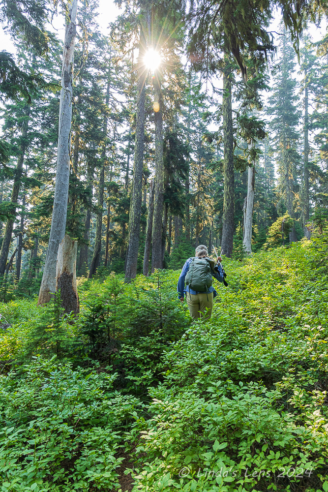
The first part of this trail looked like it needed a bit more hikers on it.  It was covered by overgrown huckleberry bushes, so much so that we nearly couldn't see the tread.  The thick forest canopy was lovely and provided more shade, although the morning sun occasionally peeked through gaps in the trees.


A sea of gray tree trunks

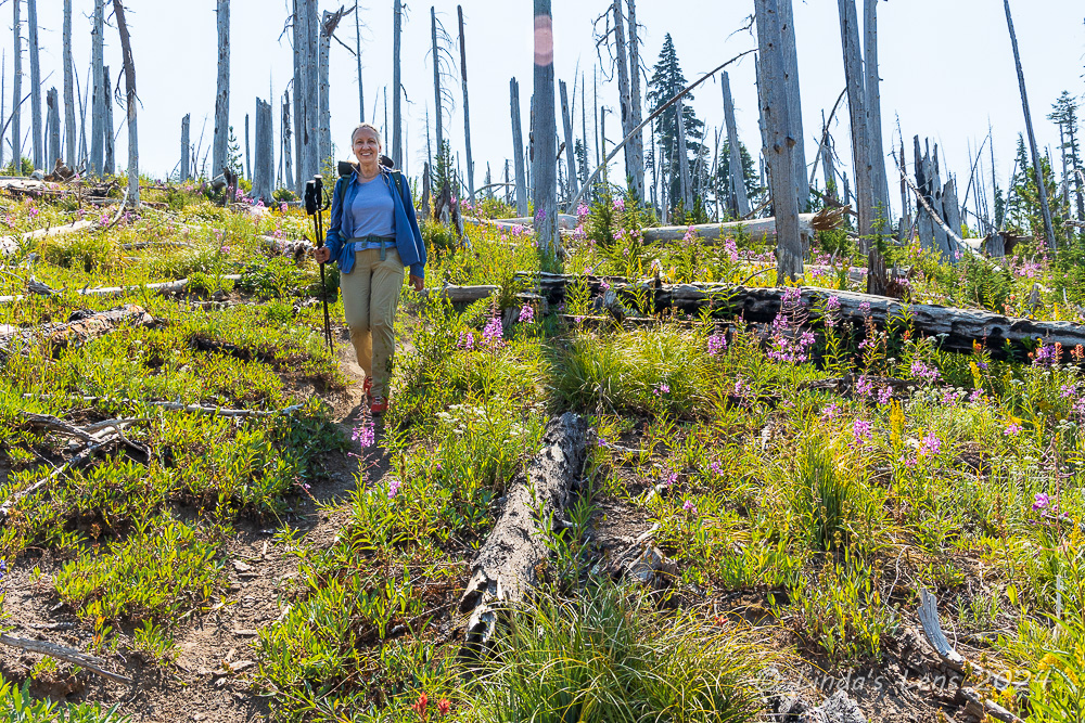
After 3/4 of a mile we came upon a side trail to Elk Mountain.  Of course, we had to check this out - there might be a good viewpoint!  This trail wound along the edge of the old burn area.  Catherine and I rambled through lots of ghostly dead tree trunks until our path ended at a promontory.  Concrete foundations indicated there had once been a fire lookout here.  Sadly the smoky, hazy skies hid any long-range views.  


Smoky Hood views

No matter, from our perch we could see our goal, Bluegrass Ridge, ahead.  It's now-barren top was covered with old burned-out tree trunks, while many others littered the ground.  But upon our return to the Bluegrass Ridge trail junction, I was delighted to see that the trail itself had indeed been cleared.


Looking out over a smoky sky

Onward we went!  Although the trail was bit circuitous, the tread was log-free.  In some places the trail was easy to follow, but in others it was so faint we had to look around for clues.  This was another path that would benefit from more boots trodding upon it.  


I managed to catch one butterfly

There were small amounts of wildflowers still blooming amidst all the downed trees.  And one benefit of the fire - it had cleared the forest enough to allow several nice views to Mt. Hood.  (Although thanks to all the smoke they were kind of sepia-toned today.)  We got a few glimpses of Elk Meadows' green fields far below.  After we traversed the ridge, that would be our day's destination.


More mountain views

Catherine and I had a nice romp along Bluegrass Ridge, taking in the views.  Now that the trail had been cleared of blow-down trees, it was really quite pleasant.  After about a mile of ridge walking, we noticed our path taking a steep turn and heading downhill towards Elk Meadows.


Orange Indian paintbrush

This was the Bluegrass Tie Trail, which linked Elk Meadows and Bluegrass Ridge.  One of the first things I noticed as we began our downward trek was the wildflowers started to become plentiful.  First orange Indian paintbrush, then fireweed, and finally goldenrod and pearly everlasting.  The further we descended, the better it got.


An arched tree!

I hadn't taken a lot of photos thus far, but that all changed in a hurry!  We came across so many colorful wildflower patches that my stops became more and more frequent.  Each group of blooms were even better than the last (or so I thought.)


Heading downhill on the tie trail

Luckily, Catherine is very patient with me when I'm in photographer mode.  She walked ahead, taking in the fantastic scenery and capturing a few images of her own.


Lots of fireweed blooming here

Although steep, I thought the Bluegrass Tie trail was impressive, not only due to the sheer volume of blooming wildflowers, but also because there were some good views of Mt. Hood as we wound downhill.  It was certainly the highlight of the today's hike!


Colorful flower garden

Enjoy the next few wildflower photos.......


The tie trail was full of wildflowers


Another Wow view


Catherine poses in the fireweed


Pink power


Lots to photograph here

When Catherine and I finally made it down to the loop trail that encircled Elk Meadows we were both hungry.  So I located a nearby campsite and we enjoyed a nice lunch break.  After eating, I ventured out into the nearby meadow itself.  I was highly disappointed to see a large circular burn mark in the meadow - some moron had lit a campfire here!  Not only are backpackers not allowed to set up tents, let alone have campfires in the meadow area, with the extreme fire danger, this campfire could've started another forest fire.  Ugh, this is why we can't have nice things!


Almost down to Elk Meadows

After lunchtime, Catherine and I followed the loop trail around Elk Meadows.  We popped out into the meadow near an old wooden tumble-down shelter to take in the fabulous Mt. Hood view.  The meadow in this area was full of purple aster blooms.  Just beautiful!  Then we returned to the original trail junction and retraced our steps back down the Elk Meadows Trail.


Elk Meadows and Mt Hood view

After successfully navigating the log crossing this morning, I was nervous about the afternoon traverse.  Glacial streams always have higher volumes in the afternoon due to more snow and ice melting high up on the mountain.  I was afraid of falling off the log and into the churning waters.  However when I came to the crossing I immediately jumped on the log and scooted across quickly, before I had time to really think about it.  That tactic seemed to work better than my "slow and steady" morning shuffle.  I was glad to have this second crossing now behind me.


Asters in the meadow

As Catherine and I traveled our final mile back to the trailhead, we stopped to pick the numerous ripe huckleberries that were lining the trail.  Catherine came prepared with an empty water bottle to hold her stash of berries.  Since I didn't have a container, I helped fill hers.  And of course, quite a few berries also made their way into my mouth!

Another good hike in the woods, exploring a newish trail, photographing wildflowers, and picking huckleberries.  Summer days don't get any better!