My hubby's New Years resolution is to walk a certain number of steps every day. He's been very diligent about meeting this goal, even heading out in the pouring rain to get his steps in. However, one Saturday morning in late January I suggested "Instead of walking the same neighborhood route, why don't you join me for a hike?"
 |
| Foggy hills above the Wilson River |
The day's weather wasn't very promising - rain was forecast. However it appeared there was a short window of dry weather in the late morning, so we decided to get a quick saunter in before the heavens opened up. Naturally I didn't want to drive very far, so suggested someplace in the nearby Coast Range.
 |
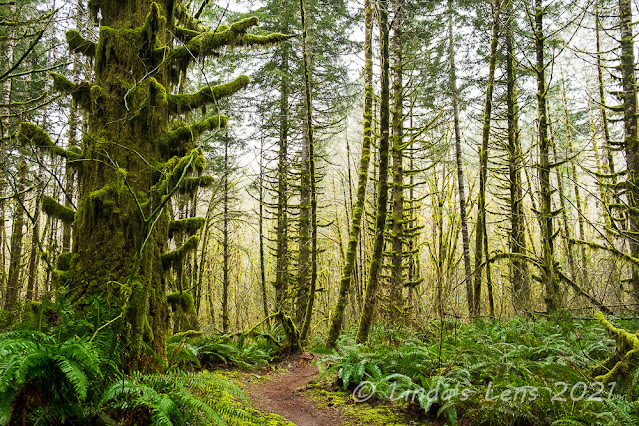
| Huge mossy tree |
There's wonderful trail in Oregon's Coast Range that follows the Wilson River. A total of 20.6 miles in length, frequent trailheads provide multiple access points to allow for shorter section hikes. I've trekked a small portion of this trail, and so far my favorite part has been the section from Jones Creek Day Use Area to the Footbridge Trailhead. I suggested to hubby that we head there.
 |
| Spooky forest |
The sky was dripping precipitation when I parked at the Jones Creek Trailhead. Donning raingear hubby and I set out into the wonderful mossy forest of the Coast Range. Here the trail followed the Wilson River, flowing furiously after an overnight rainstorm. Lined by lots of grand fir trees, mossy rocks, and ferns it was a lovely sight.
However, we'd only covered a half mile when we encountered our first roadblock. A construction fence was strung across the trail - apparently a nearby bridge was out.
 |
| There's the bridge! |
What to do? Lucky for us, the closure notice attached to the fence also included a map of nearby trails. It appeared the downed bridge could be bypassed by hiking through nearby Jones Creek Campground and rejoining the Wilson River Trail on the other side. It added a half mile or so to the daily total, but since our goal was to get steps, it was no biggie.
 |
| Side creek crossing |
So hubby and I navigated our way through the closed Jones Creek Campground, making a couple of wrong turns before finding the correct connector trail. This path wound through a beautiful forest full of mossy old trees and huge green ferns. I kept finding so many photo subjects it took me awhile to cover the extra half mile distance. But it was so pretty I was glad for the detour.
 |
| More wonderful mossy trees |
After crossing a side creek on a sturdy bridge (that was very much intact) we rejoined the Wilson River Trail. Passing by a huge suspension bridge over the mighty Wilson, we briefly considered walking across to visit the Tillamook Forest Learning Center on the opposite shore. But a sign indicated it was closed due to COVID so we continued on.
 |
| Fairy tale forest |
This section of trail followed the Wilson near river level. I enjoyed glimpsing it's blue-gray waters between mossy tree trunks. Hubby noticed a few fisherman scattered along the banks, all vying for winter steelhead.
And yahoo - the intermittent sprinkles that had fallen off and on since we'd started our hike finally let up. It was nice to finally hike with my hood down.
 |
| Wilson River framed by mossy trees |
I made frequent stops to photograph the amazing scenery, especially the mossy trees. With leaves absent from the branches, the brilliant green moss really stood out. Some trees were absolutely coated with the stuff.
 |
| These trees had tiny branches |
Some of the trees had tiny nubs for branches, each with a tuft of moss attached.
 |
| The mighty Wilson |
Another mile down the trail hubby and I ran into another closure notice. This one mentioned downed tree removal and trail repair work a short distance ahead and to detour onto the adjacent powerline road. Since it was a weekend, I didn't think any work was happening, and told hubby we should just keep going.
 |
| Detour on a powerline road |
But.....only a short distance later we came upon another fence blocking the trail. It appeared we could easily slip around this obstacle, and it was tempting to ignore the sign and keep going. But my law-abiding hubby said we probably shouldn't (also the sign also mentioned a stiff fine for noncompliance). Not willing to backtrack the entire way, we ended up bushwhacking through the forest to reach the powerline road.
 |
| Back to the riverside trail |
After crashing through brush and ferns, it was nice to walk on a level gravel road. Luckily, the detour wasn't too far of a distance and before we knew it another sign directed us back to the Wilson River Trail.
 |
| Moss close-up |
I'd mentioned to hubby that this portion of the trail was relatively flat. However, after a couple of miles, the trail began to climb quite a bit - a fact that I'd obviously forgotten.
 |
| Trail lined by mossy rocks |
The path zigged and zagged uphill until we were looking down on the Wilson River, far below.
 |
| Another river view |
But all that climbing did give us great views. Not only of the Wilson River, we also passed by a nice waterfall. It was named - you guessed it - Wilson River Falls.
 |
| Wilson River Falls |
The waterfall was near the trail's high point, so once we passed by this cascade, the trail began switchbacking downhill to eventually reach the Footbridge Trailhead on the banks of the Wilson.
 |
| Taking in the lush forest |
My hubby's knees aren't fond of downhill grades, and the steep downhill in combination with some extremely slippery mud made him extra cautious. We traveled a short distance gingerly stepping over the muddy track. It didn't seem to be getting any better the lower we descended. Afraid of wrenching a knee, hubby asked if we could turn around early.
 |
| Wilson River's emerald waters |
Since the detours had added some mileage to our day I was fine with cutting our trek short. Besides, the sky was darkening once again, and I knew it was only a matter of time before the afternoon's predicted showers would start up.
 |
| Mega-mossy forest |
Retracing our steps we climbed back to the waterfall, then downhill to near the river level once again.
 |
| Fog in the woods |
Thus far, we'd only encountered a half dozen people, all of them fisherman. But past the waterfall climb, hubby and I began to meet a couple of hiking parties traveling in the opposite direction. Still it was nothing like the crowds of hikers we would've encountered at some of the more popular Coast Range trailheads (or in the Columbia River Gorge).
 |
| Hubby watching the fishermen |
At one place where the trail gave particularly nice views of the Wilson River, hubby and I stopped and took in the beauty of the aqua-green water. We watched a couple fishermen on the opposite banks casting for steelhead.
 |
| Steelhead fishermen |
Then we meandered back down the trail, past the suspension bridge, until we reached the final trail detour. Winding through the beautiful mossy forest once again, I couldn't help but take just a few more photographs, despite droplets beginning to fall from the sky. Back at the campground, I took a quick potty break at a very stinky pit toilet (but luckily it was open - and even had tp!). After my little break I noticed this very cute building in the campground with trees carved into it's door. I think it served as a woodshed for the campground.
 |
| Cute woodshed at Jones Creek Campground |
From the campground it was a quick (very quick because it was now full-on raining) back to the parking area and hubby's truck.
Driving home, we passed by overflowing trailheads at Elk and King Mountains. Cars lined the highway on both sides. I remarked how lucky we were to have had such an empty trail where we hiked. Encountering less than a dozen hikers, I decided we'd chosen well for our trek. Not only that, we'd succeeded in meeting hubby's step quota for the day.


