Friday, July 31, 2015

Salmon River Trail

Where does one hike when it's midday, and temps are predicted to top 90 degrees?  Answer - you find yourself a lush old-growth forest beside a clear, rushing river.

And one of the best places is none other than lovely Salmon River Trail, at the base of Mt. Hood.


Thick, cool, mossy forest

It was the first Sunday of June, and my son was departing for his summer assignment in Montana.  The day was predicted to be a hot one.  Normally I'd rise early and get my hike in while the air was relatively cool.  But my son wasn't planning on leaving until noon.  Being the good mommy I am, I waited around to see him off.


Foxglove

Then, with the AC on high, I drove towards Mt. Hood and the crystal clear Salmon River.  My car's outside thermometer read a sweltering 92 degrees as I pulled into the trailhead.  The hot blast that hit me as I opened the door felt like the inside of an oven.


Salmon River's rocky beach

Ugh!  Not a fan of hot weather, I briefly questioned my sanity for hiking in such heat.  But I'd driven all the way here.  Telling myself to at least give it a try, I shouldered my backpack and headed towards the trail.


Stonecrop flower

Located south of the tiny village of Zigzag, the Salmon River Trail is a popular place on hot summer weekends.  There's a lower trail, that follows the river for 2.5 miles before reaching Green Canyon Campground.  From this campground, the trail continues upriver for another 14 miles.  Hikers can explore as far as their feet can take them, be it 2 mile out-and-back, or long backpacking trip.


Large fallen tree

Although the lower trail is pretty, I much prefer the greener, wilder upper portion, my path of choice for today. 


Larkspur

The trail began by climbing a steep bank, until I was high above the river's rushing waters.  A dense forest of mossy Douglas firs and cedars provided ample shade (for which I was most thankful!)


Lovely green ferns

About a half mile later, the path descended until it was nearly level with the rocky riverbank.  Many groups of people were congregated here, some splashing in the Salmon River's frigid waters, while others sat on shore dangling their feet in the current.  I passed by a large group of teenagers gathered around a half-finshed case of beer.  Their loud shouts rudely interrupted the serene forest environment, and I quickly hustled by.


Hairy moss

Beyond the river's beach, I entered a spectacular old growth forest, complete with huge, mossy trees.  Moss hung from branches like wispy old men's beards.  Enormous fallen trees lay across the forest floor, their massive roots outstretched like a giant's hand.


Columbine close-up

And the wildflowers!  I saw cheery orange Columbine, a lovely patch of purple Larkspur, and some bright yellow Stonecrop unfurling from a rocky ledge.


Mossy nurse log

Some of the fallen logs had laid on the forest floor so long, they now had plants growing on them.  Called "nurse logs" the wood of these trees had decayed enough to form soil that nourished small ferns and moss.  I even spotted one log with a small tree growing out of it's top!


Clear, cool river

The trail passed closely by the river once again, and I stopped and marveled the water's clarity.  I could see clearly all the way to the very bottom.  Fed by snowmelt, this river was as clean and pure as they get.


Pretty in pink

But the sun was hot here on the bank, and I was more than happy to dive back in the forest's cool shade.


Lots of shade here!

At the two mile mark, I passed several backpacking campsites, some complete with fire rings and fancy logs to sit upon.  A popular place for weekend campers, by Sunday afternoon the place was deserted.


Penstemon 

I ventured a short distance further until I came upon a sturdy bridge crossing a side creek.  Beyond this point, I knew the old growth forest ended, and the creek turned away from the river's edge.  Since the day was getting late, I decided to make this my turn-around point.


Bridge selfie


Before heading back, however, I had some fun with my camera's timer, trying to capture a selfie crossing the bridge.  It was harder than it looked - the camera kept focusing on my feet, or the bridge.  After several botched shots, the only keeper was this one of my lower half (complete with dirty photographer's knees!)


Wild rose with friends

The hike out was fast and uneventful, save for a garter snake sighting as I passed by the drunk teenagers.  I pointed the reptile out to one wobbly young girl and instead of the expected freak-out, she chased after it, telling me that she liked snakes.


Odd colored fern

I reached the trailhead sweaty, but satisfied.  Although not ideal hiking weather, I'd made the best of things, endured the heat, and was rewarded with views of a beautiful river, forest, and wildflowers.

But now I quite was ready for my car's air conditioning - and a frosty chai frappuccino!


Sharing with:  Scenic Weekends and Friday Greens

Tuesday, July 28, 2015

Beargrass Season

Along with everything else this wacky summer, the beargrass began blooming a month early.


A typical beargrass "poof"

A tall clublike plant, whose flowers form a large white ball at it's very top, beargrass is known for growing in mountain meadows throughout the Western U.S.  Here in the Cascades, it usually reaches peak bloom by early July.  But....this year's strange weather pattern with it's unseasonable hot temperatures saw beargrass flowering by late May.


The head is composed of hundreds of tiny flowers

After my photo session at Panther Creek Falls, I drove over to nearby Falls Creek Falls, hoping to catch another waterfall in action.  But the midday sunshine was not conducive to photography, and all my images turned out lousy.  (I've decided to wait for a cloudy autumn day before returning.)  However, the silver lining to this otherwise nonproductive trip was a forest full of beargrass plumes.


Close up

A member of the corn lily family, beargrass is typically the first plant to sprout after a forest fire.  These lovely poofy plumes are common in forest clearings throughout the high Cascades.  Beargrass bloom in cycles, only reaching peak every five to seven years.


Extreme close up

I love beargrass and try not to miss peak bloom season.  It appears different regions of the PNW Cascades take turns having good beargrass years.  Last year, the forests around Central Oregon seemed to win the beargrass lottery.  This year, Mt. Hood and the surrounding forests of SW Washington sported the lion's share of blooming plants.


A favorite of bugs and people

I came away from this short hike with a dozen good photos of beargrass poofs - and some nice macro shots of their tiny flowers.


Sharing with:  Our World Tuesday

Thursday, July 23, 2015

Panther Creek Falls

Oh, I've found the most beautiful waterfall in the world! 


Panther Creek Falls

Okay, if not the world at least in the Pacific NW.  And it's just across the river in Washington state.

While recuperating from my October surgery, I came across a jaw-dropping photo of Panther Creek Falls in an issue of Backpacker magazine.  Then I discovered this lovely cascade was local - just outside of Carson, WA.  Why had I never visited this?


Sunlight peeps through the woods

As you might have guessed, Panther Creek Falls immediately got placed on my springtime hiking list.  Finally, the last Friday in May found me buzzing through the sleepy little hamlet of Carson on a mission to locate this fabulous waterfall.

This trail doesn't show up in any of my hiking books, so finding the falls required a bit of internet detective work.  Scouring hiking websites, I was able to patch together the general location.  Google Maps also helped a ton.  Armed with this info, I headed down FS Road 65, looking for a sharp bend in the road.  The falls was supposed to be at this bend.


Hairy tree

I parked my car in the adjacent gravel pullout.  After donning hiking boots, backpack, and camera gear, I trekked across the road.  The ground dropped steeply from the pavement edge, nearly vertical, to the rushing creek below.  I didn't see any signs.  Hmmm.....where would the trail be?

I decided to head towards the sharp roadway curve.  That seemed like a logical place for a waterfall.  Continuously scanning the downhill slope, I hoped to spot the magic path. 


Falls from upper viewpoint

I was almost to the bend, and still no sign of a trail.  The slope seemed to flatten out a tiny bit here, so I decided to bite the bullet and scramble my way down to the creek.  It wasn't easy.  The road was perched on a large, moss-covered boulder field.  Thick bushes rose through the rocks.  I bushwhacked my way through the vegetation (occasionally walking through spiderwebs - ugh!) until I reached Panther Creek's muddy shore.


Much better views at the base

The creek was uber-green and quite lovely.  The surrounding lush mossy forest was also quite nice.  But the waterfall I sought was nowhere to be found.

After snapping a few quick pics, I dejectedly climbed back up the brushy slope.  I walked a short distance in the opposite direction and still no luck.  Where the heck was this falls?


Such lovely streams

I was about ready to give up.  I'd scrambled down to the creek in one location, and wasn't super-keen about doing another bushwhack.  But a little voice told me not to quit just yet, and to walk a little bit further away from the bend.  So I did.  And a few steps later, I saw the trail.


Ultra-green surrounding forest

The trail wasn't at all where I'd expected it to be.  It was quite a distance from the sharp roadway curve.  But after following this path a short distance, I began to hear a roar.  Then I spotted a wooden viewing platform.  And beyond that platform was the one and only Panther Creek Falls.

Oh my was it gorgeous!  I set up my tripod and shot a few images of this waterfall's lacy streams.  The rough rock surface appeared to split the flow into numerous tiny capillaries.  They looked like delicate white fingers.  Surrounding bright green moss and deep green ferns were perfect compliments to these gleaming, white cascades.  The only disappointment was the bright morning sunlight streaming over the fall's very top.  This large difference in exposures made capturing the entire waterfall extremely difficult (that's why I love dark, cloudy days for waterfall photography).


Falls and creek below

The photos I'd seen depicted a perspective of the falls from it's base.  The viewing platform looked down upon the falls from above.  Although not a bad view, it wasn't the shot I'd hoped to get.  I began scanning the adjacent forest.  How did people get down there?

Leaving the platform, I spied a faint path winding through the forest.  I followed as it skirted the top of a steep rock cliff, and then dived nearly vertical down a slippery, muddy bank.  I ended up literally climbing down this route on hands and knees, grabbing onto rocks and tree roots, with my tripod flopping around on my back.  But despite it's precarious nature, the path did it's job.  Sliding down the last bit of muddy trail got me to the fall's base.  Spread out above me in all her glory, was Panther Creek Falls.


Lower Panther Creek Falls

Although the upper view was great, the falls were even more stunning from below.  The multiple tiny torrents looked like a lacy curtain as they gushed down the rocky face.  The creek below frothed and churned, tumbling over it's bed.  And everything was surrounded by a thick, mossy green forest.  An ample reward for that scary downhill scramble.


Water-beaded leaves

But there was still more.  Panther Creek Falls also had a lower cascade.  One more crude scramble trail led me down another near-vertical bank to the three-pronged falls below.  Although not quite as spectacular as it's upper cousin, this little waterfall was still awfully darned nice.  And it was entirely in the shade, so no exposure issues.


Three tiers and a mossy log

Finishing up my final photo session, I clambered back up the steep, muddy slope.  Reaching the pavement, I began to follow the road's shoulder towards my car.  Passing by the first path, I discovered a trail sign prominently bolted to a large tree.  D'oh!  Now how had I missed that?


The sign I missed

No mind, I now knew exactly how to find Panther Creek Falls.  And before reaching the car, I'd already made plans for a return trip.  I've decided to wait until autumn - with all the surrounding deciduous foliage, fall colors should be stunning.  But next time, I'm picking a cloudy day!


Sharing with:  Friday Greens and Scenic Weekends

Monday, July 20, 2015

The Fifteenmile Trail In Spring

Sigh....still playing blog catch-up, it's embarrassing to admit how far behind I've become.  This post is from Memorial Day (Yes, I know.....way back in May)  Despite the lateness, I hope you enjoy it.


The gang is ready to go!

My hiking buddy John said he'd heard reports of nice wildflower blooms along the Fifteenmile Trail.  Having previously hiked this area in the fall (see recap here) I knew what a gorgeous place it could be.  Eager to see what springtime would bring, I suggested John schedule a group hike for Memorial Day.  One thing I like about John - he's good at taking advice.


John on the bridge

Memorial Day morning, a large group of happy hikers gathered in Hood River.  Our ranks swelled to a whopping nine, and for once the women outnumbered the men (six to three!)


Oregon anemone

Our group shuffled into three cars, and after a cruise down Hwy 35, another up Road 44, and navigating a maze of Forest Service roads, we arrived at Fifteenmile Campground, the trailhead for today's trek.


John and his "hiker harem"

A historic moment for one of his hikes, it's not often women are the majority.  I just had to get a photo of John and all the ladies.  For the rest of the day, we teased John about his "hiker harem."


Droopy lupine

After several last-minute potty breaks and some clothing adjustments, our group was ready to go.  Gathering for a quick pic at the trailhead sign, we headed down Fifteenmile Trail.  A short distance later, we arrived at a trail junction, crossed Fifteenmile Creek on a nice bridge, and began to climb up the Cedar Creek Trail.


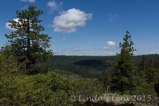
Our first big view

Today's hike was a loop between two paths.  The Cedar Creek Trail would take us along the south side of the creek's deep canyon.  We'd follow this trail for 5-ish miles before descending to cross the creek, and hooking back up with the Fifteenmile Trail.  Our return trip would follow the canyon's north rim, via the Fifteenmile Trail.


Bitterroot bloom

Because this area was east of Mt. Hood, and in the rain shadow of the Cascade range, the forest was predominately Ponderosa pine, cedar, and manzanita.  I did spot a couple of different wildflower varieties too, such as this lovely pink Bitterroot bloom.


Heading back to the trail

After hiking through forest for a mile or so, our group came upon a clearing, complete with a nice rocky viewpoint.  Time for some photo ops!


Doreen and Jon in motion

And some shots of my friends in action.  Doreen laughed when I crouched down low to capture a different perspective.


Passing by some big Ponderosas

Then it was back into the forest again.


Photography break

We occasionally passed by areas sporting wildflower patches, and progress would stop while the photographers among us brandished their cameras.


Big blue sky

We couldn't have asked for better weather.  Blue skies and sunshine - and fairly mild temperatures.  Perfect!


Lovely yellow flowers

Although this trail doesn't see much hiker use (ours was the only party all day) we were surprised by three separate groups of mountain bikers.  The bikers were always very courteous, and immediately slowed down when passing by, but the speed at which they approached was unnerving.  After the first encounter, my friends and I began warily looking over our shoulders.


Heading down to the creek

After four dusty miles down the trail, we finally began our descent into the canyon to Fifteenmile Creek.  The ridge's very top produced the most amazing wide-open vistas of surrounding forested hills, and Central Oregon's farmlands beyond.


Trail junction at the halfway point

After a long, steep descent down a rocky trail, my friends and I finally reached Fifteenmile Creek.  And it was a sight for sore eyes!  Not only was this the junction with our return trail, there was also a creekside campfire ring, complete with two large logs for sitting.  Perfect lunch spot!


Ready to go after lunch

And everyone was famished.  Nearing one o'clock, tummies had been grumbling for awhile.  We all spread out our lunches and chowed down.  Too busy filling my belly, I neglected to get any pictures of our lovely little break area.


Calypso orchids

Bellies full, bladders empty, after lunch our group was ready to tackle the remainder of this hike.  The good news - completion of the Cedar Creek Trail meant we were over halfway done.  The bad news - we'd now have to regain the elevation lost during our descent to the creek (about 2000 feet).  Yup - our return trail would be all uphill.


Trekking pole line-up

But luckily the majority of this trail meandered through thick woods, so we'd be in shade most of the time.  And the climb was fairly well-graded, with only a few steep spots.  (At least those are the things I told myself to make it better!)


John is king of the rock

So away we trudged, up, up, and more up.  Luckily, there were a few nice wildflowers to distract us from the task at hand.  I even spotted a small patch of rare pink calypso orchids.


Scenic break spot

Around the halfway mark, we came upon a large open area with some big, flat rocks.  More wonderful views, and nice places to sit while enjoying them.


Ann and Doreen take a breather

And good photo ops too!


Paintbrush

We passed by another rocky outcrop, and I noticed a few more colorful wildflowers blooming amidst the stony soil.  This patch of penstemon was especially lovely.


Penstemon

Then someone noticed a tick crawling on the back of Jon's neck.  This sent us all into immediate itchiness, and we ladies began frantically checking each other's necks and hair.  Fortunately, no more ticks were discovered (and yes, someone quickly swiped that tick off of Jon!)


Tick check

The final mile of any hike is always the longest, and this trek was no exception.  Footsore, hot, tired, and dreaming of beer and pizza, I could've swore the "trail stretchers" had been up to their tricks again.  Never was a trailhead sign such a welcome sight!


The final push

It was great to see a favorite fall trail during a different season.  Once again, the Fifteenmile Trail delivered.  The terrain variety, abundance of wildflowers, and fantastic views make this hike a year-round winner.  Another wonderful day in the woods!

Stats:  12.8 miles, 2000 feet elevation gain.


Sharing with:  Our World Tuesday