Tuesday, June 28, 2011

Bald Butte

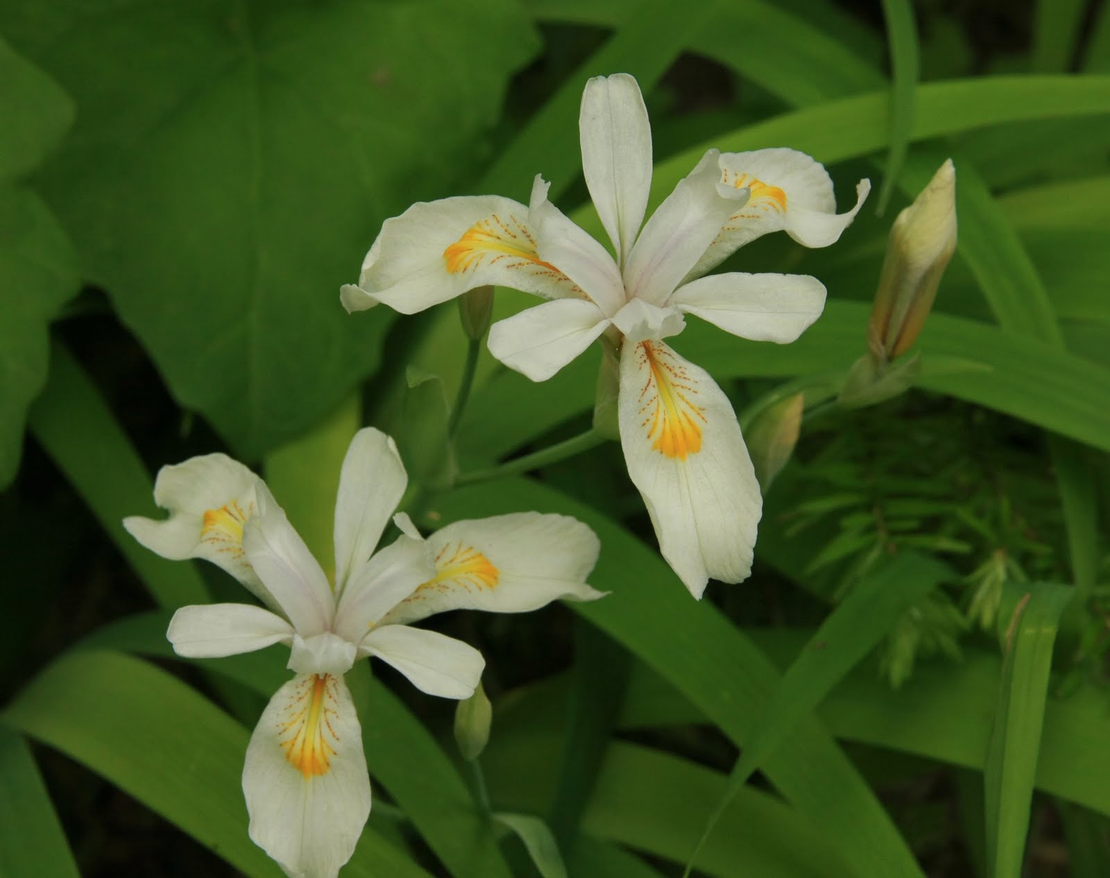
Another Sunday, another decision.  Where to hike this week?  The high country was still snowed in, concentrating hikers on the Gorge trails.  I didn't feel like fighting the crowds.  Clear warm weather was in the forecast.  Time to hike someplace with views.


No, this is not Bald Butte

Then I heard that the flowers were really blooming up on Bald Butte.  Hmmm.... I hadn't been there in a few years.  I was due for a visit.


Chuck admiring the bachelor button flowers

When I sent out a mass email looking for hiking companions, my friend Chuck responded.  He was thinking about hiking the same place.  Great minds really do think alike!


Hmmm....what was this sign supposed to advise?

So Sunday morning found Chuck and I traveling through the town of Hood River and up Hwy 35 for a rendezvous with Bald Butte.  Chuck had grown up in the Hood River Valley at the foot of Bald Butte, so for him this hike was like coming home.


Our day's destination

It was a beautiful clear blue-sky day as Chuck and I set out from the trailhead.  Not far up the trail we were treated to an incredible view of Mt. Hood's stunning north side.  Chuck and I both agreed that this side was the mountain's best view.  Hood was looking especially good, still wearing a coat of winter white.  It looked absolutely stunning against the blue sky.  I proceeded to click away, creating many images of my favorite mountain.


Mt Adams sighting

Chuck and I climbed through an oak and pine forest that gave way to a clearing. The open meadow was chock-full of colorful bachelor button flowers.  The flowers were vibrant blues and purples, with a few white ones randomly thrown in.  One hillside was so covered it looked like small blue dots speckling the grass.  Chuck told me he really loves bachelor buttons, and after that so did I!


Ugly powerlines

The trail dipped back into the woods, and we continued our climb.  Douglas fir trees began to join the oaks and pines.  We began to see lupine and balsamroot flowers, however, some of them were looking withered and past their prime.  I was hoping for a better floral display once we got higher up.


The steep trail to the top

Through the trees, we got glimpses of Mt. St.Helens, and Bald Butte itself.  We could look ahead and see our hike's destination, Bald Butte's grassy summit.  It sure appeared like a long way still!


Mt. Hood view on the way

Finally our trail intersected with a road on top of Surveyor's Ridge.  It was there Chuck and I ran into a large group of teenage boys, accompanied by a few adults.  We said our "hello's" and continued on to the Surveyor's Ridge Trail.


Mt. St. Helens shows itself

We wound through woods on top of Surveyor's Ridge, and then came to the National Forest boundary.  Beyond this boundary was the ugly portion of the hike.  Our trail became a wide rocky dirt road that was shared with motorcycles and four wheel drives.  Sometimes people use the adjacent roads and woods for target practice, and today we heard gunshots off in the distance.  The trail passed under a large number of powerlines supported by a string of huge metal towers.  Not exactly pristine wilderness!


Patchwork quilt of Hood River Valley orchards

But to make up for the ugliness, the flowers were out in force.  Balsamroot turned the grassy slopes of Bald Butte into a patch quilt of yellow and green.  Purple lupine and orange paintbrush joined in the party.


Introducing.......Mt. St. Helens!

Chuck and I followed the dusty rocky road, heading for the summit.  The road got super-steep, and being out in the open under the blazing sun quickly zapped our energy.  We gasped, sweated, and struggled up the trail, slowly putting one foot in front of the other. 


Makin' friends with the balsamroot

To break up the climb (and to steal some quick rest breaks) I stopped for Kodak moments along the way.  The scenery was so stunning, I really didn't need the rest break excuse to stop.  Mt. Hood loomed to the south.  The Hood River Valley spread out below, showing its patchwork quilt of orchards and farm fields.  The floral fields on Bald Butte's slopes provided good foreground material for my subjects.  Unfortunately, the sky around Mt. Hood had clouded up a bit, and instead of this morning's blue, was now a dull white.  I was glad I'd taken a bunch of Hood photos right away while the sky was still blue.


Happy yellow flowers

Chuck continued on ahead, and I finally made my way to join him on the top of Bald Butte.  On the summit was a jaw-dropping view of three mountain peaks - Mt. St. Helens, Mt. Adams, and Mt. Rainer.  The sky was still blue to the north, so I got some good photos of blue sky and white mountains.


Vibrant paintbrush

Chuck and I settled into the grass for lunch with a view.  Oh and how magnificent a view it was!  The Hood River Valley stretched below us.  Mt. Hood rose to the south.  The Washington peaks dotted the sky to the north.  Flowers bloomed in the meadows all around us.  Chuck pointed out his childhood home, directly below us.


Lovely bachelor button bloom

Then the group of boys caught up with us and gathered in the nearby summit meadows.  We discovered they were a troop of Boy Scouts from Cleveland - Ohio!  Wow, what a long way to travel.  The kids were all awestruck by the mountains and flowers.  I'm assuming they don't see many snow-capped peaks in Ohio.  We saw lots of cameras coming out of packs and pointing in all directions.


Bachelor buttons galore!

Chuck and I tore into our lunches with gusto.  I was certain all that climbing had burned tons of calories.  Surely enough to justify eating all the cookies I'd packed up with me.  I love cookies, and have been trying to cut back on my consumption.  But it's a tradition of mine to pack cookies on hikes.  When climbing up something steep, you need the motivation of a sweet reward at the top.


Wild rose

After a nice rest and refueling, it was time to return to the trailhead. After the morning's climb, I was looking forward to a little downhill traveling for a change.


Parting view of Hood near the trailhead

Back we traveled, sliding down the dusty road.  The sky clouded over, providing better light for flower photography.  I took full advantage of the conditions with frequent photo stops.  Some of my hiking companions aren't very patient with my many Kodak moments, but Chuck said he was grateful for the rest breaks.  What a great hiking buddy!


Trailhead flower garden

With the subdued lighting, the colors in the bachelor button flower field were even more vivid.  I took additional photo ops here and think I got some of my best images.  You be the judge.


Wonderful flower patch

We finally reached Chuck's car, dusty, tired and thirsty.  After changing out of our boots and washing off our dirty legs and faces, a frosty beer at the nearby pub was sounding mighty good!  And that's exactly where we headed.

Another great Sunday hike.  I'm so lucky to have such a large variety of trails to explore right in my own backyard.

:)

Saturday, June 25, 2011

Herman Creek Trail

Last Sunday was Father's Day and I decided I'd better stick around the house and spend time with my hubby.  But when Roger got up and saw me sitting around, he asked "aren't you going hiking?"  Well....it sounded like he was giving me permission to go.  So I packed up Bear and off I went!


Obligatory trail sign photo

Not getting out of the house until mid-morning limited my hiking to someplace a short drive away.  I pointed my car towards the Columbia River Gorge.  There's always someplace great to hike in the Gorge.  I decided to try the Herman Creek Trail.  That's one trail I've yet to explore.


"C'mon, let's go!"

I've hiked small portions of the Herman Creek Trail usually on my way to other destinations.  It's the trail you start off on to access Nick Eaton Ridge and Indian Point, and many backpackers use it to get to Wahtum Lake.  Usually when I've started from this trail, I climb up (way up!) to Nick Eaton Ridge.  This time however, I was staying down low, and simply following the creek.


Surprise waterfall along the trail

The trail started out with a gradual, but endless climb.  I followed a nice wide road for some distance until it finally narrowed up into a mere path.  Bear and I trekked through some beautiful woods, with the sound of Herman creek flowing far below us. 


Bottom of waterfall

My hiking guidebook briefly mentioned there was a waterfall along this trail.  I got the impression it wasn't very big.  However, when I came upon the falls, I was pleasantly surprised to find a large, beautiful cascade.  The waterfall was about 100 feet tall, and located in a pleasant mossy grotto.  I unsuccessfully tried to fit the entire thing in a photo.  When that didn't work I instead took many separate photos of the top and the bottom.  Look at both the above images together and you'll get an idea of the waterfall's scale.


Mossy oak trees line the trail

Soon after we left the waterfall, I began to see flowers in the woods.  First some sunny yellow blooms, then a few strands of lupine, and then an entire hillside of pink and yellow flowers (which I couldn't identify!).  There were also some cool, mossy old oak trees perched on the slope below the trail.


Entering the wilderness area

I saw a couple groups of backpackers returning from their weekend outings.  Judging from the number of people I saw, this must be a popular place to camp. 


Columbine flower

I saw lots of lovely columbine flowers decorating the forest floor.  This was the best photo I captured of the bunch.


Gigantic trees

Bear and I also hiked through some really impressive old growth forests.  Those trees were huge!


Sunny yellow blossoms

When I came to a junction with the Casey Creek trail, my guidebook mentioned you could hike down a rough path 0.3 of a mile to reach Herman Creek itself.  I located the said trail and started down.  It was super steep!  While sliding down a especially treacherous pitch, I got to thinking, if I go all the way down this, I've got to hike back up it again.  And it's gonna be a bear to climb back up.  I decided I didn't really want to see Herman Creek that badly, and turned around.


Lovely tiger lily

After my aborted attempt to see the creek, I decided I'd hiked far enough and headed back to my car.  I normally like to do loop hikes, because it's fun to see new things along the entire route.  But this trail was just as nice on my return trip.  I got to see all of the lovely flowers a second time.  And I enjoyed another stop at the waterfall for one more quick photo session.


Another great tiger lily

A very short distance from the trailhead I spied two tiger lily flowers blowing in the breeze.  I absolutely love wild tiger lilies, and immediately got out my camera to try and get a couple of good shots.  The wind was blowing strong, so it was difficult to capture the blooms sitting still.  I ended up holding the stem of one plant with my free hand, and clicking the shutter with the other.  I did manage to get a couple of images I liked.

Another great hike!  I didn't expect a lot from this trail, but was pleasantly surprised by an awesome waterfall, a stand of stately old trees, and a bunch of colorful blossoms.  I guess you never know what you're going to find when you visit the Gorge.

:)

Tuesday, June 21, 2011

Clackamas Riverside Trail

The day after the Helvetia Half was Sunday.  Sunday is usually my day to go hiking.  But I was kinda tired from my race the previous day.  The weather forecast was good (ie, no rain) so I didn't want to waste the nice weather sitting around home.  What to do?  Well, of course I chose to go hiking.  I decided to pick an easy hike, and get out there!


Mossy old trail sign

I'm still on my quest to hike all of the hikes in Sullivan's "100 Hikes in Northwest Oregon" book (the 1994 edition) so grabbed my book and looked through the hikes I've yet to complete.  The Riverside Trail on the Clackamas River jumped out at me.  It was a short hike (around 5 miles) and not much elevation gain.  Perfect for someone recovering from running a half marathon! 


The mighty Clackamas River

I  haven't hiked around the Clackamas River for awhile.  I'm not sure why.  Maybe Mt. Hood and the Gorge call out just a little bit louder.  But as I drove to the trailhead I decided I need to come out here more often.  The Clackamas is a beautiful river, and the road that parallels it wonderfully scenic.  Flowers were blooming along the roadside.  The river was lined with tall, regal Douglas firs.  The water was a beautiful blue-green color.  Recent rainfall and snowmelt have swollen the river, and I saw lots of rafters bouncing down its rapids.


Rhodies in bloom

From the trailhead, it didn't take long for me to find my first views.  Only a tenth of a mile from my car was a wonderful blufftop overlook of the Clackamas.  The river curved gracefully around a bend, the water burbling happily downstream.  Bright green trees lined the banks.  It was a sight worthy of many Kodak moments.  What a great way to start a hike!


Iris in bloom too

And then not too far from the overlook, I ran into a bunch of pink rhodies in bloom.  Things were starting out really good.


Doggie log balance

Further down the trail were more flowers showing off their colors.  I came upon some wild iris pushing up from the forest floor.  It's always wonderful to see iris growing in the wild.


Beautiful blue-green water

The trail zigged and zagged downhill until I came to a rocky beach.  I walked out to the beach to check out the river.  The water was flowing mightily, creating small rapids as it hit the few rocks that were out in mid-channel.  I loved the color of the water, a beautiful deep blue-green.


Gigantic tree

I hiked through a magnificent grove of large Douglas fir trees.  These trees were huge!  I'm really glad that some of these great old trees have been saved for future generations to enjoy.


Colorful yellow flowers lined the river banks

I came upon a second little river access, this one a small sandy beach.  A perfect spot for lunch.  I enjoyed watching the water flow while munching my PB&J.  The river in this area was lined by bright yellow flowering bushes.  I wish I knew the name of this plant, but sadly I was without my botanist son that day.  So I'll just call it the unidentified yellow flower (UYF).


River rapids

After my lunch, it was back on the trail.  It roller-coastered up and down until I passed through a clearing area thick with flowers.  There were tons of small purple blooms.  And then, I came to an area thick with irises (I think that's the plural of iris).


Lots more iris flowers

There were oodles of delicate white blooms lining the side of the trail.  Wow!  I didn't expect to see so many kinds of flowers.  Especially so many iris(es) growing in one area.  Lots of subject matter for my camera.


Glowing green forest

The trail continued to a campground, where I turned around and headed back to my car.  That was great, because I got to visit all these wonderful scenic spots a second time around. 

So I got to work the lactic acid out of my legs, and took in some wonderful scenery too.  I'm learning if you have the chance to go hiking, by all means go!  I always return home glad that I went.  After this hike, I certainly felt that way.

:)

Friday, June 17, 2011

Helvetia Half

When I began running two-plus years ago, the Helvetia 10k was one of the races I ran that first year.  It featured a 10k and half marathon course that wound through the beautiful farming country in Helvetia.  The race itself was so well-organized, I decided this was one I'd do again.  But next time, I wanted to try the half marathon. 


Nice race tee!

The Helvetia Half has a reputation for being a difficult, hilly course.  But to me, that only added to its intrigue.  I missed the race last year, because I was in South Dakota, running the Mickelson Half.  But this year I was bound and determined to be there!


The starting line crowd

Last Saturday morning found me and 4,500 of my closest friends toeing the starting line near the Hillsboro Stadium.  A helicopter with the race photographer on board circled the waiting participants, and the announcer told us all to give him a wave.  Then we were all asked to "high five" the people around us - which was great fun to do and made me feel like we were all one big racing family.  After the photographer did his fly-by and got an aerial group shot, we runners were released into the streets.


My dorky starting line photo

The weather couldn't have been more ideal for running - cloudy skies and cool temps. It was a little bit chilly to start out, but perfect once you got moving.  I took off on a fast pace, darting around the slower runners.  I wasn't feeling my best this morning, and hadn't trained very hard for this race, so I wasn't sure how things would unfold.  But before every race, I always make some sort of goal, and this time I decided to run another sub-2 hour half.  Considering the hilliness of this course, and how I was feeling, finishing this course in under two hours would be tough.  But I decided to give it a try anyway.


Beautiful farmlands

After the first mile, we crossed over the highway and into farm country.  No hills yet, just acres of lovely green fields.  We headed up the road to the Helvetia Tavern.  I've traveled this road in a car many times, but on foot it sure seemed like a long way!

And then, right around mile four, we hit the hills.  Ugh!  I wasn't ready.  But I slogged up the first hill, got a brief break, and there was another.  I was almost to the top of the second hill, when what did I see ahead, but yet another hill!  Finally about mile 5.5 or 6, we got some relief.  What goes up must come down, and I was happy to have a little downhill stretch.  I zoomed down the hill.  It was great - I felt like I was flying!   For a couple of brief minutes I felt strong and invincible.


One of the many hills

But, oh there were more hills.  Not as bad as the first, but enough to slow me down.  I kept myself as close to a nine minute mile pace as I could muster and soldiered on.

Of course, I still did all my usual mile marker celebrations.  Once and awhile, I got some of the people around me to "woo-hoo" along, but mostly I got funny stares and silence.  The mile six marker happened to be placed right next to a field of cows.  I let out a "woo-hoo" as I passed this marker and one of the cows emitted a loud "moo!"  I'd like to think the cow was cheering along with me.  It was really funny, and got a lot of the other runners around me to laugh.


Finish line victory photo!

From about mile 9 on, things got tough.   It wasn't the hills, because after mile 8 things flattened out.  I'd been pushing myself really hard, and I think that I was just wearing out.  I struggled along, trying to keep my 9-minute mile pace.  The last two miles, my side started to ache.  But looking at my watch, I saw that I still had a chance to come in under two hours.  I told myself "don't slow down now - finish strong."  I kept telling myself "finish strong" as I crossed back over the freeway.  A bunch of ODOT guys were standing by the closed-off on ramp and one high-fived me as I ran by.

Mile 12 came and went.  I gave it all I had, speeding down the road towards the finish line.  My side was screaming, and I didn't feel like I had much energy left.  Finally, the stadium loomed into view.  I turned onto the field, and a nice volunteer told me "you're almost to the burgers and beer!"  The race finished on the field of the Hillsboro Stadium.  The nice cushy AstroTurf gave my feet a little boost.  I kicked it into high gear and sprinted to the finish line.

Finish line crowd on the field


This time I remembered to shut off my watch as I hit the timing mats.  After catching my breath, I saw my time.  It was 1:58:52.  I did it!  After all the hills, not feeling my best, and battling my tired body, I'd still reached my goal!

After reviving with a burger and many Jamba juices, I was feeling pretty good.  It was a tough race, but I'd still come away meeting my goal.  I basked in the post-race entertainment and savored my victory.  And decided then and there, I'd be back next year.  Those hills and I are gonna have a rematch!


:)

Monday, June 13, 2011

Hikin' Up Hamilton

Last weekend, not only did I manage to hike Dog Mtn, but on Sunday I joined friends Dorene and Chuck on a hike up Hamilton Mountain.  Sunday was forecast to be a nice (but hot) day.  I just couldn't waste such a good day sticking around home doing chores!


My companions at the trailhead

Hamilton Mountain is located on the Washington side of the Gorge, not far from Bonneville Dam.  It's a pleasant three miles and 2000' to the summit.  On the way, one passes a really cool waterfall, a huge rock cliff, and many nice Gorge views.

Balancing on rocks at the Rodney Falls overlook

Chuck and Dorene were trying to get back their "hiking legs" from a winter layoff.  I was still a little tired from Friday's hike, so Hamilton was just the right amount of challenge for us all.


Dorene and Chuck admire Rodney Falls from the bridge

After the first mile, the trail leads you to Rodney Falls, a very interesting cascade that is trapped inside a rock-walled cliff.  There is a railed overlook that allows visitors to peer inside the "bowl of winds" as the cliff entrapment is nicknamed.  From the bowl, the falls flows down the side of a steep rocky dropoff into the creek below.  At the bottom of the falls, a nice wood footbridge allows hikers to cross the creek and continue their climb up the mountain.


Another trail with "steep" choices

After the falls, the trail begins its climb.  At a junction your choices of trails are "difficult" and "more difficult" (just like on Dog Mtn).  The "more difficult" path to the top is packed with wonderful Gorge views,and is the route I usually take.  The panoramic sights help keep my mind off my raspy breath and aching quads. 


Dorene finds a couple of chocolate tiger lilies

The surprise this time was the abundance of flowers!  Every time I rounded a switchback, I spotted another variety blooming along the trail.  There were larkspur, paintbrush, desert parsley, wild strawberry, and one entire hillside covered in chocolate tiger lilies.  I've hiked this mountain many times, and never seen so many flowers blooming.


Girls by the cliffs
We reached the cliffs, which is a spot where the trail passes by a massive rock formation that creates a huge ridge along the side of Hamilton Mtn.  The vegetation opens up to frame a grand view of the Columbia River below.  And, best of all, there were tons of purple larkspur flowers blooming at the cliff's base.


View of Bonneville Dam

Way far below we could see Bonneville Dam.  Due to lots of spring rain, and recent snowmelt, the Columbia River was very high.  Water was shooting through the gates of the dam.  Even from far above, it was an impressive sight.


Hiking against the blue sky

Chuck and Dorene took off, bound for the summit.  I lagged behind, snapping photos of all the cool flowers lining the trail.  From the cliffs on up, it was one big flower show.

I reach the summit!

But I finally caught up to my companions just before the summit.  There were already lots of people on the top, so we took a couple of summit shots, and decided to hike a little further before taking our lunch break.


Chuck, Dorene and the grand summit view

But the view from the summit is glorious!  You can look east down the Gorge and follow the Columbia River past Bonneville Dam.  Table Mountain dominates the northeastern view.  And a tiny Mt. Adams appears to the north of Table Mtns summit.  To take in these wonderful views - this is the reason I hike up to high places.


Our reward for climbing to the top

Not far down the trail Chuck found a little ridge that was the perfect lunch spot.  We rested our legs and dug into our lunch bags.  Chuck packed up a tube of potato chips and being the nice guy he is, shared with Dorene and I.  After all that uphill climbing, we burned enough calories to warrant some chips!


Chuck and Dorene model their winter-white legs

The day was getting hot.  Sitting up on the exposed ridge in the sun warmed us up quite a bit.  So off came the legs of our hiking pants.  Dorene and Chuck joked about who had the whitest legs, but I think I was the winner (that's why you don't see me in this picture!).


Hiking along the saddle

You can make the Hamilton Mtn hike into a loop, which is always much more interesting than an out-and-back hike.  Chuck led us along an exposed saddle, which offered great views of neighboring Table Mtn.  Sometimes the saddle can be really windy, but on this day it wasn't too bad.  With the day's heat, we would've welcomed a little breeze.


Trail sign funny

At the end of the ridge, hikers have the choice of either continuing one mile down an old road, or taking "Don's Cutoff" which is a trail that meanders through the woods, eventually connecting back up with the road.  My companions and I chose the cutoff trail, which is much more interesting than hiking down a road.  But before we started down the cutoff, Chuck had a little bit of fun with the sign. He covered up some of the words so it read "Don's Cutoff Foot".  (The sign really says:  "Don's Cutoff  Foot Traffic Only." )


Rodney Falls

From the cutoff trail, another trail led us through a meadow by a creek crossing.  Then we hiked through a trail beside some beautiful alder woods that took us back to the bridge below Rodney Falls.  By now it was mid-afternoon and the area was full of people.  We lingered long enough for a couple of quick photos. 

A happy hiker on the bridge

At lunch, Dorene had mentioned stopping for ice cream on the way home.  By the time I reached the bridge, I was feeling hot and sweaty and ice cream was sounding mighty nice.  We all agreed it was time to hightail it back to the car.  With the promise of cool treats, we covered the final mile in record time.

Another wonderful hike with great companions.  It was good to get out and enjoy a warm, rain-free spring day (finally!)  Chuck and Dorene, thanks for the company.  I'm ready to hike with you guys again anytime!

:)