Monday, October 26, 2009

Badger Lake Loop Hike

One brisk Sunday in early October, I wanted to take a hike I'd never done before.  My goal for the last several years has been to hike all 100 of the hikes featured in William L. Sullivan's "100 Hikes in Northwest Oregon" book.  I've hiked about 3/4 of them so far, and the ones that are left are not as easy to get to, or not as interesting to me. 

But my goal for this day was a new hike, so I decided to try one of the loop hikes to Badger Lake in the Badger Creek Wilderness east of Mt. Hood.  The hike described in the book was a measly 6.7-mile loop.  I decided to add to the distance and elevation gain by taking the Gumjuwac Trail from Highway 35.  This trail is supposed to switchback up 1700 feet in 2.4 miles.


After parking on the side of Hwy 35, and dashing across the road, I was at the trailhead.  It was really cold and windy and I thought to myself "What am I doing?"  But the climb up warmed me quickly.  The trail was as steep as it promised to be.  Near the top, I started running into small patches of snow.  Just before the Gumjuwac Saddle, was a nice viewpoint of Mt. Hood.  The mountain was looking a little bit barren---it  needed some snowfall!


Bear and I reached the trail junction at Gumjuwac Saddle.  The saddle was marked by a beat-up sign telling the history of the Gumjuwac name.  Apparently it's named for some French-Canadian sheep herder who used to camp in this area.  He was nicknamed "Gum Shoe Jack." 

There are lots of trails departing from this area, and I had to search to find the trail I was looking for.  As you can see by the photo above, I also encountered a lot of snow.


I started down the Gumjuwac Creek Trail.  After all that climbing I did, this trail headed downhill quite rapidly.  It was really cold up on the saddle, so going down in elevation meant warmer temps.  That was fine with me!  This trail also featured lots of nice fall colors.


A stunning vine maple tree and red huckleberry bush leaves make for a very scenic spot.


Bear gives me one of his cute doggy expressions as he peeks through the golden huckleberry leaves.


More great fall colors courtesy of the abundant huckleberry bushes.


The fall foliage looked like red fire on the forest floor.  What a great scenic trail!

Unfortunately, the rest of the hike was not as nice.  The next trail I hiked, the Badger Creek Trail, was two miles of solid blowdowns.  It took me over an hour to go two miles. I had to scramble over, under, or around hundreds of downed trees.  I scraped up my legs and wore myself out.  By the end of this trail, I was cursing at the trees, and just wanted to finsh the hike and go home.  There was no more photo-taking from this point on.  There really wasn't anything nice to take pictures of.

This trial (oops, I mean trail!) ended at a junction with Badger Lake.  Badger Lake was not very pretty, and I could hear gunshots in the distance, so I didn't linger long.  I headed up the Divide Trail, which was to take me back to Gumjuwac Saddle.  I was hoping that I wouldn't encounter any more blowdown trees -- by this time, I'd had enough!

Luckily, there were no more large blowdowns.  But the Divide Trail launched uphill, seeking to gain the elevation I'd lost from the Gumjuwac Creek Trail.  By this time, it was really getting cold, so slogging up the trail was keeping me warm.  I'd never noticed before, but I discovered that my altimeter watch has a thermometer---and it read 32.1 degrees! 

At the saddle, it was really cold, and I took off down the Gumjuwac trail just as fast as my legs would allow me.  I was never so happy to see Hwy 35!  I got to my car as the sun was starting to sink behind the mountains.  I was so cold, I hit the Starbucks in Hood River for a warm drink, and blasted the car heater all the way home (Oh do I love my heated car seats!)

So, this hike was not so great.  I doubt I'll do it again anytime soon.  But now I can check off Hike # 78 in my Sullivan book!


I

Friday, October 23, 2009

Time to Rake the Leaves!

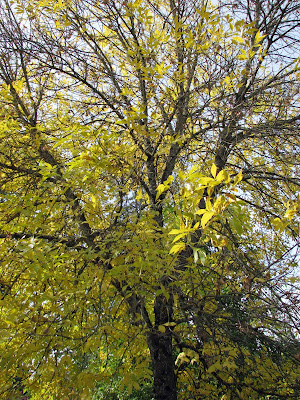
Fall has arrived in Portland......It is a beautiful time of year.  There are lots of different varieties of deciduous trees in our area, and they all turn colors in the fall.  It is a wonderful sight, all these brightly colored leaves of orange, red and yellow.

BUT ----- The downside to this is that the leaves eventually fall to the ground.  And then someone has to rake them all up.  This chore fell upon Roger one nice fall afternoon a couple of weeks ago.


Roger raking up the leaves in our backyard.


He's starting to get a leaf pile together.


Here's the culprit!

Monday, October 19, 2009

South Sister Climb

South Sister is a volcanic mountain near Bend.  At approximately 10,300 feet it is the third tallest mountain in Oregon.  It is one of three mountains in the "sister" chain - along with North and Middle Sister.  On clear days, the Three Sisters dominate the skyline of central Oregon.

I've always been intrigued with climbing South Sister.  In the late summer, when most of the snow has melted, it is a walk-up hike (in mountaineering terms, an "easy" climb).  Many of my hiking friends have summited this mountain.  My brother Dale, who lives in Bend, made it up S. Sister last year, and this gave me the idea that he and I should plan a climb of our own.

So, the last weekend in September found Dale and I at the trailhead, ready for our adventure.  We decided to backpack into Moraine Lake on Friday, camp overnight, and hit the mountain early Saturday morning.


Here I am at the trailhead, ready to go.  I'm pointing towards our ultimate destination!  South Sister is just peeping over the adjacent hills.


Another hiker offered to take our photo together on the bridge.  Here are Dale and I at the beginning of our hike in.  We hiked the Green Lakes Trail to Moraine Lake.  This trail followed a beautiful little creek, with lots of small waterfalls.  It was a great scenic trail.


After a 3 mile hike, we arrived at Moraine Lake.  We found a nice campsite, set up camp, and waited for Dale's friend and co-worker Kevin to arrive.  Kevin was joining us on our climb tomorrow.  To pass the time, I hiked around Moraine Lake, taking lots of photos of the area.  Here's a view of South Sister from the shore of Moraine Lake.


Kevin arrived later that afternoon.  We made dinner, and at sunset watched a spectacular display of evening light on the top of South Sister.  The mountain reflected itself in Moraine Lake very nicely.  I grabbed my camera to capture the views.


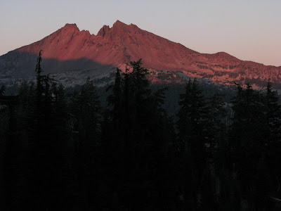
Broken Top Mountain, another adjacent peak that we could see from our campsite, glowed red in the evening's last light.  Magnificent!

We stayed up watching the stars in the sky.  The stars were so much more brilliant than anything I see in Portland.  We stargazed until dropping temperatures forced us into our sleeping bags.  We had a big day ahead of us tomorrow, so we needed to get some sleep!


The next morning, we were up bright and early.  After breakfast, we hit the trail!  Here are Dale and Kevin at the beginning of our hike, heading towards our day's destination.


Dale points the way to the summit (with a little help from the trail sign!)


Soon we climbed out of the treeline and onto the mountain's rocky slopes.  Dale and Kevin take a breather from the continuous uphill slog.


We took a break by a small pond created by the melting glaciers.  A little chipmunk came running to greet us.  The little creature struck a cute begging pose.  It was obviously used to handouts from hikers!


Kevin tempts the chipmunk with his Snickers bar.


A view of the glacial pond, and the summit ahead.  Still a long ways to climb!


The last 1500 feet of climbing was on a steep scree slope.  It was like walking on a mix of sand and small rocks.  Progress was really slow.  You slid one step for each two steps you took (or so it seemed!)  We took lots of rest breaks as we ascended.  I thought we would never reach the summit.


But --- We finally made it to the top!  Yahoo!  And oh - what a glorious view we had from the north side of the summit!  We could see a line up of all the Cascade peaks to the north.  North and Middle Sister dominated the view.


Here's our summit group "victory" photo!


And I had to get a "brother-sister" summit photo!


South Sister is an old dormant volcano.  There is a crater in the summit.  In the crater is a permanent glacier.  In the summer, the melting ice creates a small pool in the middle of the glacier.  On some maps, this pool is referred to as the "Teardrop Pool."  We hiked across the glacier, and I got a nice shot of the glacier, the teardrop pool, and the summit.


Our view of the surrounding area as we descended down the mountain.  Below is the glacial pond that we stopped at on our way up.  The mountain in the distance is Mt. Bachelor, Bend's famous ski area.


Coming down the mountain was definitely easier than climbing up.  I let gravity help out, and slid down the steep scree slope.  Here's Dale and Kevin towards the bottom of the scree.


The sun was at a better angle for photos, and the views coming down were great.  Here's the glacial pool, much closer now, and Broken Top Mountain in the background.


The rest of the climb down was long, but uneventful.  As we hiked down, we ran into a steady stream of people still climbing up.  It was a beautiful sunny fall day, and it lured many people up South Sister.

Finally, Moraine Lake came back into view.  I was getting tired by then (hiking downhill tires me out more than going up - you have to continuously keep "putting on the brakes" and my quads get quite worn out).  Moraine Lake was a very welcome sight!

We ate a hearty dinner.  Freeze dried backpacker meals never tasted so good.  Kevin had packed in a plastic flask of red wine - and it was wonderful!  After food, wine, and ibuprofen, I was ready for my sleeping bag.


We awoke the next morning to clear skies and calm waters on Moraine Lake.   When the sun came up, the mountain reflected perfectly on the lake.  A fitting scene, as we bid the lake goodbye, and began the hike back to the trailhead.

What a great weekend adventure!  I'm now hooked on climbing mountains, and am already thinking of coming back next year to do it again.  Dale and Kevin, how about it?

Thursday, October 15, 2009

Green Line Opening Day

September 12, 2009 was opening day for the MAX Green Line.  It was a big day for my colleagues at TriMet, and for everyone who has worked on this project.  I came onto the project in September 2005, and at the time, thought the 2009 completion date was eons away!  Well, it's amazing how fast time flies --- here I am in 2009 watching the Green Line open to the public.


The day began at the Clackamas Town Center Station.  All of us who worked on the project were invited to ride the ceremonial first train into downtown Portland.  Here's some of the participants boarding the train for the ride.


Rob Barnard, TriMet's director for the Mall project, smiles through the window of the MAX train as we travel on the Green Line towards downtown.


Our journey ended at the PSU Urban Plaza, where TriMet had set up a stage for the ceremonies.  A drumline, and PSU cheerleaders greeted us as we exited the train.

We then listened to the many congratulating words from the local politicians.  Above, Portland Mayor Sam Adams praises the project.  I was happy to hear Sam personally thank Teresa, my coworker, and the City's project manager for the Green Line project.  She has worked so hard and made many tough decisions --- it was well-deserved recognition!


Congressman Earl Blumenauer sings the praises of mass transit under the large "Green Means Go" banner.


Teresa and I pose for a photo in front of the stage.  I thought we made a good team!


Teresa introduced me to Portland Mayor Sam Adams.  Sam was gracious enough to pose for a couple of photos.

It was very satisfying for me to see a project I'd worked on for four years come to completion.  It was great to see the trains carrying passengers gliding through downtown Portland.  Teresa and I are already deep into the preliminary engineering for the next light rail project -- Portland to Milwaukie.  I look forward to the opening day of this project --- 2015 seems like a long ways away, but I'm sure it will be here before I know it!

Wednesday, October 7, 2009

A Day at the Coast

One sunny Friday in early September, I had the day off and both kids happened to be home.  I suggested a trip to the coast.  Although the Oregon coast is only an hour's drive from our home, we never seem to head that way.  It seems I'm always headed in the opposite direction - either to Mt. Hood or the Gorge, which are longer drives.  Maybe it's because I grew up in a land-locked state and don't know enough to miss the ocean!

Denise bagged out on the trip.  She was heading to college in a week, and had lots of stuff to do.  But I was able to convince Cody to come along with me.


So we grabbed Bear, gassed up the car, bought some snacks, and were on our way!  We headed down towards Tillamook.  I took the "Three Capes Scenic Loop" and stopped at Cape Meares Lighthouse.  I love lighthouses!  They are always great photo subjects.  Above is my attempt at photographing this cute little lighthouse.


There were lots of people visiting the lighthouse.  We brought Bear along on a leash, and everyone loved him.  A lady that was working at the lighthouse gave him some dog treats. 

After that, we took a short trail that wound along the rocky headland.  There were lots of viewpoints off of the trail to look out upon the sea.  Above is a great view of the ocean from one of the trail overlooks.


After our visit at Cape Meares, we drove on to the town of Oceanside.  Oceanside has a really nice beach, and is a little bit off of the beaten path, so you don't encounter hordes of people like you do at Cannon Beach or Seaside.  Above is a beach scene from Oceanside.  These are two of the Three Arch Rocks.


Of course Bear's favorite thing to do at the beach is PLAY FRISBEE!  He runs and runs and runs.....


Until he is absolutely too pooped to do anything!


Eventually Bear gets a second wind, and is ready for more frisbee games.


Cody enjoyed walking in the sand.  It was a nice, warm, not-too-windy day.  Perfect weather for the coast!


Poop patrol - the downside to dog ownership!


There is a tunnel between the two beaches at Oceanside.  The beach on the other side of the tunnel is a rocky beach.  We didn't stay here long - the rocks were hard on bare feet!  However, we were here long enough for Bear to lose his frisbee in the ocean.  I think he set it down for some reason, and the waves instantly took it out to sea!  That was the end of his frisbee games.


The coast is a great place for photography.  Every time I visit, I wonder why I don't come out here more often.


It was a great way to spend a day.  We couldn't have asked for better weather.  And it was nice to spend some time with Cody before he left for Montana.

Sunday, October 4, 2009

South Dakota Trip


I'm way behind in my blog postings!  Lots has happened, so I'm attempting to catch up!  Here are some photos from early September, when I went to visit my family in South Dakota.


My parent's backyard can be a real "Wild Kingdom."  Their neighbor likes to feed the wildlife, and that attracts lots of deer and wild turkeys.  Here's a gobbler I caught in their backyard one day.


My Dad shows why he's "king of the grill."


One night we all hit happy hour at a local Mexican restaurant.  They offered cheap pitchers of margueritas.  That was enough to get us in the door!  The underage crowd had to enjoy sodas or virgin margueritas.


No visit to the Black Hills is complete without a visit to the Alpine Inn.  It's a great German restaurant located in the heart of the Hills.  My Mom, Sister, Denise, and I had a "girl's day" and went out to lunch.  After a wonderful lunch, we made room to have one of their "to die for" desserts! 


My niece Rachael got a great summer job working in the bird show at a local wildlife park.  After lunch, we dropped in and caught her show.  It was a fun show, and Rachael did a great job.  Here she's asking the parrot to wave "goodbye."


The next day, a large group of us set out to hike "Little Devil's Tower."  We got started on the wrong trailhead at first, so that killed some time.  Most of our group had to turn back early - some were tired and others had to be somewhere.  So Denise, Susan and I hiked on towards the top of the tower.


The trail got real steep and rocky, and pretty soon it was more of a rock climb than a hike.  We had to follow blue diamonds painted in the rock for a trail.  Denise and Susan take a breather before the final climb to the top.


But once we were at the top - oh what a view!  We looked across at Harney Peak, the highest point in South Dakota.  We could see the Needles, Custer State Park, and towards Mt. Rushmore.  It was a clear sunny day so the views were optimum.


Susan and I posed for a "sister's summit shot."   It was great to be able to hike with my sis.


The next day, I drug my family on another hike.  This time we hiked from Mt. Rushmore to Horsethief Lake, a distance of about three miles.  It was a pretty trail.  My niece Alisha came along and she did pretty good (I did have to bribe her with a rice crispie treat once!).  Here's the gang resting on some steps in the trail.


A view of the cool granite outcrops that we saw along the trail.  The rocks in the Black Hills are these pretty sparkling granites, with lots of unique minerals in them.  I miss the variety of rock - all we have in Oregon is boring volcanic rock.


Trail's end!  Hooray!  Time for some lunch!


After lunch we stopped by Mt. Rushmore, because my sister said they had the best ice cream (and she was right!).  It had been awhile since I'd visited the famous faces, so it was good to check out the memorial and see how it had changed.  The Avenue of Flags is still the same.   We located the Oregon flag, and found someone with an Oregon Ducks t-shirt standing under it!  I told him we were from Oregon but were Beaver fans, and he made a snide remark about OSU.  I guess for some folks, the rivalry doesn't take a vacation.


You gotta get the "tourist shot" by the presidents.


On the way back to the car, we ran into a mountain goat.  He was walking around inside the memorial.  As a matter of fact, he walked right across the sidewalk, past one of my nieces.  The goat calmly climbed the hill beside the sidewalk and began munching away at the grass.  He was totally oblivious to the many camera-clicking tourists that were having a heyday.

It was great to visit home and see my family.  I enjoyed taking a couple of hikes in the Black Hills, something I haven't done for a very long time.  I'm glad my family (especially my folks) were able to hike with me.  I'll be planning some more hikes for next summer's visit!